
More storms ahead after wild night of wind and rain lashes Victoria
Snow could fall near Wilsons Promontory and on the Otways tomorrow as another wave of Antarctic weather sweeps across Australia’s southeast coast. It’s great news for powderhounds, but a miserable Melbourne forecast is in store for the week ahead.

VIC News
Don't miss out on the headlines from VIC News. Followed categories will be added to My News.
A triple whammy of Antarctic air has blasted Victoria, bringing heavy rain, gusty winds and blizzard conditions.
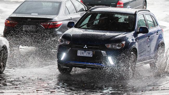
Melbourne was belted with a burst of heavy rain overnight, with 6.4mm of rain falling in an hour after the skies opened up around 10pm.
— Were you affected? Email news@heraldsun.com.au
The SES had 61 calls from the Frankston area, with more than 1000 calls across the state in 24 hours, an SES spokeswoman said.
Last night, SES workers were confronted with trees falling across roads as the winds tore through the state.
Power lines were brought down by a tree on the Mount Dandenong Tourist Rd between Olinda and Sassafras, with VicRoads reporting the road being closed between Perrins Creek Rd and the Mountain Highway this morning.
Overnight, the strongest gusts were recorded at Mt Hotham at 124kmh and 119kmh at Mt William.
Travellers arriving at Melbourne Airport this morning would have shivered through an apparent temperature of just 2.1C.
Enjoy the fleeting Thursday sunshine, for the city is in for a wet and dreary week ahead with cloudy skies and showers forecast up til next Wednesday.
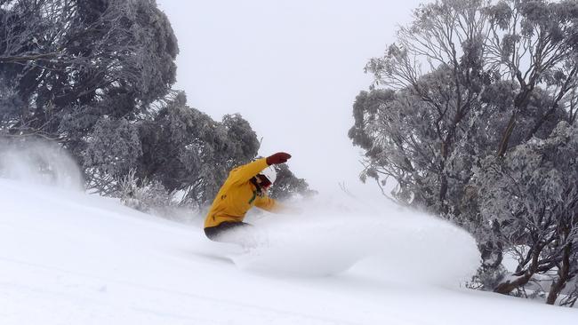
But it’s good news for snow lovers, with snowfall forecast as low as 600m tomorrow.
Heavy snow is also predicted at the Otways and near Wilsons Promontory tomorrow as temperatures continue to dip.
Blizzard conditions were already blasting the Victorian Alps with snow yesterday, prompting Falls Creek resort to warn snow lovers of severe conditions overnight.
Western Victoria was the wettest part of the state, copping a hammering as 36.8mm of rain was dumped in Port Fairy.
The bureau has issued a severe weather warning for damaging squalls on the state’s coastline and mountain ranges.
It warned of winds gusts up to 130kmh and heavy snowfall, with a risk of tree falls.
Why isn’t #melbweather trending?? pic.twitter.com/bwsH7JbRF5
— Daniel James (@MrDTJames) July 10, 2019
Mt Hotham is the coldest part of the state at -4.1C and an apparent temperature of -7C.
This is just the first of three waves of Antarctic weather expected to sweep across parts of the continent.
A second wave barrels through on Friday, with showers, thunderstorms and possible hail to sweep through in the late afternoon or evening.
Saturday will bring plenty of rain with the southeastern suburbs facing the chance of hail in the morning.
Victoria will be wet but will be spared from the third of the Antarctic waves, which will mostly be concentrated on Tasmania on Sunday.
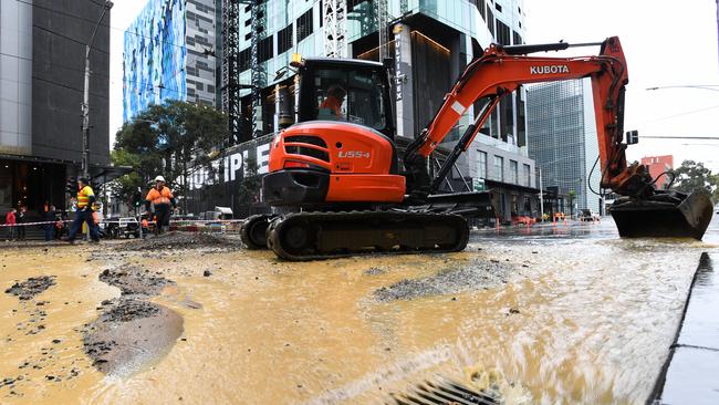
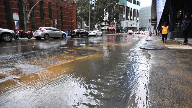
BURST WATER MAIN FLOODS CBD
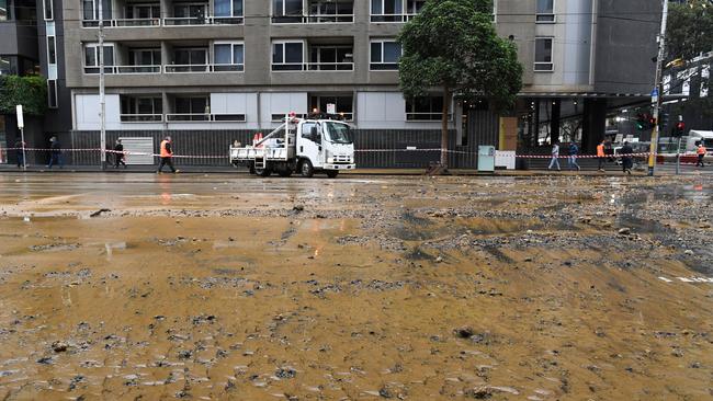
Meanwhile, a burst water main is adding to the overnight weather havoc in this city this morning, with the corner of Swanston and Victoria Streets blocked off.
Extensive flooding is still blocking access to Victoria St, between Swanston and Elizabeth streets, and nearby Therry Street.
Part of the road on Victoria St appears to have lifted and washed away as a result of the excess water.
Emergency crews and CityWide Water are still on scene trying to bring the flooding under control.
It is not yet clear what caused the flooding.
MORE NEWS: MEGHAN TAKES ARCHIE TO POLO WITH KATE
Meghan takes Archie to polo with KateDESPERATE EFFORTS TO SAVE DOG ATTACK VICTIM
PRISON GUARDS THREATEN TO RAPE, BASH FORMER INMATE
Local businesses including Ibis hotel and an Audi dealership remain open.
Victoria St is closed to traffic in both directions but footpaths are clear for pedestrian access.
Members from the SES and MFB are currently sandbagging the area.
Extensive flooding can be seen across all lanes of traffic and onto surrounding footpaths.
An SES spokesperson said: “Victoria St will remain closed for a number of hours.”
Victoria Police are also in attendance to redirect traffic.
VicTraffic is warning commuters to expect delays and pedestrians are being urged to avoid the area.

‘Angels’: Hero Coles workers save mum’s life
A mother of three has opened up on how her life was saved after she suddenly collapsed while doing a routine supermarket shop.

Wildlife and traffic fears over music festival
Wildlife advocates fear a weekend music festival in central Victoria will endanger native animals including rescued joeys.