Melbourne traffic gridlock extending to outer suburbs including Craigieburn, Sunbury
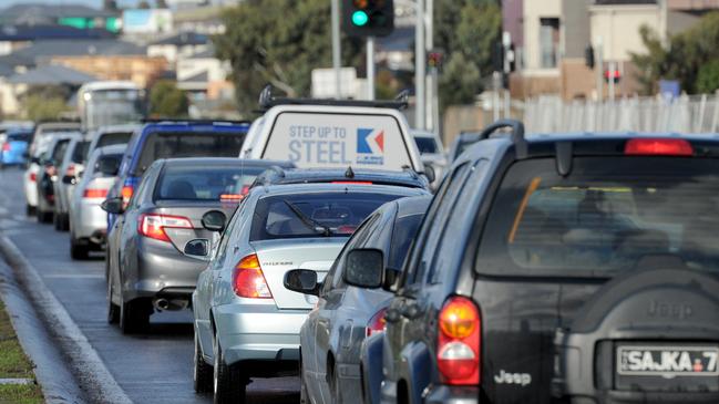
Feel like the amount of time you spend sitting in gridlock is increasing? Melbourne’s peak-hour congestion is no longer limited to the inner city, with traffic snarls now extending to suburban streets. These are our worst affected roads.

VIC News
Don't miss out on the headlines from VIC News. Followed categories will be added to My News.
Melbourne’s congestion crunch has moved to the suburbs as new figures show the city’s north and west are choked in gridlock.
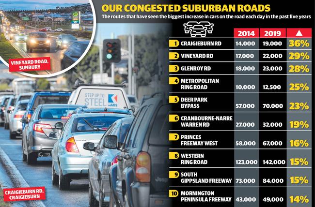
Some roads have logged an increase of 5000 cars a day compared with five years ago.
Craigieburn Rd in Melbourne’s north recorded the city’s biggest surge with a 36 per cent increase, jumping from 14,000 in 2014 to 19,000 this year, according to VicRoads.
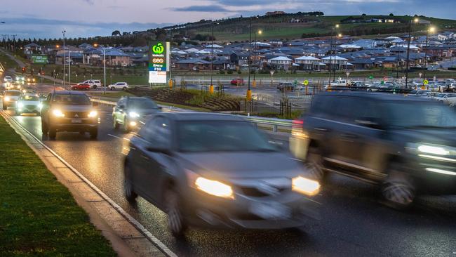
It was followed closely by Vineyard Rd, Sunbury, and Glenroy Rd, Glenroy, where residential estates have put pressure on once sparsely populated areas.
Half of the top 10 roads to record major increases were in the city’s north, while two were in the west.
The state’s biggest infrastructure project, the $15.8 billion North East Link, will aim to solve some of the suburban crawl, but there is still pressure to build the East West Link to end traffic woes on the other side of the city.

Even arterial roads such as the Metropolitan Ring Road, which is now being hammered with 125,000 cars a day, and the Western Ring Road, which carries 142,000 cars a day, are under strain, forcing vehicles into suburban rat runs and roads with less traffic.
VicRoads chief engineering and road management officer Andrew Wall said Melbourne’s west was growing twice as fast as the rest of the city.
“Major projects currently under way will help increase capacity and provide more options to travel across the network but we’re also investing in technology to keep people moving, including freeway ramp signals, lane-use management and variable speed limits,” he said.
“In planning for our future needs and to meet the demands of population growth, we continually monitor traffic volume, congestion and road safety to help determine trends and changing travel patterns across our road network.”
RACV general manager of public policy Bryce Prosser said transport had fallen behind in the outer suburbs.
“Inadequate public transport, gaps in the road network and congestion are creating barriers to mobility, including access to critical services, education and employment opportunities,” he said.
“In our outer suburbs, numerous arterial roads are currently at or beyond capacity, creating significant issues of congestion, delay and safety.
“By 2031, our population in the outer suburbs will have overtaken the total population of Melbourne’s inner and middle suburbs.
“Residents of outer suburbs deserve a fast, convenient and high-quality transport system linking housing and employment and providing access to goods and services, health care, education and recreation.”
It comes as more information on the North East Link is to be released on Monday, showing the toll road will cut as much as 29 minutes off trips from the eastern suburbs during peak hour.

MORE: MELBOURNE DRIVERS STUCK IN TRAFFIC FOR LONGER
COUNCIL TARGETS THROUGH-TRAFFIC TO CUT CONGESTION
Modelling shows drivers will be able to cut through congestion along the M1 corridor, while taking pressure off overloaded roads in the city’s north eastern suburbs.
About 45 per cent of residents of areas such as Banyule, Boroondara and Whittlesea work in the region and about 70 per cent drive to work rather than use public transport. Transport Infrastructure Minister Jacinta Allan said the project would benefit them.
“It will also cut airport travel times for people living in the eastern suburbs, giving them a hassle-free trip along the Eastern Freeway and all the way to the airport,” she said.
Up to 135,000 vehicles a day are expected to use the North East Link by 2036, and a government inquiry is now hearing public submissions on its environmental and economic effects.
Machines will dig a 6km tunnel under Banyule flats and the Yarra River — but a large industrial zone, football ovals and Boroondara Tennis Centre will be demolished.


