Victorians shiver through snow, hail as bitter winter-like weather sweeps state this weekend, next week
Victorians have been pelted by hail and blanketed in snow as a sudden cold front seizes the state — and more winter-like conditions are on their way.
Victoria
Don't miss out on the headlines from Victoria. Followed categories will be added to My News.
Snow? In spring?
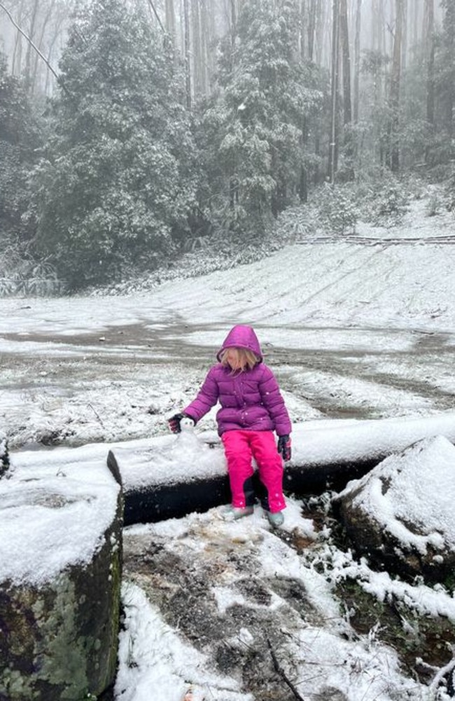
Victoria has been swept up by a bitter winter-like cold front, sending a sudden spout of snow across central and eastern regions.
Snow was recorded on Saturday in Lake Mountain, Mount Baw Baw, Mount Donna Buang, Trentham, Woodend, Mount Macedon and elevated parts of the Yarra Ranges, the Bureau of Meterology confirmed.
Meanwhile, residents in Craigieburn and Yarraville were saw showers of small hail.
The sudden cold front from the south saw temperatures plummet on Friday night, sending the Victoria back into the depths of winter this weekend.
Saturday’s maximum temperature of 12 degrees was a huge five degrees below the September average — the coldest day we’ve seen since the end of July.

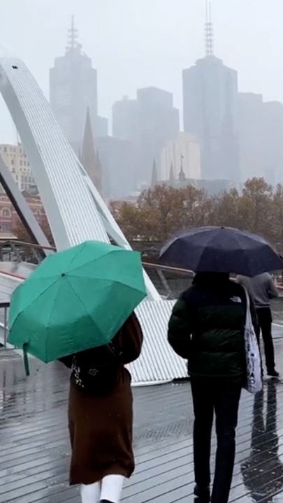
Deeper in the city, Melburnians were pulling their puffer jackets out from the back of their closets as maximum temperatures struggled to reach the teens.
As of 3pm, the coldest maximum temperatures around Melbourne were recorded at Ferny Creek (7 degrees), Melbourne Airport (10.3 degrees), Scoresby (10.3 degrees), and Viewbank (10.6 degrees).
The coldest Saturday maximum in the state was recorded in Mount Baw Baw, where polar conditions saw a freezing top of -1.5 degrees as of 3pm.
Mount Buller, Mount Hotham and Mount William also recorded bitter maximum temperatures of 0, 0.1 and 1.5 degrees, respectively.

The Bureau of Meterology forecasts snow in Gippsland and the Grampians to fall above 600m and 800m, respectively, for the rest of the day on Saturday.
It’s a whiplash of weather for Victorians after a line-up of beautifully sunny days last month — average temperatures three degrees warmer than what we typically see in August, according to the Bureau of Meteorology.

The chilly weather will continue into Sunday for a maximum of 14 degrees — Melbourne in for patches of morning frost and just a slight chance of a shower.
“We’ve got a high pressure system that is very slow moving at the moment … that actually keeps the southerly air flow streaming over Victoria on Sunday and into Monday,” Senior meteorologist Bettina Hill said.
The cold front is expected to move off to the east by Sunday morning, but a second and potentially third blast of cold air could return in coming days and weeks.

When will it get warmer in Melbourne?
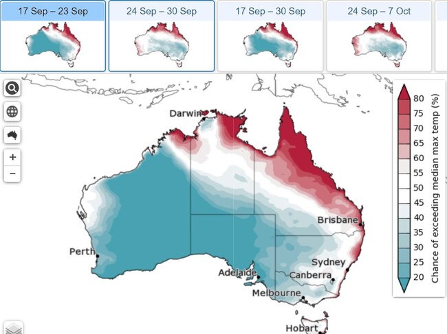
In a dismal display for Melburnians, temperatures are expected to remain at or below the September average across the state for the remainder of the month.
But there is some cause for relief, with this week’s temperatures to be warmer than the weekend’s chilly winter-like conditions.
Melbourne will see a top of 15 degrees on Monday with a medium chance of showers before a partly cloudy Tuesday with a top of 19 degrees.
“Still, Tuesday morning is going to be pretty frosty,” Ms Hill warned.
Ms Hill explained another cold front, expected to cross on Wednesday and Thursday, is going to change the airstream to be more north-westerly.
“So slowly, our temperatures will start to increase from Tuesday,” she said.
Wednesday will deliver a welcome top of 22, but also a very high chance of showers and west to north-westerly winds of up to 35 km/h.
The city usually sees maximum temperatures around 17 degrees and minimums around 8 in September.
October, however, is being pegged to deliver higher than usual temperatures in Victoria.
*Historic data and averages as per observations at Melbourne Olympic Park.


