
Torrential rain, hail as storms lash Victoria
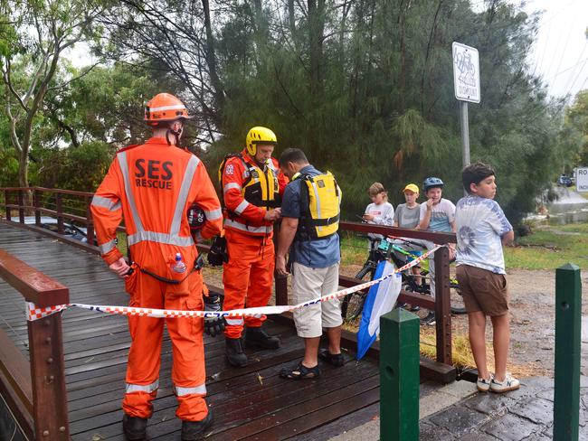
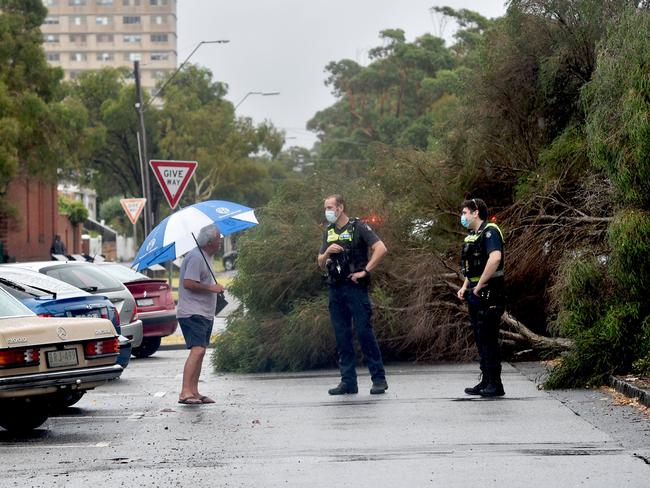
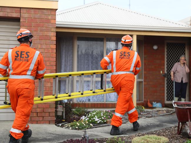
VICSES are working through over 2000 calls as clean up continues after significant building damage, floods or reports of fallen trees.
Victoria
Don't miss out on the headlines from Victoria. Followed categories will be added to My News.
VICSES has reported that more than 2000 requests for help have been made across Victoria since the thunderstorms began on Wednesday night, to 8am Saturday.
While the service estimated that the vast majority of calls had been cleared by volunteers, reports of fallen trees and flash flooding continued to pour in on Saturday morning.
Residents in Wheelers Hill in Melbourne’s southeast, Castlemaine about 120km northwest of Melbourne and New Gisborne required the most assistance on Friday night.
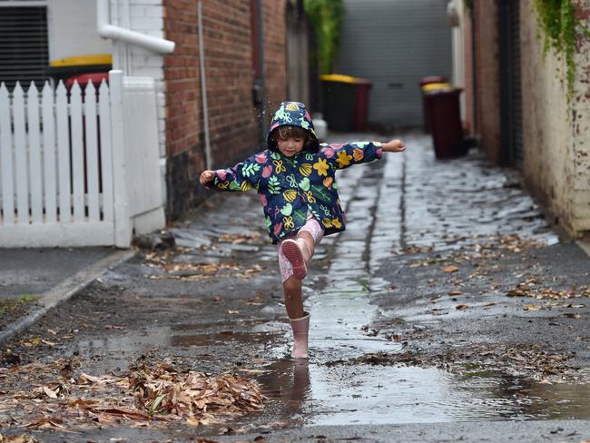
Rainfall levels in the greater Melbourne area are expected to drop to between one and five millimetres on Saturday, with temperatures slated to reach a top of 24C.
The slight drop will bring some reprieve from the 34C days seen earlier in the week, although humidity is expected to remain in the air until Tuesday.
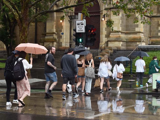
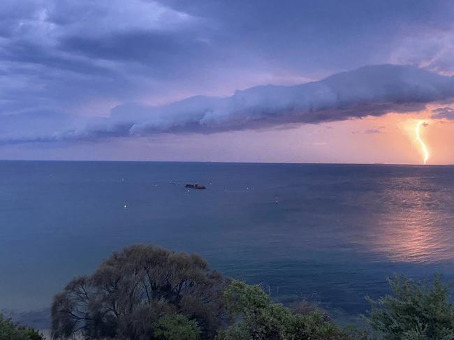
The intense rain that fell on Friday afternoon saw a flood warning issued for the Yarra River.
But with the light showers expected to clear by Saturday afternoon, several severe thunderstorm and “likely” life-threatening flash flood warnings have been downgraded by the state’s emergency services.
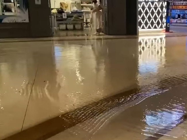
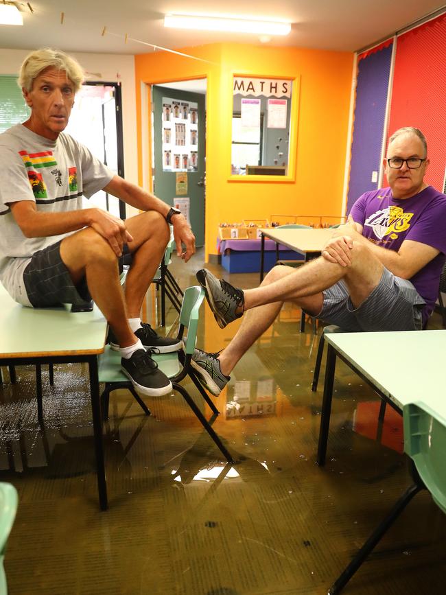
Shoppers at Chadstone were forced to walk through flood water after storms and torrential rainfall lashed the city on Friday afternoon.
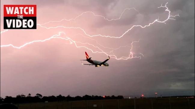
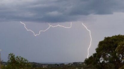
A Qantas flight landing at Melbourne Airport has narrowly escaped being hit by lightning as thunderstorms pound the state.
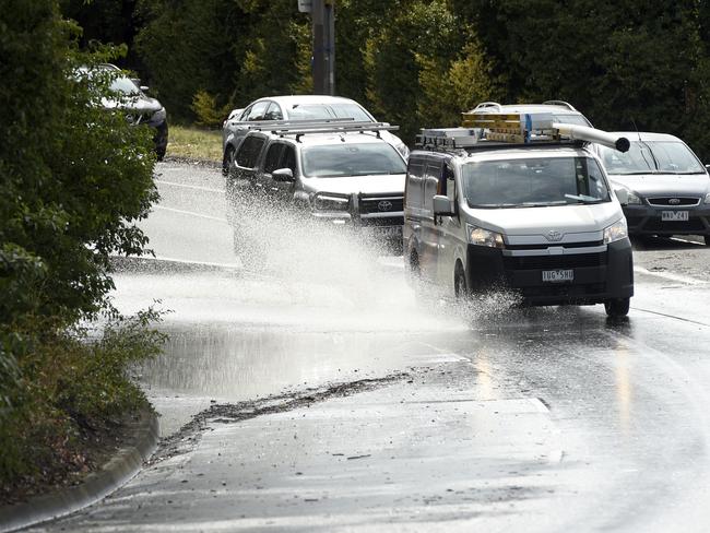
Drivers were also forced to abandon their cars and thousands were left without power after wild weather wreaked havoc across the state.
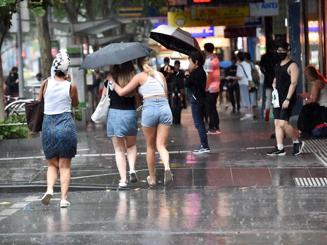
A watch and act message was issued for southwestern and southern parts of greater Melbourne on Friday afternoon as the weather worsened.
The downpour began in Melbourne at 2.30pm— with temeperatures plummeting more than 10 degrees from 32C to 21C between noon and 3pm.
Residents in the city’s inner east reported 3cm-sized hailstones, according to the state’s weather bureau, with Springvale recording 35mm of rain in just 30 minutes.
Glen Eira and Greater Dandenong were among the hardest hit areas, with the majority of the call-outs relating to building damage, flooding and fallen trees.
Some of Melbourne’s busiest shopping centres were also impacted by wild conditions.
Shoppers were forced to walk in shallow water at Chadstone Shopping Centre after it was hit with flooding.
Cars were also stuck in floodwater at the entry of Parkmore shopping centre in Keysborough.
Sections of the Monash and Maroondah Hwy were closed due to flooding.
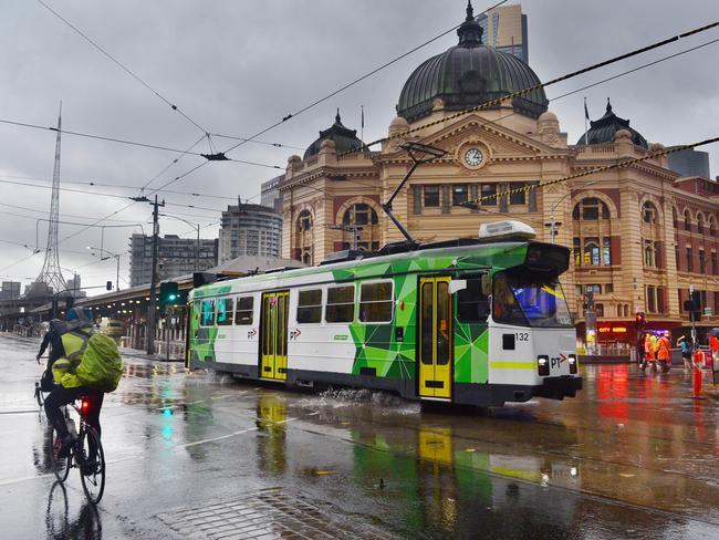
A number of train and tram services were also cancelled across Melbourne causing major delays for travellers.
Some motorists were also forced to abandon their cars after they also tried to drive through the dangerous waters, with one vehicle swept away by flooding into Elwood Creek.
Calmer conditions are expected across the weekend before hot weather returns.
A spokeswoman from the Bureau of Meteorology said storms were moving over the city area and there may be an increase in calls to the SES.
Victorians are being advised to keep an eye on the weather radar to see where the storms are developing, as well as follow advice from all emergency services.
âš ï¸Severe Thunderstorm Warningsâš ï¸ for #Melbourne and #Victoria have both been updated.
— Bureau of Meteorology, Victoria (@BOM_Vic) January 28, 2022
DAMAGING WINDS, LARGE HAIL, and HEAVY RAINFALL that may lead to FLASH FLOODING are a risk. #VicWeather
Details: https://t.co/qYhJyaJGI6pic.twitter.com/kGmOsiC620

Shopping centres were flooded on Friday after the state was hammered with rain.
Footage obtained by the Herald Sun shows cars stuck in floodwater at the entrance to Parkmore Shopping Centre in Keysborough.
Video footage also shows flooding at Chadstone shopping centre, with shoppers forced to walk in shallow water.
Meanwhile, Clayton and Wheelers Hill libraries were closed due to flooding.
âš ï¸Severe Thunderstorm Warning âš ï¸ for DAMAGING WINDS, LARGE HAIL and HEAVY to INTENSE RAINFALL that may lead to FLASH FLOODING has been updated for #Victoria. #VicWeather
— Bureau of Meteorology, Victoria (@BOM_Vic) January 28, 2022
Details: https://t.co/KXPCR3brDWpic.twitter.com/OaPggkO5Zv
It comes after clean-up efforts across the state after severe storms on Thursday night.
More than 500 calls were made to SES over reports of fallen trees and powerlines.
Volunteers received 120 calls from South Barwon and 37 calls from residents in Sorrento.
Debris and fallen trees were being removed on Friday morning in Geelong, which experienced the most severe of the intense rainfall on Thursday night.
Forty-one calls were made to the SES overnight.
Thousands were left in the dark after powerlines were brought down by strong winds and fallen trees.

Videos posted on social media on Thursday night showed flooded streets in the Geelong suburb of Belmont while a wind gust of 139km/h was recorded at Horsham.
St Arnaud in the state’s west was hammered with 34mm of rain recorded in just 30 minutes.
@VicStormChaserspic.twitter.com/dBkFrJZdhr
— Alex (@AlexLang154) January 27, 2022
The State Emergency Service advised motorists to drive to conditions and avoid unnecessary travel.
“Stay safe by avoiding dangerous hazards, such as floodwater, mud, debris, damaged roads and fallen trees,” the SES said in a statement.
SEVERE THUNDERSTORM WARNING for DAMAGING WINDS and HEAVY RAINFALL that may lead to FLASH FLOODING has been update for the Melbourne Metropolitan Area. #Vicweather
— Bureau of Meteorology, Victoria (@BOM_Vic) January 27, 2022
Check out the warning at https://t.co/HLs2UYFQyQpic.twitter.com/RDTd176OHu
WETTEST JANUARY DAY ON RECORD
The Bureau of Meteorology said Thursday was the wettest January day on record for Mildura as heavy rains fell across the state, with almost 70mm falling within just two hours.
“The worst of the rain was over the Mildura area where we saw 80mm and a lot of that fell in a very quick period,” BOM Hazard Preparedness Response manager Diana Eadie said.
“That makes this particular day the wettest January day for Mildura on record,” she said.
While Ms Eadie said Victoria is lashed by storm weather every summer, Thursday’s severe wet weather was accelerated by the extreme wind event, La Niña.
VICSES state agency commander David Tucek said Wednesday night and Thursday morning had proven to be “ a very busy time for our volunteers.”
Mr Tucek warned rain just had to reach a height of 15mm to become life-threatening, urging Victorians to take extra care on Friday and over the weekend.
“The things you can do to prepare around the harm before of course the event occurs, secure lights, loose objects and make sure your data is appended to it as well,” he said.
Almost 3000 homes across Victoria remained without power on Thursday afternoon.
More than 150 calls for assistance had placed to VICSES in the northwest region in the 12 hours to Thursday morning.
In Melbourne, two people were taken to hospital after a lightning strike set a Bundoora home alight on Thursday morning.
Almost 30 firefighters worked to contain the fire that broke out just after 8am, badly damaging the roof of a single storey home on Betula Ave.
SEVERE THUNDERSTORM WARNING - MELBOURNE AREA for HEAVY RAINFALL
— VicEmergency (@vicemergency) January 26, 2022
For people in Inner East, Inner, Northern and parts of Port Phillip waters, South East, Outer East and Western Local Warning Areas.
Stay informed: https://t.co/T05ONtx8bBpic.twitter.com/G747PSrY6p
A Fire Rescue Victoria spokesman said crews received several calls for help after lightning struck the property and threatened to spread to a nearby home.
The spokesman said the two residents were treated at the home before being taken to The Austin Hospital.
Crews remained at Betula Ave to monitor the fire, which specialists estimated caused damage to 40 per cent of the brick home.
More than 3500 Victorian homes were left without power due to thunderstorms sweeping across the state.
On Thursday morning, more than 360 properties in Victoria across CitiPower and Powercor’s networks were without power.
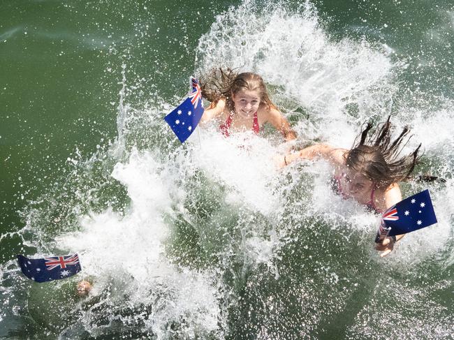
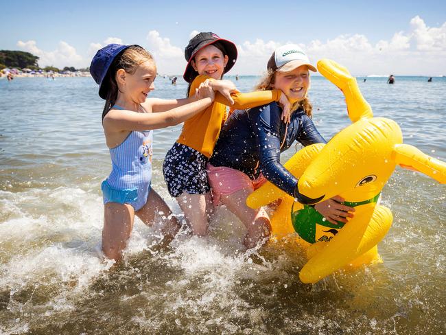
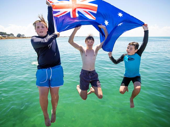
AUSTRALIA DAY TEMPERATURE RECORD
The warning came after Melbourne sweltered through its hottest Australia Day in 16 years with the mercury tipping 35.9C at Olympic Park just before 4pm.
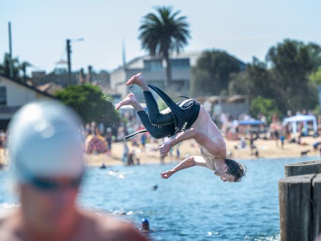
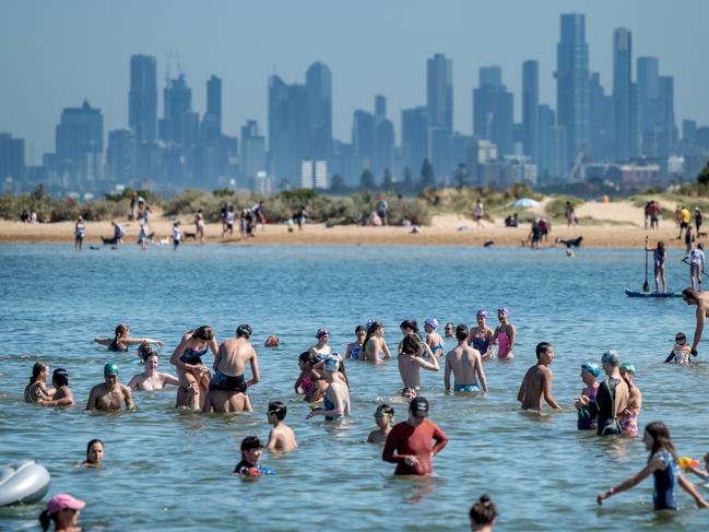
Thousands flocked to the beach to escape the unrelenting heat which was made worse by high humidity, making Melbourne feel more like Darwin.
Other hot spots around the city included Melbourne Airport which hit 36.9C and Viewbank with a scorching 38.1C.
Bureau of Meteorology duty forecaster Gina Lawrie said it was the hottest Australia Day since 2006, when the city had a top of 39.6C.
Despite Victorians flocking to beaches in droves, Life Saving Victoria confirmed no major incidents were reported.
“While our members have reported undertaking about 40 rescues so far today, this is not more than what we’d normally see on a public holiday in summer,” LSV GM lifesaving services Liam Krige said.
“It’s been pleasing to see that overwhelmingly, people have been playing it safe by the water and seeking out safe places to swim within their skill level, particularly between the red and yellow flags.”

Melbourne came close to breaking the record for the most consecutive days of temperatures above 30C.
The nine-day streak which set the record in March 2013 would have been challenged later this week had Friday’s final temperature edged over the 30C mark, but the mercury flatlined at 29.6.
The Bureau of Meteorology said northerly winds were dragging tropical moisture down from inland South Australia and NSW which would continue to build throughout the week.
before a low pressure system was set to bring heavy showers and thunderstorms.

Forecasters said Wednesday would be the fifth day in a row above 30C, but tipped the current streak would end on Saturday following heavy rain on Friday night.
Bureau senior forecaster Mark Anolak said Melbourne had sweltered through balmy nights, with the city averaging a January low of about 18C — about 3C above average.

January 20 was the only night to dip below 14C this month and the warm nights are set to continue with lows in the high teens to mid twenties forecast until Sunday.
“Temperatures have been above average right through the month and it looks like we’ll see that continue,” Mr Anolak said.
In Mildura the mercury has tipped above 33C for its sixth straight day while the usually mild Warrnambool experienced four consecutive days above 30C – including a sweltering 35.7C on Saturday.
While temperatures have been warm, Melbourne is yet to see a 40C day this summer with the 37.7C on New Year’s Eve the hottest so far.
Mr Anolak said 40C days were more common in late January into February and it would be “unusual” if the city didn’t see at least one scorcher this summer.
More Coverage

Join the conversation
Melbourne councillor speaks out on big issue with bin tax
A councillor has hit out at Town Hall for a major failure in dealing with businesses that will be affected by new bin taxes.
Read more
Startling new evidence provides ‘glimmer of hope’ in Terry Floyd mystery
Stunning new evidence has been uncovered that could finally see charges laid over the 50-year-old disappearance of Avoca schoolboy Terry Floyd.
Read more