
Concerns over Japanese encephalitis detected in humans in Victoria and other eastern states
Health authorities are on high alert after more cases of encephalitis were detected in humans, with concerns mounting the floods could bring a spike in infections.
Victoria
Don't miss out on the headlines from Victoria. Followed categories will be added to My News.
Health authorities in Queensland, New South Wales and Victoria are on high alert after a number of cases and “probable cases” of Japanese encephalitis were detected in humans.
Concerns are mounting that recent flooding events across the states could be a catalyst for more infections, considering cases have rarely been confirmed outside of the tropics.
Victorian health authorities are aware of eight suspected cases, including two children under the age of 10 and six adults aged between 35 and 75.
In addition, 14 piggeries across NSW, South Australia, Queensland and Victoria have now confirmed outbreaks in animals.
Meanwhile, an earlier forecast of thunderstorms has been downgraded and warnings across the Gippsland region cancelled.
The cloud band carrying embedded thunderstorms has cleared and the threat of severe rainfall has passed in the North and Central and West and South Gippsland area.
Flash flooding is no longer forecast for the state.
Heavy rain in Gippsland
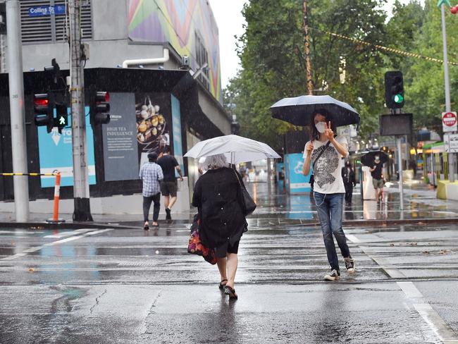
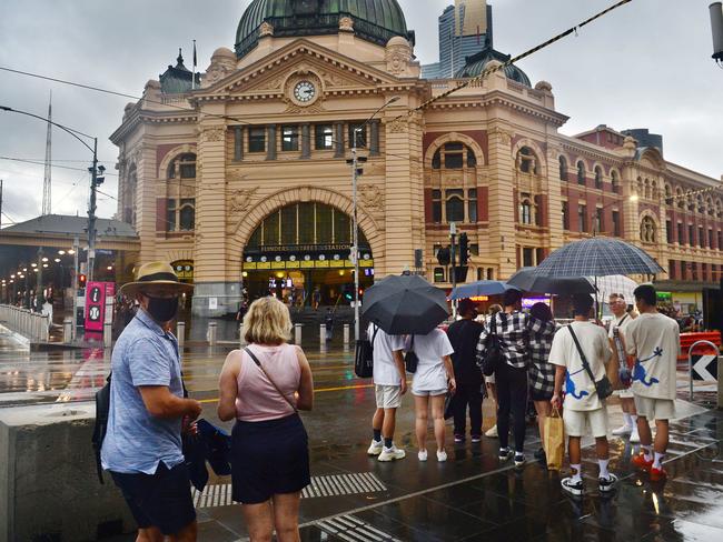
Suburbs in the south east and the Otway Coast both copped significant downpours overnight on Friday as a cold front swept across the state and headed towards Gippsland this morning.
The heaviest falls were felt throughout the Otways with some areas drenched in 80mm of rain.
In Melbourne, Springvale was hit with 67mm overnight while Keysborough (58mm) and Frankston (57mm) also bore the brunt of the storm.
BOM senior meteorologist Sarah Scully said a cold front collided with Friday’s humidity to produce turbulent conditions.
“A cold front and trough moved across overnight and there were really humid conditions it was able to tap into,” Ms Scully said.
“Eastern suburbs had widespread rainfall totals of 40 to 60mm.
“Western suburbs were more 20 to 40mm.”
The city has seen the worst of the rain with heavy falls pushing east, but Gippsland remains on alert with severe thunderstorm warnings still in place.
“The rain band with embedded storms is still really active,” Ms Scully said.
“It’s now pushing into eastern parts of the states.”
Temperatures are dropping two-to-six degrees below the March average due to the cold front.
The SES responded to 238 calls for assistance across the state, with flood and building damages making up a large portion of requests.
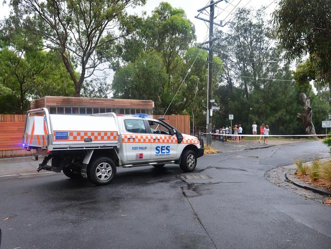
Frankston was the most affected suburb with 12 incidents.
An SES spokesperson said that while Victorians should remain alert, conditions weren’t comparable to what has been experienced in New South Wales and Queensland.
“Of those (requests) only 31 are still active, so most of the jobs have been cleared,” a spokesperson said.
“We should remain vigilant, but conditions aren’t anything like New South Wales and Queensland.”
83 requests for assistance where flood water related over the last 12 hours.
Western parts of Victoria have seen a night of moderately heavy rain, but the band of rain is moving fast to the eastern part of the state, according to Senior Meteorologist Mark Anolak.
The eastern suburbs of Melbourne bore the heaviest rain with Springvale recording 68mm of rain in a 3 hour period. Melbourne’s south eastern suburb Frankston sent out 14 calls for assistance to SES last night due to minor flooding.
“4 separate calls for help came in this morning about cars driving into the flood water around Dockland and Derrimut areas,” said Amy Miles from SES.
“We have responded to all the requests as necessary. Fortunately, none of the situations were too dangerous,” Ms Miles said.
“Heavy rain with thunderstorms is in the forecast for the eastern side of the state over the weekend while Melbourne and the western side will have a shower or two with a cooler temperature,” said Mr. Anoak from the Bureau meteorology. .
“The minor flood warning for the Snowy River will stay in place over the weekend as most of the state will have a slightly windy day on Sunday with wind gusts up to 60kms/hour,” he said.
Victoria on alert with more wild weather on the way
Wild weather has been forecast to lash the state this weekend, but Victorians will escape the rain bomb that has devastated the country’s north.
As a low-pressure system moves across from the country’s west, Victoria’s emergency services are bracing for flash flooding and severe thunderstorms, with the east of the state likely to be the worst hit.
Heavy falls are predicted for Melbourne on Saturday, with the city on track to record up to 30mm.
On Sunday, there is a medium (60 per cent) chance of showers, most likely in the early afternoon, and strong winds southerly 25 to 35 km/h during the morning.
A minor flood warning has been issued for the Snowy River and a flood watch has been flagged for Bemm, Cann and Genoa Catchments.
Bureau of Meteorology forecaster Ilana Cherny said the worst of the weather will hit Melbourne late Friday evening and Saturday morning.
“Late on Friday we will see showers and the possibility of severe thunderstorms,” she said.
“We’re expecting five to 10mm by midnight on Friday night alone.
“Saturday morning we’ll see another 10-20mm.”
Ms Cherny said Gippsland and surrounding areas will be hit the hardest on Sunday.
“On Sunday the east of the state could see up to 40mm of rainfall,” she said.
But Ms Cherny said Victoria’s forecast was very different from the devastating situation that has gripped Queensland and New South Wales.
“It’s not the same system that we’re seeing in New South Wales and Queensland … the system moving across Victoria this weekend is coming from South Australia rather than from up north,” she said.
“Victoria looks as though it has escaped that weather for now.”
Residents in Gippsland have been urged to stay indoors, stay away from windows and avoid travel if possible.
All loose items, such as outdoor settings, umbrellas and trampolines should be safely secured and vehicles moved under cover or away from trees.
Weather warnings can be monitored online on the Bureau of Meteorology or VicEmergency website.


Police taser knife-wielding man in dramatic arrest in Coolaroo
Footage shows the moment a knife-wielding man is brought down in a car park in Melbourne’s north as officers used tasers while one bystander tried to stop the offender with a shopping trolley.

Baby killer cleared to work with children
A Victorian woman who killed her eight-week-old daughter was granted a Working with Children Check through a loophole that has angered child safety advocates and victim families.