
Explore volcanic landmarks and our indigenous past in southwest Victoria
SOUTH-WEST Victoria is filled with amazing volcanic features and 30,000 years of history. The best part? It’s easy to explore our ancient past.
VIC News
Don't miss out on the headlines from VIC News. Followed categories will be added to My News.
- Top camping spots on the Great Ocean Road
- Phillip Island’s best camping spots
- Best camping on the Mornington Peninsula
- Victoria’s hidden gems: Gippsland
VICTORIA’S southwest is a magical place of volcanic landmarks and links to the region’s ancient indigenous past.
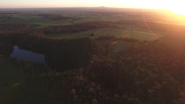
The region bounded by The Grampians, Warrnambool, Portland and the South Australian border town of Mount Gambier is part of the vast Western Victorian Volcanic Plains, the third largest volcanic plains in the world, which stretch from Melbourne’s west into SA.
It is filled with extinct volcanoes, crater lakes, caves, gorges and the remains of ancient aboriginal villages that are easy to reach and make a stunning getaway only a few hours west from Melbourne.
Damein Bell, the chief executive of the Gunditj Mirring Traditional Owners Aboriginal Corporation, says most of the best sites in the region are open to the public.
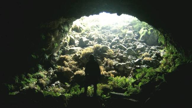
The centrepiece for indigenous culture is just east of Heywood in the Mount Eccles National Park.
Mount Eccles is an extinct volcano also known as Budj Bim, which Mr Bell says his Gunditjmara ancestors witnessed erupting about 30,000 years ago.
“From that and resultant lava flows, they created the Budj Bim National Heritage Landscape, which is home to traditional stone villages and what is probably the oldest freshwater aquaculture system in the world (at nearby Lake Condah),” Mr Bell said.
TOP 10 VICTORIAN COASTAL GETAWAYS
The Gunditjmara people believed Budj Bim was where their people’s creation spirit revealed himself, shaping the landscape and providing its riches.
Budj Bim conceals Lake Surprise, a stunning crater lake. Walking trails offer great views and easy access to the lake and surprising facilities for tourists.
“They have got the best camping grounds there. There are about 20 separate camping grounds and they are all well set up. It’s the only place outside Wilsons Promontory that has hot showers,” Mr Bell said.
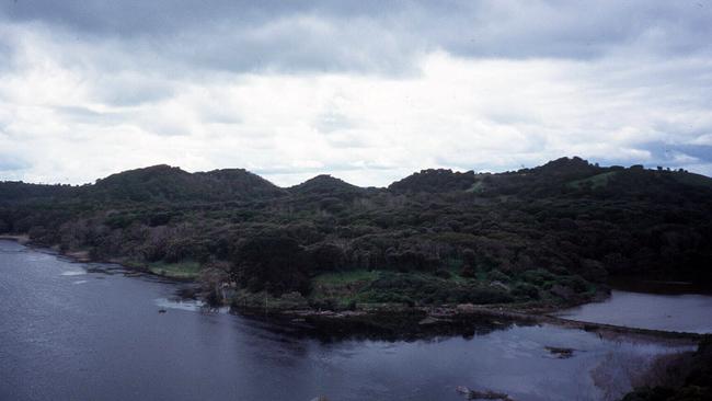
“It’s spectacular There’s a walkway around the top of the crater and you’ve got a walkway down around the lake itself. The walking trails take you through the lava flows, which are brilliant. It’s a wonderful place.
“Then we have Lake Condah, Lake Gorrie and Allambie (a former aboriginal mission on mission on Gunditjmara land), as well as a couple of properties down towards the coast.”
GETAWAY GOURMETS: FOOD TRAILS SHOW WHY VICTORIA HAS AUSTRALIA’S FINEST FOOD, WINE AND PRODUCE
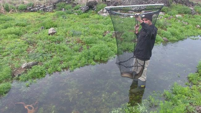
Aquaculture systems along the Budj Bim landscape are among the world’s oldest, and allowed the Gunditjmara people to herd and harvest eels for food and trade.
Find out more about the Mount Eccles National Park here.
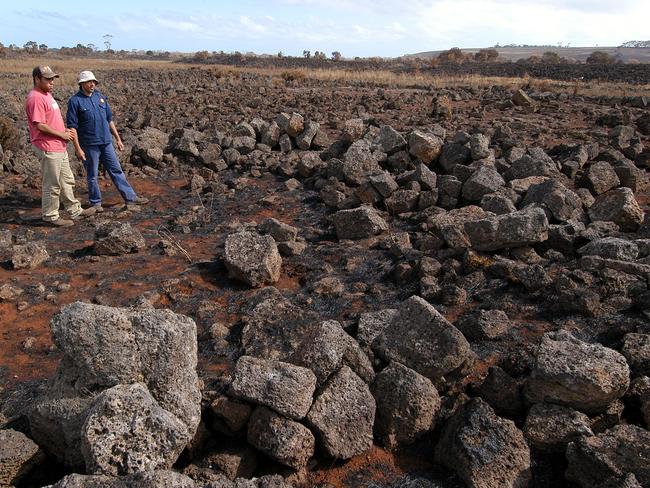
More exists at the Tyrendarra Indigenous Protection Area, between Warrnambool and Portland, where about 3km of signed walkways take visitors through the lava landscape and indigenous history including stone village sites and eel and fish traps.
Darlots Creek runs nearby along the lava flow and has great significance to the Gunditjmara.
“It connects us all. The traditional name for the creek is Killara, and that means ‘always permanent’. It’s never run dry in our cultural memory,” Mr Bell said.
The federal Department of Environment has plenty more information here.
About 25km north of Budj Bim is another extinct volcano — Mount Napier, or Tapoc — which is [protected by the Mount Napier State Park.
“You can walk to the summit of Tapoc. It’s a vigorous walk up to the top crater, but the views up there are amazing,” Mr Bell said.
“Then, just down the road, you’ve got the Byaduk Caves and Harmans Valley. You can really embed yourself in a volcanic landscape.”
Walks through the area take you to the crater at the top of the mountain, scoria cones and along lava flows that feature lava blisters — clusters of basalt the size of houses that jut into the landscape.
Find out more from Parks Victoria here.
Just west of Warrnambool, you can drive into a massive extinct volcano at Tower Hill.
The Tower Hill Wildlife Reserve is a haven for birds and wildlife, with two magnificent crater lakes, native bush and volcanic features where kangaroos and emus hold court in the car park.
It shares its traditional name, Koroit, with the nearest town.
What’s your favourite Victorian holiday getaway? Let us know in the comments below.
“The experience that visitors have there are very deadly, and that means very good. You can quote me on that,” Mr Bell said.
“There are cultural interpreters there at Tower Hill, and I think what the visitor gets to experience at Tower Hill is not just the geology with the eruptions on the coast, but you get the cultural heritage that the Gunditjmara people have with the mountain and the lake, and you also get the European history. It was one of the first spots that gliding started off.”
For more information on Tower Hill, head here.
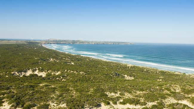
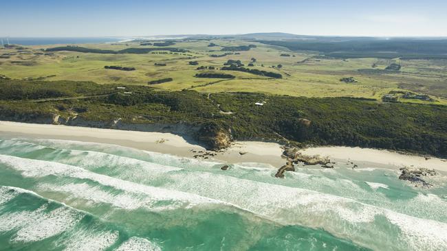
The Discovery Bay Coastal Park runs west from Cape Bridgewater, near Portland, to the SA border and protects 55km of uninterrupted ocean beach and many volcanic features.
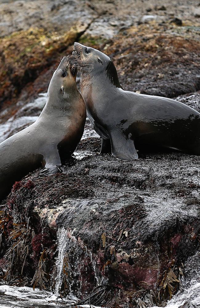
“You can take the Great South West Walk, which will take you into river country and sea country. You can see the seals, there are tours to the seals, and there is the petrified forest (at Cape Bridgewater), which is astounding. They are rock formations that look like tree stumps.
“That area has the highest cliffs on the Victorian coast. I remember being on the cliffs, looking down at the seal colony, and that has a couple of hundred seals, and over my shoulder I was looking at the sunset and mobs of kangaroos. That was pretty cool.”
HERE’S HOW YOU CAN GET BACK TO NATURE LESS THAN 100KM FROM MELBOURNE
The Tarragal Caves, north of Cape Bridgewater, are carved into limestone on the side of a hill, Mr Bell said.
“Our ancestors’ occupation there, according to archaeologists, goes back 14,000 or 15,000 years.
When you’re up there, it’s like you’re sitting on a throne looking over the cliffs and the ocean. It’s stunning,” he said.
The Discovery Bay region also features beautiful lakes with camping facilities including Bridgewater Lake, Swan Lake and Lake Monibeong.
Bushwalkers and picnickers can check out the fauna and wildflowers at the Mount Richmond National Park. Mount Richmond is an extinct volcano that’s covered by a layer of sand blown from the beaches of Discovery Bay.
“The visitor numbers are good but Discovery Bay is never crowded because you’ve got 55km of open beach,” Mr Bell said.
Parks Victoria has plenty of details about Discovery Bay here.
Nelson — the last Victorian town along the coast before the SA border — opens up yet another volcanic landscape — the gorge and cave country of the Glenelg River and the Lower Glenelg National Park leading through to the towns of Casterton and Coleraine.
Go here for details about the Lower Glenelg National Park.
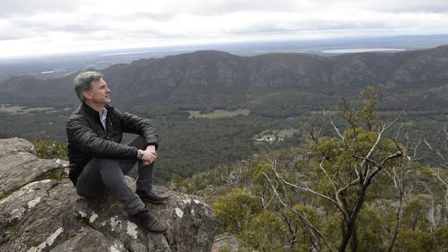
The Glenelg River leads all the way up to the Grampians (Gariwerd), the jagged end of the Great Dividing Range with two bush-covered ranges of granite outcrops that are significant to the whole landscape of the southwest, Mr Bell said.
Apart from the amazing lookouts and bushwalks through the Grampians National Park, the Brambuk Cultural Centre near Halls Gap gives visitors an insight into the area’s indigenous past.
For more information on the Grampians National park, go here.
Mr Bell said the Gunditjmara people co-manage many of these sites with Parks Victoria.
“It fills you with pride. With the stories in the stories that have been handed down from your Elders, and that gives you the obligation to protect country, care for country and to share the immense story of country,” he said.

‘Angels’: Hero Coles workers save mum’s life
A mother of three has opened up on how her life was saved after she suddenly collapsed while doing a routine supermarket shop.
Wildlife and traffic fears over music festival
Wildlife advocates fear a weekend music festival in central Victoria will endanger native animals including rescued joeys.