
Bold plan to link Melbourne’s green spaces
An ambitious plan to revitalise Melbourne by making it easier to walk from inner city green spaces has be revealed, with hopes the proposal could once again make people excited about coming into the city.
Victoria
Don't miss out on the headlines from Victoria. Followed categories will be added to My News.
Plans for a 10km continuous trail linking inner city green spaces are being finalised by the City of Melbourne.
The ambitious proposal would see Royal Park connected with Port Phillip Bay via North Melbourne, Docklands, the Yarra River’s North Bank in the CBD and Southbank Blvd.
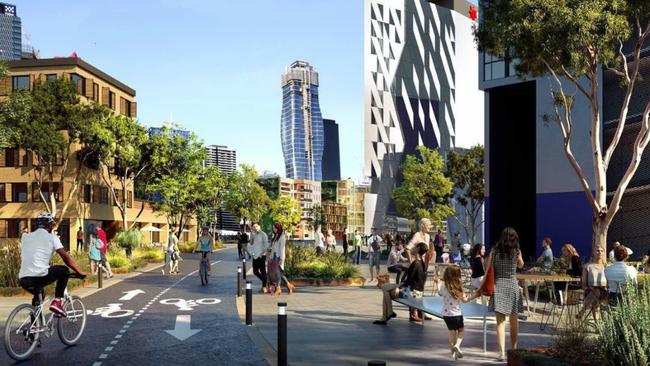
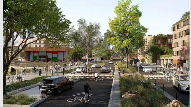
The Sunday Herald Sun can exclusively reveal the first images from the top secret project which is still to be vetted by city councillors amid competing visions for improving central Melbourne’s amenity.
One image shows how pedestrians, cyclists and cars would interact in a landscaped West Melbourne street, while the other reveals a bike path through Docklands with adjacent pedestrian spaces.
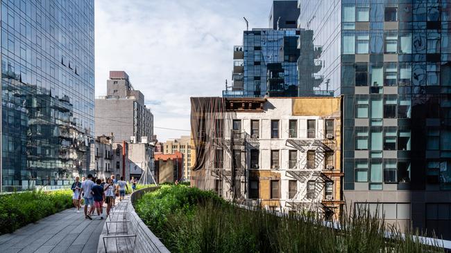
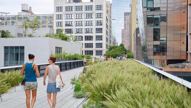
Called Greenline, the concept combines elements of city council planner ideas with Lord Mayor Sally Capp’s election pledge for Melbourne to have its own version of New York’s High Line Park.
But the High Line proposal, which would have involved building a platform over active rail viaducts, was quietly shelved given the huge costs and impracticalities involved.
On Saturday, Ms Capp said: “My vision for the Greenline is to create new public spaces to connect to existing parks and gardens in key inner city areas such as the North Bank of the Yarra River.”
“The North Bank is crying out for revitalisation and new connections to make our city more attractive and walkable. I want people to be excited about coming into the city.”
The Lord Mayor said more parks and gardens also needed to be provided in the growing areas of West Melbourne and North Melbourne.
“If the Greenline project stays true to this vision, it will provide a major boost to nearby businesses, create desperately needed jobs, make a more connected city, deliver new parks and open spaces for all Melburnians to enjoy, and become a major tourist attraction,” she said.
“Now is the time to have bold thinking and to start work on city-changing projects without delay.”
The proposal is expected to generate heated debate at Town Hall, with councillors split over the merits of the plan and the potential cost of creating a 10km linear green trail.
Council has previously discussed improvements to riverside amenity, releasing images last November showing new cafes, walkways and pontoons on the neglected North Bank.
And the council’s Domain Parklands Master Plan suggested a pedestrian and cyclist bridge be built over the Yarra linking Birrarung Marr and Botanic Gardens.
RELATED:
CHICAGO-STYLE TOWER TO REVITALISE SEEDY CBD STRIP
MELBOURNE SKYLINE CHANGING AS NEST OF CRANES RESHAPES OUR CITY