
Another cold front to sweep Victoria, bringing snow
Freezing cold winds, snowfall and rain are on the way for Victoria as another cold front blasts the state.
Victoria
Don't miss out on the headlines from Victoria. Followed categories will be added to My News.
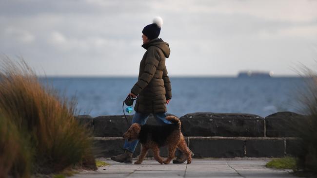
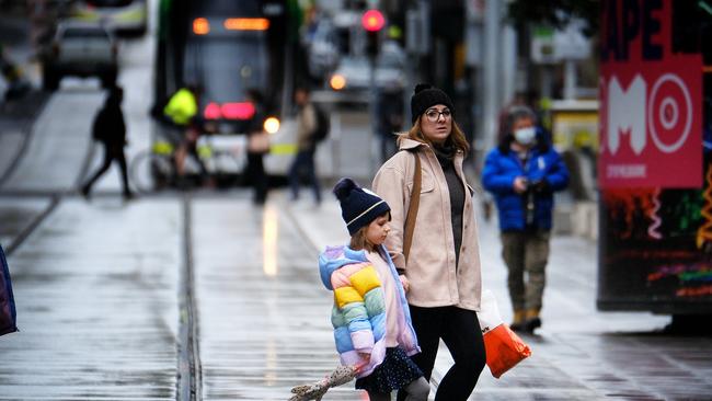
Victorians are being advised to rug up as a “vigorous cold front” sends the mercury plunging and wild winds batter parts of the state.
The Bureau of Meteorology issued a fresh severe weather warning early Monday, advising that “damaging winds” were expected for parts of Gippsland while a gale warning had been sounded for Port Phillip in Melbourne.
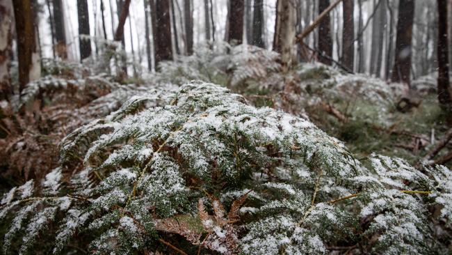
The cold front will also produce snow at elevated areas in some parts of the state.
Temperatures dropped to as low as -3.9C at Mount Hotham and -3.3C at Falls Creek overnight Sunday, while Latrobe Valley recorded a low of -0.1C and Sale 1.6C.
Across Melbourne, Coldstream was the coldest spot with the temperature dropping to 3.2C Sunday evening.
Melbourne will record a maximum of 16C on Monday with showers to hit the city in the afternoon.
The mercury will fall to 5C overnight with a maximum of 12C on Tuesday and 13C on Wednesday.
“A vigorous cold front will move across Victoria during the day today, with strengthening gusty northwesterly winds ahead of it,” the latest Bureau of Meteorology advice says.
“Damaging wind gusts in excess of 90km/h are expected to develop about elevated and exposed terrain this morning.
“These winds are expected to ease from the west later this afternoon.
“Locations which may be affected include Dargo, Mt Baw Baw, Falls Creek, Mt Hotham, Mt Buller and Omeo.”
Snow is forecast for mountain peaks above 1400m on Monday, before dropping to above 900m over central and western districts late Monday evening.
Snow is then possible above 500m during Tuesday morning with the snow forecast rising to 900m by Tuesday evening.
Earlier this month, the bureau warned the nation to brace for a third consecutive year of La Niña, sparking new fears of more flooding for the east coast.
Higgins Storm Chasing chief forecaster Thomas Hinterdorfer said the La Nina would bring strong winds, storms, hail and heavy rainfall across the state.
Mr Hinterdorfer said Melburnians can expect wilder, wetter weather until March.
“There is a big window,” he said.
“There should be a lot of rain events with the consecutive cold fronts that have come through and then we are expected to see more storms than normal through Victoria, heavy rain, hail and damaging winds.
“Typically Victoria sees above-average rainfall with La Nina, the data across the years isn’t as clear-cut as NSW and Queensland.”
For more weather, head to the Herald Sun weather page. Enter your town or postcode for region-specific weather information including a Melbourne radar and seven-day forecast.
More Coverage


Future Victoria: No room for cricket in shrinking back yards
Victoria will be fighting to save the back yard over the next 25 years after decades of shrinkage have turned it into a thin green line smaller than a cricket pitch.

Nick Reece has been Lord Mayor for 100 days. How has he gone so far?
Lord Mayor Nick Reece has reached 100 days in charge of Melbourne. As far he’s concerned, it’s so far, so good — but there’s still work to be done.