NewsBite

A look back at 100 years of flooding in Melbourne

MELBOURNE is set for a very soggy week, with rain forecast every day. Take a look back at the wettest days in Melbourne over the past 100 years when the city was inundated by floods.

The junction of Whiteman St, Clarendon St and Normanby Rd in Southbank is flooded after heavy rain hit Melbourne in 2016. Picture: Jake Nowakowski

MELBOURNE had a taste of sunny, spring weather last week — but it’s over.

Well, at least for the rest of this week.

The cold, wet misery of winter has returned with gusto, and parts of Victoria could be inundated with a month’s worth of rain today.

The town of Coleraine is battling rising floodwaters and flood warnings are in place for most rivers and catchments across the state.

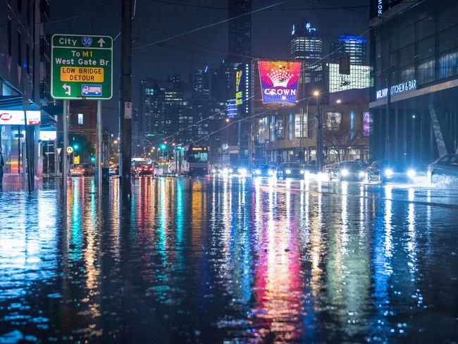
Melbourne is also set for a drenching, with a flood watch in place for Greater Melbourne catchments in Werribee, Maribyrnong, Yarra, Dandenong and Bunyip.

It’s unlikely Melbourne will be completely inundated, but it has happened before — with major floods that put much of the city underwater in 1934, and inundated in Elizabeth Street in 1972.

Take a look at the floods that shocked — and stopped — Melbourne.

This photograph was taken of flash flooding in Elizabeth St in 1862. Elizabeth Street has been inundated many times over the years. Picture: HWT Library.

The Yarra floods, 1934

After a wet spring that drenched the ground, the great Yarra River flood of 1934 was always a chance.

A cold front crossed Victoria on November 29 that year and a low pressure system developed in Bass Strait, which brought gale force south-westerly winds and torrential rain in central Victoria and Gippsland.

About 140mm of rain fell in Melbourne in the two days to December 1, but the rain was much heavier in the hills east of Melbourne, with some falls of 350mm or more recorded there and in South Gippsland over the same period.

That led to landslides and inundated roads.

Bridges washed away.

The Yarra River burst its banks and inundated Melbourne suburbs, forcing evacuations.

At least 36 people died and more than 400 buildings were flooded in Melbourne alone.

The show courts at Kooyong filled with water.

Strong winds and sodden ground caused many trees to be uprooted.

Stock, crop and property losses were heavy in the Yarra Valley, the Latrobe Valley and South Gippsland.

Many animals perished not because of the flood but from exposure caused by the continuous rain and high winds.

he tennis complex at Kooyong at the height of the December 1934 flood, as captured by a Herald photographer from the air. Picture: HWT Library.
A postman battles to deliver telegrams as floods turn streets by the Yarra River into canals in December 1934. Picture: HWT Library.
Men rowing through the suburb of Elwood in 1934 during a major flood that affected much of Melbourne. Picture: HWT Library
Front page of The Sun newspaper in 1934. Marooned Families Rescued By Police At Hawthorn. Picture: HWT Linrary.
Melbourne Zoo turned into a river during the 1934 floods. Picture: HWT Library.

Elizabeth Street floods, 1972

Melbourne’s wettest month was in February 1972, when 238.2mm filled the gauge.

On February 17 that year, a downpour from a severe thunderstorm drenched the Melbourne CBD.

The deluge flooded Elizabeth Street, which was built over a creek.

It sent a torrent of water roaring down the street towards Flinders Street station, swamping some cars and sweeping others away.

It’s not the first time Elizabeth Street has flooded in this way.

Elizabeth Street has flooded a number of times since Melbourne was first established, with the latest instance in March 2010.

Elizabeth St, during the heaviest rainfall ever recorded in Melbourne in 1972. Picture: HWT Library.
A storm caused flash flooding on Elizabeth Street in 1947. Picture: HWT Library.
A man swims along Elizabeth St in 2010. Picture: HWT Library.
Corner of Little Bourke and Elizabeth streets inundated by floods in 2010. Picture: HWT Library.
Ponyfish Island bar is no longer an island in this picture. The bar under the footbridge is at the mercy of the elements and is often flooded. Picture: HWT Library.
A punter finishes off his champagne despite the flooding at the Melbourne Cup in 1995. Picture: HWT Library.
The street flowing at Camberwell Junction in 2011. The cafe furniture is being washed away. Picture: HWT Library.
A bus battles through floodwater on Punt Road (St Kilda Junction) in 2011. Picture: HWT Library.
Business man Keith Owen walks through the flooded Yarra River on his way to work in 2012. Picture: HWT Library.
A car floating in floodwaters in Hoppers Crossing in 2012. Picture: HWT Library.
A cyclist on the bike path alongside Mullum Mullum Creek in Donvale. Water reached five metres above the normal creek height in 2011. Picture: HWT Library.
A swollen Yarra River in 2013 after torrential rain in Melbourne. Picture: HWT Library.

BTM

Add your comment to this story

To join the conversation, please Don't have an account? Register

Join the conversation, you are commenting as Logout

Original URL: https://www.heraldsun.com.au/news/victoria/a-look-back-at-100-years-of-flooding-in-melbourne/news-story/05238f77f8008cbaebd0b65a666b5575