
SA tops December rainfall average in just one day
SA’s December rainfall average has already been exceeded and the BoM says we can expect plenty more.
SA News
Don't miss out on the headlines from SA News. Followed categories will be added to My News.
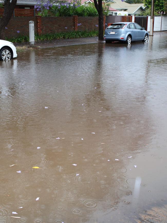
Adelaide has exceeded its average December rainfall in just over a day as heavy downpours continue to batter the state.
The city recorded 27mm of rain in the 30 hours up to 3pm today, which is more than the December average of 25.9mm, according to the Bureau of Meteorology.
Friday’s high heat was replaced with clouds and a chance of thunderstorms late yesterday and while that stayed away for the most part – except for some lightning strikes in the far southern suburbs – the rain has remained steady.
Senior meteorologist Simon Timcke said the showers will continue into tomorrow as a rainband moves down from the north-west of the state towards Adelaide.
“We will see periods of rain, on and off, for the rest of today and through tomorrow before a significant easing of the weather over Adelaide on Sunday afternoon,” he said, forecasting up to 20mm of rain on Sunday.

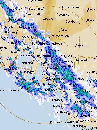
There won’t be any respite for the Eyre Peninsula with a severe weather warning issued for the area tomorrow, including parts of West Coast and North West Pastoral districts.
Heavy rainfall which may lead to flash flooding is forecast for the region throughout Sunday, with six-hourly rainfall totals between 30-40mm likely, and up to 100mm in some areas.
Towns which could be impacted include Whyalla, Coober Pedy, Wudinna, Elliston, Cleve and Woomera.
Wudinna is already one of the wettest towns in the state, receiving 32mm of rain in the six hours to 3pm.
Longwood in the Adelaide Hills also recorded 32mm of rain, while Strathalbyn and Hindmarsh Island both received 28mm.
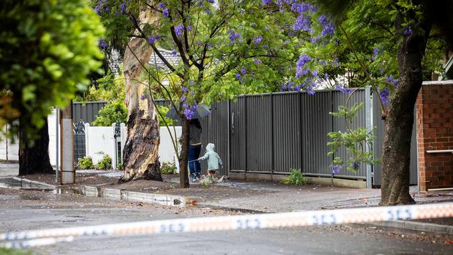
A flood watch was also issued today for the Mt Lofty Ranges, Mid North and Eyre Peninsula, with rivers and creeks in the Mt Lofty area at risk of isolated minor flooding.
Overnight, Adelaide’s metropolitan area picked up 8.2mm of rain, and Mount Lofty has recorded 12.8mm since yesterday 9am.
Meanwhile, tens of thousands of customers were left without power at the peak of SA’s predicted extreme weather event on Friday.
A high of 17 C is forecast for the city today, with rainfall between 10mm to 35mm.
Meanwhile, wind gusts this morning will travel south-easterly at 20 to 30 km/h with strengths increasing to 35 km/h in the afternoon.
Despite the predicted deluge, two major events in Adelaide’s CBD will go ahead as planned Saturday.
Locals are set for a wet summer week, with rain and cooler weather forecast to continue until Thursday, December 14 in the city areas.
The Adelaide Hills is expected to experience similar conditions, with a low pressure trough a cause for concern. Warnings have been issued for Mount Lofty Ranges, Eyre Peninsula and the Mid North, with Saturday’s thunderstorms and showers predicted to result in floods on Sunday.
The rainfall across Mt Lofty Ranges overnight has also caused rapid creek and river rises, with isolated flooding impacts.
But the rainfall in the Eyre Peninsula has the potential for the most damage, causing waterbanks to impact roads, travel and transport.
The temperatures for Mt Lofty will be a top of 14C and Eyre Peninsula will be a top of 16C.
Murray Bridge will also experience heavy rain on Saturday, which will continue until Wednesday, December 13, but the rainfall should get lighter each day.
The top temperature for Murray Bridge today is 17 C.
Senior meteorologist at the Bureau of Meteorology Simon Timcke warned of the “potential” of worsening weather, recommending people prepare their house and clear the gutters.
“Nothing threatening Adelaide right now but the potential is there,” he said on FIVEaa on Saturday morning.
“We have a few warnings out and one of those is a flood warning … and I think you’d want to make sure your box gutters are cleared.”
“But the much cooler conditions are significant, easing of the fire dangers for today.”
Widespread blackouts hit state
Dangerous weather conditions on Friday led to widespread blackouts, as 36 outages affected 25,000 customers across the state.
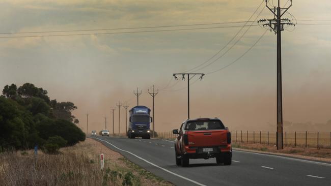
About 12,000 properties around Gawler, Roseworthy, Barossa Valley and across parts of the Mid North, including the Wirrabara Forest, were without power after SA Power Networks disconnected them due to the catastrophic fire danger warning.
By 6pm, more than 9000 customers were still without power as 28 outages continued with the most affected customers residing in the state’s far north and south-east parts of Adelaide.
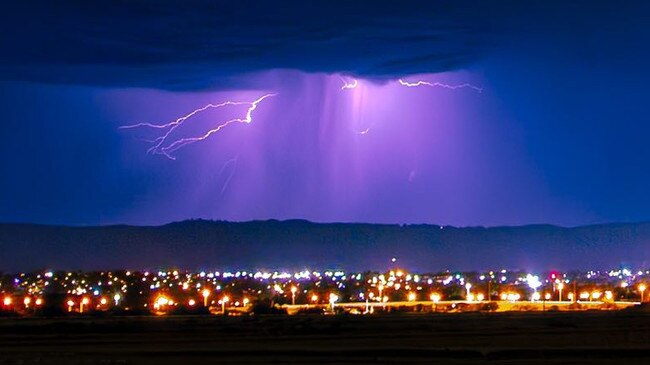
Dry lightning also took out electrical supply in the far-north Aboriginal community of Fregon, leaving 100 residents without power for two hours this afternoon. The state recorded 30,000 dry lightning strikes in total.
Emergency Services Minister Joe Szakacs said “the extreme weather and difficult conditions” across the state “played out as suspected”.
“The declaration of the catastrophic conditions across the state have been realised,” Mr Szakacs said.
“Today, we have had 250 crew on the ground, around 70 appliances.”
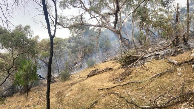
Several firefighters battled a number of blazes across the state with MFS and CFS crews attending 12 blazes by Friday afternoon.
The most significant flames were at Fourteenth St, Gawler South, Crouch Rd at Golden Grove a farm at Wye, Stuart Highway, Wirraminna, Spring Creek Mine Rd, Melrose and the Gammon Ranges National Park, 625km north of Adelaide.
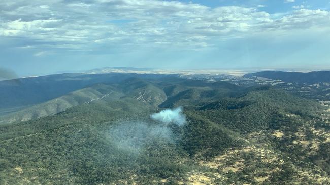
A series of fires ignited along the Stuart Highway between Pimba and Glendambo, and Tarcoola Rd stretching west to Kingoonya, approximately 630km northwest of Adelaide.
The fires along Stuart Highway, which ignited around 9.45am on Friday, had not been contained by 7pm.
Another bushfire sparked at Melrose in near Mount Remarkable in the Flinders Ranges, 260km north of Adelaide, required about 35 CFS, National Parks and Wildlife Services and Farm Fire Unit firefighters, supported by six aircraft.
About 35 firefighters worked to contain the Wye farm fire which sparked at about 1pm.
The blaze caused about $100,000 worth of damage and destroyed about 6,000 tonnes of cattle feed.
Many of the fires were believed to have been ignited by a band of lightning storms moving across the state, with total fire bans still in place for 10 regions by Friday.

The bushfire risk was rated as catastrophic in the Eastern Eyre Peninsula, Flinders, Mid North, Yorke Peninsula and Riverland. Thirty-four schools were closed on Friday.
Mount Lofty Ranges, North East Pastoral, West Coast, Upper South East and Murraylands, were hit with extreme fire danger ratings.
More than 30,000 lightning strikes were recorded across the state in 24 hours, with dozens of blazes contained by firefighters in the wake of the dry storm.
Wind gusts of more than 80km/h were recorded at Snowtown, combined with “extremely hot” temperatures – creating a perfect fire storm.
In the northeastern part of Eyre Peninsula, Cultana recorded wind gusts of 93km/h at 9am.
Authorities were bracing for an influx of flood-related call-outs as flood warnings were issued for the Mt Lofty Ranges, Mid North and Eyre Peninsula regions on Saturday.
Rivers in the Light and Wakefield, Angas and Bremer, Torrens and metro areas were all under flood warnings by Friday night, as were the Gawler and Onkaparinga rivers, West Coast rivers and creeks, and those on the Eastern Eyre Peninsula, and Lower Eyre Peninsula.
More Coverage


Originally published as SA tops December rainfall average in just one day

‘I don’t think I’d still be here’: Mum’s raw 27-week abortion story
A South Australian woman has given a raw and personal account of what her late-term abortion was like and why she chose that path.

Dramatic scenes as abortion vote descends into chaos
A Liberal MP is furious with party colleagues after late night drama erupted over what was expected to be a foregone conclusion.