
Gold Coast City releases new mapping which show 6000 properties in Cyclone Alfred’s firing line
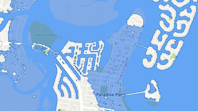
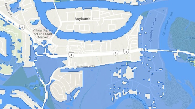
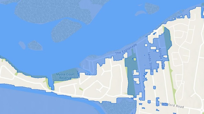
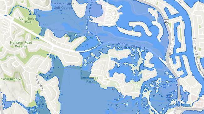
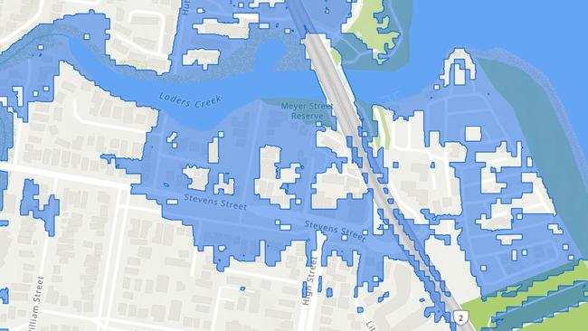
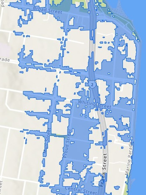
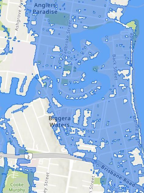
At least 6000 Gold Coast properties face being impacted by flooding or storm surges due to Tropical Cyclone Alfred, new mapping reveals. CHECK YOUR PROPERTY ADDRESS NOW
Gold Coast
Don't miss out on the headlines from Gold Coast. Followed categories will be added to My News.
At least 6000 Gold Coast properties could be impacted by flooding or storm surges due to Tropical Cyclone Alfred, new mapping reveals.
The new mapping to give impacted residents notice before the cyclone crosses the Gold Coast either late Thursday or early Friday morning was released by the City at 2pm on Tuesday.
It shows the worst areas will be Paradise Point, Hope Island, Jacob’s Well, Southport, Labrador, Biggera Waters, Runaway Bay, Coombabah, Norwell, Carrara, Surfers Paradise and Elanora.
Some parts of those suburbs are completely underwater in the maps, with neighbouring areas cut off from the road network.
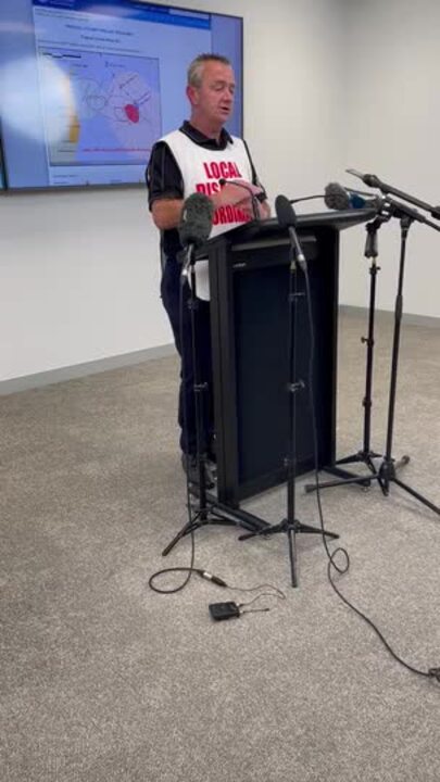
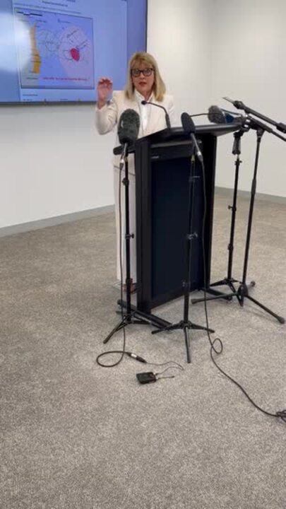
Acting Mayor Donna Gates said: “It is the very worst-case scenario. It’s not all over floor flooding that’s indicated. It might be just a small amount of water entering the boundary of the property.
“People will need to put their address (into our City dashboard system) and have a look.”
Ms Gates said no suburbs would need to be evacuated in preparation for the cyclone.
“Until the cyclone hits and we know where it crosses, there’s nothing that’s concrete. These maps are being provided just so people have an access to and understanding what the worst situation may be,” she said.
‘IT’S SCARY’: LATEST CYCLONE ALFRED WARNING FOR GC
EVENTS INTERRUPTED: GOLD COAST GIGS, SPORT AND MORE
FOUR EXPERTS WITH CYCLONE ALFRED INSIGHTS AND PREDICTIONS
The mapping was based on the highest amount of rainfall, flood waters and peak tidal surge.
Because each property is different, the modelling cannot show how much flooding will be at each premises.
Residents are encouraged to visit dashboard.cityofgoldcoast.com.au to search their property.
Mudgeeraba-based councillor Glenn Tozer, on Tuesday, warned hinterland residents Alfred would have huge impact in the city’s west starting on Wednesday.
“Expect sustained high winds, heavy rainfall and power outages. Make plans for your home today,” Mr Tozer said.
Just two years ago, the City was warned of the potential “catastrophic’ impact of future tropical cyclones with more of these extreme weather events likely to occur.
In a briefing which provided a guide, councillors were told in that instance more than 100,000 residential properties would be at risk of complete damage based on the modelling of the worst possible weather event - a Category 5 cyclone where wind gusts exceed 250km/h on the coast.
In a stunning twist, those winds would increase to more than 300km/h in the hinterland creating more damage there.
The Commonwealth’s Severe Wind Hazard Assessment report chose to investigate the city as a case study because Federal Government agencies feared the Coast due to population growth and older housing could sustain worse damage than any other regional area.
“While the probability of a Category 5 impact on the Gold Coast – or anywhere in South East Queensland – is low, the consequences would be catastrophic, comparable to the impact of Hurricane Andrew on Miami, Florida where 63,000 houses were completely destroyed,” the report said.
City leaders, at the time, met behind closed doors to discuss the shock findings and later worked to improve modelling and education of residents to the threat.
The key takeaways from the Geoscience Report were:
■ the city experienced the 1954 “Great Gold Coast Cyclone” and the 1967 cyclone season – and there is “significant likelihood of direct and indirect impacts from future TC events”.
■ In Category 3 and Category 5 scenarios, the older suburbs along the coastline suffer significant damage – all pre-1980s houses face extensive or complete damage.
■ more than 135,000 houses would suffer this fate, impacting on emergency management with large numbers of people being evacuated, seeking temporary accommodation.
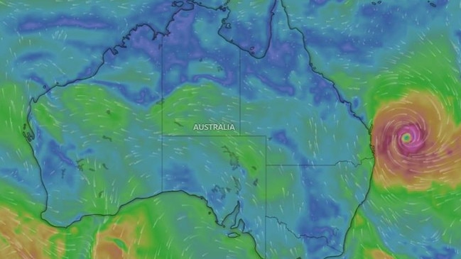
Alfred is gaining strength but only expected to be a Category 2 on landfall with forecasts of minor structural damage.
More Coverage
Originally published as Gold Coast City releases new mapping which show 6000 properties in Cyclone Alfred’s firing line
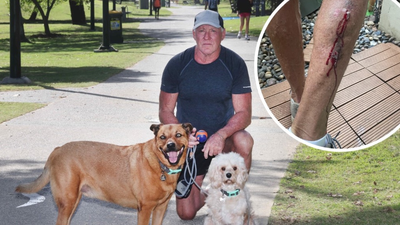
‘A baby will get killed’: Oceanway ebike victim calls for crackdown
The latest Gold Coast victim of an electric bike collision says a state government crackdown can’t come soon enough. FULL DETAILS
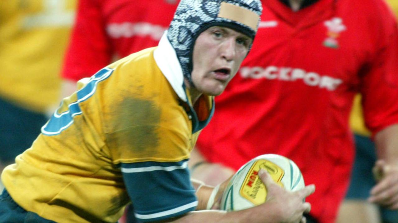
Rugby legend, insurer sued after alleged red-light T-bone crash
The CTP insurer of a hero of Australia’s 2003 Rugby World Cup is being sued after the legendary playmaker, who now owns a financial advisory, allegedly ran a red light and caused a collision on the Gold Coast.