
Colonial vision would have turned Glebe Island wasteland into a harbour gem
It could have been one of the most beautiful parts of Sydney Harbour but Glebe Island missed its chance, condemmned to remain an industrial wasteland

Today in History
Don't miss out on the headlines from Today in History. Followed categories will be added to My News.
As the renewal of waterfront real estate at Barangaroo continues, attention is now being turned to Glebe Island, with plans to transform the industrial district into one of Sydney’s gems.
The curiously named land feature, which hasn’t been an island since the 1840s, has languished as a virtual industrial wasteland since the failure of the original plans to give it over to residential development.
The island was first charted by Lieutenants John Hunter and William Bradley within weeks of the arrival of the First Fleet in 1788. The rocky outcrop, with high sandstone cliffs, was then part of 400 acres (161ha) of land granted to the Reverend Richard Johnson, the colony’s first chaplain in 1790. He didn’t think much of any of this land, describing it as “400 acres for which I would not give 400 pence”.
He tried to work the land but eventually abandoned it in favour of his personal land grants. The area became known as the Glebe, a term used for lands that are traditionally used to support the priest of a given parish. The island, across the water from Johnson’s grant, naturally became known as Glebe Island.
Johnson later left the colony and his lands were leased or sold by the church to small farmers and people wanting to build homes outside the bustle of the main colony around Sydney Cove, except for Glebe Island, which was sadly neglected while other islands and settlements continued to grow.
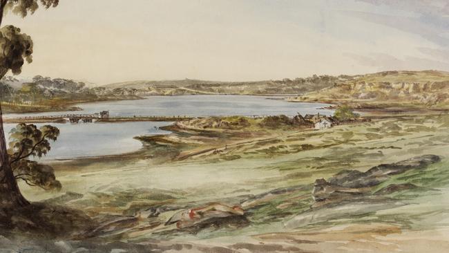
In 1841, surveyor William Wells drew up plans for a subdivision of the island. The plans show a series of streets at the western end of the island, suggesting plans for either housing or small businesses.
A notice for the sale of allotments was printed in newspapers in July 1841 and there were several more sales of plots over the next few years. But the subdivision as Wells envisaged it, with a residential development, didn’t eventuate and the land became increasingly industrial, resulting in the building of a narrow causeway out to the island, joining it to the Balmain shore.
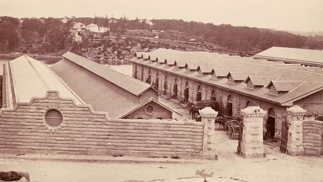
In 1848 the government began to discuss building an abattoir on the island, to remove animal slaughter from the centre of Sydney. The island was considered “admirably suited for the purposes.” Architect Edmund Blacket designed the buildings, which were erected over a period in the 1850s.
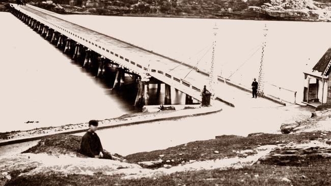
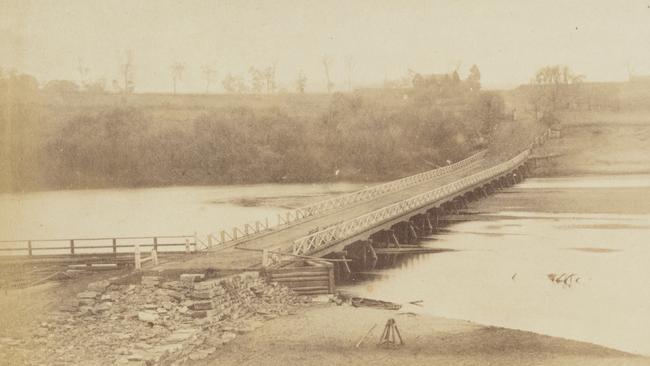
Balmain Council saw the potential for the island as a stepping stone across the waters to Pyrmont and into the heart of town. They purchased land to build a road across the island and built the first Glebe Island bridge in 1861, a low, wooden toll bridge.
By the 1890s, the bridge was badly in need of repair and in 1891 a competition was held to design a new bridge. It would take years for the new iron, swing-bridge replacement to be built. It opened in 1903 and operated until it was replaced by a new bridge in 1995, which became known as the Anzac Bridge.
By then, the abattoir had outlived its usefulness and was the subject of constant complaints about the smells as well as the pollution of the surrounding harbour. It was shut in 1915, the work removed to a new abattoir at Homebush and the Glebe Island structure was demolished in the 1920s.
In 1915, work began on levelling the island, quarrying the large sandstone outcrops and cliffs in order to create wharves. Much of the quarried material was used to reclaim land to join more of the island to the Rozelle shore.
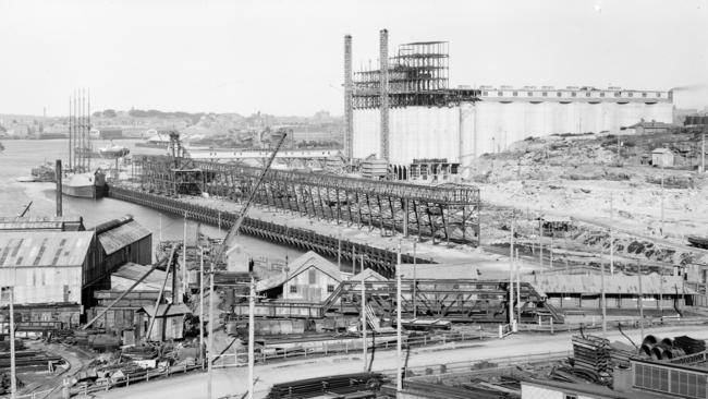
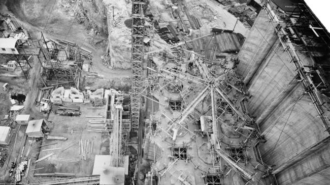
When the government secured contracts to supply vast quantities of wheat to the front in World War I, work began on constructing grain silos for handling the grain coming in from around the country.
Operated by the Grain Elevators Board of NSW, they became a major landmark, rising high above the increasingly flat stretch of land. They were used up until the 1990s when the bulk wheat handling operations were transferred to Port Kembla.
During World War II Glebe Island was partly taken over for use as a US Army base and after the war the thousands of cars being offloaded during the post-war boom became a familiar sight.
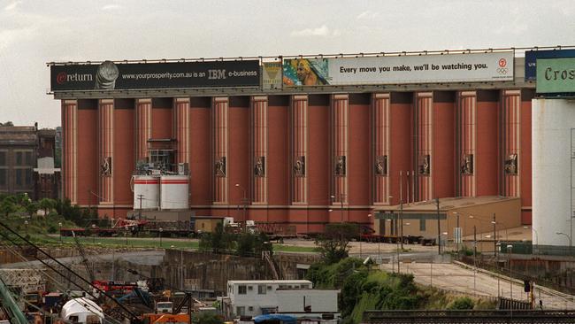
The eyesore got a bit of a makeover for the Sydney Olympics when the silos were painted to look like the columns of a Greek temple. While many people would lament these familiar symbols of Sydney’s working harbour and its past, others might agree that the island could use some beautification.
Originally published as Colonial vision would have turned Glebe Island wasteland into a harbour gem
Gallipoli to D-Day: Aussie’s epic war story
George Dixon went ashore with the original Anzacs at Gallipoli, aged just 15 – and was shot. Three decades later he was fighting again, at history’s other most famous wartime landing.
Love story behind escape tragedy
An Australian murdered in the infamous wartime Great Escape died after swapping places with another man. And his story is still unfolding, 80 years on.