
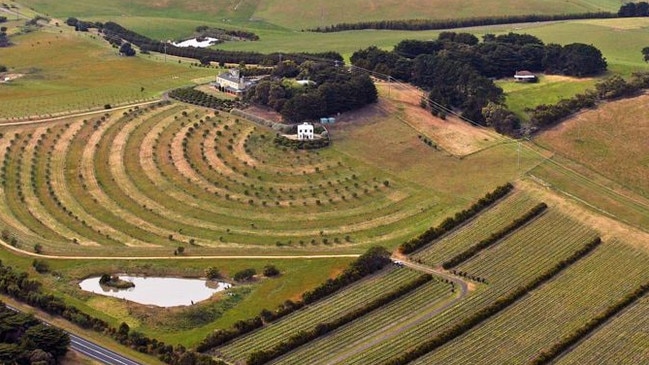
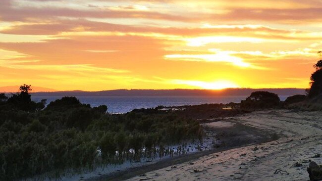
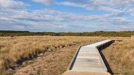
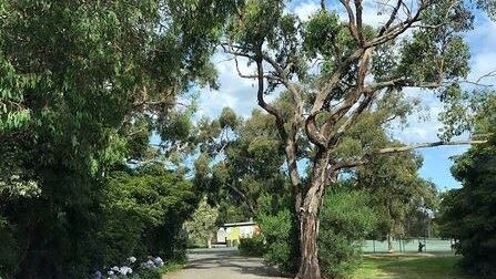
San Remo, Wonthaggi, Phillip Island: The best 30+ walks around the Bass Coast
From strolls around San Remo to hikes through Cape Woolamai, coastal views and lush wetlands Bass Coast has a plethora of walking and cycling trails. See the top 30+ here.

Bass Coast News
Don't miss out on the headlines from Bass Coast News. Followed categories will be added to My News.
The weather is getting better and Victorians are keen to get outside and take advantage of the great outdoor landscapes of Bass Coast.
There is no shortage of beautiful walks around the Bass Coast area.
With ranging levels of difficulty and accessibility there is something for everyone … even our four legged friends.
Here are the top walking and cycling tracks and trails around Bass Coast:
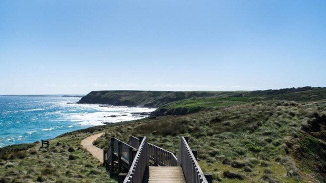
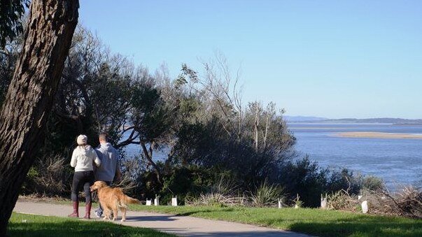
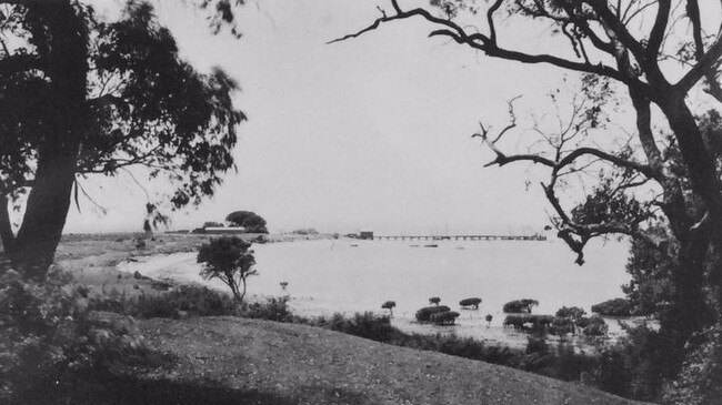
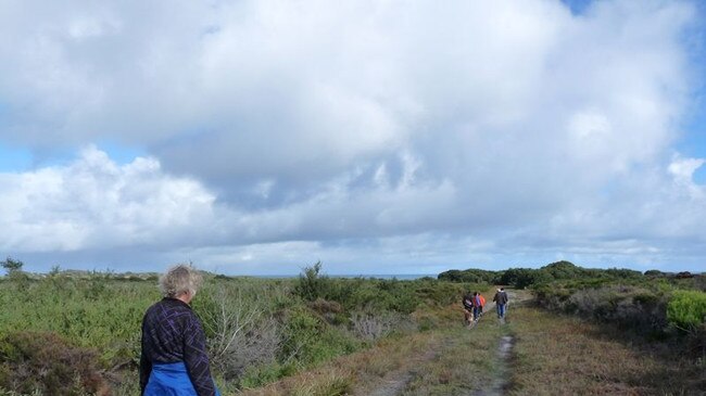
Anderson to San Remo pathway
Location: Phillip Island Road, Anderson
Soak up spectacular views of Western Port, San Remo and the Phillip Island Bridge as you make your way from Anderson into the San Remo township.
Enjoy fish and chips on the beach at the end of the walk or browse San Remo’s boutique shops for the perfect gift for that upcoming birthday.
Begin at the Anderson roundabout for a moderate to difficult 8km hike on gravel, concrete and boardwalk.
It is estimated to take about two hours to complete the walk.
Dogs are permitted on leads however it is not recommended for prams or wheelchairs due to steep inclines.
There are toilets and seating available.
Ayr Creek Walk
Location: Nesci Court, Inverloch
The Ayr Creek Walk takes you through some beautiful native bushland and wetlands. Enjoy the peace and serenity as you head down Nesci Court towards Royal Parade, cross the road and take the track through to Toorak Road.
From here, walk down Evergreen Ave, pick up the track from the corner at Beach Ave and wander through to Surf Parade, before crossing the road to the beach.
The walk should take you about one hour return and is about 3.4km of easy walking trails on grass, bitumen, boardwalk and sand. There is parking and is wheelchair friendly for about 2km from Nesi Court to Royal Parade.
Dogs are permitted on a lead and you can also ride your bike on this trail.
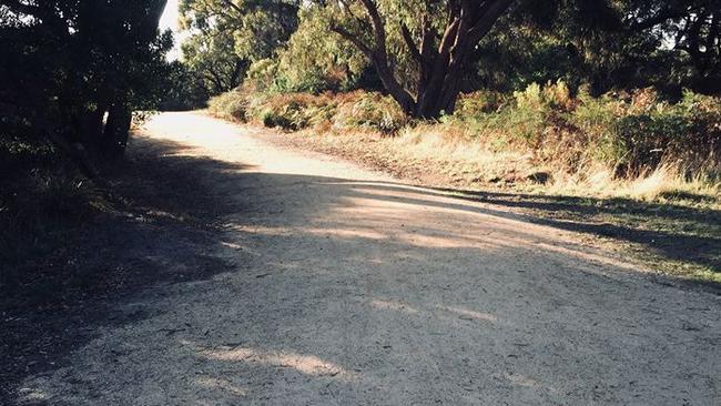
Bass Coast Rail Trail
Location: Old Wonthaggi Railway Station in Murray Street and runs to the Woolamai Racecourse.
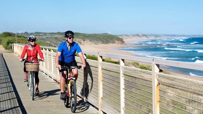
One of the biggest and arguably best walks in Bass Coast is the Bass Coast Rail Trail.
For 23km, the trail showcases the region’s history against stunning coastal views.
It is Victoria’s only coastal rail trail and it runs through the hinterlands of Wonthaggi, past the sand dunes of Dalyston, across the majestic Kilcunda Trestle Bridge and all the way to the breathtaking ocean views of Woolamai.
You can walk all of it, which would take about six hours or you can walk just one section of it, you chose.
It is rated an easy walk however there are two moderate climbs and a portion is uphill. The ground is granitic sand, gravel and boardwalk.
There are toilets and it is suitable for wheelchairs, sections closest to Wonthaggi and Kilcunda being the most accessible
Bikes and dogs on a lead are permitted and there is picnic tables and BBQs located at Wonthaggi Guide Park and in Kilcunda.
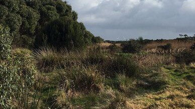
Baxters Wetland
Location: Intersection of Campbell and Chisholm Road, Wonthaggi
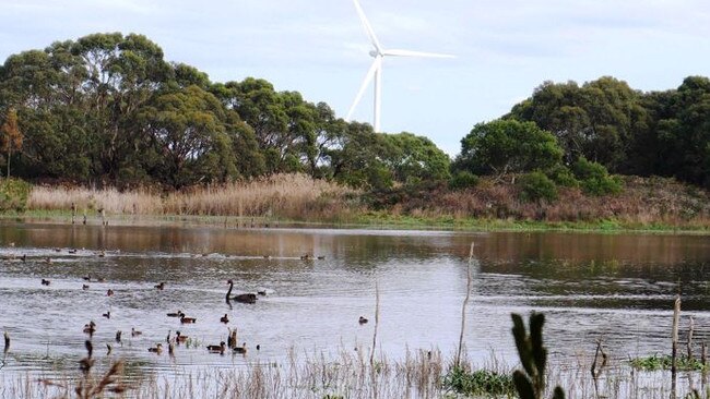
If you’re a wildlife lover or a birdwatcher, this is the trail for you.
This replanting project is home to indigenous vegetation, wetlands and its very own bird hide making it ideal for bird watching.
Wander a little further along the Baxter Wetlands trail to discover views of the Wonthaggi Wind Farm, and if you‘re feeling adventurous, follow the track all the way to Baxters Beach – but be warned this section of the track is a rough, steep track that can at times be a little muddy.
Dogs are permitted on a lead and bikes are also permitted. It is not recommended for wheelchairs.
Cape Paterson Foreshore walk
Location: Off Surf Beach Road, Cape Paterson near the boat ramp
Along the Cape Paterson Foreshore Track you’ll encounter a variety of spectacular scenic clifftop lookouts, and views of the coastline.
Wander down to the beach and explore Cape Paterson’s iconic rock pools, and make sure you look for the ‘swimming pool’ near the boat ramp, blasted from rock platform by miners in 1910.
At only 1.4km return this is one of Bass Coast’s shorter walks.
If you don’t stop it will take approximately 20 minutes, but with so many beautiful sights be prepared to take a bit longer.
It is an easy trail with gentle undulations over gravel, boardwalk and soft sand.
Wheelchairs suitable for about 1km from Surf Beach Rd to main track and between boat ramp and First Surf car parks.
Dogs are permitted on a lead however, bikes are not permitted.
Cape Woolamai Walks
Location: Woolamai Beach Road, Cape Woolamai, Phillip Island.
Cape Woolamai is home to some of Bass Coast’s most iconic walking tracks.
This area is a hiker’s delight with an array of walks to choose from, including the Pinnacles Walk, Old Granite Quarry Walk and Cape Woolamai Beacon Walk.
You can tackle just one or make a day of it and embark on all three as part of the Cape Woolamai Circuit.
If you’re visiting between October and April be prepared to see the shearwaters, as Cape Woolamai plays host to up to a million of them.
From the carpark, walk onto the beach, turn left, follow beach for about 1km, then take the stairs up to cliff top to loop walks.
The Pinnacles Walk follows the green makers and is 4.5 km return. It should take you about one and a half hours.
The Old Granite Quarry Walk follows the blue markers and is 6km return. This one should take you about two hours of walking.
The Cape Woolamai Beacon Walk follows the black markers and measures at 6.6km return. It should take about two and a half hours out of your day.
If you’d like to tackle the whole circuit you’re up for about 8km of walking and expect it to take you about four hours.
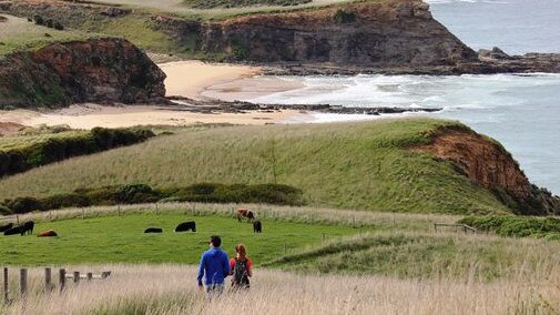
Churchill Island
Location: Churchill Island is reached by a bridge from Phillip Island (near Newhaven). The turn-off to Churchill Island from Phillip Island Road is well signed.
If you're interested in a bit of history while you walk, the Churchill Island trails are perfect for you.
On Churchill Island, you‘ll not only find an adorable family of Highland Cows, but walking and cycling tracks.
The Churchill Island Loop walk is an easy stroll around the island, and you can also enjoy the shorter walks – the North Point Loop, and the Wadjil’garook Wetland, where you can learn about Indigenous culture and wetland birds.
The Churchill Island loop is 5km and will take about one and a half hours and the North Point loop is a bit shorter at 2.5km, only taking about 45 minutes to complete.
Both are considered a moderate level of difficulty however are wheelchair and pram friendly.
There are toilets and parking available. Bikes are allowed but dogs are not.
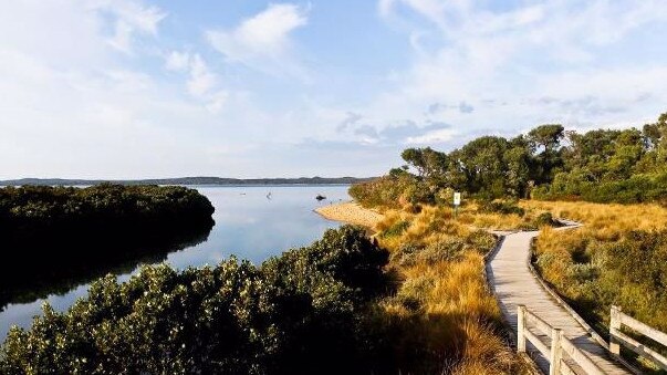
Conservation Hill and Rhyll Inlet Walks Phillip Island
Another one for the bird lovers, this habitat is world renowned for migratory wader birds and other wildlife species and its tranquil mangroves and wetlands are listed under the Ramsar Convention as having international importance.
Along the Conservation Hill and Rhyll Inlet Walks you will find an array of boardwalks that loop through the mangroves, saltmarsh and mudflats. You may even be treated to the presence of spoonbills, oystercatchers, herons, egrets and cormorants.
With lots of options you can either pick one boardwalk or tackle them all for a great day of exploring.
The Mangrove boardwalk is a shorter walk, measuring at just 1.2km return it should take you about 25 minutes to complete a round trip.
The McIlwraith Road Lookout walk is 4.5km return which will take about one hour of walking return and the Rhyll Village walk is the longest of the three at 7km return taking about two and a half hours return.
All easy walks they are suitable for prams with the Mangrove boardwalk being suitable for wheelchairs.
No dogs are allowed but feel free to take the bikes along.
Corinella Foreshore Walk
Location: Jamieson Street, Corinella
Enjoy an evening stroll and stunning sunset with views of French Island and Westernport Bay or head out for a picnic lunch.
A sheltered walk with views across the large tidal bay, the Corinella Foreshore Walk is also home to swans and other waterbirds.
This walk should take about 40 minutes to complete measuring in at a nice 2.3km return.
It is not suitable for wheelchairs but is suitable for prams. It is ranked at the easy level with gentle undulations.
There are no toilets but there is parking and seating available. Dogs are allowed on a lead and you can also ride the trail on a bike.
Coronet Bay to Corinella
Location: Norsemens Road, Coronet Bay to Palmer Street, Corinella
Pack a picnic and explore the coast.
As you embark on the Coronet Bay to Corinella walk, you'll discover a small wetland area that is home to a variety of waterbirds and enjoy scenic views across Western Port. Enjoy this coastal walk through She Oaks and Coastal Banksia, enjoying views of Western Port’s cliffs and coastlines.
This is an easy walk with one uphill section near Settlement Point. It is suitable for wheelchairs, prams, bikes and dogs on a lead.
Cowes East Heritage Walk
Location: Starting point is at the Cowes Visitor Information Centre – 97 Thompson Ave, Cowes
This is one for the history lovers.
The Cowes East Heritage Walk is your chance to embrace and explore the history of Phillip Island. During the self-guided walk of Cowes, you will discover Phillip Island heritage sites including the parish hall, butcher shop, bakery, guesthouses, farms and old post office.
One way is a 3km walk which should take about one and a half hours to complete. It is suitable for wheelchairs and prams.
There are toilets and parking available.
Dogs are permitted on a lead and bikes are also allowed.
Pop into the Visitor Information Centres in Cowes or Newhaven to collect your own map.
Cowes West Heritage Walk
Location: Starting point is at the Cowes Visitor Information Centre – 97 Thompson Ave, Cowes.
Continue with a historic walk around Cowes and explore the West.
If the Cowes East Heritage Walk wasn't quite enough history for one day, embark on the self-guided Cowes West Heritage Walk. Along the trail, you will discover further heritage sites including Phillip Island’s first and second hospitals, historic houses, guesthouses and cottages, and the power station site.
This walk also measures in at 3km one way and should take about the same amount of time, one and a half hours.
Wheelchairs, prams, dogs and bikes are all allowed and much like the East Heritage Walks toilets and parking are available.
Pop into the Visitor Information Centres in Cowes or Newhaven to collect your own map.
Forrest Caves Walk
Location: Turn left off the main Phillip Island Road (coming from San Remo) just before the Surf Beach Estate. Walk up the steps from the car park on to the beach and then turn left.
At 2km return it should take about 45 minutes to complete.
Grading is Easy walking over beach sand and steps. It is not suitable for wheelchairs, prams or bikes and dogs are not allowed.
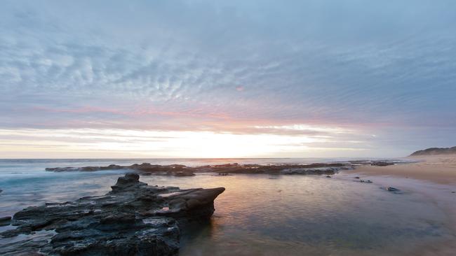
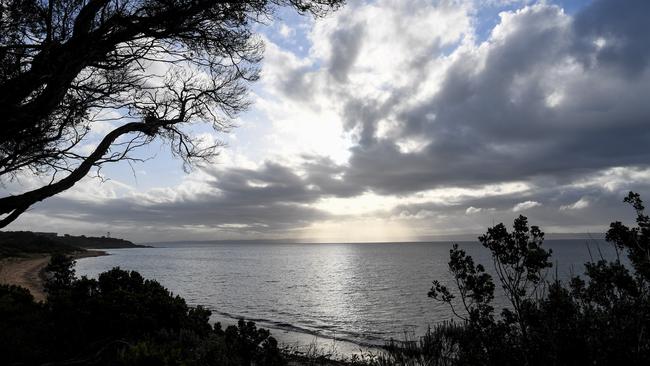
George Bass Coastal Walk
Location: Bass Highway, Kilcunda or Punchbowl Road, San Remo
One of the most magnificent walks in the region, this spectacular trail rises high above the pounding surf of Bass Strait.
The walk offers panoramic coastal views, before its winding path passes across the beach and through farmland to the Punchbowl Coastal Reserve.
Make sure you plan your trip wisely, as beach access is at low tide only.
A longer walk, this one will take about five to six hours return at 14km. You can enjoy a halfway lunch at the Kilcunda General Store when you arrive in Kilcunda.
It is a moderate to difficult hike and is not suitable for wheelchairs or prams. Dogs are permitted on a lead.
Grantville Foreshore Walk
Location:Pier Road, Grantville
Pack your binoculars and bird book, and head off on a short walk along Grantville Foreshore.
Soak in the beautiful views of Western Port, French Island and Westernport’s mangrove habitats along the Grantville Foreshore Walk, all while keeping a look out for some or all of the 300 bird species that make Western Port their home.
Only measuring at 720m this one should only take you about 10 minutes to complete but that doesn’t mean it isn’t a spectacular stroll.
It is an easy one suitable for prams and bikes but not for wheelchairs.
Dogs are permitted on a lead.
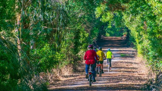
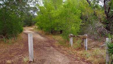
Great Southern Rail Trail
Location: From Leongatha, the trail goes through Koonwarra, Meeniyan, Stony Creek, Buffalo, Fish Creek, Foster, Toora, Welshpool and Port Welshpool, offering rural and bush views along the way.
Inverloch Foreshore shared pathway
Location: Cuttriss Street, Inverloch
Whether you're walking the dog, going for a ride with the family or for an afternoon jog, the Inverloch Foreshore Shared Pathway is always a good option.
Running between Cuttriss Street and the Ayr Creek Bridge, this path has a number of access points to the foreshore, and also passes by the Rainbow Park playground, picnic areas and four exercise stations.
You’ll also enjoy beautiful views of Anderson Inlet and Point Smythe along the way.
At 5km return this entire walk should take you about one and a half hours.
It is an easy walk with a sealed concrete pathway making it suitable for wheelchairs and prams.
Bikes are permitted as are dogs on a lead.
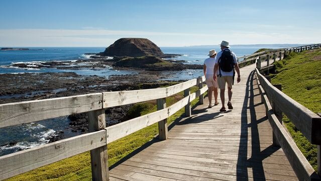
Kitty Miller Bay Walk
Location: Start from the Kitty Miller Bay car park at the end of Kitty Miller Road and walk left along the beach and rock platform.
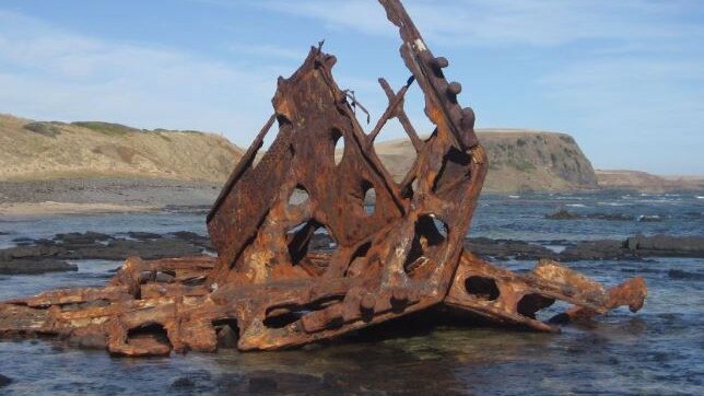
Spot a shipwreck and stunning ocean views.
Running aground Phillip Island‘s coast over a century ago in 1906, remnants of the SS Speke shipwreck can sometimes be spotted from the Kitty Miller Bay Walk. Either way, you’ll have stunning ocean views to enjoy. Make sure you plan your walk for low tide, as access is otherwise limited.
A difficult 2km walk will take you about an hour to complete over rocks, grass and sand. It is a slippery undefined track and is not suitable for wheelchairs or prams. Dogs are not permitted and while bikes are allowed they are not recommended.
Newhaven Historical Walk

Another self-guided history walk at the other end of Phillip Island.
Along the Newhaven Historical Walk, you'll find yourself passing by a collection of historic sites on Phillip Island, including the old suspension bridge, St Pauls boys home, the original site of the post office and much more.
Made pathways make this 3.5km walk an easy one and a half-hour stroll. It is wheelchair friendly and suitable for prams and bikes.
Dogs are also allowed.
Pop into the Visitor Information Centres in Cowes or Newhaven to collect your own map.
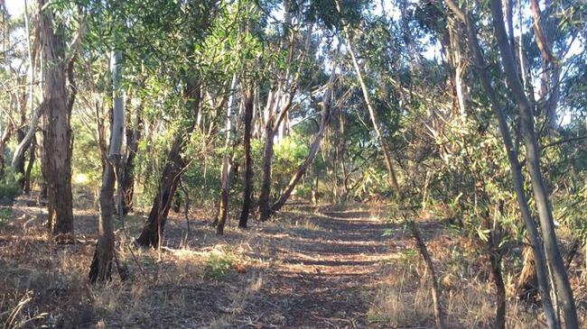
Oswin Roberts Reserve Walks
Location: There are three track loops which all start from the car park off Harbison Road.
Explore the last remaining bushland on Phillip Island at the Oswin Roberts Reserve.
Offering a series of different walking and cycling tracks, this thriving area is ideal for spotting wildlife, including koalas, wallabies and birds, and is the perfect setting for a family outing.
The Oswin Roberts Circuit is 4.6km return and should take about one and a quarter hours to complete.
The Woodland Loop is a bit shorter at only 2.8km return it should take walkers about 45 minutes to complete a round trip.
The Melaleuca Loop is the shortest of all the trails at only 1km and should take about 30 minutes.
All tracks are easy however the longer tracks do have some moderate undulations.
The walks are wheelchair friendly and pram friendly
Bicycles are permitted but dogs are not.
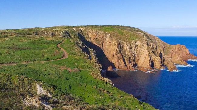
Pyramid Rock to Berrys Beach Walk
Location: Walk starts from the car park at the southern end of Pyramid Rock Road.
This walk starts near Pyramid Rock — one of Phillip Island’s southern most points — and proceeds along the coast to Berry’s Beach Road, with boardwalks leading to viewing platforms that allow you to really soak in the stunning coastline before you.
A moderate difficulty this 5km walk should take you about two hours to complete a round trip. There is parking and toilets available at the beginning of the walk.
There are no dogs or bikes allowed on this walk and it is not suitable for wheelchairs or prams.
Rhyll Historical Walk/Drive
Another history lesson, this time in the peaceful Rhyll.
With over 150 years of European history, the quaint seaside town of Rhyll has an abundance of historic sites and buildings worth discovering. This walking and driving tour will take you to sites including the post office, general store, pioneer houses and cottages, a sealers hut and Lady Nelson Point. The tour is marked by upright jetty timber posts showcasing informative bronze plaques so you can learn while you wander.
It is a 3.5km trail and if walking it will take about two hours return.
it is rated easy to moderate and the surface is gravel, boardwalks and grass.
Most of the walk is suitable for wheelchairs, some areas are grass and can be difficult to access in wet weather.
It is suitable for prams, bikes are permitted and so are dogs.
San Remo Coastal Circuit

A scenic coastal track with spectacular views of Cape Woolamai, the bridge to Phillip Island and Western Port, the San Remo Coastal Circuit curves around Davis Point and follows the length of Children’s Beach and Back Beach.
During the San Remo Coastal circuit, you can opt to walk through San Remo, and perhaps enjoy a coffee or lunch while you‘re there, or continue along the coast and enjoy the views.
The Circuit walk is a 2.5km loop and will take about 40 minutes return.
The Coastal walk is 4km return and will take a little longer at about one hour.
It is rated easy but wheelchairs are unsuitable except for Marine Parade and Back Beach Road, this is the same for prams and bikes.
No dogs between 10am-6pm between December 1 and April 30, other times dogs on lead.
Scenic Estate Conservation Reserve
Location: The Reserve is sited along the Phillip Island Road (in between Newhaven and Surf Beach Estate) and is easily accessed by car or bike via the shared pathway across the Island from Newhaven to Cowes.
With its interesting history as a failed residential estate in the 1960s, Scenic Estate has been transformed into a stunning conservation reserve with stunning views.
The reserve is also a haven for avid bird watchers, as it provides habitat for six species of threatened birds.
A boardwalk takes you through a variety of endangered native grasslands, wetlands and indigenous plants, with a viewing platform overlooking the Churchill Island Marine National Park and Ramsar Wetland. Don‘t forget to pack a picnic and take advantage of the picnic shelters and seats.
Go at your own pace and explore the 195m of boardwalks. It is an easy walk that is pram friendly and bikes are permitted.
It is not wheelchair friendly and dogs are not allowed on the foreshore reserve but are allowed on a lead in the other areas.
Screw Creek Townsend Bluff Estuary Walk
Location: Foreshore Camping Reserve Road, which is a continuation of The Esplanade, Inverloch
The Screw Creek Townsend Bluff Estuary Walk splits after the bridge at Screw Creek, with the left track continuing on to fishing platforms, and the right track winding up to the Bluff. Enjoy an undulating walk over the boardwalks, saltmarsh and mangroves of Screw Creek, and be rewarded with scenic views over Anderson Inlet from the Townsend Bluff lookout.
At only 2km return this walk should take you about 30 minutes. It is an easy walk but is unsuitable for wheelchairs.
There are a small amount of steps but otherwise it is suitable for prams. Bikes are not permitted but dogs are allowed if kept on a lead.
Settlement Point, Corinella Walk
After this short walk through a wide variety of native vegetation and wetlands, you‘ll enjoy ample views from the lookout of Western Port’s cliffs and coastline, as well as the nearby French Island.
A very short walk at only 850m it should take about 15 minutes to complete.
Wheelchairs suitable on main track, except in wet weather, and prams are suitable for the track also.
Enjoy a bike ride along the track or take your dog down for a walk on the lead.
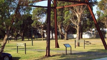
State Coal Mine Central Area Walking Tracks
Location: Campbell Street or West Area Road, Wonthaggi.
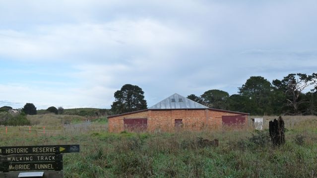
Wonthaggi’s historic coal mining sites, including the Number 5 Brace and Rescue Station can be easily viewed from the path along the State Coal Mine Central Area Walking Tracks. Each of the five designated walking tracks reveal a different aspect of the central mining area.
The Pioneer Mines Loop track will take you to where boring for coal started in 1909. The Baxters Loop will take you to Number nine shaft and Number 10 shaft, Baxters Wetland and bird hide.
The Brace Loop takes you through the main central working areas and along the haulage line. The Rail Trail Historic Mining Track takes you through the central area workings and along the railway marshalling yards.
The Cinder Loop track is unique in that a section of the track is made of cinders (ash) from the powerhouse boilers.
Dogs are permitted on a lead but the tracks are unsuitable for wheelchairs, prams and bikes.
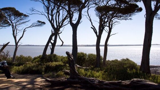
Swan Lake Trail

Location: Swan Lake information shelter on Ventnor Road just before the Penguin Parade entrance.
Stroll around the Swan Lake Trail and enjoy an abundance of bird life and the tranquillity of the only permanent freshwater lake on Phillip Island. Situated just before the Penguin Parade entrance, this area is also a significant site for the Bunurong Aboriginal people, and provides great bird watching from the bird hides near the lake’s edge.
About 20 minutes of walking could in fact take a lot longer if you stop to take in the sights and spend some time at the bird watching house.
It is graded as easy and is both wheelchair and pram friendly. Bikes are permitted and dogs are not permitted.
Tank Hill Reserve
Location: Reed Crescent, Wonthaggi
If you’re looking for a brief stroll this one is for you.
Take a wander through the native bushland at Tank Hill Reserve and see if you can spot a wide range of birds species. This trail takes you through the site of Wonthaggi’s first water supply, and you can explore a number of smaller tracks branching off from the main loop. You may also notice some new vegetation planted by dedicated volunteers after a fire damaged the area in December 2015.
The main track is only 600m return which should only take about 10 minutes.
There are a few short steep climbs with parts of uneven track. The track surface is sand and dirt
It is not wheelchair friendly or pram friendly and bikes are not permitted. Dog are allowed on lead.
The Gurdies Nature Conservation Reserve
The Reserve represents some of the largest remaining areas of native vegetation on the eastern shore of Westernport. It is home to a variety of animals, birdlife and even native orchids.
A moderate walk that is 5.8km should take you about one and a half hours to complete.
The track surface is sand and gravel. Mountain bike riding permitted on vehicle width tracks and dogs are permitted on a lead.
The Nobbies Walk
Location: The walk can be accessed from the car park
Endless views of our spectacular coast.
With a maze of boardwalks waiting for you to explore, see if you can spot the blowhole, an amazing sea cave that thunders during big southern swells. It‘s also a popular area for breeding colonies of a variety of seabirds, including Little Penguins and Silver Gulls.
It is an 800m track that would take about 20 minutes of straight walking but, with all the beautiful sights it is recommended you leave a bit longer to take it all in.
It is suitable for wheelchairs for approximately 800m of timber boardwalk in the upper level, there are steps in the lower section of the boardwalk.
It is pram friendly however dogs and bikes are not permitted.
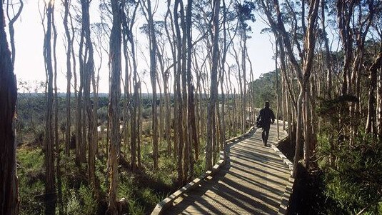
Thompson Estate Nature Reserve
Location: Inverloch-Venus Bay Road, Cuttriss Street, or Pier Road, Inverloch.
For a glimpse of what Inverloch looked like before settlement, take a stroll through this woodland reserve.
This short trail will take you through natural bushland, original woodland and low-lying swamp paperbark thickets that once covered the land where Inverloch now stands. This is a marked nature walk and the South Gippsland Conservation Society pamphlet (available at your local Visitor Information Centre) corresponds to the pegs along the track to provide information on flora and fauna.
A 2km loop should take about half an hour to complete.
Prams suitable in some parts of walk but not all bikes are not permitted but dogs are allowed on a lead.
Ventnor Beach Walk
Enjoy this 5km, one hour return walk along the Ventnor beach while enjoying the spectacular sights of Phillip Island, and the Mornington Peninsula in the distance.
An easy walk across gravel, stairs and beach sand. The surface of this track makes it unsuitable for wheelchairs, prams and bikes.
No dogs west of Ventnor Beach as signed
Wonthaggi Bushland Nature Conservation Reserve
Wander through rare natural remnant bushland that has never been cleared. Only a short walk, the Wonthaggi Bushland Nature Conservation trail will take you through native vegetation including a Melaleuca Swamp trail.
A 20 minute 1.2km loop is an easy walk but is narrow in sections making it unsuitable for prams, bikes and wheelchairs.
Dogs permitted on lead.
Wonthaggi East Area Rail Trail
Discover Wonthaggi by foot and pass by a tribute to its coal mining history in the heart of town. This Wonthaggi East Area Rail Trail joins on from the Wonthaggi State Coal Mine and will guide you to the iconic Poppet Head in Apex Park. You can choose your own beginning and end on this easy walk that will take you through Fincher Street Reserve, across Bass Highway and continue on a sheltered path bordered by native vegetation.
4.4km of track should take walkers about one hour to complete. It is an easy track and is wheelchair accessible for Fincher St Reserve only, 2km return.
This walk is pram friendly and bikes and dogs are both permitted.
Wonthaggi Heathland and Coastal Reserve
The Wonthaggi Heathland and Coastal Reserve is an incredible 811ha area surrounded by 10km of unspoilt and secluded coastland. The Reserve was formed from old coastal dunes, and the developed heathland has been able to sustain a specialised vegetation cover. It‘s also the perfect place for viewing the area’s flora and fauna.
The main track is 6.7km long and will take about two hours to complete however, there are many other smaller tracks to complete as well.
Due to the surface being rough and sandy it is not suitable for wheelchairs or prams.
Bikes are permitted and so are dogs if they are on a lead.
Wonthaggi Rifle Range Wetland
Enjoy a scenic walk through the wetlands of the rehabilitated Wonthaggi Rifle Range before soaking in panoramic views from The Butts Lookout. About 200m from the car park, the Wonthaggi Rifle Range Wetland track branches to the right to a bird hide overlooking the wetlands and if you‘re keen for a longer stroll, you can continue on from the Butts Lookout to the Wonthaggi Heathland and Coastal Reserve. A bit of fun trivia for you – The Butts is a mound of clay placed behind the targets of the old rifle range, with any bullets that missed the targets generally hitting the clay mound.
The easy track is about 2km and should make a return trip of about one hour.
Track surface is grass and compacted gravel. It is not suitable for prams, wheelchairs or bikes.
Dogs permitted on lead.
Wonthaggi Wetlands Reserve
Location: Dudley Road, Outlook Drive or the Corner of Korumburra Road and Biggs Drive, Wonthaggi
You may be surprised to find such a peaceful wetland walk in the centre of Wonthaggi.
This easily accessible area allows you to enjoy stunning natural surrounds, with plenty of birdwatching opportunities. Pack a picnic, bring the family and walk or cycle this scenic boardwalk and track.
The loop is 2.2km long and including the side tracks should take about 45 minutes.
Grading is Easy with gentle undulation the track surface is boardwalk and compacted gravel.
It is suitable for wheelchairs and prams and bikes are permitted.
Dogs permitted on a lead.


Join the conversation
Person rushed to hospital after being hit by car in Driffield
A person, believed to be a cyclist in his 60s, has been rushed to hospital after being hit by a car on a country highway in the state’s southeast.
Read more

Offender steals Grimace sign from Gippsland McDonald’s
Has anyone in Sale seen Grimace? A sign of the popular McDonald’s character has gone missing from the local Maccas.
Read more