Brisbane weather: Dam gates open for first time since 2022
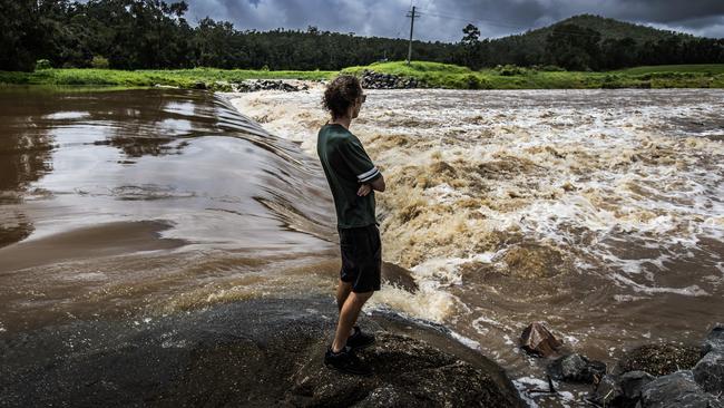
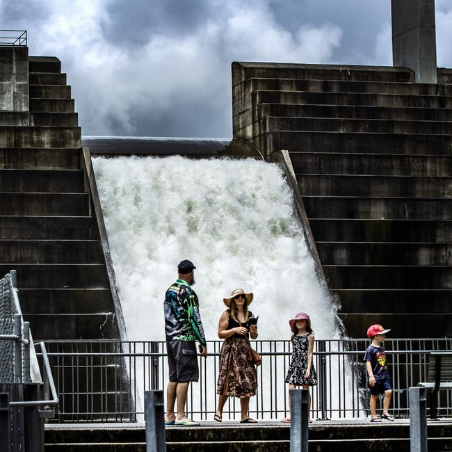
Wivenhoe Dam’s floodgates have been opened for the first time in two years as Queensland braces for its wettest December since the 2011 floods.
QLD News
Don't miss out on the headlines from QLD News. Followed categories will be added to My News.
Wivenhoe Dam’s floodgates have been opened for the first time in two years as Queensland braces for its wettest December since the 2011 floods.
The emergency release was activated after 141mm of rain fell overnight on Monday, and there could be further outflows for the rest of the week, the first time such action has been taken since October 2022.
Dozens of roads across the southeast were cut on Tuesday and 17 dams were spilling, with thunderstorms and rainfall of about 30mm forecast for the region later on Wednesday.
In good news, the rain was set to ease from Thursday and the Bureau of Meteorology predicted drier conditions across the state on Christmas Day.
Just days after Lord Mayor Adrian Schrinner warned residents to prepare for a possible repeat of the 2022 flood disaster, Brisbane City Council said more than 87,000 sandbags had been stockpiled across its five depots.
About 2500 free sandbags had been collected by residents since Monday morning.
Logan City Mayor Jon Raven echoed the need for preparedness and said he would be on call for the entire Christmas period.
It came as Deputy Premier Jarrod Bleijie ruled out a repeat of the $55 water rebates the former Labor government rushed in when Wivenhoe’s gates were thrown open in 2022.
Mr Bleijie said circumstances were different to 2022 when then premier Annastacia Palaszczuk told residents to use as much water as they could over a two-week period before 100,000Ml of water was released from Wivenhoe.
Mr Bleijie said his government would not be offering a similar rebate.
“This was when some areas in Queensland were in drought and (Ms Palaszczuk) told everyone to go and soak the houses and wash the cars and waste a bunch of water … no we won’t be doing that,” he said
He said the government was concerned about people and property but it had to rely on the experts give warnings.
“Queenslanders are resilient people. They’ll deal with it as it happens, and we’re getting the appropriate briefings over the summer period,” he said.
Weather bureau meteorologist Stephen Stefanac said moderate to locally heavy rainfall would continue over the coming days along the state’s coastline and ranges, before tracking north.
A total of 86mm of rain fell in just two hours to 2am on Tuesday at Lawnton, while Kallangur was saturated by 70mm of rain in just one hour to 1.15am.
A lot of the heaviest falls were just to the west of Brisbane, with Cedar Creek near Samford copping 141mm since 9am on Monday.
Other 100mm-plus totals were recorded at Delaneys Creek (132mm), Kallangur (129mm), Hervey Bay (119mm), Mt Nebo (117mm), Highvale (115mm), Lawnton (111mm), North Pine Dam (107mm), Murrumba Downs (106mm), Mount Mee (100mm) and Biggenden (100mm).
In Brisbane, most of the biggest totals were on the northside, with 61mm recorded in the CBD, 83mm at Hendra, 80mm at Mt Coot-tha, 78mm at Albany Creek and 73mm at Bowen Hills.
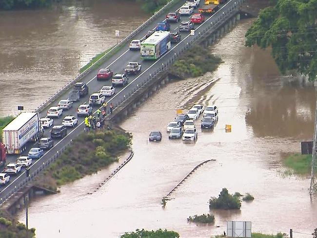
Further north, Hervey Bay recorded 119mm in the 20 hours to 5am, while Torbanlea recorded 127mm in the 22 hours from 9am on Monday.
Seqwater said local catchment flows and dam releases meant Savages Crossing and Twin Bridges near Fernvale and Colleges Crossing at Chuwar had closed to traffic.
The last time releases from Wivenhoe occurred in 2022, to provide additional flood mitigation storage, it was at 90 per cent capacity.
The dam level was 86 per cent on Tuesday this week.
An Seqwater spokesman said: “During periods of heavy rain, Wivenhoe Dam is designed to hold back close to two million megalitres on top of its water supply storage capacity.
“It can temporarily store flood waters for a period of time and release these waters at a controlled rate to mitigate impacts downstream.”
Water began to be released from North Pine Dam at midnight on Monday as well.
The Seqwater spokesman said the releases, combined with river and creek flows downstream of the dam, were likely to cause water to spill over Youngs Crossing.
“Operational releases from Somerset Dam, which flow into Wivenhoe Dam, are also continuing,” he said.
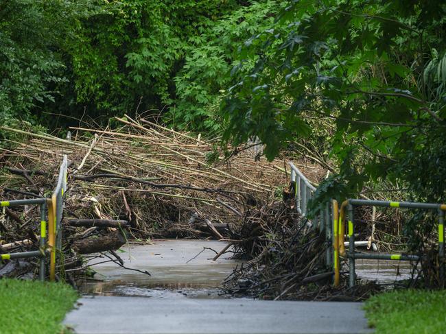
Dozens of minor roads across Brisbane and other parts of the southeast were also closed.
Weather bureau meteorologist Stephen Stefanac said moderate to locally heavy rainfall would continue over the coming days along the coast and ranges, before tracking north later this week.
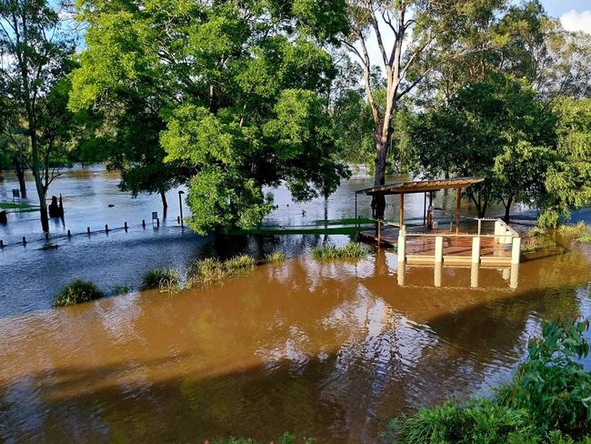
Riverine flooding and potential flash flooding could still occur until Thursday in some areas.
“Riverine flooding occurs over a broader area and longer timescale than flash flooding, and is also not out of the question for the coming days, as we’re currently seeing in the Mary River near Hervey Bay,’’ he said.
“But this will depend on the rainfall being less localised and spreading more widely across the catchment areas along the coast and across the north.
“Saturated soil conditions tend to increase the risk of flash and riverine flooding as there’s less capacity for the rainfall to be absorbed by the soil, thus increasing the run-off that leads to the flooding.”
But Mr Stefanac said heavy rainfall was not on the cards for Christmas.
“At this stage, the threat of moderate to heavy rainfall shifts to the far north of the Cape by Christmas Eve and Christmas Day, bringing mostly dry conditions to much of the state, though some isolated showers and thunderstorms may linger,” he said.
Mr Raven said City of Logan staff had spent this year preparing for weather events and disasters.
“As we saw over Christmas last year, storms can hit at any time,” he said.
More Coverage
Originally published as Brisbane weather: Dam gates open for first time since 2022


