
Intense rain set to continue for days on Gold Coast and across southeast Queensland
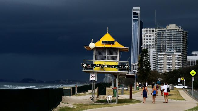
Gold Coasters have been warned to batte down the hatches to kickstart the weekend as thunderstorm activity continues to develop over the southeast.
Weather
Don't miss out on the headlines from Weather. Followed categories will be added to My News.
GOLD Coast residents have been warned to batte down the hatches to kickstart the weekend as thunderstorm activity continues to develop over the southeast.
The Bureau of Meterology (BOM) issued a severe thunderstorm warning for parts of the region about 5.30pm Friday evening.
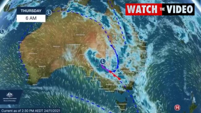
According to BOM, the wind structure favours the development of slow-moving bands of storms, capable of producing heavy rainfall.
The system is currently tracking east and is expected to reach areas including Springbrook within the hour.
It follows days of intense rainfall and flash flooding, prompting Bureau of Meteorology on November 23 to declare a La Nina weather event.
Residents closer to the coast can expect storms to hit in coming hours.
The next warning is due about 8.30pm.
Coast soaked at start of La Niña – and much more to come
November 26, 2021
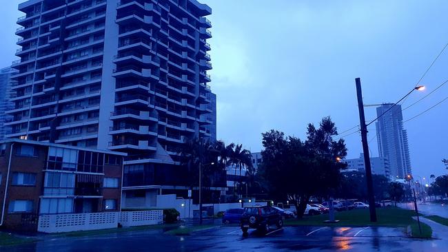
PARTS of the Gold Coast have recorded nearly 100 millimetres of rain days after the Bureau of Meteorology declared the start of the La Niña weather phenomenon.
The city is due to be soaked by rain every day until at least late next week.
Steiglitz in the north of the city was saturated by 88mm in the 24 hours to 9am on Friday, according to the Bureau (BOM).
Considerable totals were also recorded along the coast at Gold Coast Seaway, Couran Point and South Stradbroke, which recorded 62mm, 66mm and 62mm respectively.
However, the Coast totals pale in comparison to the 191mm recorded in Bundaberg overnight.
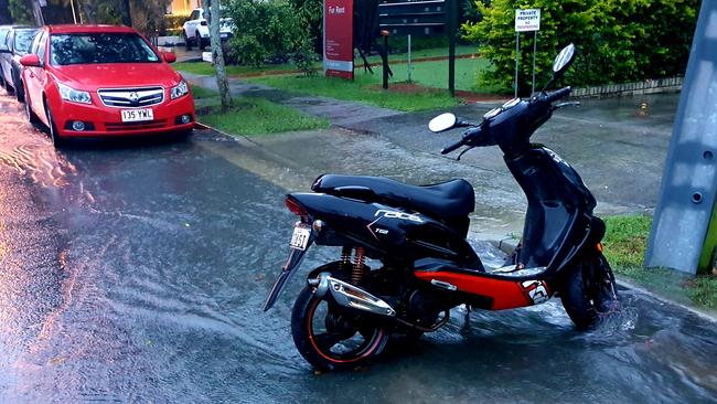
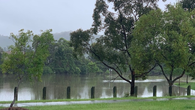
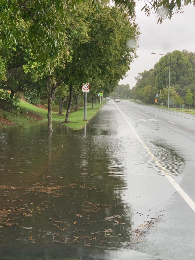
Nevertheless, ongoing rain on the Coast has resulted in overflowing gutters and localised flooding in some areas.
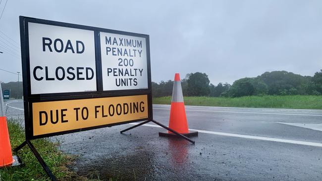
Gold Coast City Council listed three roads as closed by floodwaters on Friday morning – Hardys Rd at Mudgeeraba, Ruffles Rd at Willow Vale and Hotham Creek Rd at Willow Vale.
The BOM has issued flood warnings across the state, including for “widespread areas of southern Queensland, but no specific alerts had been issued for the Coast by midmorning Friday.
“A trough is forecast to continue moving slowly east across the state bringing showers and severe thunderstorms with heavy rainfall in most areas of southern Queensland, which may cause flooding impacts,” the BOM warned.
Coast residents should stay up to date with the latest forecasts and expect potential flooding later on Friday and in coming days.
The BOM has stated that its climate models suggest La Niña will be “short-lived” and continue until “the late southern hemisphere summer or early autumn” next year.
The phenomenon increases the chance of above average rainfall in Queensland.
The wet weather has resulted in the cancellation of divisional councillors’ Runaway Bay Carols by Candlelight and the Arundel/Parkwood Community Carols.
Additionally, Gold Coast City Council’s CBD Sundown – Laneway Cabaret event at Mr PP’s in Southport has also been canned.
Flash flooding fears as ‘intense rain’ set to continue
November 26: The Bureau of Meteorology has warned the Gold Coast will likely cop a prolonged drenching, while investigations continue into a fake flooding alert received by some residents.
It comes as the State Emergency Service (SES) has been kept busy helping residents manage leaking roofs and localised flooding as rainfall totals surge.
Earlier this morning, Gold Coast City Council closed roads at Bonogin, Clagiraba, Guanaba, Maudsland, Willow Vale and Wongawallan due to flooding.
But all roads except for Ruffles Rd at Willowvale had reopened by early Thursday afternoon.
The Bureau (BOM) has warned of potential flooding across southern Queensland.
Coast residents can expect more rain throughout the day and into at least early next week.
The SES attended 45 jobs in the southeast of the state in the 24 hours to 6am on Thursday.
Most of the jobs were on the Coast, involving leaking roofs and minor flooding requiring sandbags, a Queensland Fire and Emergency Services spokeswoman said.
The Bulletin was alerted to text messages sent to some residents’ mobile phones on Thursday morning, warning of possible flooding in the north of the city.

But the council has since advised the alert was not sent by its team members, despite the hyperlink provided in the message directing recipients to the council’s emergency dashboard.
The message stated: “Watch & Act Oxenford, Hope Is, Helensvale”.
“Flooding may occur near Coomera River and Saltwater Ck. Consider moving to higher ground,” the message stated.
A council spokeswoman said in a statement: “City of Gold Coast did NOT issue a Watch and Act Emergency Alert this morning.”
“Despite recent rain, there are no current flood warnings for the Gold Coast,” she said.
“We do ask people to remain vigilant, as more heavy rainfall is predicted in coming days.
“We are investigating the source of the message.”
In the 24 hours to 9am on Thursday, north Tamborine was drenched by 112 millimetres of rain – the highest rainfall total on the Coast.
Coolangatta in the south of the city received just 12mm, Gold Coast Seaway in the centre of the Coast recorded 33mm and Steiglitz in the north was soaked by 67mm.
BOM meteorologist Kimba Wong confirmed showers and storms would continue across the state and there was “soggy catchments across broad parts”, which could lead to flash flooding.
“In the southeast we also have had some light to moderate falls across the broader southeast, but in particular around the Gold Coast and the Gold Coast hinterland,” she said.
“Some heavier falls have accumulated.
“If severe thunderstorms occur then the main risk here is heavy rainfall leading to flash flooding.”
The wild weather prompted Emergency Services Minister Mark Ryan to speak up.
“Areas of locally intense rain and flash flooding are expected to become an increased risk in coming days across southeast and central Queensland,” he warned.
Mr Ryan said many roads had already been impacted by big falls over a short period of time.
“It is a reminder of how quickly conditions can turn, so it is crucial that everyone stays vigilant and prepared for heavy rain and flash flooding,” he said.

“We all have a responsibility to make good decisions on the road to keep other drivers and ourselves safe, but this is especially the case during severe weather events.
“Check the warnings, steer clear of flood-prone areas and if you don’t need to be on saturated roads, please stay off them.”
Queensland Fire and Emergency Services (QFES) Commissioner Greg Leach said SES crews were “working hard to assist with leaking roofs, tarping and other flood-related requests”.
“Queensland’s storm and cyclone season has well and truly kicked off and we’ve already seen several severe weather events across the state in the past weeks,” he said.
“Clear gutters, remove overhanging branches and make sure your emergency kit is up-to-date.”
Fire and Rescue Service (FRS) Swiftwater Technicians have been on standby.
For storm and flood damage or assistance phone the SES on 132 500.
Several roads closed due to flash flooding
November 24: Several Gold Coast roads have been closed due to flooding, a day after BOM declared a La Nina.
Four roads including Tamborine Oxenford Road, Ruffles Road, Birds Road in Maudsland and Birds Road in Guanaba have been closed due to flash flooding.
The Rocky Point Rural Fire Brigade (Jacob’s Well) posted an alert to Facebook at 4.30pm warning drivers water levels were rising around Pimpama Jacobs Well Rd and was close to going under at Kings Rd.
“The Swailes are also not far from bursting on Jacobs Well Rd,” they said.
“There is a lot of standing water on the road in the area so please drive with caution.
“Remember, if it’s flooded forget it.”
Motorists were advised to use alternative routes and not to drive through floodwaters.
Bureau of Meteorology on November 23 declared a La Nina was established in the tropical Pacific.
La Nina refers to a weather pattern which pushes warm water towards the western side of the Pacific.
This usually causes extensive rainfall over Australia and the southeast particularly.
More Coverage


Join the conversation

In pictures: Gold Coast celebrates Australia Day 2025
Thousands of revellers have crowded Gold Coast beaches for Australia Day celebrations. See all the pictures.
Read more

Lightning strikes, roof collapses in wild Coast storm
A Gold Coast home has reportedly been struck by lightning during a wild weekend storm. Read the latest
Read more