
Best of the Gold Coast 2018: the top 10 walking tracks and hikes throughout our region
THE mild spring weather is ideal for getting out and enjoying the Gold Coast’s hikes. From scenic strolls to epic treks, here are the region’s top 10 walking tracks.

Travel
Don't miss out on the headlines from Travel. Followed categories will be added to My News.
THE mild spring weather is ideal for getting out and enjoying the Gold Coast’s hikes. From scenic strolls to epic treks, Amber Macpherson explores 10 of the best.
O’Reilly’s Rainforest
Lamington National Park Rd, Canungra
If you’re looking for somewhere to get swept away in the wilderness, O’Reilly’s is the place to go.
There’s 320km of walking tracks through 22,000ha of ancient rainforest, home to more than 160 species of bird as well as reptiles, frogs, mammals and invertebrates.
The most outstanding walk is the Tree Top Walk, an icon in the O’Reilly’s Rainforest.
It consists of nine suspension bridges 16m above the ground — you’ll literally be walking through the canopies.
10 WEEKEND GETAWAYS JUST A SHORT DRIVE AWAY

SUBSCRIBE TO THE BULLETIN AND GET A FITBIT
“The iconic Tree Top Walk is brilliant for families of all ages,” O’Reilly’s spokeswoman Nikki Hobbs says.
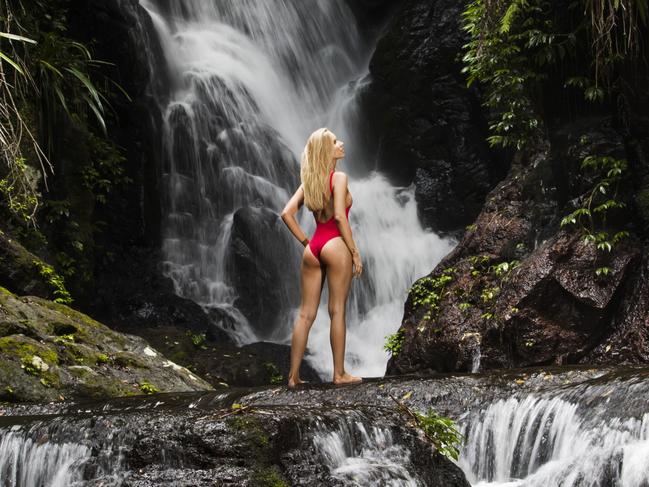
It’s only 800m return and is free for all to experience. Other top tracks in the rainforest are the Wishing Tree trail, which winds past a huge old tree trunk that creates an open shelter, and Mick’s Tower, a rainforest observation tower that can be climbed. The 7.6km Elabana Falls (pictured main) walk branches off the Main Border Track 1.7 km from the entrance and descends through a stand of Antarctic Beech to the prettiest of picnic spots.
For adventure hikers, there’s the 37km Stinson Hike, which is run as a guided tour twice a year or can be booked for groups of four people or more.
WHY YOU HAVE TO VISIT QUEEN MARY FALLS
It follows the footsteps of rainforest namesake Bernard O’Reilly as he looked for the Stinson Model A aeroplane that crashed in the National Park in 1937.
Before you embark on an adventure, it’s best to visit the O’Reilly’s Rainforest Retreat and follow the signs and instructions for the various tracks.
It’s wise to bring insect repellent and a jacket, as the high elevation often means cooler temperatures than the Coast.
O’Reilly’s sells picnic hampers at the retreat reception, but carrying the goodies is up to you, so remember a backpack.
Curtis Falls Circuit
Dapsang Drive, Tamborine Mountain
NEVER MISS A MINUTE WITH THE GOLD COAST BULLETIN APP
Breathe in clean mountain air as you explore the remains of a 22 million-year-old volcanic eruption at Tamborine Mountain. The flowing lava from the explosion of the prehistoric Mount Warning left fertile soil, forests, valleys and water in its wake, including the formation of Curtis Falls. The Curtis Falls circuit is 1.1km return and loops through eucalypt bush as well as lush rainforest, boasting staghorn ferns and the famous strangler fig. Upon arrival at the falls, a lookout platform offers views of the freshwater tumbling down a two-storey rock wall.
Coombabah Wetlands boardwalk
Coombabah Lakelands Conversation Area, Myola Ct, Coombabah

GOLD COAST’S TRANQUIL HIDDEN GEM REVEALED
This walk encompasses wetlands, eucalypt forest, saltmarsh and mangrove habitat. The entire Conservation Area stretches more than 1200ha but you’ll get to experience plenty of wildlife along the 300m Myola Court boardwalk, part of the 1.2km trail flanking Coombabah Creek. It’s the best spot for spotting kangaroos and other animals including koalas, native owls and grey-headed flying foxes. It’s suitable for all fitness levels and is wheelchair accessible. There are no toilets or drinking water, however, so plan ahead.
The Pinnacle Lookout
Tweed Range Scenic Dr, Border Ranges National Park
ANN WASON MOORE: THE BEST HINTERLAND WALKING TRACKS
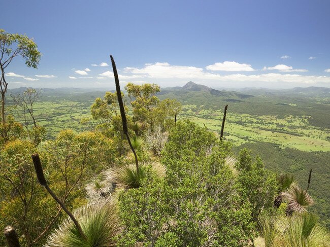
This walk is the best for uninterrupted views without collapsing in a heap at the peak. The distance is only 800m return, but it presents a 360-degree panorama of the Border Ranges National Park, out to the coastline, the escarpment crater and Wollumbin / Mount Warning. The track is regarded as a highlight of the entire Border Ranges National Park. Those in the know recommend making the trek at sunrise and watching the silhouette of Wollumbin cast over the vast bushland below. The Pinnacle Lookout track is listed as a Grade 2 difficulty, with gentle hills and occasional steps.
Mount Warning Summit
Mount Warning Rd, Wollumbin National Park

Wollumbin/Mount Warning summit track is not for the faint-hearted. It’s 8.8km return and takes about five to six hours to complete, with a steep incline and lots of steps. Wollumbin holds great spiritual significance to the local indigenous community, the Bundjalung People, and they ask visitors not to climb it. Instead you can try the nearby Lyrebird Track that takes you through Breakfast Creek and a palm forest to a scenic viewing platform. Woolumbin National Park is World Heritage listed and boasts a lush subtropical rainforest, home to a variety of animals and birdlife. It’s a magic spot for sunrises.
SUBSCRIBE TO THE BULLETIN AND GET A FITBIT
Oceanway 37km walk
SeaWorld Dr, Main Beach
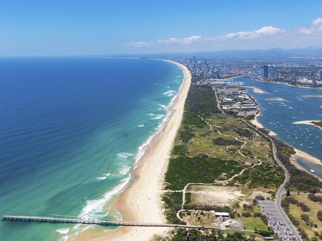
MAGICAL FAIRY COTTAGES JUST A QUICK DRIVE WEST
This walk connects the north of the Gold Coast to the south, starting at Federation Walk at The Spit in Main Beach and winding all the way down to Point Danger at Tweed Heads — or vice versa. The route hugs the coastline with the vast Pacific Ocean to the east and city skyline to the west. You can walk the entire length on footpaths, or mix it up with boardwalks and sand walking. It takes about seven hours non-stop, but luckily there are countless cafes to rest and recuperate along the way. Photo: Tourism & Events Queensland.
Natural Bridge Circuit
Bakers Rd, Springbrook National Park

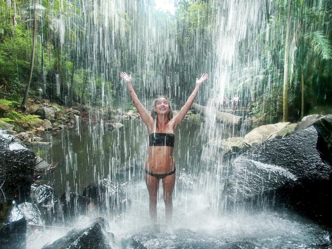
The shapes and structures of Mother Nature will leave you breathless at Natural Bridge Circuit. National Parks senior ranger Scott Rogers says this Springbrook National Park track is remarkable at any hour. “You can do it 24 hours a day,” Scott says. “You’ve got two different aspects — the day aspect of viewing the creek and the rainforest birds, versus the night experience, where you’ve got the nocturnal wildlife and glow worms.” The circuit is 1km return and is paved the whole way, which makes it suitable for families, however, a number of steps are not ideal for wheelchairs. Photo: Jules Ingall
NEVER MISS A MINUTE WITH THE GOLD COAST BULLETIN APP
Ocean View Track
Julia St, Burleigh Heads National Park

The Burleigh Heads Ocean View Track has finally reopened after falling boulders forced its closure for five months. The 2.4km return trip is pram-friendly and offers gorgeous views of the Gold Coast coastline to the north and south. “It’s about 45 minutes (walk) or so,” Scott says. “You can access it from carparks at either end. It’s a pretty easy circuit and at this time you’ll probably see a heap of whales.” For a more challenging hike, there’s a couple of longer tracks that branch off from the entrance of Ocean View looping the tip of the headland.
Photo: Tourism & Events Queensland
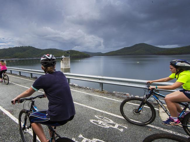
Hinze Dam
Spillway Rd, Advancetown
THE TOP 10 BEST GYMS AS VOTED BY YOU
The colossal volume of Hinze Dam can be seen up close with a walk along the dam wall. The vastness of the dam and the surrounding hills and valleys stretch out for as far as the eye can see. “Stretching just under 2km, the scenic walk offers spectacular views of the water, dam wall and the hills surrounding the dam,” Seqwater spokesman Matthew Wellington says. “It is a popular site for families to enjoy — especially those looking to get their exercise fix.” To access the wall, visitors can head to the Hinze Dam Visitor Centre on Advancetown Rd.
SUBSCRIBE TO THE BULLETIN AND GET A FITBIT
Purling Brook Falls Circuit
Carricks Rd, Springbrook National Park

THE GOLD COAST’S SEVEN BEST SWIMWEAR LABELS
This circuit boasts one of the most stunning waterfalls in Queensland. At 80m high, the rushing water can be heard from almost every point on the track, and recent rainfall has only enhanced its magnificence. “It’s a pretty impressive waterfall,” Scott says. “The track is about 4km long. It takes you for a short walk around the top of the waterfalls — you start at the Gwongorella Picnic Area. It is a beautiful rainforest walk that goes past Warringa Pool and a number of different tracks leads off that.” The track is uneven in parts with many steps. It’s recommended you walk it in a clockwise direction.

Major overhaul to Bali bombing site for Aussies
The site of the 2002 Bali bombing site, which claimed 88 Australian lives, is set to become a place to promote “tolerance”.

MAFS star’s free upgrade, cake after viral smash-up of luxe resort
A MAFS star has received a free upgrade and full refund after her scathing critique of a luxury, five-star Gold Coast resort racked up more than six million views.