
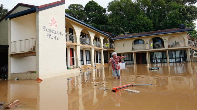
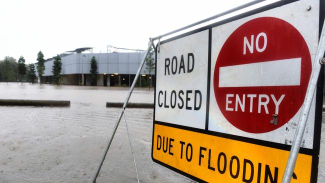
Ex-tropical cyclone Debbie: Gold Coast smashed with 900mm of rain, cyclone-force winds and flooding
UPDATE: EMERGENCY services hold grave concerns for a man still missing in Lamington National Park with rescue efforts hampered by the landslips and flooding.
Lifestyle
Don't miss out on the headlines from Lifestyle. Followed categories will be added to My News.
UPDATE: EMERGENCY services hold grave concerns for a man still missing in Lamington National Park with rescue efforts hampered by the landslips and flooding.
The man in his 60s hasn’t been seen since Wednesday at 2pm, when he did not return to the designated meeting spot with his sightseeing group.
Park rangers managed to make initial contact with the man but a few hours later they lost contact with him.
A landslip and flooding meant rescuers couldn’t gain access to the area yesterday but park rangers were able to resume the search today, however SES and police were unable to get to the area.
Scenic Rim local controller for SES Jeff McConnell said they were concerned for the man’s safety and would resume the search by 8.30am tomorrow.
Springbrook also remains cut off to the world.
Hundreds of locals have been left stranded in Hinterland suburb with no power after torrential rain washed away one of just two roads onto the mountain.
And with numerous landslides on the second road, locals have been unable to leave or enter the area.
Residents attempting to leave Springbrook found part of Pine Creek Rd had been washed away, leaving a gaping divide.
There are also six landslides to be cleared from Gold Coast Springbrook Rd.
Power is expected to be off for at least three days
Sad discovery: Body found on property
A woman’s body has been found on a flooded property about 20km south of Murwillumbah.
Police from Tweed/Byron Local Area Command have been told the woman disappeared in floodwaters overnight from a rural property at Upper Burringbar.
#BREAKING: Body found on a property at South Murwillumbah in NSW. @tomsteinfort #9News pic.twitter.com/Voudh4OTwk
— Nine News Queensland (@9NewsQueensland) March 31, 2017
Inquiries are underway and a post mortem is expected to be conducted next week.
Her body was found by a family member on Upper Burringbar about 8am today.
Police are urging anyone with information in relation to this incident to call Crime Stoppers on 1800 333 000.
Alberton locals to stay for peak
A majority of Alberton residents have chosen to stay in their homes despite the big test yet to come.
Police doorknocked about 125 homes and of those homes 118 elected to stay for the peak midnight peak.
Mayor Tom Tate said he viewed the city from their air earlier today.
“It is apparent to me that there is a very high spread water flow and the water flow will remain for 24 hours,” he said.
FULL LIST OF FLOODED ROADS
Cr Tate said the Ormeau evacuation centre had been well established for those who had to leave their homes.
SES officers have been working hard throughout the day, aiding by fine weather and slower than predicted wind gusts.
Volunteers have managed to reduce their workload down to just 45 jobs from a peak of more than 400.
Gold Coast police Acting Inspector Jim Muncton said travel around the area would still be difficult.
He said the M1 southbound was not expected to open today.
Springbrook, where residents have been cut off after the main access road washed away, it will be at least 12 hours before the Department of Transport and Main Roads can repair an alternate route out of the area.
Insp Muncton said he the worst weather was behind the Gold Coast.
“We are confident at this stage that the responses we put in place adequately dealt with what Mother Nature has thrown at us and we are confident we are moving forward now and we will be in a good position tomorrow,” he said.
Emergency crews and volunteers will work throughout the weekend with recovery efforts already started in some parts of the city.
There has also been unconfirmed reports a body has been recovered from Tweed property this afternoon.
Nine News reports that a body has been found on a property at South Murwillumbah.
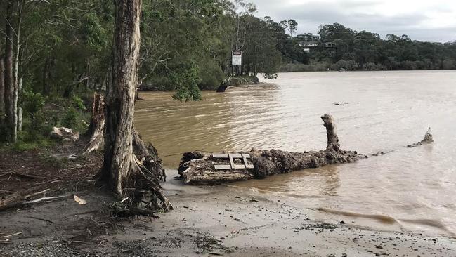
Major flooding is occurring along the Tweed River at Murwillumbah, where the river level peaked slightly higher than the 1954 flood early Friday morning.
The main flood peak in the Tweed River is nearing Chinderah where river levels are peaking with this afternoon’s high tide. Further rises are possible with the high tide tonight, and the situation is being closely monitored, according to the Bureau of Meteorology.
Premier visits Coast
ALBERTON residents will spend the next 24 hours waiting for waters to go down after the inundation caused by ex-Tropical Cyclone Debbie.
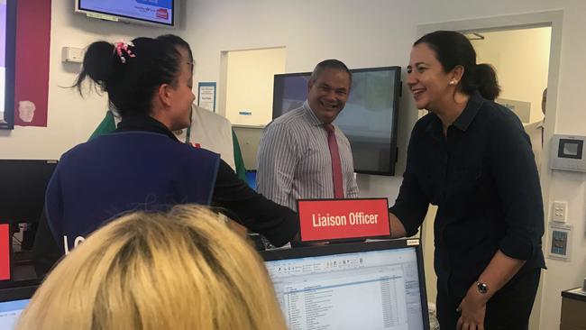
Premier Annastacia Palaszczuk visited the Southport Disaster Management Centre this afternoon to speak with volunteers and emergency management workers about the recovery efforts.
“They have been working hard, you can see their exhaustion, these mighty men and women of Queensland,” she said.
The Premier promised the state government would be working with families effected to ensure they had all the support they needed.
Funding arrangements for the recovery effects are yet to start being discussed.
“We will be speaking with the federal government,” she said.
“We have the NDRRA that kicks in.”
Mayor Tom Tate said Alberton was expected to be inundated for about 24 hours but the resilient recovery meetings had already started to arrange for repairs to the damage.
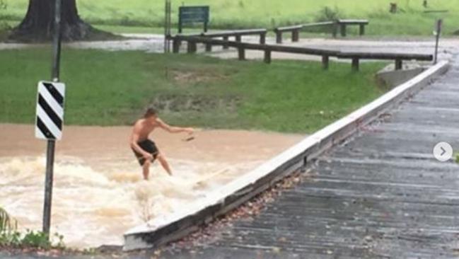
Mayor slams ‘idiots’
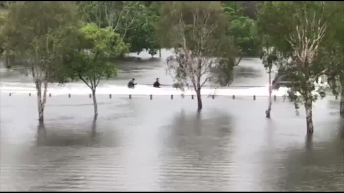
MAYOR Tom Tate has taken a “bumpy ride” on a helicopter but what he saw brought home the reality of how the tail of Cyclone Debbie has hurt the Gold Coast.
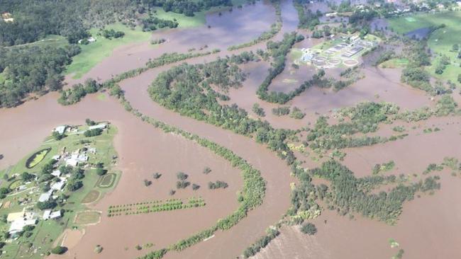
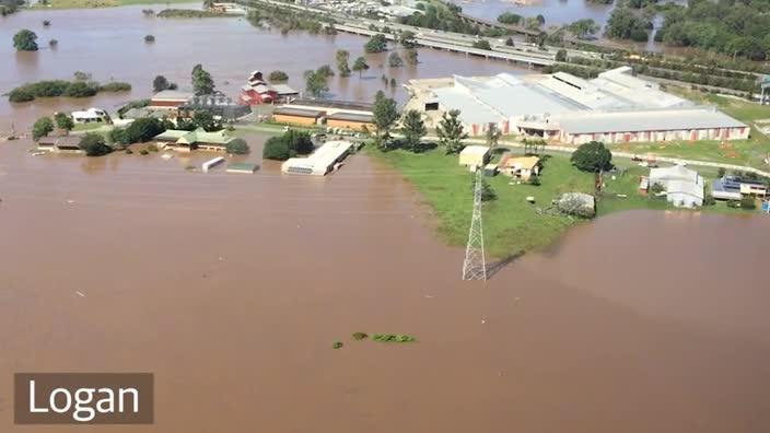
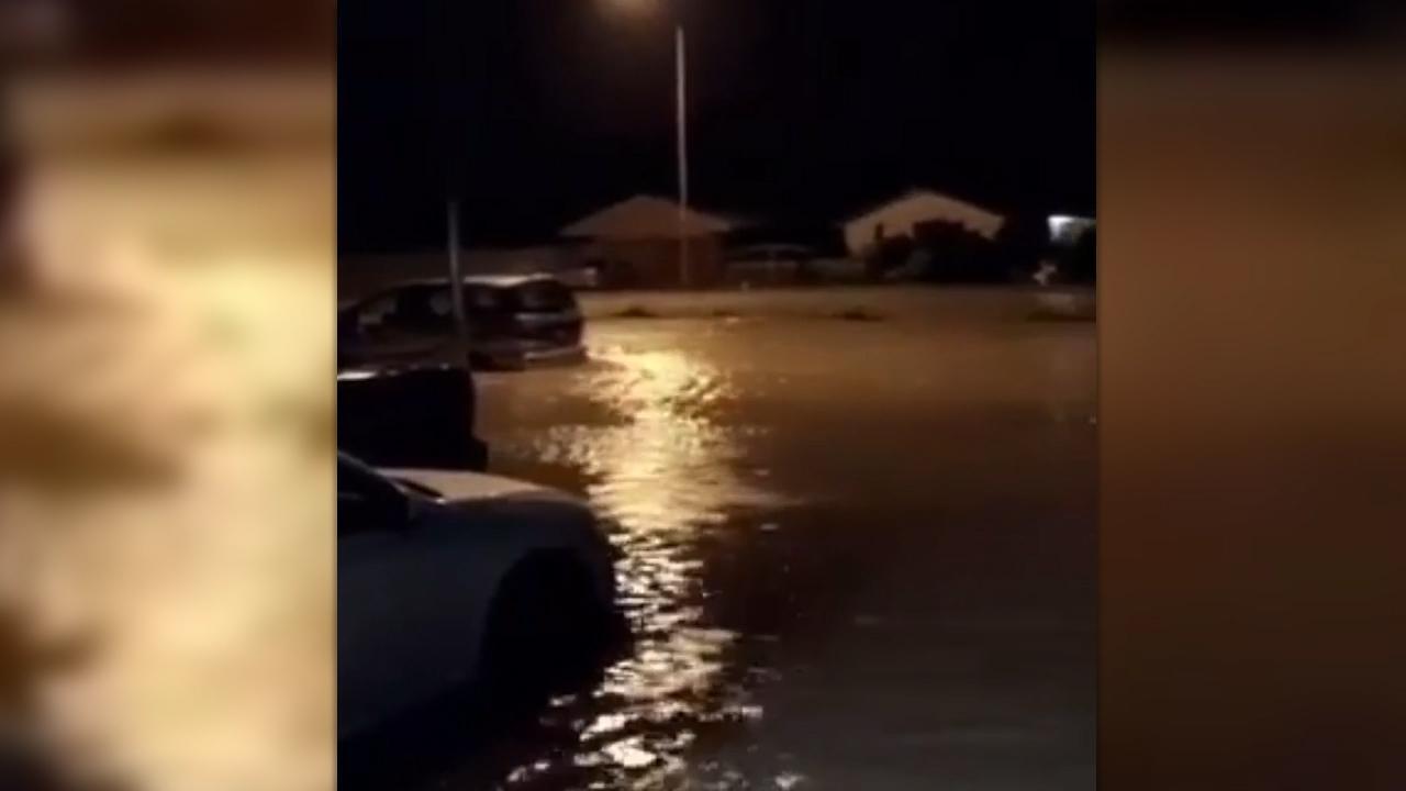
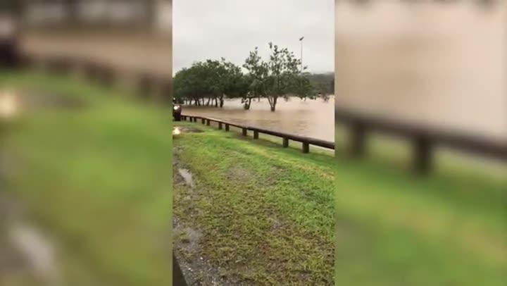
The mayor’s office late today released video footage which shows Coast communities surrounded by brown rivers and creeks.
“I wanted to check on the helicopter to get a visual,” he told the Gold Coast Bulletin.
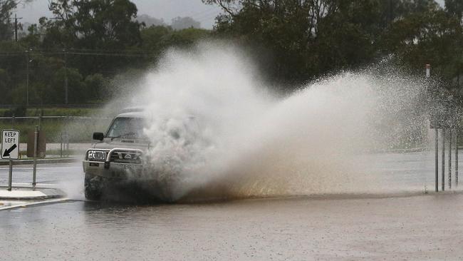
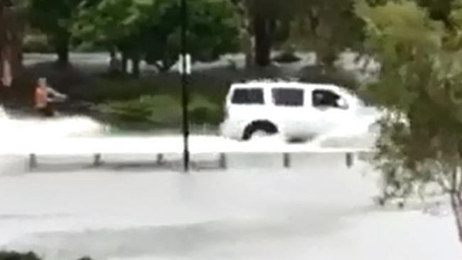
“It really confirmed the devastation that this has caused. There were a lot of roads cut off. I even saw some people try and drive through and get stuck while I’m up there watching it.
“The message is “flooded and forget it”. Some people are just so thick they don’t get it.”
Boiled water alert
TWEED Shire Council has warned Uki residents of possible water contamination in the local supply.
Heavy rain has made the Uki drinking water supply untreatable. Uki has its own water treatment plant and this water may have become contaminated.
Residents are advised that water used for drinking or food preparation should be brought to a rolling boil and allowed to cool before being stored in a clean container with a lid and refrigerated.
Tweed Shire Council is working to fix the problem and bring in alternative water via a tanker or bottled water.
Homes and businesses at Greenhills at Murwillumbah South, in the vicinity of Blacks Drain, are without water and a number of properties have been inundated in the Tweed Valley Way area.
Council staff are working to restore water to the Greenhills Lodge aged care facility, however properties and businesses south of there will be without water until the water recedes and repairs are made to infrastructure.
The water main and rising sewer main were both washed out during the heavy rain and the road, a bridge, culvert and footpath sustained major damage.
It will take time for council to access the site, with plant and equipment isolated in other locations.
Anyone wanting to enter Murwillumbah from the south will need to use the alternative routes through Stokers Siding and Bakers Road (caution needed) or the Motorway and Clothiers Creek once it reopens.
EARLIER: Wild winds are set to return to the Gold and Tweed coasts this afternoon as ex-tropical cyclone Debbie strengthens and combines with a cold front out to sea.
Wind gusts up to 100km/h are expected to lash the region from about 2-6pm this afternoon prompting the Bureau of Meteorlogy to issue a severe weather warning for damaging winds, abnormally high tides and dangerous surf.
The Bureau warns damaging wind gusts, with peak gusts of around 100km/h are expected across the Gold Coast, Hinterland, and Scenic Rim.
Weatherzone meteorologist Joel Pittard said Debbie remained a low pressure system and when combined with a southerly cold front, would produce gale-force winds as remnants of her tail continued to cross the region.
“The winds back on top of each other and that’s why they are stronger than what you would see with the systems in isolation,” he said.
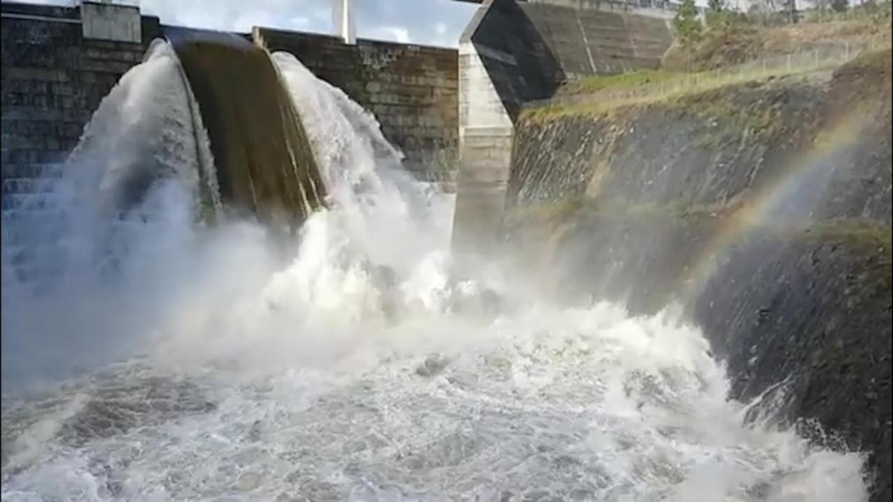
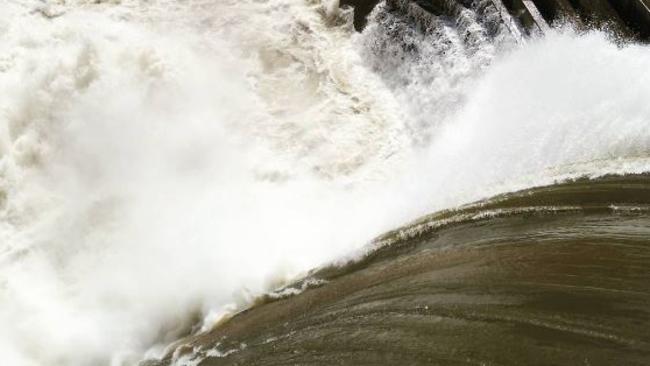
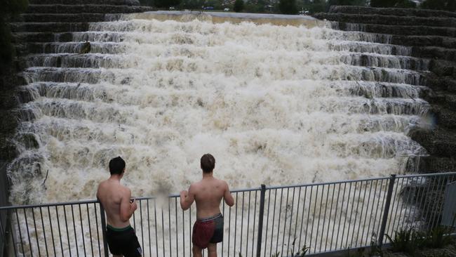
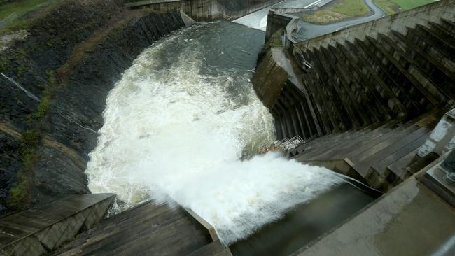
The Hinze Dam is spewing huge amounts of water after the deluge with water levels rising 6m above the spillway at 100.28m above sea level.
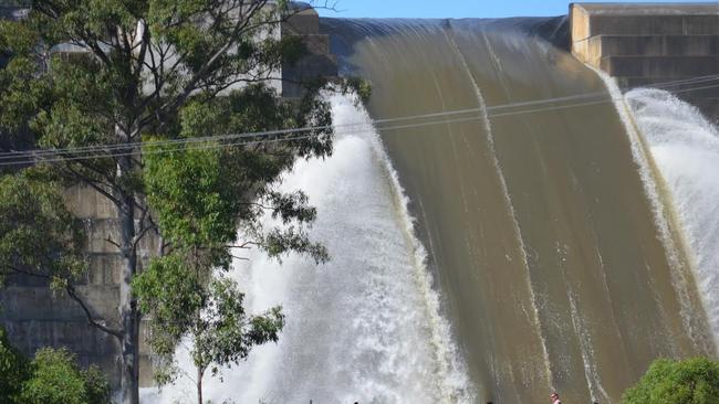
It broke previous records from January 2013 when the water level rose to 98.86m.
Little Nerang Dam levels also broke records, peaking at 171.74m at 11pm last night.
10.15AM UPDATE: POLICE have begun door knocking homes in the north of the city after sending out an emergency alert about the flooded Albert River.
At least 50 to 60 homes properties are in danger, most of them in the Alberton area.
The properties are in the following roads — Quinns Hill Road East, Rossmans Road, Wohlsen Road, Zipfs Road, Bruckner Road Cooks Road and Rotary Park Road.
The exit roads are: Burnside Road; Eggersdorf Road and Mirambeena Drive.
Residents in these areas should also consider evacuating: Cowley Road, Finglas Road, Goldmine Road, Creek Street, Minka Lane, Halfway Drive
“If you are in these areas we strongly suggest that you evacuate to higher ground,” Councillor Tate told the Gold Coast Bulletin.
“Flood waters may be in this area inside the next three hours.”
Police are currently assessing the flood risk in those areas.
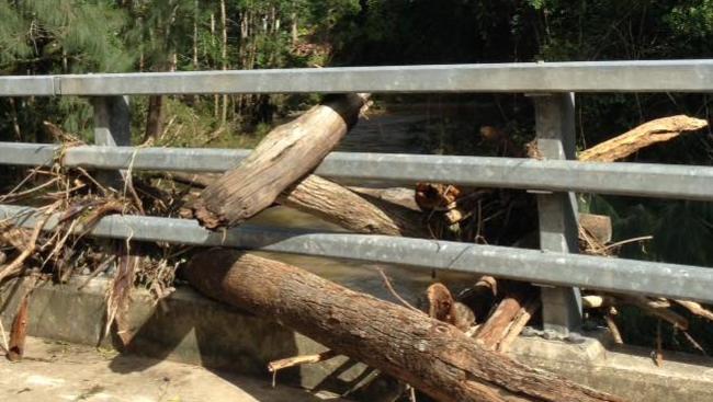
9.45AM UPDATE: GETTING to Springbrook may be a little tough in weeks to come, roads have been ripped up across the city.
Up to 2000 residents at Springbrook in the Gold Coast hinterland could be isolated for several days.
The mountain community copped the worst of the downpour with nearly 900mm falling over 48 hours but residents were well prepared, having stocked up with food for days knowing they could lose electricity and road links.
Mudgeeraba MP Ros Bates told the Gold Coast Bulletin: “From Neranwood you can’t get up to Springbrook that way. Pine Creek Road (the other access point) has had some major damage. That road is closed.
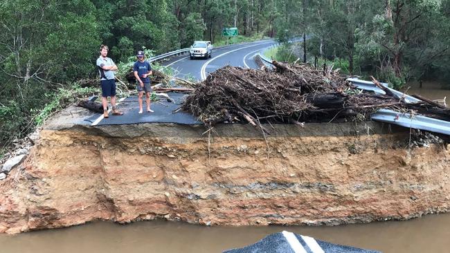
“They have had record rains but other than that they’ve been good. They were well organised.”
Photographs of Pine Creek Road reveal major works will be needed to repair it.
Residents will have to rely on rations because their corner store is closed.
They are not expecting power to be connected for several days.
Meanwhile, Jacob’s Well residents have less than three hours to get our of their homes before floodwaters surround their properties.
Gold Coast mayor Tom Tate has urged between 50 and 60 residents to leave immediately, and find shelter with either family or friends, or use the Ormeau Library which has been set up as evacuation centre.
Cr Tate said the floodwaters would rise in the next three hours and if residents refused to leave they could face days of isolation.
“It is likely that the floodwaters will be over your property but not in your home,” he said..
Meanwhile, SES crews are now using a boat to evacuate people from Chinderah and surrounding areas.
The Tweed floodwaters are about a metre deep along the Tweed River along Chinderah Bay Dr.
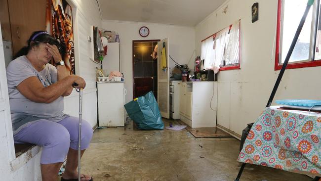
Residents who spent last night without sleep monitoring the 1am high tide said the flooding had caught them by surprise.
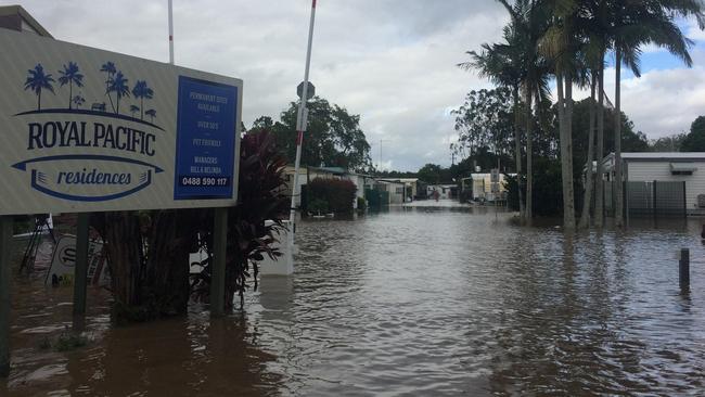
“We were up at 1am last night watching the river and it wasn’t too bad,” Royal Pacific residencies caravan park manager Bill Dinsey.
“We were watching the SES alerts all last night and managed to get about 40 per cent of the park out just in case.
“But it’s surprising how much the waters have come up. Our house has about 600mm of water in it. It’s making us pretty nervous.”
This is how things are looking at Fingal Head today as the Tweed River floods #bigwet via @abcnews pic.twitter.com/203OsBpds0
— ABC Gold Coast (@abcgoldcoast) March 31, 2017
Flood water surrounds the grounds of the Melaleuca Station Crematorium. #Chinderah #BigWet pic.twitter.com/JLXy08uIba
— Lachlan Grant (@_LachlanGrant) March 31, 2017
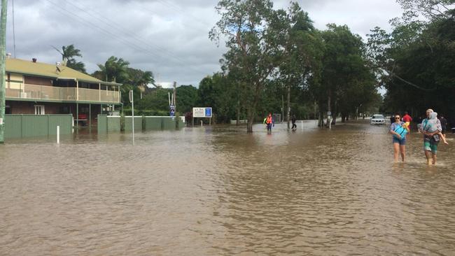
Chinderah residents wade through #floods , but will worsen. High tide from Tweed River not expected until around 2pm @SBSNews pic.twitter.com/HMs5QoIxo8
— Manny Tsigas (@mantsig) March 30, 2017
8.15AM UPDATE: JACOBS WELL residents are being told to evacuate their homes immediately or face being isolated by floodwaters for several days.
The Albert River is set to peak in coming hours and low-lying areas along the river may flood.
“We need those in the area of Staplyton-Jacobs Well, Norwell Road, Eggersdorf Road, Kerkin Road and Pimpama-Jacobs Well to evacuate now,” a council spokesman said.
“Flood waters are approaching and you will have received an SMS. Please go to higher ground now.”
Residents can go to the Ormeau Community Centre at 3 Cuthbert Drive.
The Bureau of Meteorology has predicted major flooding will develop downstream along the Albert River this morning and that low lying areas of Alberton may flood.

Roads to Fingal and Chinderah remain underwater as residents brace for a 10.15am high tide on the Tweed River.
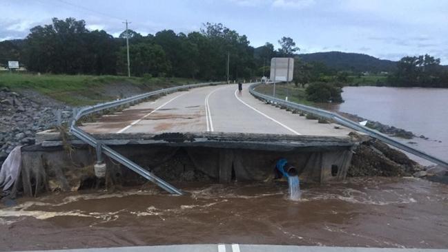
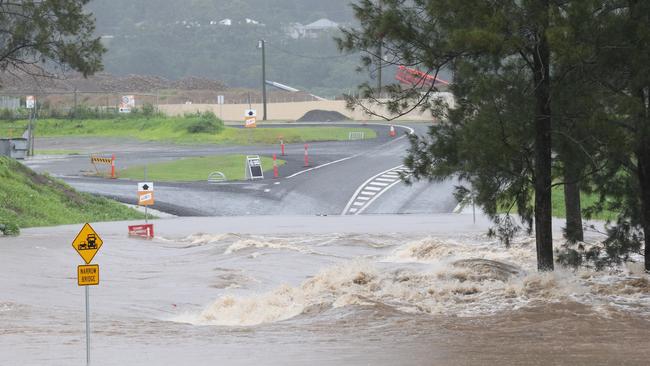
It comes as a large section of John Muntz Causeway at Oxenford has been washed away.
7.45AM UPDATE: SES are currently working on two evacuations by boat at Tallebudgera and Luscombe.
As winds are expected to pick up this morning, the SES said their main concern would be falling trees on suburban streets.
A man who went missing in Lamington National Park on Wednesday has not been found after emergency services were forced to abandon the search due to a landslide yesterday.
It is unknown whether the search will recommence today.
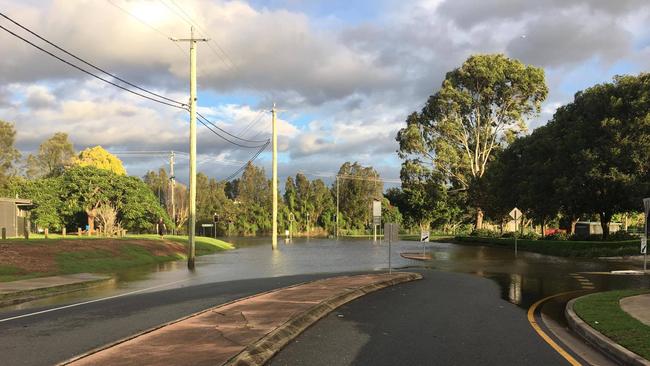
Residents on Emerald Lakes are stranded on the Carrara ‘island’ with floodwater blocking the only exit out of the suburb. Picture: Chloe Walshaw
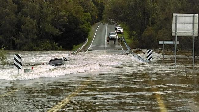
7AM UPDATE: A large section of the bridge at the John Muntz Causeway at Oxenford has been washed away.
Tamborine-Oxenford Rd is impassable, affecting a number of Hinterland residents.
One vehicle was washed into the water when the bridge collapsed.
Emergency services performed a swift water rescue.
6.30AM UPDATE: About 10,000 people have been affected by the evacuation order at Tweed Heads.
New South Wales SES received 550 calls overnight in the Tweed and Murwillumbah regions as the Tweed River is expected to reach its peak this morning.
On the Gold Coast, more than 10,000 homes are without power this morning and trees are down on a number of roads including Turpin Rd at Labrador.
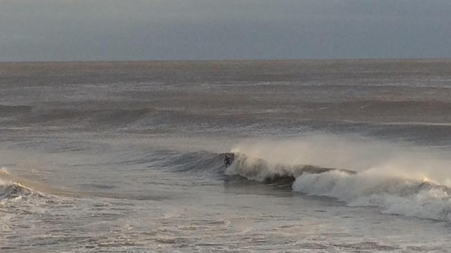
Two boardriders haven’t wasted any time getting into the pounding 1.5m surf at Burleigh Heads despite rough conditions offshore.
Authorities have said Hinze Dam, which is more than 130 per cent full, currently has “the most water we’ve ever seen”.
It comes as the desalination plant at Tugun is two thirds at capacity.
6AM UPDATE: Nearly 10,000 homes are without power on the Gold Coast as winds up to 125km/h lash the city. Meanwhile, the Tweed river has broken it’s banks causing extensive flooding from Murwillumbah to Chinderah.
Residents along the river were evacuated last night and — as day broke — the full extent of flooding was realised with entire streets underwater.
Robina and Varsity Lakes are the latest suburbs to lose power due to severe weather.

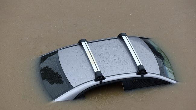
A downed tree at exit 84 southbound on the M1 is also causing havoc and authorities had to perform several swift water rescues overnight including a man stuck in car in floodwater on Tamborine-Oxenford Road.
.@tomsteinfort is in Chinderah this morning, where the Tweed River has broken its banks. #9Today pic.twitter.com/L2heCzo3uN
— The Today Show (@TheTodayShow) March 30, 2017
4.30AM UPDATE: SUBURBAN streets are flooded and nearly 4000 homes are without power as the tail of ex-tropical cyclone Debbie tracks a destructive path across the Gold Coast.
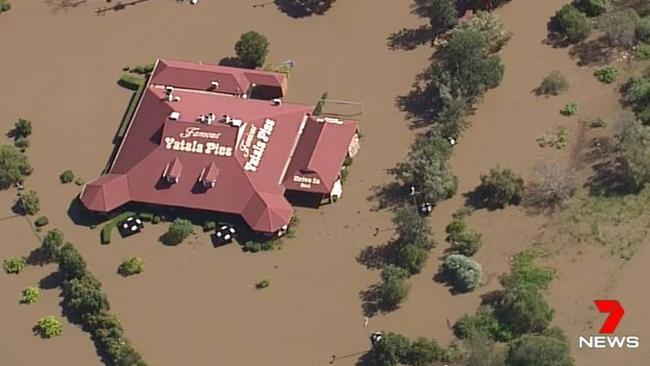
125km/h winds gusts of up to Category 1 cyclone-force strength have howled all night bringing down powerlines and cutting power to residents in Advancetown, Bonogin, Burleigh Heads, Burleigh Waters, Cedar Creek, Currumbin Valley, Guanaba, Lower Beechmont, Maudsland, Numinbah Valley, Paradise Point, Springbrook, Tallebudgera Valley and Yatala.

Meanwhile, many residents have had a sleepless night as rapidly rising rivers, creeks and canals inundated their streets following a 1am high tide.
Some chose to paddleboard along 19th Avenue at Elanora after the entire street went under, with residents desperately trying to stop water lapping at their door.
Meanwhile, an emergency alert was issued for Tallebudgera Valley residents who are stranded by flood water.
A total of 900mm of rain has fallen in the Gold Coast hinterland in the past two days with Springbrook copping 75mm in just an hour last night as the worst of the storm hit.
Flooding, destructive winds and dangerous surf will be the main challenge today as fast-running water in swollen waterways rushes out toward the sea.
An emergency alert is in place in Tallebudgera on the Gold Coast where residents are stranded by flood waters. #9Today pic.twitter.com/9Ud3loT1JE
— The Today Show (@TheTodayShow) March 30, 2017
EARLIER: THE flood risk for the Gold Coast will remain until at least the weekend as the sting in the tail of ex-Tropical Cyclone Debbie threatens to swamp Hinterland communities.
But emergency experts are confident the city has “dodged a bullet again” with rising high tides during the next few days unlikely to create flooding around canal estates.
Half a metre of rain has fallen on parts of the Gold Coast in two days with Upper Springbrook and Numinbah recording almost 600mm in the past 48 hours.
More than 1000 schools in southern Queensland, including those on the Gold Coast, will remain closed today.
The council has put heavy machinery on standby and will check the closed beaches today for scarping.
The consensus is that Cyclone Debbie will not bring the clean-up bill of Cyclone Oswald in 2013, which caused millions of dollars of damage to the foreshore.
Mayor Tom Tate last night opened another two evacuation centres with the Ormeau Centre and Elanora Library backing up the Helensvale, Robina and Nerang community centres opened earlier in the day.
“The areas of concern are the low-lying Currumbin area and also low-lying Tallebudgera. Alberton is also another area that potentially we have some minor flooding,” Cr Tate said.
Emergency chiefs are so concerned about Alberton, where more than 570 residents live between the Logan River and its tributary the Albert River, that the flood watch will continue until noon tomorrow.
“The biggest rains are over the back of the Coast, and we will be getting them for two days. Alberton could still get smashed,” an emergency services source told the Bulletin.
“We are keeping a close eye on the Logan River. We are not stopping until Saturday lunchtime.”
The approach last night was conservative with authorities confident about their flood modelling and reluctant to move the elderly from nursing homes.
A day of unprecedented downpours began with schools and beaches being closed as between 150mm and 250mm of rain threatened to swamp coastal parts of the city by late afternoon.
Hinterland schools began alerting parents by text that it was too dangerous for children to be dropped off as creeks swelled around their grounds.
By midmorning in the Hinterland suburbs of Mudgeeraba and Nerang, fire crews had completed nine swift water rescues, removing drivers as their stalled cars disappeared under floodwaters.
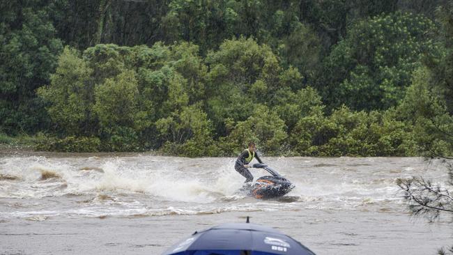
Organisers abandoned the Aussie surf titles and while most residents heeded the message to stay inside, some thrillseekers took to the water on jet skis.
Cr Tate in his first briefing just after 10am announced that 25 roads had been closed and the Hinze Dam was spilling at 117 per cent full.
Told about the skylarking, he advised residents to attend local libraries and read Harry Potter or stay at home.
“You’re a bloody idiot, get out of there. You’re not just potentially harming your own life,” he said.
Waters began lapping the back step of the Palmer Colonial Golf Course and strategies were being put in place to get patients to the Robina Hospital as a back carpark became flooded.
By 1.30pm the council had opened three evacuation centres as the city confronted a predicted 500mm rain event.
At Gooding Drive at Carrara, the last rural acreage close to Broadbeach, cows were stranded on an “island” created by flood waters. SES managers began calling out for volunteers as 16 crews headed out on 120 jobs spread from Pimpama to Currumbin.
Most of the jobs involved removing fallen trees, helping to sandbag houses and keeping people out of creeks. Some cheekily asked for extra repair work around their homes.
At Canungra in the Hinterland a family was isolated as a creek rose around their property, firies checking in every 20 minutes but unable to get a chopper to them. By 3.30pm an emergency alert was issued for Tallebudgera residents as major roads were cut off.
“The roads will be substantially inundated. People won’t be able to get out,” Cr Tate said.
After Mudgeeraba copped the worst of the storm during the morning, the focus of emergency teams turned to the Currumbin and Tallebudgera valleys.
As Debbie’s tail slowly headed south from the Sunshine Coast, bringing with it stronger winds and rain, the downpour stepped up a gear after 5pm.
Meanwhile the border communities along the Tweed faced the same ugly burst of weather which began the day on the tourist strip.
By 6pm the council had closed 74 roads on the Coast. The SES was managing 184 jobs with 13 teams working across the city.
The homes most at risk last night were west of the Pacific Motorway at Currumbin and Tallebudgera, while localised flooding was predicted at the Wolfdene-Alberton area in the north around midnight.
Welfare agencies moved the homeless off the street into evacuation centres.
The high tide at 11pm was expected to be 10cm higher than normal and could rise to 35cm higher by the weekend.
But only the northern community of Paradise Point was under watch late last night.
“At the moment it (Debbie) is moving slowly. I’m hopeful when we wake up in the morning the worst will be over,” Cr Tate said.

‘Missing link’: The traffic solution no one’s talking about
While the city argues over billion-dollar spends on light rail and electric buses, there is one mode of transport that costs a fraction of the dollars, makes tons of sense yet attracts almost zero funding. That’s something this man wants to change.

Custom-made Louboutins and a pooch in pearls: Opulent details for Coast ‘country luxe’ wedding
Custom Christian Louboutin shoes, extravagant guest gifts and doggy dress-ups were among the special touches for this hinterland wedding.