
What happened to our once glorious winter weather? Weather pro Anthony Cornelius explains
Don’t let the warm weather this week trick you – the grim, grey skies, wild weather and chilly starts could be with us much longer than we expect.

News
Don't miss out on the headlines from News. Followed categories will be added to My News.
Bitter mornings, extra doonas, heaters cranking 24/7 … Gold Coast, what happened to our once glorious winter weather?
It’s already been anything but a dry July, with yet another cool and wet weekend forecast, and now there’s cold comfort to be found in the fact that these frosty conditions are shattering decades-old records.
Weatherwatch managing director and meteorologist Anthony Cornelius says data shows that the city is shivering its way through the coldest July in almost 30 years.
Anthony says the average July maximum recorded at the Seaway is 21.3C, but so far this year we’re at just 19.6C. If that average stands at the end of the month, it will make it the coldest average maximum temperature for July since 1994.

He says while next week is looking brighter, it would take a wave of super-warm days to turn the cold tide and shift the average maximum back into normal territory.
“It’s only almost two degrees cooler than the average maximum, but that’s actually quite significant,” says Anthony.
“The difference in Brisbane is even starker. The average July max there is 22C, but it’s currently at 19.3C, which makes it the coolest since 1984.
“Those are big changes. It’s always tricky to pick patterns over time, but we are definitely seeing changes, and we’re not alone.
“There is no safe space from wild weather.”
Indeed, a quick glance at headline news shows the UK literally melting down with its hottest day ever on record, while heatwaves fuel fires in France, Spain, Portugal and Greece.
Across the Atlantic, the southern parts of the United States have been experiencing consistently high temperatures as unrelenting drought continues in the west. On the other side of the globe, flash flooding has hit the southwest and northwest of China.
It all comes just weeks after torrential rain forced the evacuation of thousands of Sydney residents for the fourth time in 18 months.
And, lest we forget, the devastating floods that affected the southeast of Queensland as well as northern NSW, where many residents remain displaced months after the event.
By May this year, more than 1395 millimetres of rain had been recorded at the Seaway since the start of the year – more than the average annual rainfall for the Gold Coast at 1303.4 millimetres.
After two years of heavy summer rainfall driven by the La Nina weather system, Anthony says his outlook for the Gold Coast in the coming months is not entirely sunny.
“The very simple answer is that it’s still too early to determine if we will see another La Nina,” he says.
“If there is a La Nina this year it will be later than the most recent, which began in October 2021 then weakened in January before strengthening again in February and March.
“We’re keeping a close eye on the oceans but, regardless of whether La Nina reforms or not, we’re going to see a trend of above-average rainfall in spring and summer.
“Even if it’s a neutral system, it will be leaning towards a La Nina.”
While the rest of us despair at yet more grey skies in the future, the truth is that the impact of wild weather means business is booming for Anthony and the Weatherwatch team.
The private weather company is contracted by major organisations, from Energy Queensland to local councils and transportation networks, to provide detailed and localised forecasts, taking a ‘deeper dive’ into data.
And that extra analysis has proven results.
Weatherwatch’s accurate forecasting was mentioned in a Crime and Misconduct Commission report after the 2011 floods, which stated that Anthony had predicted devastating flash flooding for Grantham and the Lockyer Valley hours before it occurred and questioned why the Bureau of Meteorology had failed to make a similar prediction.
Anthony also accurately predicted the return of torrential rainfall in Lismore this year as residents were advised to return to their homes - only to be evacuated again just hours later.
While Acting Premier Paul Toole defended the BOM’s failed forecast, saying ‘no one could have predicted’ the catastrophic weather, Anthony says he could see it coming.
“My jaw dropped last night when I saw the ‘all clear’ message given for residents to return to evacuated areas with the low hurtling towards the NE NSW coastline,” Anthony posted online at the time.
“As expected, the low has generated further torrential rain. I don’t want to throw people under buses, but what we saw, we had this obvious low-pressure system that became dominant east of Brisbane and was tracking southwest.”
Anthony says he has nothing but respect for his BOM counterparts, but their job is to advise for large areas using automated systems, while his business is all about looking deeper into the details.
And as the weather gets wilder, more businesses are set to need that information to mitigate damage.
“Online forecasts are generally developed through automation by computer models. Most major organisations, including the Bureau, do this to provide a large number of forecasts in a short period of time,” he says.
“Weatherwatch does the opposite – we produce a smaller number of forecasts over a longer time period by having highly skilled meteorologists work with advanced weather modelling. The result is superior accuracy, increased warning and fewer false alarms.
“Without a doubt we’re coming into a period where these extreme events are happening more often and there will be an increased need for this specific information.
“That’s especially true for the east coast, where we’re susceptible to warming sea surface temperatures. It’s not just the risk of tropical cyclones but other damaging systems like we’ve seen this year that are becoming more significant.
“Businesses, including councils that need to warn residents, need to be able to prepare as soon as possible and try to mitigate the damage as much as they can.”
Anthony says the Gold Coast is a particularly tricky city for general predictions as it covers such a linear stretch of geography.
He says weather on the northern end of the Coast can differ substantially from the southern suburbs, while Springbrook is something else altogether.
“You can have rainfall of 150mm in Springbrook, while elsewhere it’s 20mm or less,” he says.
“Having high-resolution models helps us detect how much and in which suburbs, there’s a lot of variation in a city that stretches more than 40km north to south.
“What I think would be helpful is if we could choose a more urbanised weather station for the Gold Coast. The Seaway is not particularly representative for most residents.”
As we slowly thaw out from winter and emerge into a season of spring storms, Anthony admits he’s looking forward to it.
After all, for him, studying the skies is not just a job but a passion.
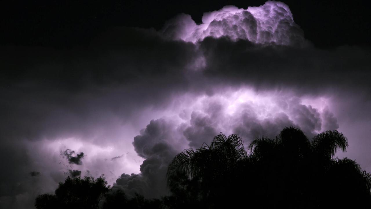
In fact, his ‘hobby’ is chasing storms across the southeast … and into the US.
“I actively chase storms here pretty much from October into March,” he says.
“As much as I love my job, it can be hard when you see a great one forming but you have to keep working.
“For me, I just love the photographic aspect.
“I’ve chased tornados in the US and I was meant to be there in 2020 but then … Covid.
“I’m hoping to get there again soon. There is something about tornados that just fascinates us all.
“But my real bucket-list wish is to chase a cyclone and see the stadium effect. That’s when you’re in the eye of the storm and you can look straight up to see the cloud around you and blue sky above.
“Of course, there are a few things that need to happen to make it work … the cyclone needs to make landfall during the day, it has to be a strong enough system to create the stadium effect, and I need to not be working.
“Given I’m a meteorologist and this would be a major, major event … I have a feeling it might stay on my bucket list.”
For Anthony Cornelius, it’s yet another accurate prediction.
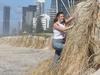
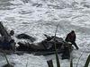
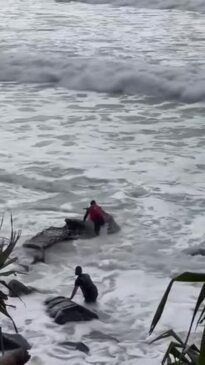
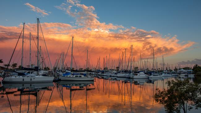
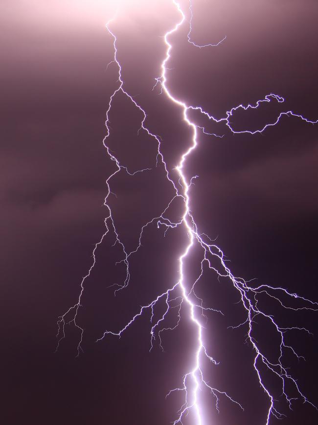
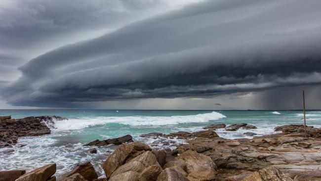
GALLERY: Qld’s most amazing weather photos over the years
Queensland is known for its wild weather – we look back at the most stunning and shocking storm photos from recent years. SEE THE FULL GALLERY

‘We’ll surprise him, take his Range Rover’: Group’s plot to bash bikie
One of seven men - including a bikie trio and Gold Coast gym owner who planned a rival’s bashing for allegedly refusing to give back a woman’s car - says “not all heroes wear capes”.