
Millions set for Anzac Day long weekend drenching
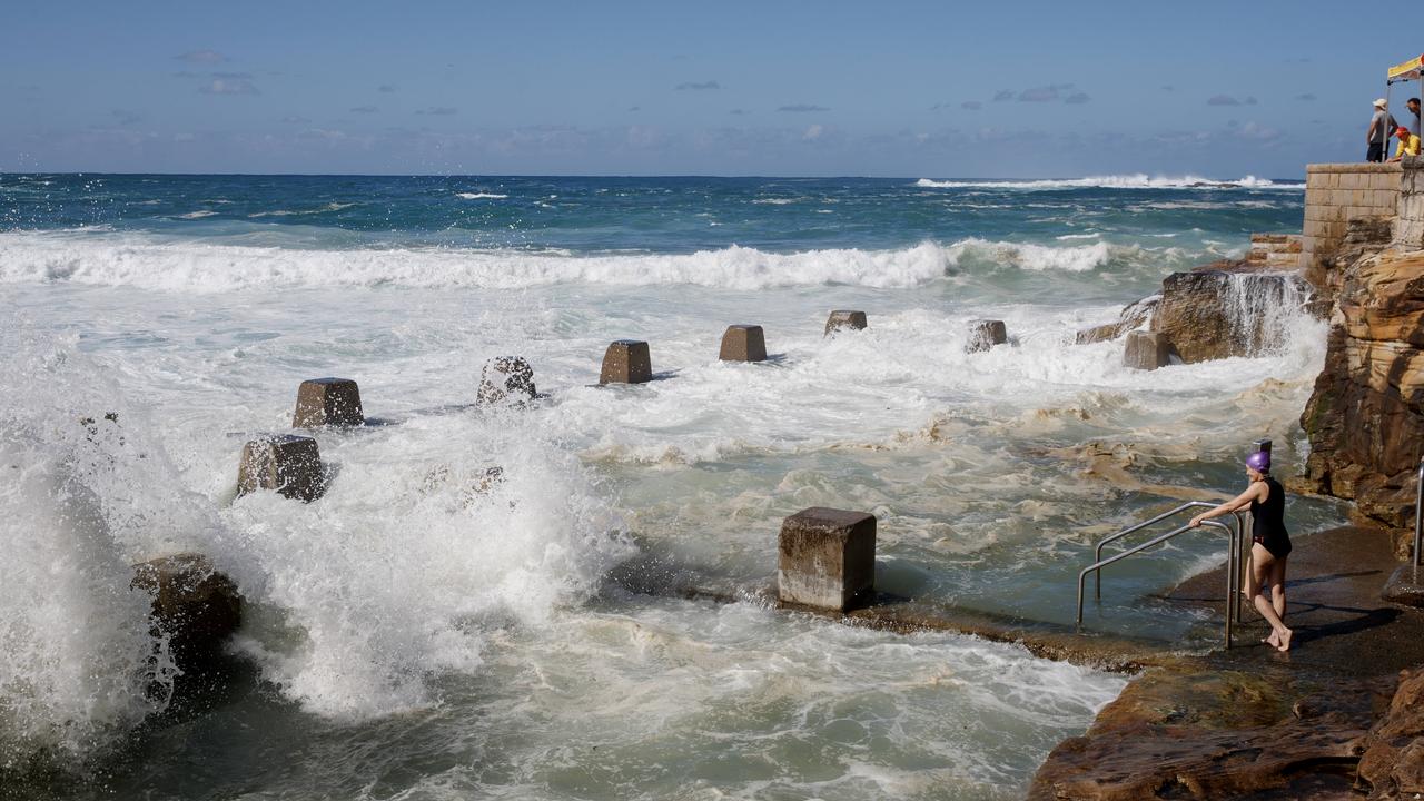
A cool front is threatening long weekend plans for millions as it continues to drench Australia’s southeast.

Environment
Don't miss out on the headlines from Environment. Followed categories will be added to My News.
Australians making the most of the back-to-back long weekends can remain hopeful for clear skies on Anzac Day morning, but for most, the rest of the week will be wet and miserable week.
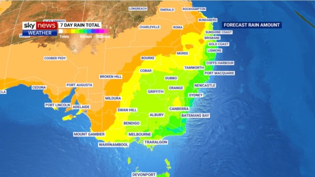
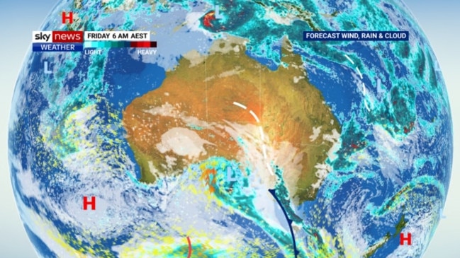
The east coast, from the northern end of New South Wales to Eastern Victoria, is in for a cool change this week as a low pressure system moves over the country bringing cloudy skies and high chances of rain.
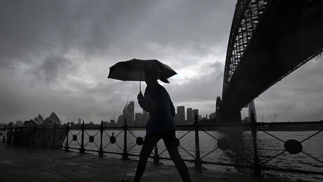
Steady rainfall is expected in Sydney for the rest of the working week and well into the Anzac Day long weekend as temperatures hover in the mid to low 20s.
Current forecasts show the Harbour City is likely to see totals of 70mm from now until Sunday.
However, those looking to attend Anzac Day services and commemorative events are in for a brief reprieve, with the bulk of the wet weather system targeting western Victoria on Friday morning before showers strengthen in Sydney on Saturday.
Melburnians will unfortunately not be so lucky and those heading to Dawn Services are advised to pack their raincoats and umbrellas.
Warm and mostly sunny weather is expected for the next couple of days before it is set to be lashed with 25mm of rain on Friday.
Temperatures are expected to drop from 26C on Thursday into the high teens over the weekend.
The nation’s capital is in for a mixed bag, alternating between wet and miserable to sunny and warm.
Clear skies and a balmy 24C is forecast for Anzac Day in Canberra before cloudy skies, light winds and showers are expected over the weekend.
Summer is not yet over for Brisbane as temperatures remain in the high 20s and the sun continues to shine.
Wet weather, bringing with it up to 30mm of rain, settles in from Thursday and continues until Sunday.
Adelaide’s week ahead is mostly dry, escaping the cool front as it heads east.
Forecasts show very little chance of rain, with pleasant temperatures in the mid to low 20s, except for Friday which is expected to bring light showers
On the country’s west coast, the remains of Cyclone Errol after it made landfall last Saturday.
Wednesday’s storms are set to dissipate in the coming days, with a possibility of showers on Thursday.
Meanwhile, partly cloudy days in the low 20s are expected for a dry end to the long weekend.
A classic start to Autumn in Darwin sees tops of 33C across the end of the working week and possible showers from Friday.
The city is likely to see totals of 40mm from Friday to Monday.
Hobart is expected to have a wet long weekend with steady showers to kick in on Friday and hang around well into the following week.
Forecasted temperatures point to a cool week in the high teens to low 20s, dropping to a low of 13C on Monday.
More Coverage

Originally published as Millions set for Anzac Day long weekend drenching
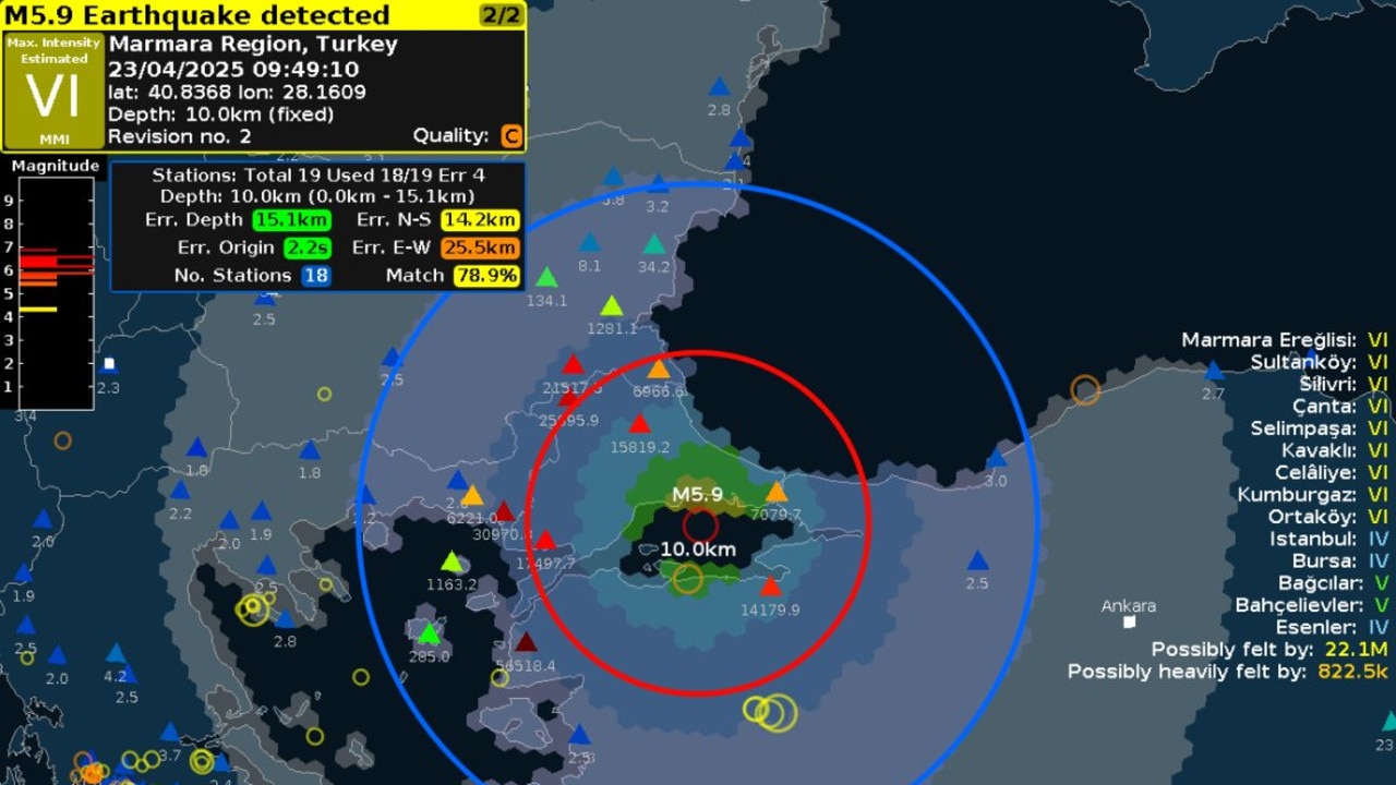
Major city rocked by earthquake
People have rushed onto the streets after the city was hit by a 6.2 magnitude earthquake on Wednesday.
Easter weekend drownings deadliest ever
A fateful combination of weather conditions has created the deadliest Easter long weekend in Australia’s recorded history.