
Bureau of Meteorology forecasts strong wind, rainfall for Western Australia and South Australia
One state is forecast to have unseasonable rainfall over the coming days, with warnings it could cause chaos as it makes its way across the country.
Environment
Don't miss out on the headlines from Environment. Followed categories will be added to My News.
A weather system brewing on the northwest coast of Western Australia could create havoc as it crosses the country in coming days.
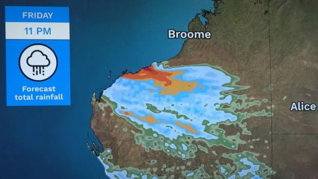
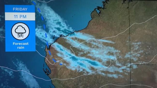
On Thursday, a cloud started to build over the Pilbara, Gascoyne and parts of the Kimberley bringing patchy light showers to the northwest.
But the Bureau of Meteorology expects it to amplify as it moves east across central Australia on the weekend, and potentially intensify when it hits the eastern states next week.
Over the weekend, the system will move east into central Australia bringing heavier rain to southern parts of the Northern Territory and northern parts of South Australia.
Bureau of Meteorology meteorologist Angus Hines said said the rainfall would be widespread with some areas receiving 20, 30 or 40mm of rain.
“When that amount of rain falls in normally dry areas in central Australia, it can certainly have some impact, particularly on travel and transportation,” he said.
“A lot of these outback roads in these parts of the country are dirt roads, so it doesn’t take that much wet weather before they become muddy and in some cases impassable.
“We could see road closures over the weekend but there is still a little bit of uncertainty, there is not complete clarity as to how this will play out.
“But we do expect to see rain through this part of the country on Saturday and in particular on Sunday.”
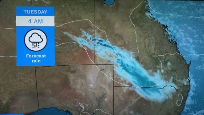
On Monday, the weather system will continue to move east potentially amplifying as it hits southern Queensland and northern NSW.
Mr Hines said Tuesday would be the day to watch because the rain intensity could pick up and develop into thunderstorms during the first few days of next week.
“It may just move across the states bringing light to locally moderate rainfall, but there is a chance this weather system could amplify and intensify on the first couple of days next week.”
Unseasonal rainfall for parts of Western Australia is forecast for the remainder of the week, as strong winds and frost sweep the country.
Bureau of Meteorology meteorologist Miriam Bradbury said parts of Western Australia will see rainfall across the coming days.
“We can see the cold front sweeping across the southern district of Western Australia,” Ms Bradbury said.
“With cold air, showers and hail following in its front.”
Ms Bradbury said the northern areas of WA will see unseasonal rainfall on Thursday.
“We also do have patchy rain a little further north across parts of Pilbara and Gascogne pushing towards the interior,” she said
“That’s associate with a cloud band coming down from the Indian Ocean.
“We’re not likely to see high rainfall in these areas but the rainfall is unseasonal for this time of year.”
Rainfalls of 15mm to 30mm are forecast across the Pilbara, parts of the Kimberley, the WA interior and central SA for the next five days.
The BoM has also issued a strong wind warning for the Leeuwin Coast, Albany Coast, Esperance Coast and Eucla Coast on Thursday.
Ms Bradbury said the cold front will continue to push into South Australia as Friday approaches, and “brushing the SA coast with a few showers and thunderstorms mostly about that coastal fringe”.
“This system will push across the southeast states this weekend but its impacts aren’t be as strong as previous cold fronts and won’t push too far inland,” she said.
Meanwhile, another strong wind warning was issued for the Far West Coast, Upper West Coast, Lower West Coast, Central Coast and South Central Coast in SA.
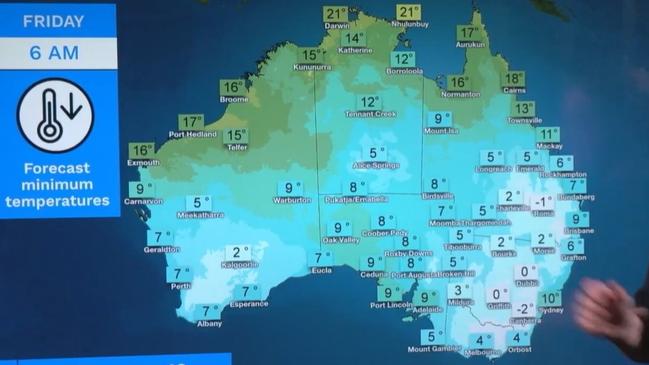
The southwest will feel the brunt of that cold front on Thursday with temperatures dropping across the south west land division behind that system.
It comes as temperatures in general across the country remain below average August.
Slightly frosty conditions are forecast to push across the southwest on Friday.
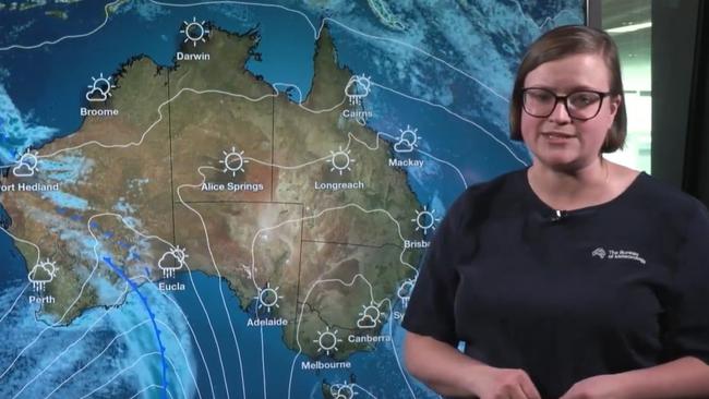
Meanwhile, in the capitals, Adelaide and Perth will reach a top of 18 degrees and 16 degrees respectively on Thursday.
Brisbane will see little chance of rain with a high of 21 degrees, while Melbourne will reach 15 degrees with only a 5 per cent chance of rainfall.
In Sydney, a shower or two is forecast on Thursday as the city sees highs of 16 degrees.


Originally published as Bureau of Meteorology forecasts strong wind, rainfall for Western Australia and South Australia

‘Big’: Wild weather warning to Aussies
Aussies in several states have been warned to brace for a weekend of wild weather, with the risk of floods and damaging winds.
Read more

Aussie miner drops F-bomb 10 times in rant
An Australian miner’s expletive-laden rant about the future of coal-burning has caught the attention of the world’s richest man.
Read more