
Sutherland Shire residents concerned about properties being identified as flood prone in study
Almost 16,000 Sutherland Shire residents have been advised their homes could be affected by floods, prompting concerns about the impact on insurance premiums, land value and planning certificates.

St George Shire Standard
Don't miss out on the headlines from St George Shire Standard. Followed categories will be added to My News.
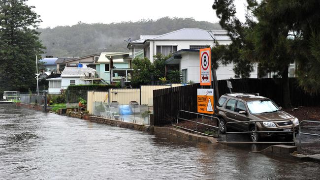
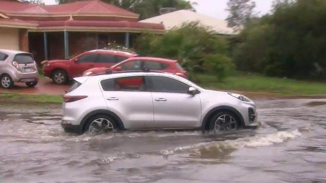
Thousands of Sutherland Shire residents have been shocked and alarmed to receive letters about a new report that identified their properties as flood prone.
Almost 16,000 residents were advised their homes were potentially flood affected following the Sutherland Shire Council’s overland flood study.
Mayor Carmelo Pesce said he heard and shared residents’ concerns, noting the council’s communication should have been better and it has now clarified key concerns.
Residents have questioned the unlikeliness of flooding occurring on their property and are concerned about the impact on insurance premiums, land value and a notation on their planning certificates.
Cr Pesce said preparing the study was not a council choice but rather a legal requirement imposed on all NSW councils by the NSW government to manage flood risks.
Bangor resident Angie said identifying homes in Bangor, Menai, Illawong and Alfords Point as flood prone was “ridiculous”.
She said there had never been a flood and did not expect to see one because her property sat on a hill, 100m above Woronora River and there were no nearby creeks or stormwater catchments.
“Half the shire would have to be underwater before our place would flood,” Angie said. “The flood would have to be of biblical proportions. There has been no common sense.”
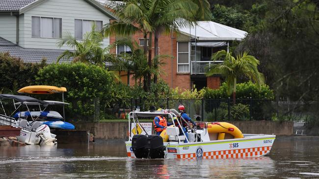
Cr Pesce has clarified the study referred to water that flowed over people’s properties and flash flooding, which occurred when there was too much water for the drains to handle because the size of the pipes were finite.
Significant rainfall can cause water run-off from roofs onto the street because the pipes can only carry a certain amount of water.
“The study is not about the flooding level but rather the overflow of water travelling through a property,” he said.
He noted the drains were cleared as part of regular council maintenance and that was not the cause of flash flooding.
Any property identified as flood prone will have a notation placed on the planning certificate which indicates flood-related development controls apply, which is the same for bushfire, landslip or coastal hazards.
This means that if there is a development proposal on the land, such as a new house, then it would need to consider the flood risk so that the future occupants can live safely on the land.
Notably, many residents complained and requested for the notation to be removed until after the consultation period concluded and the study finalised.
Cr Pesce said removing the notation was not possible because the notation was a legal requirement and if not included, left the council vulnerable to legal action.

He said the council had previously been successfully sued by a developer who purchased a block of land that had been identified as flood prone.
The council did not update the certificate because the flood study was still in draft but once the study was completed, the certificate was updated and when the buyer went to develop the property they were restricted in what they could do and sued the council.
Cr Pesce said that the notation would be removed if the identification was no longer required or updated to reflect the level of flood risk, which would be determined on an individual basis.
Angie was particularly annoyed by the lack of consultation from the council and wanted to see council staff and the mayor be more proactive in addressing residents’ concerns.
Cr Pesce acknowledged the communication about the study had been poor and had caused residents anguish, adding he wished the letter had been clearer.
Cr Pesce also noted residents’ concerns about insurance premiums increasing due to the identification but he stated insurance companies used their own flood studies to determine premiums, not the council’s study.
He said property values would also unlikely be affected because that was determined by supply and demand in the market, adding notations were usually minor considerations for most purchases unless developing the land.
The draft study is on public exhibition until December 6.


Country rugby captain leading from front in City battle
He’s torn between league and union but this weekend this teens focus is 100 per cent on leading his side to a defence of the title they won at last years City v Country rugby event
Read more

‘Like the Honey Badger’: U16 players to watch at City v Country rugby
Young guns in the U16s City v Country battle will be playing for more than pride and victory on Sunday. Rising stars - including ones likened to the Honey Badger and Brian To’o - to watch
Read more