
NSW floods: Penrith, Hawkesbury, Hills regions hit with evacuation orders, warnings
As water levels continue to rise at North Richmond, a silver lining has emerged with the BOM forecasting the peak will not reach the same levels as the flood in March last year.
Penrith
Don't miss out on the headlines from Penrith. Followed categories will be added to My News.
As water levels continue to rise at North Richmond, a silver lining has emerged with the Bureau of Meteorology (BOM) forecasting the peak will not reach the same levels as the flood in March last year.
At Windsor, flood levels continue to rise with the potential of major flooding on Thursday night.
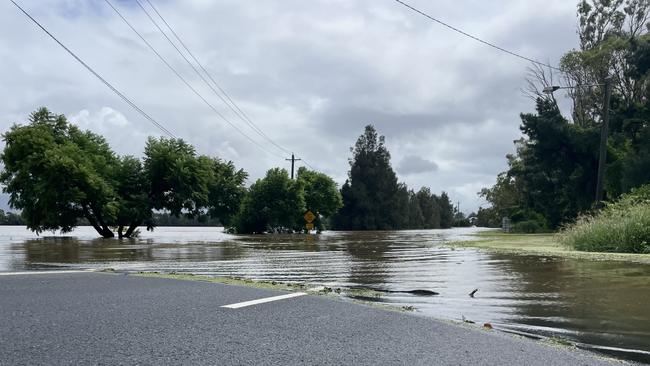
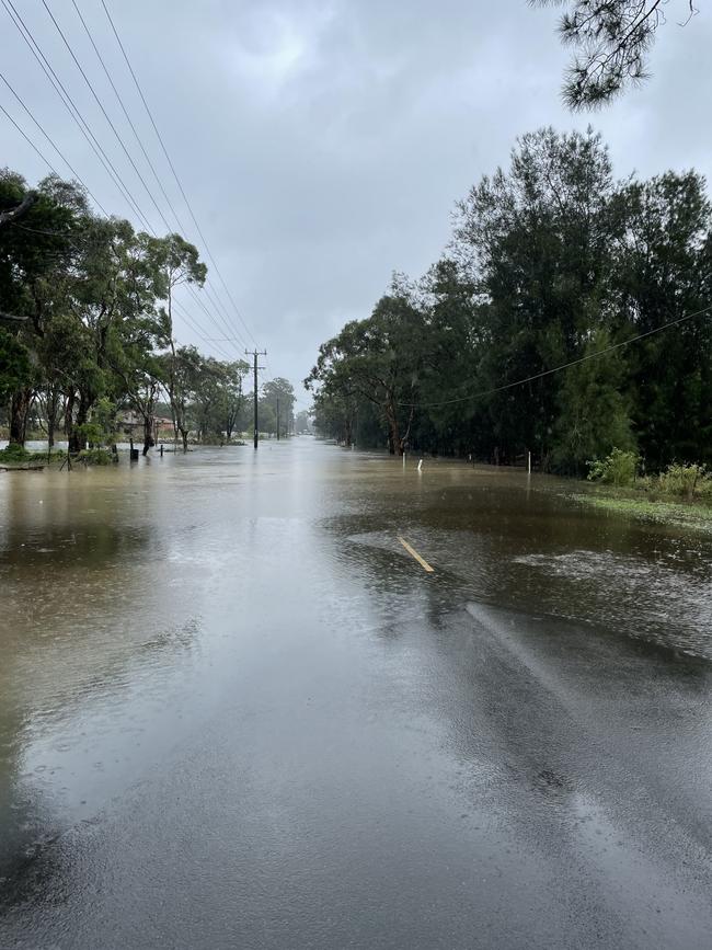
There is currently minor flooding at Penrith, Sackville and Lower Portland with the Nepean River at Penrith peaking at 8.1m about 3am Thursday.
There is no respite in the coming days with major rainfall predicted.
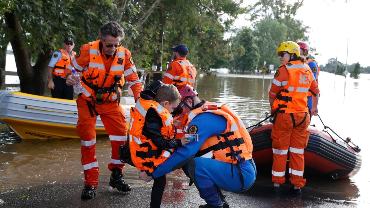
Hundreds of western Sydney families were evacuated due to flooding on Wednesday night and Thursday morning as the water levels of Hawkesbury and Nepean rivers rose.
EERIE CALM FOR PITT TOWN
In Pitt Town, a surprising sense of calm was expressed by locals congregating at The Bird In Hand Inn, which they called the Pitt Town’s unofficial “town hall.”
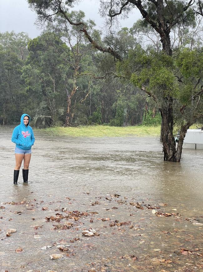
Throughout Thursday afternoon the rain largely ceased - interrupted at times by short, sudden downpours.
Some patrons had already evacuated from their homes while others who live on the other side of town - away from the Hawkesbury River - felt confident their homes would not be damaged by the floods.
Over the course of the afternoon, one man, Brendan, was watching his home’s shed slowly sink underwater on his phone.
Unlike last year’s floods Brendan said he had more time to prepare and managed to remove all of his possessions from the shed.
“When there’s flooding, you never know what will remain,” Brendan said. “Like, last year, we lost our trampoline in the waters - pretty much everything - but, for some reason, our BBQ remained where it was.”
Brett Matthews, who moved to Pitt Town three years ago, believed there was no chance his house wiould be hit by floods because it was on high ground.
“There is as much chance of my house getting flooded as there is Castle Hill,” he said.
Many of the locals at the pub felt this flood was different from the previous ones they had endured.
Frank Colosimo, who has lived in Pitt Town for five years, put the difference down to new infrastructure, particularly large property developments on what once was farm land.
“It’s changed the shape, the structure of the land here,” he said. “That’s why the flooding is now happening in parts of the town that were not previously flood prone.”
This sentiment was echoed by other local residents, who did not wish to be named.
AREAS EVACUATED, ON HIGH ALERT
An evacuation order was issued for all properties along Bents Basin Rd at Wallacia on Thursday morning, with residents directed by the SES to leave the area by 11.30am.
Properties in parts of Riverstone, Cattai, Windsor, Yarramundi, Londonderry, Vineyard, North Richmond, Mulgrave, Shanes Park and South Maroota had been previously ordered to evacuate.

On high alert were residents in parts of Penrith, Jamisontown, Mulgoa, Pitt Town and Lower Portland with flood evacuation warnings in place, which meant residents should be preparing to evacuate if conditions worsen.
At a press conference on Thursday morning, NSW Premier Dominic Perrottet expressed his sympathy for families traumatised by fleeing their homes in the past 24 hours as rain continued to pelt down.
“We are with you side-by-side through this difficult and challenging time,” the premier said.
“We have currently half a million people across our state who are subject to either one of those warnings or one of those orders.”
WINDSOR BRIDGE FLOODING TIMELAPSE
Windsor Bridge, which was built in 2020, is underwater for the second time in a 12-month period.
The closure comes as the state government warned the current flood emergency could be worse than the one experienced last March.
Watch the timelapse of the rising waters engulfing Windsor Bridge, courtesy of NSW SES Hawkesbury Unit.

“NEVER SEEN ANYTHING LIKE IT”
Londonderry resident Jordan Rovira, who has lived on Torkington Rd since January. said she had never seen flooding like this before.
“It started flooding on Tuesday night and now it’s about 2.5m high,” she said. “It looks like a deadset river. It’ll probably get deeper if more rain comes.
“We’re not thinking about evacuating till it gets to the back of the house.”
“LOOK OUT FOR EACH OTHER”
Lindsay federal MP Melissa McIntosh has urged residents of the Penrith area to “look out for each other” as areas of Londonderry and Agnes Banks receive evacuation orders.
“When we have the best community spirit in the country, we can get through anything together,” Ms McIntosh said in a video posted to Facebook.
Situated in front of Tench Reserve, a park which has been completely flooded by water from the Nepean River, Ms McIntosh said while water levels had slightly dropped it was vital residents were prepared to leave if necessary.
“Make sure you have your evacuation plans in place and are activating those now,” she said.
“We know there will be a number of potential evacuations going to be happening, depending on what’s happening with the floods across our community and also here along the Nepean River.”
ANIMAL EVACUATION CENTRE
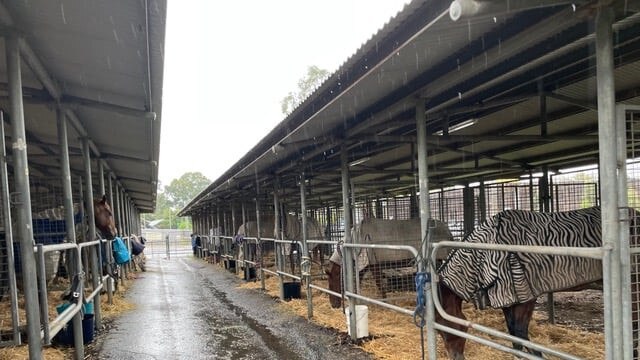

Castle Hill Showground has been transformed into an evacuation centre for livestock, horses and domestic animals, with Castle Hill RSL being used as an evacuation centre for residents.
The Hills Shire Council has emphasised the importance of anyone taking animals to the showground to bring both food and water for their furry friends.
A council spokeswoman said there were 44 horses currently at the complex with room for 25 more.
ROAD CLOSURES
Following the wild weather events, a number of roads have been closed, including:
– St Marys Road/Stony Creek Rd (at causeway)
– Eighth Ave, Llandilo (between 2nd Ave and Bridge)
– Torkington Rd, Londonderry
– Devlin Rd, Londonderry (Nutt Road End)
– Carrington Rd, Londonderry (between Bowman Rd and Milford Rd)
– The Kingsway, Werrington
– The Great River Walk & Board Walk near Penrith Weir
– Luddenham Rd, Orchard Hills (Mamre Rd end)
– Smeeton Rd, Londonderry (east end)
– Clark Road, Londonderry
– Reynolds Road, Londonderry
– Wilshire Road, Londonderry (east end)
– Fourth Ave, Llandilo (at The Northern Rd)
– Second Ave, Llandilo (between Ninth Ave and Eighth Ave)
– Durham St, Oxley Park (in both direction)
– Hobart St, Oxley Park (near Constance Ave)
– Seventh Ave, Llandilo (between Third Ave and Second Ave)
– Werrington Rd, Werrington (at The Kingsway)
– Dunkley Pl, Werrington
– McNaughton St, Jamisontown
– Anakai Dr, Jamisontown
– Willoring Cr, Jamisontown
– Silverdale Rd, Wallacia (at the Blaxland Crossing Bridge)
– Ninth Ave, Llandilo
– Barker St, St Marys (near Cook Park)
– Wilson Rd, St Marys (between Pages Rd to Barker St)
– Charles Hackett Dr, St Marys
– Christie St, St Marys
– Blue Gum Rd, Annangrove (at bridge crossing)
– McClymonts Rd, Maraylya (at bridge crossing)
– Cattai Ridge Rd, Maraylya/Glenorie (at bridge crossing)
– 2255-2275 River Rd, Leets Vale
– Terry Rd at the intersection of Hedgewood Drive, Box Hill
– 990-1027 River Road (at Blundell’s swamp)
– 313-337 Pitt Town Road, Maraylya (at bridge crossings)
Other closures include the boat ramp at Tench Reserve, the Great River Walk and Penrith Aquatic Centre (Ripples Penrith)


‘The greatest man ever’: Tributes flow for slain pizza shop owner
A public floral tribute for a slain business owner and new grandfather is growing at the site of his alleged murder, as shattered family and friends unite to remember the beloved man.

Meet the talented young artists from ARTEXPRESS 2025
The annual art exhibition which shows some of the most outstanding and exemplary artworks across NSW by HSC visual arts students has opened. Meet the students and see their amazing works.