
Picture special: Nearmap images reveal a decade of development in The Hills Shire
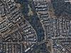
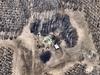
Once a green region, The Hills is now more than ever an urbanised centre. Aerial photographs reveal the massive developments that are changing the face of the Garden Shire.
Hills Shire
Don't miss out on the headlines from Hills Shire. Followed categories will be added to My News.
The Hills Shire is undergoing a marked transformation.
Known as ‘The Garden Shire’, this north west Sydney region is increasingly characterised by massive developments and highrise meccas.
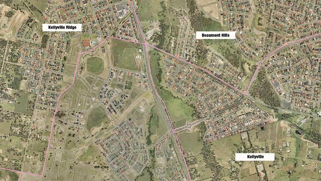
Now, in an extraordinary set of aerial photographs by Australian location intelligence company Nearmap, the full scale of The Hills’ transformation over the past decade can be revealed.
Nearmap provides government organisations, architectural, construction and engineering firms, and other companies, with easy, instant access to high resolution aerial imagery, city-scale 3D content, artificial intelligence data sets, and geospatial tools to assist with urban planning, monitoring and development projects.
Speaking about The Hills’ marked transformation over the past decade, Castle Hill MP Mr Ray Williams viewed the developments in a largely positive light.
“The Hills Shire has gradually progressed from a fruit growing region into the most vibrant, unique and modern areas to live, work and play,” he said.
“It is no longer a hidden gem in the crown of Sydney.
“It has become a highly sought after location for young families to raise their children as we offer plenty of open space, excellent schools, contemporary shopping centres and a public transport system that enables them to visit the wider Sydney area with ease.”
However, not all residents of the Hills share Mr William’s view of their Shire’s marked transformation.
West Pennant Hills Valley Progress Association president Peter Ernst spoke to The Hills Shire Times of his heartbreak over many new developments.
“(Residents) are devastated that the spread of high rise towers has now even reached into our beautiful, leafy valley,” he said.
Similarly, a spokesperson for a local action group, Forest in Danger, described “the old Hills ‘Garden Shire” as “rapidly changing into the Concrete Shire.”
“A combination of seemingly unstoppable rapacious development and a Council that isn‘t willing to push back against overdevelopment of sites, is an unmitigated disaster for the once green and leafy Hills Garden Shire,” the statement read.
“The loss of over 3000 trees mature trees on the Mirvac site at West Pennant Hills alone, shows the devastating impact these monstrous developments are having on the Hills Shire.”
And yet, Mr Williams stressed even though the landscape of The Hills has changed, it still retained some of the green space which once characterised Sydney’s Garden Shire.
“(The Hills) still has small hobby farms and acreage property mixed with medium density suburban housing and more recently higher density options near our transport networks,” he said.
As Sydney’s population grows, so will the areas of greater western Sydney.
“And, I think we have done this carefully, thoughtfully, and with great emphasis on ensuring that the culture of The Hills remains that of a community as opposed to just an area, suburb or street.”
Join the conversation

Sensational! Australian schoolgirl footy guns on special mission
They are small but mighty - a group of schoolgirls aiming to be at the LA and Brisbane Olympics on a rugby sevens mission. Australian schoolgirls players to watch, new squad.
Read more

Top shot! Massive scorelines, tries galore as rugby’s top teens amp up
There was a comeback, great kicking, explosions of speed and crucial results racked up in round three of the Super Rugby U16s and U19s series. Rd 3 wrap, great photos, standouts and scorers
Read more