
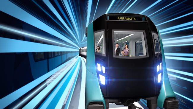
Metro map forecasts Sydney’s future driverless network
A blueprint of what the Sydney Metro network could look like in 2056 has been revealed, providing a look at new lines earmarked to connect suburbs.

Hills Shire
Don't miss out on the headlines from Hills Shire. Followed categories will be added to My News.
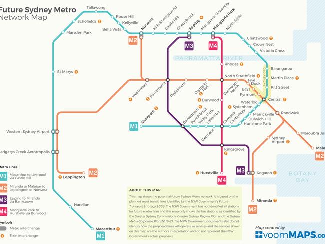
A map forecasting Sydney’s driverless metro future has been released — earmarking the introduction of two new routes reaching through Sydney and out to the western suburbs.
The 37-year jump into the future predicts what the Sydney Metro network could look like in 2056. The blueprint was released by Voommaps, identifying key transport routes and stations highlighted by the Greater Sydney Commission and NSW Government.
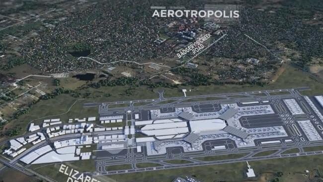
The map suggests the Sydney Metro west would link Westmead and Norwest stations before extending out to the Western Sydney Airport and Aerotropolis site. Meanwhile, the Metro northwest line would be extended from Tallawong connecting Schofields and Marsden Park to the North South Rail Link from St Marys to the new airport.
A Voom maps spokesman said although the map created is not an official government document, it is based on “planned mass transit lines identified by the NSW Government’s Future Transport Strategy 2056”.
The prediction of the future metro services includes the Sydney Metro West — which is scheduled to commence construction in 2020, Sydney Metro Greater West — earmarked to start work in 2021, the Sydney Metro City and Southwest extension to Liverpool, Sydney Metro Greater West northern extension to Sydney Metro Northwest and Sydney Metro Greater West southern extension to Macarthur.
The map also includes a rail line from Parramatta to Western Sydney Airport and Badgerys Creek Aerotropolis, as well as a rail line from Leppington to Western Sydney Airport and Badgerys Creek Aerotropolis and a series of mass transit links from the Sydney CBD to Malabar via Randwick, Parramatta to Kogarah via Bankstown, Macquarie Park to Hurstville via Rhodes and Parramatta to Norwest Business Park.
MORE FROM JAKE McCALLUM
Construction of Castle Towers Metro link underway
Wheels stolen off ute as owner catches Sydney Metro
Sydney’s west to be ‘manufacturing leader’: Premier
First look at controversial Waves Aquatic Centre plans
“The map’s design is influenced primarily by the current Sydney Trains network map so as to be familiar design to Sydney’s public transport users,” the spokesman said.
“I believe that the major transport hubs referenced in the map are a step forward in promoting a more polycentric city, as opposed to the traditional paradigm dominated by the one Sydney CBD.”
Voom Maps forecast cross-country links would improve the feasibility of city centres, such as Parramatta.
“Currently, to get to Parramatta from Kogarah, one would have to travel all the way to the city first,” the spokesman said.
“The proposed direct link would make Parramatta significantly more accessible for a large proportion of Sydney’s population.”
The spokesman said the creation of the map was to see the NSW Government’s planned mass transit lines “holistically, as one interconnected network” rather than individual projects on separate maps.
A Spokeswoman for Transport Minister, Andrew Constance, confirmed the map was not an official government document, while a Greater Sydney Commission spokesman said the map “is the vision looking out to 2056”. The spokesman said the map aligned with the Metropolis of Three Cities and the 30-minute city concept.
“The Future Transport 2056 Strategy, the Greater Sydney Region Plan and the State Infrastructure Strategy from Infrastructure NSW were prepared concurrently,” he said.
“I believe that map is be based on the initiatives section of the Future Transport plan.”

The suggestion of the Sydney Metro’s future growth also comes as Mr Constance announced more than 5.6 million trips had been taken on the Sydney Metro northwest since it opened on 26 May — with “an overall customer satisfaction rating of 95 per cent”.