
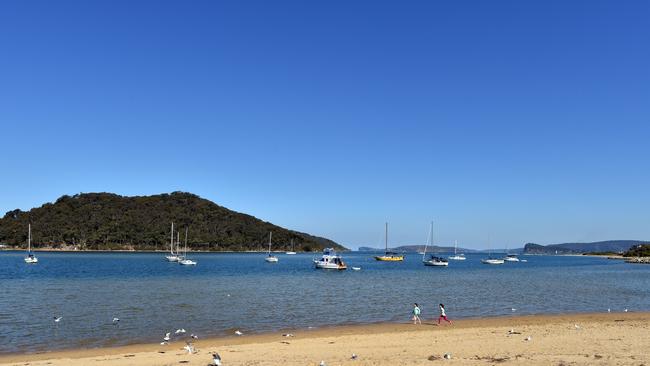
Tsunami safety day at Ettalong Beach
A TSUNAMI roaring toward the picturesque beaches of the Central Coast is the last thing in the minds of residents, but here’s why the SES thinks you should be prepared.
Central Coast
Don't miss out on the headlines from Central Coast. Followed categories will be added to My News.
- Buns in the sun this summer
- Woman aquitted of shocking bashing murder
- New tourism strategy to sell the Central Coast to the world
A TSUNAMI roaring toward the picturesque beaches of the Central Coast is probably the last thing in the minds of local residents, but the State Emergency Service takes the risk seriously.
Tomrrow (Sunday) SES volunteers will be on Ettalong Beach trying to raise awareness about tsunami risk and urging local people to be prepared.
SES Gosford’s Katrina Fowler said the idea was to help people understand what would happen in the event of a Tsunami.
“The problem isn’t the threat of a Tsunami, the problem is, if one happens, you won’t have the time to learn. You need to know, because you’ll have only minutes to act,” Ms Fowler said.
Ms Fowler said while the risk of a tsunami was moderate, if there was one, the Central Coast was vulnerable.
“Five minutes of preparation could literally save lives. An inundation here on the Coast would cause serious issue — it’s better to at least understand the warnings,” she said.
AT RISK AREAS
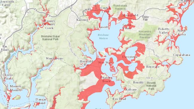
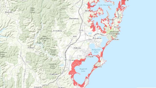
The SES Tsunami Safe website has maps which show areas of the Central Coast which would be evacuated in the event of a major tsunami.
Southern areas potentially affected include Forresters Beach, Mooney Mooney and Mooney Mooney Creek, Wamberal, Terrigal, Avoca, St Huberts Island, Copacabana, Cogra Bay, Little Wobby Beach, Hungry Beach, Umina Beach, Pearl Beach, Booker Bay, Ettalong Beach, Pretty Beach, Wagstaffe, Hardys Bay, Putty Beach, Patonga and Croppy Beach.
In the northern areas beaches from Shelley to Budewoi are in the firing line and many suburbs around Tuggerah Lake.
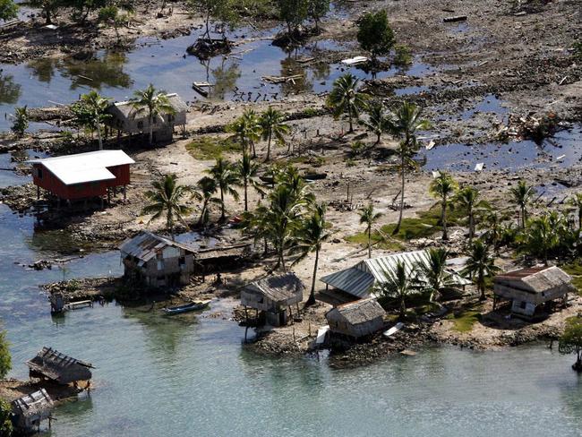
The NSW coast has been affected by more than 30 tsunamis in the past 200 years.
Tsunami warnings with a marine and immediate foreshore threat are more common on the Australian east coast than warnings of land inundation, and can involve dangerous rips, waves and strong ocean currents that can damage marinas and wash away boats, rock fishermen and swimmers.
EARTHQUAKE ZONE
While Australia is a tectonically stable continent, it is surrounded by a number earthquake prone areas from which a tsunami could originate.
A tsunami originating from earthquakes in the Solomon Island trench, the New Hebrides trench south of the Solomons, the Tonga and Kermadec trench north of New Zealand or the Puysegur trench south of New Zealand could be devastating to Australia’s east coast.
Earthquakes closer to home are not unheard of.
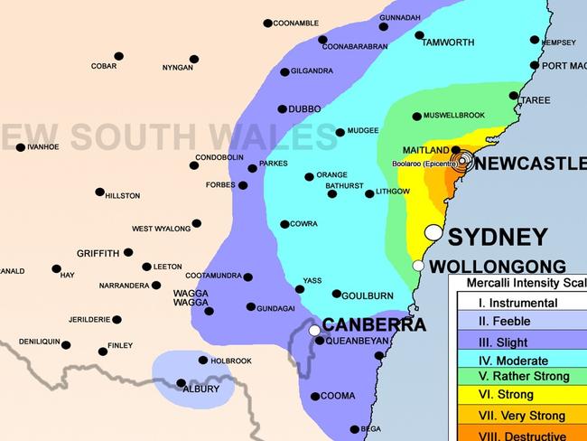
The 1989 Newcastle earthquake measured 5.6 on the Richter scale and was one of Australia’s most serious natural disasters, killing 13 people and injuring more than 160.
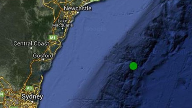
A magnitude 4.1 earthquake stuck off the NSW Central Coast in June, about 100km east of Terrigal, with reports of tremors being felt from Sydney to Newcastle.
Geoscience Australia’s instruments detected the quake at 10.02am, at the surface of the Earth’s crust on the edge of Australia’s continental shelf.
At the time, the duty Seismologist Hugh Glanville said “hopefully given if it’s 100km from shore there won’t be any damage”.
Magnitude 4 is starting to get a decent size,” Mr Glanville said.
“If it hit on shore it would have caused a bit of damage.”
He said quake was considered too small and too far away to generate a tsunami.
SES TSUNAMI ADVICE
SAFETY DAY: Ettalong Beach Esplanade, 10am - 2pm
■ In the event of a Tsunami, to go to higher ground — at least 10 meters above sea level or move at least 1km away from beaches.
■ Remember the first wave is not always the biggest.
■ Let your neighbours know about the danger.
■ Never go to the beach to watch a tsunami, it will put your life at serious risk.