
Urgent wind warnings for Mt Lofty Ranges, Murraylands
People in two regions have been told its time to get their cars under cover as forecaster issue new warnings ahead of another spate of wild weather.
SA News
Don't miss out on the headlines from SA News. Followed categories will be added to My News.
Wind gusts predicted to peak at around 90km/h on Saturday night lashing the Mount Lofty Ranges and Murraylands has prompted an urgent warning from the State Emergency Service for people in affected areas to stay inside and away from windows.
But first they should move vehicles under cover or away from trees and secure or put away loose items from around their property that could become dangerous missiles.
The Bureau of Metoerology has issued a severe weather warning for damaging winds in those regions.
“Strong to damaging wind gusts with peak gusts of around 90 km/h are possible over the Mount Lofty Ranges and adjacent areas to the east, particularly with shower activity,” the alert issued at 4.20pm on Saturday states.
“Damaging wind gusts are expected to ease below warning thresholds during Sunday afternoon.
“Recent rainfall has led to saturated soil, so trees may be more susceptible to strong and gusty winds.”
The Bureau says locations which may be affected include Mount Barker, Murray Bridge, Victor Harbor, Strathalbyn and Mannum.
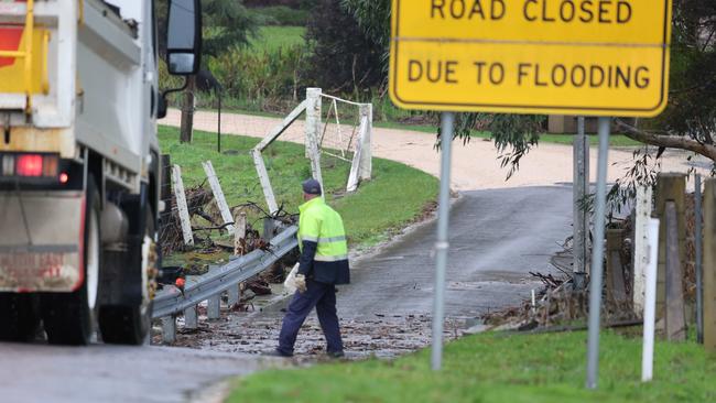
The Bureau of Meteorology also has issued flood warnings for parts of the North West Pastoral District ahead of more rain lashing South Australia.
Flooding is possible from Tuesday following heavy rains over the weekend and developing on Monday.
Heavy rainfall predicted in the flood watch region may cause areas of ponding and overland flow, along with rises in local creeks and overbank flooding.
The Bureau has warned communities may be cut off with roads, travel and transport being impacted.
Catchments likely to be affected include Finke River and Stephenson Creek and, Eastern Great Victoria Desert and Warburton District Rivers.
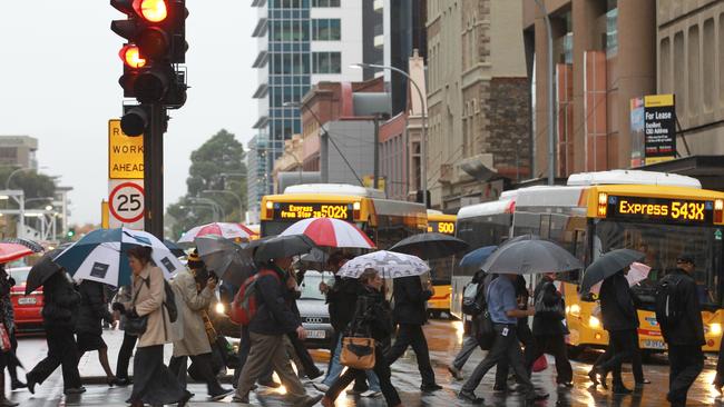
Adelaideans are being warned to prepare for more wet and windy weather with Adelaide expected to see maximum temperatures of 15C over the weekend.
Bureau of Meteorology forecaster Jon Fisher said the state should expect a “burst of wet and windy weather,” with the focus of the rainfall more towards the south, and “widespread strong and gusty winds”.
“As we move into later Saturday and Sunday, some of those showers will push a little bit further north across the Mt Lofty Ranges, and we’re likely to see further rainfall totals of about 10 to 20mm,” he said.
Sheep graziers are warned that cold temperatures, showers and northwesterly winds are expected tonight and Sunday in areas including the Mount Lofty Ranges and Lower South East and parts of the Lower Eyre Peninsula, Kangaroo Island, Flinders and Mid North forecast districts.
There is a risk of losses of lambs and sheep exposed to these conditions. However the warning to sheep graziers for the West Coast and Yorke Peninsula has been cancelled.
Mr Fisher said the Bureau is monitoring issues across the state, and will issue Flood Watches and warnings as necessary.
The forecast is similar across the metropolitan area, with even cooler temperatures in the outer suburbs and Adelaide Hills. Stirling is forecast to reach 10-11C over the weekend.
This comes after the state was hit by a rainstorm with spates of thunder and lightning on Friday leaving thousands of households without power.
Over 2800 SA households and businesses experienced blackouts as strong heavy rain and storms hit Adelaide and the Adelaide Hills in the early hours of Thursday morning.
SA Power Networks reported more than 2000 properties in Blackwood, Coromandel East, Coromandel Valley, Craigburn Farm and Hawthorndene experienced a power outage overnight.

By 7.30pm on Friday power was restored to the majority of properties but 583 households were still without power.
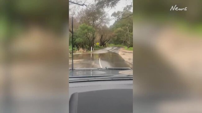
The State Emergency Service responded to more than 240 requests for assistance after heavy rainfall of up to 80mm in some parts of the state from Thursday morning through to Friday morning.
As of 5pm on Friday Adelaide had received a total of 48.2mm of rain in 48 hours.
SES chief of staff Derren Halleday said Coromandel Valley, Blackwood, Eden Hills, and the Mt Lofty catchment were the worst affected areas.
Mr Halleday said domestic, over road and broader industrial areas flooding were the most common call-outs.
As of 6.30am, the SES had undertaken seven separate swift water rescues as people became trapped in fast-rising floodwaters, which Mr Halleday said was a “significant spike”.
“All of them have involved people either inadvertently or making a conscious decision in driving into floodwaters against the messaging that we put out,” Mr Halleday said.
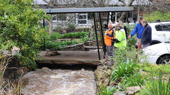
A dam spillway on Swamp Rd, Lenswood was overtopping after the heavy overnight rainfall, which raised concerns from the public.
Mr Halleday said the dam “appeared to be structurally safe,” and “there had been temporary diversion and overnight work to alleviate any pressure on that spills”.
Bureau of Meteorology forecaster Jon Fisher said Thursday’s overnight rainfall has marked the wettest day since last June – and was the fifth wettest day in the last decade.
Mr Fisher said Mt Lofty Ranges had the top rainfall totals in the 24 hours to 9am, with 50mm to 100mm of rainfall recorded, with Woodhouse recording 96mm of rainfall.
“We saw a fairly heavy band of showers and thunderstorms move across the metropolitan area yesterday evening, and as it moved across Marion and the Southern suburbs, we saw rainfall totals of around 20mm in half an hour,” Mr Fisher said.
Noarlunga recorded 30mm while Lenswood recorded 79mm of rainfall in 24 hours at 9am on Friday.
Ashton, near Uraidla, recorded 81mm in that time.
ADELAIDE RAIN RADAR
WEATHER FORECASTER: HIT PLAY BUTTON

Originally published as Urgent wind warnings for Mt Lofty Ranges, Murraylands
Join the conversation

Woman and teen boy stabbed in terrifying home invasion
Two people have been stabbed and a third person has also been hurt in what police believe was a targeted attack early on Wednesday morning.
Read more

Heartbroken family speaks after young dad’s motorcycle death
The 22-year-old died over the weekend at the scene of a crash on a major Adelaide road.
Read more