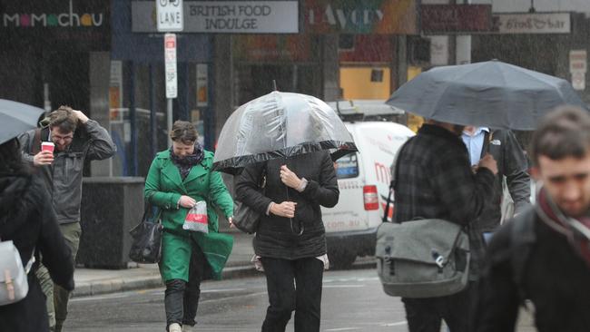
Climate outlooks reveal SA will have coldest day of the year so far, and wetter than average winter
As the state braces for the coldest day of the year so far, climate experts predict one of the wettest winters since records began – find out where to pick up free sandbags.
SA News
Don't miss out on the headlines from SA News. Followed categories will be added to My News.
Weather forecasters have predicted the coldest day of the year so far on Monday with heavy rainfall, as a cold front will move through western SA from Sunday morning.
A severe weather warning may be issued for damaging wind gusts.
Elevated seas and large waves are possible in the west on Sunday and moving into central coasts on Monday.
And long-range forecasts are for one of the wettest winters on record despite a weakening La Nina climate outlook.
Bureau of Meteorology senior forecaster Vince Rowlands said showers were forecast in Adelaide on Saturday, but heavier falls would hit late Sunday.
“It looks like Sunday will be mainly dry ahead of the more significant system coming through, so it’s a pretty deep low pressure system and associated front moving across the west hitting central parts late Sunday,” Mr Rowlands said.
Thunderstorms and up to 20mm of rain are expected to fall on Sunday, while 35mm could fall on Monday, coupled with wind gusts up to 50km/h during the day.
“It certainly looks like a pretty wet period from that sort of late afternoon Sunday through to Monday and then we start to get into an easing trend as we get into the latter part of Monday,” he said.

While Saturday and Sundays’ temperatures are forecast as mild, 17C and 19C respectively, Monday will drop to a maximum of 14C.
Less intense showers will continue into the early part of next week.
According to the bureau’s climate outlook, South Australia is likely to have a wetter than average winter.
BOM senior climatology specialist Simon Grainger said it was 1.5 to 2.5 times more likely for SA’s winter to be in the wettest 20 per cent in the state’s history.
“This reflects several climate influences, including a developing negative Indian Ocean dipole and a slowly declining La Niña in the Pacific Ocean,” he said.
“These influences lead to warmer than usual waters off northern Australia, particularly in the tropical east Indian Ocean. This is conducive to the wetter than usual conditions across South Australia, and eastern Australia more generally.”
Low-lying flood waters from saturated areas in Queensland and New South Wales are also expected to slowly move inland towards SA in coming months.
Mr Rowlands said the weather system developing late Sunday would not affect inland rivers following a warning from the State Emergency Services this week.
Potential flooding was expected along the Diamantina River in the Far North of SA.
The river starts in central west Queensland and flows through Birdsville and the Goyder Lagoons.
“Floodwaters may cut roads and access tracks, and in particular river crossings,” the SES said.
The peak flow entering SA is not expected for up to three weeks.
The causeway at Innamincka was already overtopped, but still passable, but would likely become impassable in the next week or so, the SES said. People in the Far North and North Eastern districts of SA should prepare by relocating stock, stocking up non-perishable items and readying pumping equipment.
SA has an increased chance of unusually low winter daytime temperatures, the outlook shows, in the coolest 20 per cent of past winters.
Warmer than average nights are also likely with at least an 80 per cent chance of higher temperatures across most of the count. This is because wetter conditions bring more cloud cover, therefore prohibiting heat from escaping at night.
Free sandbags
The State Emergency Service has issued a list of places where free sandbags will be available.
Only some locations can provide free sand and/or help filling the bags – more information at www.ses.sa.gov.au
Originally published as Climate outlooks reveal SA will have coldest day of the year so far, and wetter than average winter


