
Qld temperatures to soar as high as 40C as extreme conditions whip up supercell
Temperatures of nearly 10C above the October average are set for parts of Queensland today and into the weekend with conditions prime for thunderstorms.

QLD weather news
Don't miss out on the headlines from QLD weather news. Followed categories will be added to My News.
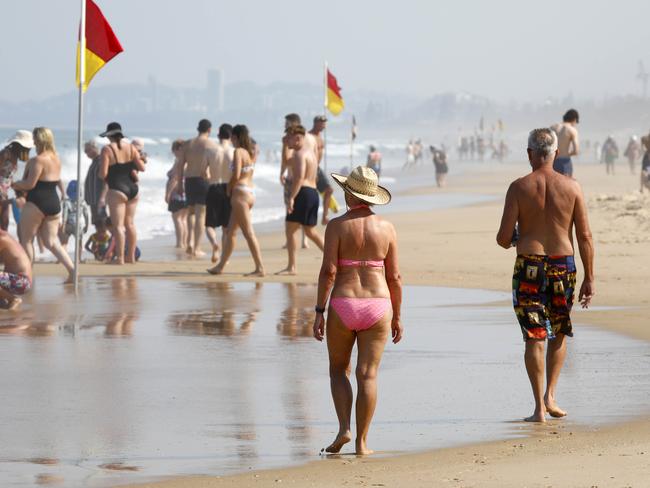
Queensland is set to swelter through near-heatwave conditions at the weekend with temperatures soaring to as high as 40C at well above the October average, potentially triggering supercell thunderstorms.
Bureau of Meteorology forecaster Patch Clapp said today’s maximum temperatures were set to reach as high as 40C in the western areas of the state.
Temperatures in Longreach climbed to 39C on Thursday, as well as 37C in Charleville and 35C in Roma.
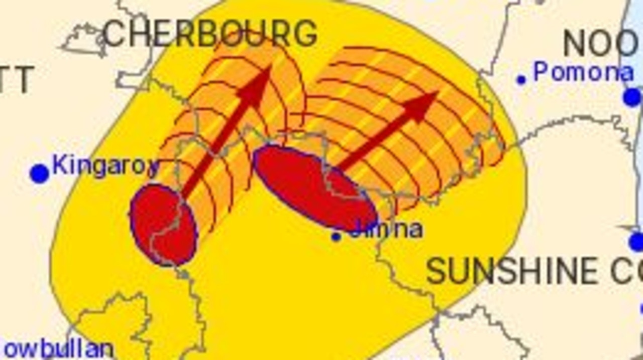
Mr Clapp said the conditions could whip up isolated thunderstorms for parts of western and southern Queensland today.
“Up to 9C above October averages today,” Metrologist Patch Clapp said.
“Isolated thunderstorm activity is expected to extend across western and southern Queensland today as a trough moves east through the region.
“Isolated severe thunderstorms with damaging wind gusts are possible in the southwest today. Late showers are possible in the southeast.”
According to Weatherzone, the conditions are set up for multi-celled thunderstorms with the possible threat of supercells.
“These types of storms increase the risk of destructive winds and very large hail,” a Weatherzone post read.
Storms are broadly possible over the southwest and southern inland west of Ipswich today, possibly severe in the far southwest.
Showers and thunderstorms will move into the southeast on Saturday and into central Queensland on Sunday as the trough continues to move east.
“At this stage, showers and isolated thunderstorms are expected to continue in parts of central Queensland early next week,” Mr Clapp said.
Daytime temperatures are forecast to reach the mid-30s in the southeast at up to 7C above October averages on Saturday.
“While warm, these temperatures do not constitute a heatwave,” Mr Clapp said.
“Very warm temperatures are forecast across central and southern Queensland for the next few days, extending eastwards into southeastern Queensland from today and across the east of the state over the weekend.”
Mr Clapp said a high to locally extreme fire danger ratings had been forecast for parts of western Queensland for Friday which will extend into the weekend.
“High fire danger ratings are expected to spread across the southern and southeastern parts of the state during Saturday with the development of warm, fresh and gusty westerly winds,” Mr Clapp said.
Strong wind warnings are in place for Gold Coast and Sunshine Coast Waters.
More Coverage


Originally published as Qld temperatures to soar as high as 40C as extreme conditions whip up supercell
Southern Qld lashed with hail, strong winds and heavy rain
Parts of southern Queensland have been hammered by heavy rain and hail, with all storm warnings cancelled after another afternoon and evening of wild weather.
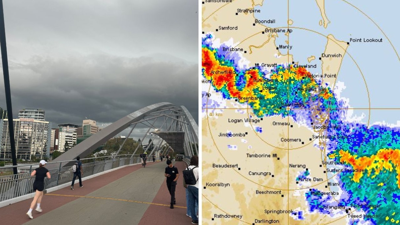
28mm rain in just 10min: SEQ hit with short, sharp storms
Brisbane smashed with thunder and lightning, while areas of the Gold Coast received 28mm of rain in just 10 minutes as storms – not severe enough to spark a BOM warning – hit the southeast.