
Sydney weather: NSW to be hit by record cold snap
Get out your winter woolies — a severe weather warning is in place with freezing cold winds and blizzard conditions ahead of the coldest predicted start to May in decades.
NSW
Don't miss out on the headlines from NSW. Followed categories will be added to My News.
- Hugs all around from Nan and Pop as restrictions eased
- Sydney beach COVID-19 closures set to be relaxed
Parts of NSW are expecting to see their coldest May day in two decades as the state braces for severe winds and freezing temperatures this weekend.
After days of rain, in which areas like Nowra and Coonamble saw their coldest April day since the 1960s, the cold snap is continuing with temperatures likely to plummet into single digits this weekend.
The Bureau of Meteorology has issued a severe weather warning for damaging winds in the llawarra, Southern Tablelands, South West Slopes, Snowy Mountains, Australian Capital Territory and parts of South Coast, Central Tablelands, Central West Slopes and Plains and Riverina Districts.
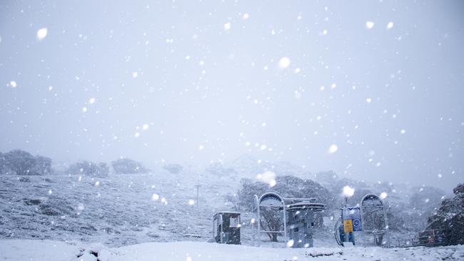
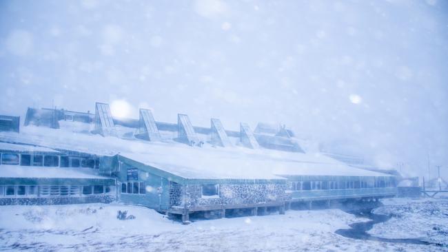
There is also a warning that the cold wind will create blizzard conditions in alpine areas.
BOM forecaster Jiwon Park said wind gusts reached 117km/h in Thredbo and 96km/h in Perisher this morning.
“This windy event will continue until tomorrow ... from the later part of tomorrow the low pressure will head towards the Tasman Sea and the winds will wind down by late Saturday or early Sunday,” Mr Park said.
“When this low pressure system moves to the Tasman Sea the winds will turn southerly from Sunday, and with this we are expecting hazardous surf conditions into Monday,” he said.
SEVERE WEATHER WARNING DAMAGING WINDS: for people in Illawarra, Southern Tablelands, South West Slopes, Snowy Mountains, Australian Capital Territory and parts of South Coast, Central Tablelands, Central West Slopes and Plains and Riverina.
— Bureau of Meteorology, New South Wales (@BOM_NSW) April 30, 2020
Warning: https://t.co/5HEkmE3euD pic.twitter.com/gDcCOQMFAS
Below average May temperatures are predicted to hit single digits in the South and Central Ranges and the Slopes, with Sydney expected to reach 19 degrees tomorrow.
The truly icy temperatures will hit Monday morning, with sub-0 temperatures expected in rural parts of the state.
MORE NEWS
Major infrastructure work powers up as traffic slows down
Sydney naturopath probed over sale of $130 swab kits online
Virus experts say COVID-19 vaccine progress is ‘incredible’
Snow and thunderstorms are forecast across NSW, the Bureau of Meteorology said, with top temperatures possibly plunging between 8C-14C below average for this time of year.
“This is a very strong and widespread cold outbreak across southeast Australia, of the kind of scale we haven’t seen in April since 2008,” metrologist Dr Adam Morgan said.
“Some parts will see their coldest May day since the year 2000,” he said.
There will be heavy snowfalls at Thredbo and as much as 40cm is expected to fall on the alps by Friday.
There is also a warning to sheep graziers this weekend that with showers, gusty winds and freezing temperatures there is a significant risk of losing lambs if exposed to the elements.