
Commuters warned to stay home tomorrow as severe weather warning issued for Sydney
Sydney and east coast residents are next in the line of fire for the rain bomb, the Premier has warned, with far western Sydney residents on alert for flooding.

NSW
Don't miss out on the headlines from NSW. Followed categories will be added to My News.
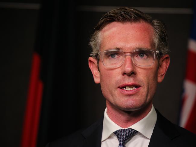
The NSW Premier has warned Sydney and east coast residents they’re next in the line of fire, with far western Sydney residents on alert for flooding.
Dominic Perrottet on Tuesday declared the weather event that created catastrophic flooding experienced in NSW’s north is soon likely to lash residents further south, with rain already beginning to fall in Sydney.
“We know at the moment (the severe weather) is focused on the north, but very quickly as we are seeing in metropolitan Sydney, there’s severe and heavy rainfall,” Mr Perrottet said.
“It will move to the south, so to all people, particularly across the east coast of our state, these issues may come your way.
“As this progresses, we need to continue to follow the instructions of the SES, so if those evacuation orders are made, we need to get ready.”
Reneging on his vow to urge city workers back into the CBD this week, the Premier asked residents to “show caution” and stay safe however possible.
“Obviously we want people to come back to the Sydney CBD but based on the advice from the Bureau (of Meteorology) it’s going to be a difficult week in our city as we see those heavy rains come from the north.
Ultimately right now we say to people right across our city and our state, look after yourself, follow the advice and stay safe.”
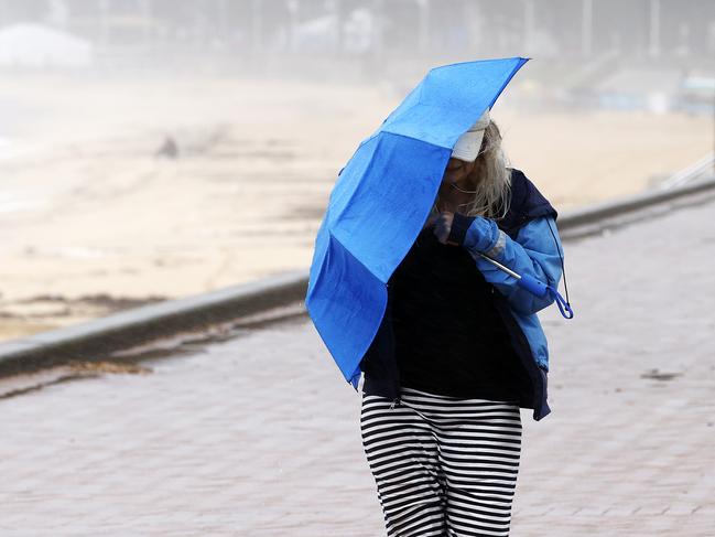
A severe weather warning for damaging winds and heavy rainfall is in place for Tuesday and Wednesday.
Bureau of Meteorlogy spokesman Dean Narramore said while the rain had stopped in the state’s north, areas further south now needed to brace for a downpour.
Mr Narramore said system was “deepening” into an east coast low which would likely smash the coastline from the Hunter down to the south coast.
“This includes the Hunter, the Sydney Metropolitan area, Wollongong and inland towards the Blue Mountains … we could see six hourly totals anywhere from 50 to 150mm with isolated falls in excess of possibly 200mm,” Mr Narramore said.
He said the heavy rainfall was a “concern” because NSW‘s rainfall catchments were already full of water, with flash flooding expected in river systems.
As rain finally eases over floodwaters in northern NSW and southeast QLD, the focus of this dangerous weather system now shifts to central and southern NSW. âš ï¸
— Weatherzone (@weatherzone) February 28, 2022
More at https://t.co/UjssSUcFCa#EastCoastLowpic.twitter.com/hetDoqZFKs
“At this stage we‘re seeing some minor, moderate flooding of some kind on some rivers and catchments … we’re very interested in the Hawkesbury and Nepean area, at this stage we’re expecting moderate flooding there … we’re probably talking minor flooding for many of the communities,” Mr Narramore said.
“And a moderate flood warning even into the Richmond and Windsor area as well.”
“The Upper Nepean we could see moderate possibly to major flooding … it is highly dependent on the tracking and the intensity of this low over the coming days.”
Mr Narramore said it was still possible the heart of Sydney‘s inner suburbs could cop the worst of the deluge.
“It‘s going to be a wet couple of days through much of the Sydney metro … but if the low crosses just to the north of the Sydney area then the heaviest rain and strongest winds ill cross right through the metropolitan area,” Mr Narramore said.
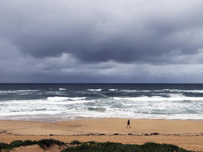
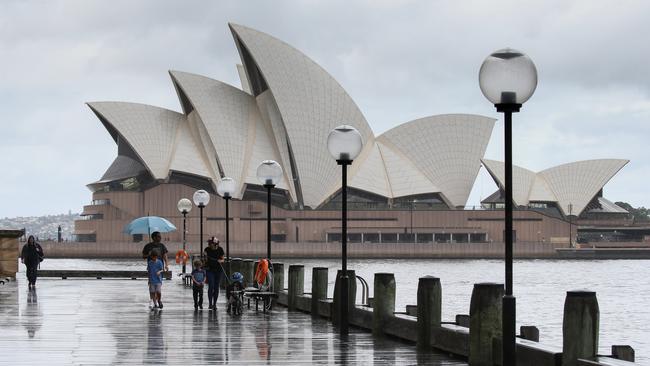
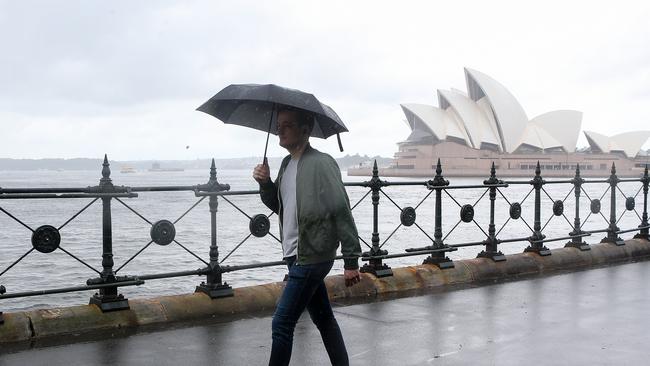
Sydney could receive up to a month’s worth of rain in the next few days as northern NSW’s rain bomb moves towards the city.
Flood warning have also been issued for many rivers, as well as dangerous surf warnings in coastal areas.
A police search is already underway today for a fisherman missing in dangerous conditions in the state’s south.
The 24-year-old man’s personal belongings were found on rocks at Mermaid Inlet, near Jervis Bay on the south coast, about 8.20am on Monday and he hasn’t been sighted since.
A land and sea search for the Victorian man has resumed on Tuesday for the man, who police believe was fishing on the rocks on Sunday.
Tuesday’s forecast is for 40mm to 60mm of rain across the Sydney basin, and then another 60 to 90mm on Wednesday, according to the Bureau of Meteorology.
This means at a minimum, Sydney could receive March’s median rainfall of 101mm in the first few days of autumn.
Between Tuesday night and Wednesday morning, six-hourly rainfall totals between 80mm and 120mm are expected, with a severe weather warning for damaging winds and heavy rainfall issued for the Metropolitan, Illawarra, south coast and parts of Central Tablelands and Southern Tablelands.
But localised heavy falls could bring up to 200mm in specific areas and flash flooding, the BOM has warned.
BOM spokeswoman Morgan Pumpa said the east coast low could potentially dodge Sydney but warned locals to bunker down for the next few days if the weather hit, with the possibility of even higher falls.
“We’re expecting to see the most impact (of the low) between Newcastle and Eden … but heavy falls could bring between 80 and 100mm to the warning areas, and locally intense falls could see possibly more, up to 200mm,” Ms Pumpa said.
She warned that people in close proximity to river systems in Sydney needed to be extra alert, and that the wet weather was set to continue.
“People really need to be careful, flash flooding is possible … we have flood watches current on the Parramatta River, Georges River, Nepean River, Cooks River, parts of northern Sydney and into the Illawarra,” Ms Pumpa said.
“Over the next week we‘ll see more rain each day, but we want people to focus on the next few days when the falls are the heaviest.”
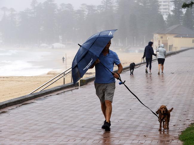
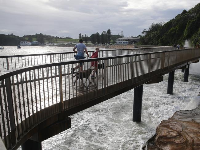
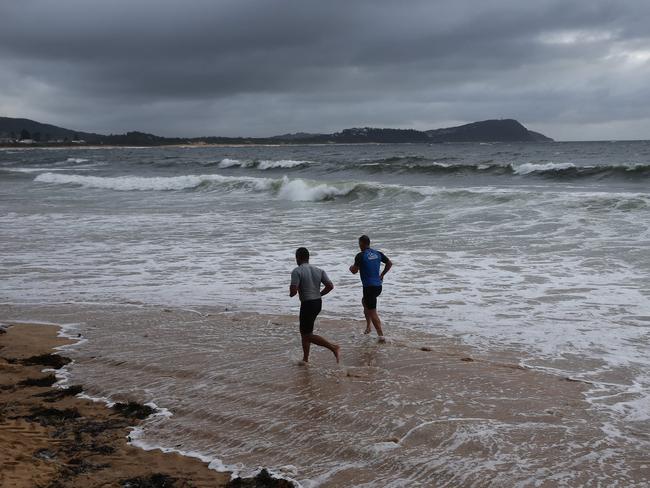
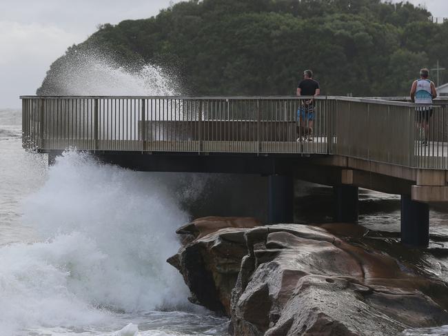
It comes as a dangerous surf warning is in place for the entire NSW coastline.
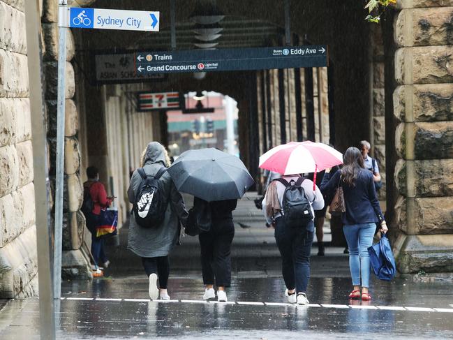
It comes as emergency services warned Sydney should brace for commuter chaos on Wednesday as a fresh round of wet weather brings flash flooding and torrential rain to the city roads.

The State Emergency Service is bracing for the wild weather to move down from NSW‘s North Coast and hit Sydney, with crews preparing to be placed in flood-prone areas as a precaution.
SES spokesman Phil Campbell said localised flooding was a “big concern” for crews in Sydneys west, the north and parts of NSW’s south coast.
He said the wet conditions could wreck the morning commute for travellers on Wednesday.
“Localised flooding is the biggest concern for us, that‘s when flood rescues occur … we’re also watching for any riverine flooding too, particularly around Menangle,” Mr Campbell said.
âš ï¸ Heavy rain, strong to damaging winds and waves look likely to develop from Tuesday evening as a low moves towards the central parts of the NSW coast. Multiple warnings are now in place.
— Bureau of Meteorology, New South Wales (@BOM_NSW) February 28, 2022
Take time now to prepare.
Monitor forecasts and warnings: https://t.co/Nxd4cGr3WF
🌧ï¸ðŸ’¨ðŸŒŠ pic.twitter.com/gpqjiOwVqx
“There is also flooding expected in Shoalhaven, and parts of Sydney’s west which are prone to it. We will also have crews stationed in Taren Point, Wolli Creek, and on the Northern Beaches near Avalon … all the usual suspects are (expected to flood).”
He added: “But the real concern is going to be on Wednesday, commuter roads flood as they are expected to … if the rain does intensify, it’ll be difficult commute for people tomorrow, people should consider working from home if they can.”
Senior meteorologist Peter Markworth said the southern half of Sydney would see the highest falls, with hundreds of mm of rain tipped to fall within six hours.
“We’re expecting most of the rainfall in the coastal areas of south Sydney, there should also be decent rainfall over the city itself,” Mr Markworth said.
“Rainfall totals should be anywhere between 80 to 120mm but some areas could see totals in excess of 200mm … the main area will be in the south and the Illawarra but really anywhere up to the Blue Mountains could be hit.”
Damaging wind gusts of up to 90km/h are tipped to develop in the warning area, including gusts of up to 125km/h, while a surf warning for all of NSW’s coast south of Grafton is also in place.
“There’s always a possibility locally destructive winds could develop (across Sydney),” Mr Markworth said.
“We’re seeing abnormally high tides as well, which are stretching just north of Sydney down to the Victorian border.”
A fisherman is said to be missing on the south coast near Shoalhaven, with authorities cautioning residents to stay well clear of the waves.
A deepening east coast low off NSW’s north is expected to drop down further towards Sydney, bringing the wet and dangerous conditions on Tuesday and Wednesday.
Since 9am on Monday the highest falls in Sydney have been at Observatory Hill with 18mm of rain, 17mm at Badgerys Creek and 15.8mm at Canterbury.
Gosford, Sydney, Penrith, Parramatta, Wollongong, Nowra, Bowral, Campbelltown, Batemans Bay, Braidwood, Bega and Moruya Heads are all expected to be impacted by the heavy weather conditions.
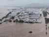
It comes after NSW’s north including the cities of Lismore and Grafton have been inundated by catastrophic flooding, with thousands forced to flee for their lives.
More Coverage

Read related topics:NSW floods
Join the conversation

‘Help us’: Jimmy Barnes’ urgent plea for missing relative
Australian rock legend Jimmy Barnes has issued a desperate plea for help after a teenage relative, Blake Powell, was reported missing.
Read more

‘No-brainer’: Bears CEO’s radical vision to take over in AFL heartland
The new boss of the Perth Bears opens up about his tumultuous departure from Channel 7, the bitter media pile-on that followed and his radical plans for the reborn team. Watch the High Steaks video.
Read more