NSW floods: Storms to smash Sydney as Lismore rescues continue
Rescue efforts around Lismore resumed at first light today, after hundreds of drenched and terrified residents were left clinging to their roofs amid record-high floodwaters yesterday. Urgent evacuation orders have now been made for Ballina and nearby towns.
NSW
Don't miss out on the headlines from NSW. Followed categories will be added to My News.
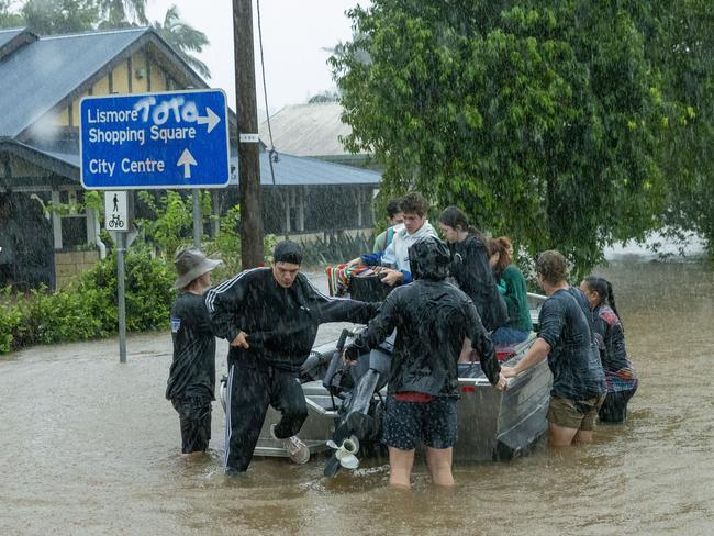
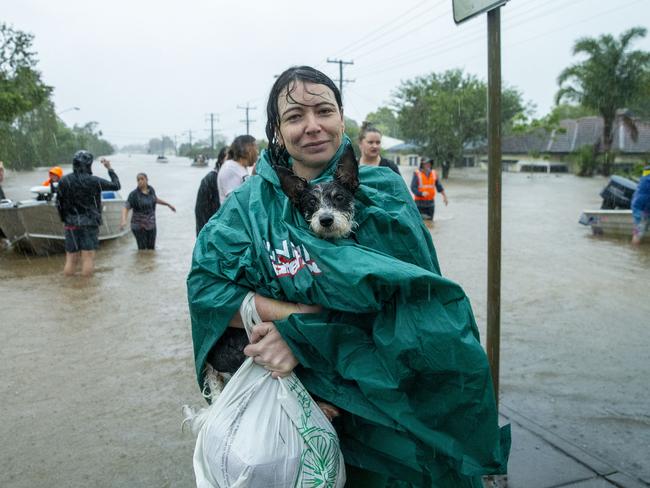
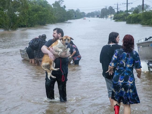
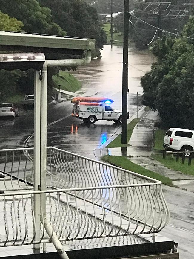
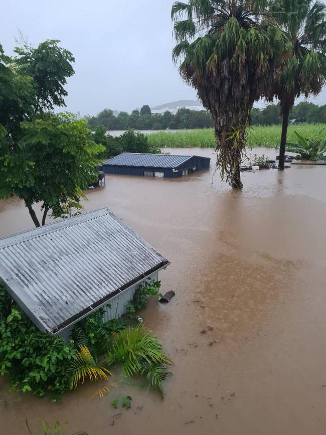
Hundreds of drenched and terrified Lismore residents clung to their roofs amid record-high floodwaters as emergency services raced until nightfall to rescue as many people as possible.
Authorities could not say how many people were missing on Monday night as an underwater maze of low-hanging power lines, street lights, homes and businesses made it impossible for rescuers to operate in the dark.
Desperate locals had been forced on to their roofs, or took refuge in their roof cavities, in an effort to escape the water.
Rescues were due to resume at first light on Tuesday after the river began to ease on Monday afternoon.
Meanwhile response efforts are ramping up in other parts of northern NSW, with urgent evacuation orders made for Ballina and towns around it.
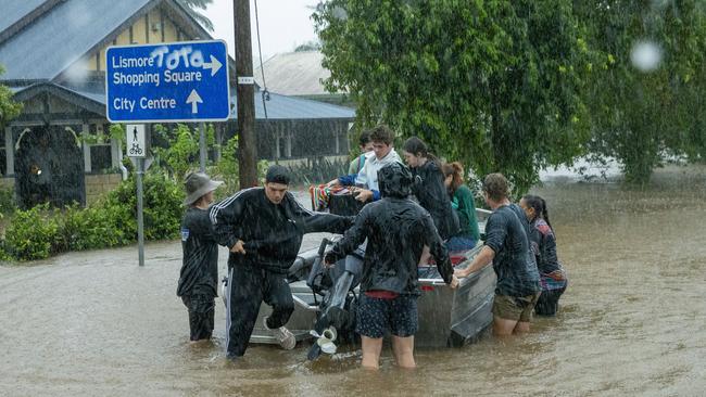
But the declining river levels provided little relief, with SES spokesman David Rankin telling The Daily Telegraph the river would need to fall at least four metres by Tuesday to make conditions somewhat manageable for emergency services.
He said it was “impossible” to determine how many people were missing or waiting to be rescued because official SES rescues were occurring alongside informal rescues by community members eager to help out.
He added that “at least 1000” people would have already been rescued across the Northern Rivers region.
It comes as forecasters warned there’s no end to the wet weather in sight for Sydney with up to 100mm of rain and wind gusts of up to 90km/h set to lash the NSW coast this week.
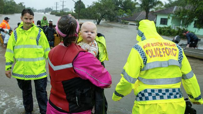
While flood warnings are already in place for parts of northern NSW, the Bureau of Meteorology has warned that the Central Coast, Sydney, Illawarra and south coast could be Mother Nature’s next victims.
“On Tuesday there’s likely to be a separate low pressure system to form offshore and then that’s expected to deepen and move towards the central NSW coast by Wednesday,” Meteorologist Neil Bennet told The Daily Telegraph.
“This is going to develop some further widespread torrential rain, some possible destructive winds and damaging surf as well.”
“That’s more likely to be to the south of the low which puts Sydney, the Central Coast, Illawarra, and the South Coast right in the firing line from late Tuesday.”
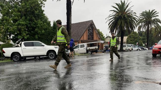
Mr Bennet said the NSW coast should be prepared for more torrential rain with up to 60mm of rain expected to fall in Sydney on Wednesday and possibly 100mm further south in Wollongong.
“There’s also the possibility we could see winds up around 90km/h in gusty,” he said.
A spike in the swell and dangerous sea conditions are also forecast from Wednesday through to Sunday across the Sydney coast along with flash flooding.
“We could well see flooding affecting road, transport, communication and power in these areas.”
“With catchments being as wet as they are, trees are not anchored in as well so when you get rain and wind on already wet catchments you see the possibility of trees down as well.”
“There will be further updates as we shift our attention to the Sydney coast, Illawarra and the South Coast throughout the week.”
Conditions are expected to ease from Thursday, but showers are forecast across Sydney right across the weekend and into next week.
While the La Nina has peaked and is beginning to weaken, it is likely conditions will remain wetter than average for a few more weeks.
ARMY CALLED IN AMID NSW FLOOD EMERGENCY
Parts of NSW are facing a “natural disaster of unprecedented proportions” as 200 army officers landed in Lismore to rescue people from roofs and rising water.
There are currently about 200 people waiting to be rescued by authorities.
River levels in the region have risen to the highest since 1954 but locals have been slow to flee despite repeated warnings from emergency services.
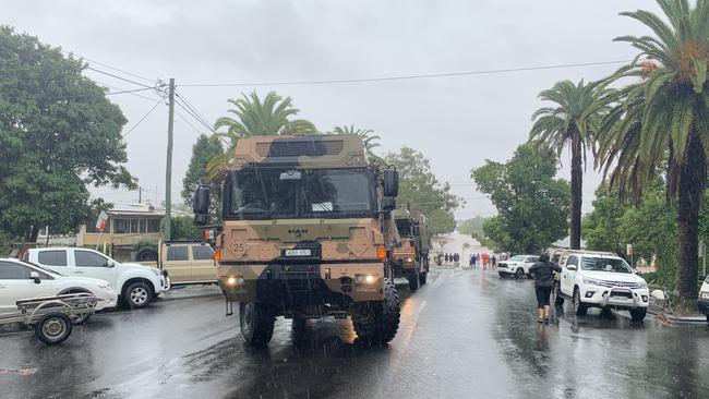
The record-breaking weather event has prompted Premier Dominic Perrottet to turn the Rural Fire Service headquarters in Homebush into the hub for the state’s flood response — a decision reminiscent of 2019’s devastating bushfires.
He said the scenes coming from northern NSW were “incredibly distressing” and conditions were expected to get worse “at the back end of this week”.
“The conditions are expected here in NSW to get worse,” he said.
“(There will also be) flash flooding in various areas across our state.”
EVACUATION ORDERS, RESCUES AS FLOODWATERS ENGULF LISMORE
All Northern Rivers residents have been ordered to seek higher ground amid “extreme risk” as terrified locals take to social media to beg for help.
The Wilsons River, which hems the western side of the Northern NSW city, has now reached 14.26 metres as of 11:30, after smashing the 2017, 1974 and 1954 flood records.
The water now sits just shy of two metres above the previous record of 12.27m in 1954, making it Lismore’s most devastating flood in history.
The Wilsons River at #Lismore has now reached 14.2m, almost TWO METRES above the previous record of 12.27m from 1954.
— Ben Domensino (@Ben_Domensino) February 28, 2022
Graph via @BOM_aupic.twitter.com/2o2hI3lUx8
It comes as the Bureau of Meteorology confirmed Rosebank on the Upper Coopers Creek, near Lismore, had recorded a staggering 701mm during the 24hrs to 9am on Monday.
The deluge is the highest daily observation total NSW has seen since 1954, the state’s 3rd highest rainfall total in history and is the highest rainfall total in Australia since 1998.
As flooding continues to spread, The NSW State Emergency Service declared just after 10:30am on Monday that locals needed to move to higher ground “immediately” as ”unprecedented flooding” continues to impact across the region.
“NSW SES have declared that areas in the Northern Rivers need to immediately take steps for their safety,” a message posted online read.
“You should immediately move to the highest safest place now, such as higher ground or inside a sturdy multi story building as high above water levels as possible.
“Move away from floodwaters as best you can. Do not enter flood water.”
The statement continued: “This flood event is an extreme risk to life.
It is not possible for emergency services to get to everyone. Move to higher ground.”
UPDATE: #SevereWeatherWarning for the #NorthernRivers, #MidNorthCoast and #NorthernTablelands with heavy to locally intense rainfall. This could lead to dangerous and life threatening flash flooding, people must follow @NSWSES evacuation orders.
— Bureau of Meteorology, New South Wales (@BOM_NSW) February 27, 2022
Warnings: https://t.co/Ss766eSCrLpic.twitter.com/jRnPc6bvlt
Major flooding from Wilsons River which has swamped Lismore now stands at 14.12 metres as of 10:43am, smashing previous records from 2017, 1974 and 1954 by almost two metres.
Current flood warnings issued by the Bureau of Meteorology include:
- Major flooding on the Tweed, Wilsons, Clarence and Brunswick Rivers as well as Marshalls Creek
- Moderate to major flooding on the Orara River
- Moderate flood for the Macintyre and Weir Rivers
- Minor to major flooding for the Richmond and Bellinger Rivers
- Minor to moderate flooding on the Nambucca River
- Minor flooding for the Deua, Lachlan, Paroo and Snowy Rivers and Coffs Creek.
Today there's heavy to locally intense rainfall expected for the #NorthernRivers where major flooding is occurring. People must follow @NSWSES evacuation orders and not drive through flood waters.
— Bureau of Meteorology, New South Wales (@BOM_NSW) February 27, 2022
Warnings: https://t.co/Ss766eSCrL
Radar: https://t.co/HG568kussZpic.twitter.com/qBntJRUkRX
Evacuation warnings have so far been issued for all of Lismore; South Murwillumbah, Condong and surrounds; Ocean Shores, New Brighton, Brunswick Heads and South Gold Beach; Marshalls Creek at Bilinudgel; Low-lying areas of Coraki; the Brunswick River at Mullumbimby; and Rocky Creek Dam.
It comes as terrified residents have taken to social media to call for help as emergency services struggle to keep up with demand for rescues.
One stuck in the Lismore CBD shared a picture of water rising above the ground floor of a building.
“Thought I‘d be safe up on first floor... now waiting for SES evacuation,” she wrote.
“Only a metre to go now.”
Thought I’d be safe up on first floor.. now waiting for SES evacuation. Only a metre to go now. pic.twitter.com/aoZLrK6EEk
— Ms Benny Saunders (@Sculptmud) February 27, 2022
From #Lismore -
— Sam Connor (@criprights) February 27, 2022
My Neice Tanya Collins and daughter are at 8 Cromer st and getting very cold. Desperately needing help. Cannot get into there ceiling space.
Rodney Bray My brother-in-law is at 12 Cromer Street and will be attempting to get onto the roof soon. 3 adults 3 dogs
Another Twitter user posted a thread of comments detailing dozens of residents in desperate need of flood rescues.
“Please help my mother is stuck inside the house about to drown, she has muscular dystrophy and can‘t use her muscle please help,” a message read.
Another message read: “My mother is stuck... she left her downstairs unit and went upstairs so she is out of water now but can‘t get out. She is 82 and alone and distressed, I have been on hold to SES with 1.5 hours now.”
A third read: “My father is trying to stay afloat with a broken back and is near exhausted to keep himself up he is stuck in my room the door is jammed windows broken please help him.”
Residents with loved ones in strife have also taken to the comments section of SES Facebook pages in a bid to get help for their relatives.
It comes as the SES race to rescue hundreds of people trapped in their homes by floodwaters as levels continue to rise above the 14 metre mark.
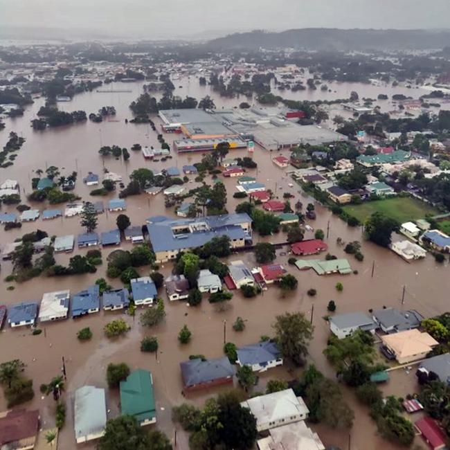
The SES has received more than 512 calls for help since midnight on Monday, with “80 per cent” of those requests for flood rescues, including more than 150 for people trapped on roofs.
Northern Rivers SES spokesman David Rankin said an SES unit was forced to evacuate its own headquarters after the building was inundated in Lismore, and was now triaging the “significant” number of rescue operations in the car park of the Lismore Heights Bowling Club.
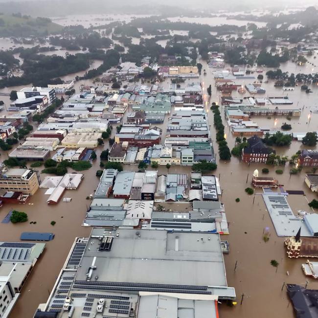
âš ï¸ #Flood Warning updated for Wilsons River. Record flooding occurring at Lismore. Levee overtopped. May reach 14 metres, which is higher than the 2017, 1974 and 1954 floods. See https://t.co/AdztI2rqg1 for details and updates; follow advice from @NSWSES. #NSWFloodspic.twitter.com/OiB1wzWes6
— Bureau of Meteorology, New South Wales (@BOM_NSW) February 27, 2022
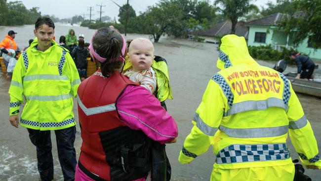
He said so many people needed rescuing, good Samaritans were using their personal boats to help local emergency services pull residents to safety.
“Everything, everyone and anyone is providing us with assistance, we‘re not condoning it but local community members, fishos are going out into floodwaters and pulling people out... we’ve had reports one local gentleman in his tinny rescued more than 20 this morning by himself,” Mr Rankin said.
Mr Rankin said it was “sickening” to see how the record flood was impacting Lismore and other Northern Rivers communities but said saving lives was top priority.
“It‘s awful, no one has ever seen anything like this before... it’s a whole of region flooding event, not just Lismore, we’re seeing other communities like Mullumbimby being impacted significantly,” he said.
“We know more rain is coming... unfortunately property protection and sandbagging has gotten away from us, our unit‘s sandbags are actually underwater... right now the focus is solely on preservation of life, by air or by water, however we can.”
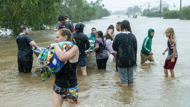
The Bureau of Meteorology is predicting at least 100mm of rain will fall on Lismore before the heavy rainfall system moves offshore later today.
BOM Senior Meteorologist Jordan Notara said: “There‘s a chance 100 to 150mm of rain will still fall between now and midnight, it’s a dynamic situation.
“There is a chance there will be periods where there is an easing trend in the area, but this doesn‘t remove the impact of flooding itself.”
Data from Weatherzone has revealed Lismore has received 716mm of rain since last Tuesday, and nearby Doondoon has seen a 1066mm drenching.
It comes as a pregnant woman is among dozens of Lismore residents trapped by the floodwaters, with the mayor declaring the disaster the city‘s “worst in recorded history”.
The northern NSW city was evacuated in the early hours of Monday morning as floodwaters rose, with SES volunteers rousing locals with sirens and evacuation texts to tell them to get out.
But residents in some areas are trapped in their homes and unable to leave after the water rose quicker than expected.
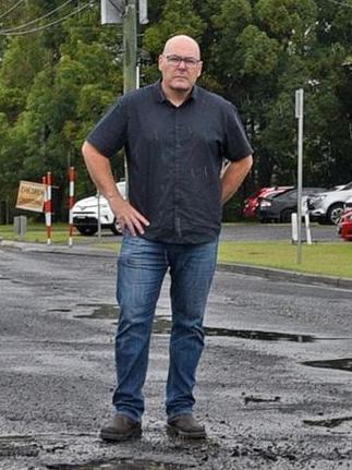
Lismore Mayor Steve Krieg said he had received “quite a few distressing calls” from locals surrounded by floodwater.
He said residents hadn’t expected the water to rise so quickly, cutting off their escape routes.
“I’ve had quite a few distressing calls pleading for someone to please help, including a young pregnant lady, her mum rang me,” Mr Krieg said.
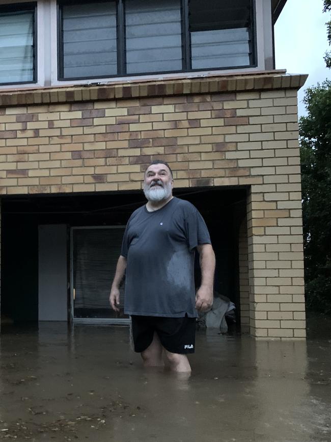
“(The mum) was pleading with me to help, to contact the SES to rescue her, she was sitting on her roof at 5am this morning … there’s been a number of cases like that, people have been caught out, you think you’re prepared but it’s happened so fast.”
“There’s a lot of people in a very precarious situation right now.”
Mr Krieg evacuated last night and is among Lismore CBD residents who have already had their homes inundated by water.
He said the flooding was “record breaking”.
“It has happened far quicker than anyone expected, to be told yesterday the levee would be breached at midday and then have it happen at 3am … this is Lismore‘s worst flood in recorded history,” Mr Krieg said.
“This is going to be a record breaking flood, people who have never had water reach the second level of their homes are seeing it happen, it‘s unbelievable.”
He begged residents to seek shelter on high ground if they could safely leave their homes.
“No one knows when this is going to end, it is going to get worse before it gets better,: Mr Krieg said.
“We’ll come back from this, no doubt, but right now the focus is on saving human life which is far more important than possessions or property.”
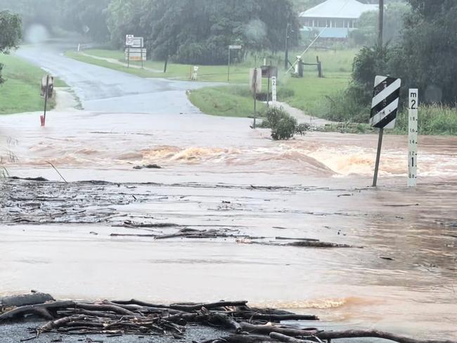
Thousands of Northern Rivers residents have been ordered to flee their homes, and a man was reported missing in floodwaters in Lismore on Sunday.
An SES emergency warning at 3am told locals to evacuate Lismore as floodwaters continued to rise.
“Due to significant additional heavy rainfall, we have seen very rapid river rises. Major flooding is expected at Lismore early Monday morning,” the message read.
“The Lismore levee is expected to be overtopped around 5.00am Monday. River rises around the levels of March 1974 (12.15 metres) are possible Monday morning, which is above the March 2017 peak (11.59 metres).”
North Lismore, South Lismore, Lismore CBD, East Lismore and Girards Hill residents are included in the order to either evacuate or bunker down.
The SES warned residents that if they did not leave, conditions could be too dangerous for volunteers to respond to any calls for help.
“Once flood water begins inundating the area road access, water, sewerage, power, phones and internet may be lost. If you remain in the area you will be trapped and it may be too dangerous for SES to rescue you,” the statement read.
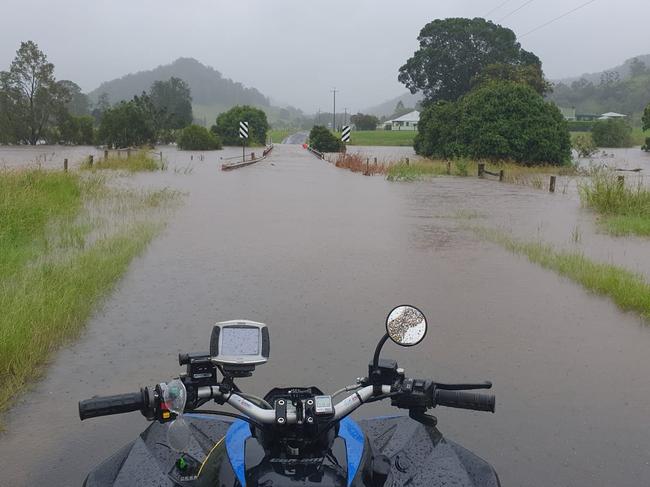
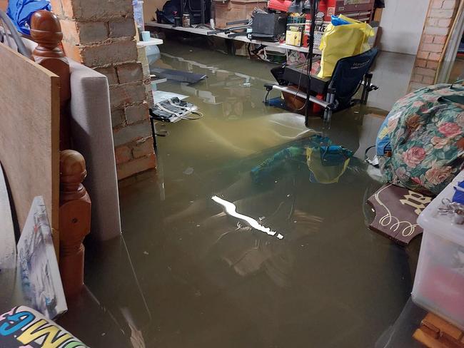
Volunteers had been travelling around the area to sound sirens and wake up residents and get them to evacuate but the levee has since burst and SES crews have been ordered to return to their base.
Residents have been told to evacuate to higher ground via the Lismore Heights Bowling Club, with Southern Cross University’s basketball stadium being used as an evacuation centre.
People who choose to stay or missed their chance to evacuate have been told to seek shelter on their roof if their house is inundated with water.
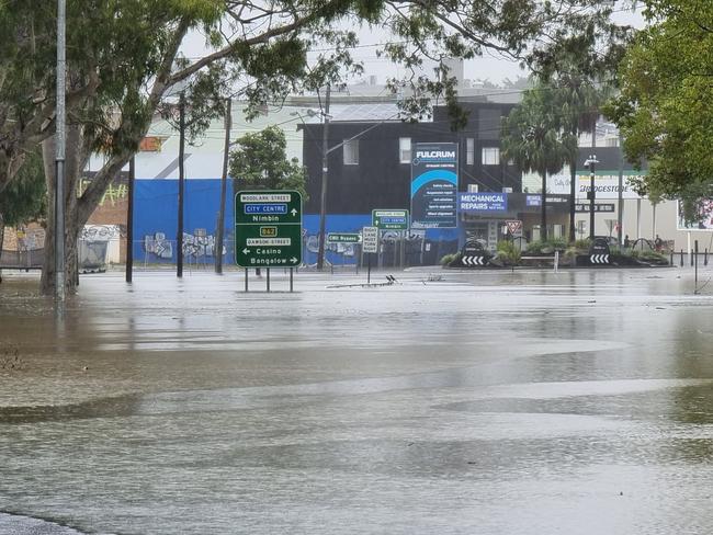
NSW Police made an order for pedestrians and motorists to stay out of the Lismore CBD.
“Due to heavy flooding the Lismore CBD is inundated with water and is now off limits to all pedestrian and vehicular traffic,” Richmond Police District wrote online.
“Motorists are reminded NOT to drive through flood waters … for the safety of YOU and your FAMILY please evacuate the township now.”
Floodwaters in Lismore on the Wilsons River reached 12.26m at 5am Monday.
âš ï¸ Severe Thunderstorm Warning has been updated. Severe thunderstorms with INTENSE RAINFALL and LIFE THREATENING FLOODING are continuing this morning about the Northern Rivers. Further details: https://t.co/Ss766eSCrLpic.twitter.com/6ys8LrUxog
— Bureau of Meteorology, New South Wales (@BOM_NSW) February 27, 2022
A severe thunderstorm warning for the Northern Rivers was issued at 3am, with the Bureau of Meteorology forecasting “life threatening” flood levels and “very dangerous” rainfall.
A severe weather warning has also been issued for damaging winds and heavy rainfall in the area and on the Mid North Coast and Northern Tablelands.
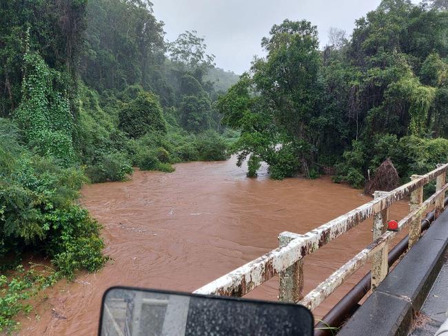
Since 9am Sunday, the BOM reported the highest falls in the Northern Rivers include a whopping 582mm has fallen in Dunoon, 552mm at The Channon and 530mm in Goonengerry.
Lismore has had 406mm, 315mm has fallen in Murwillumbah and 246mm has fallen in Yamba.
BOM Senior Meteorologist Jackson Browne said Northern Rivers residents should be prepared to evacuate at a moment’s notice.
“The advice is to stay off the roads, stay in place so you’re not putting undue stress on stretched emergency services … but monitor the situation, if you are given a warning to evacuate, heed that,” Mr Brown said.
“In essence residents need to be prepared and stay across the situation.”
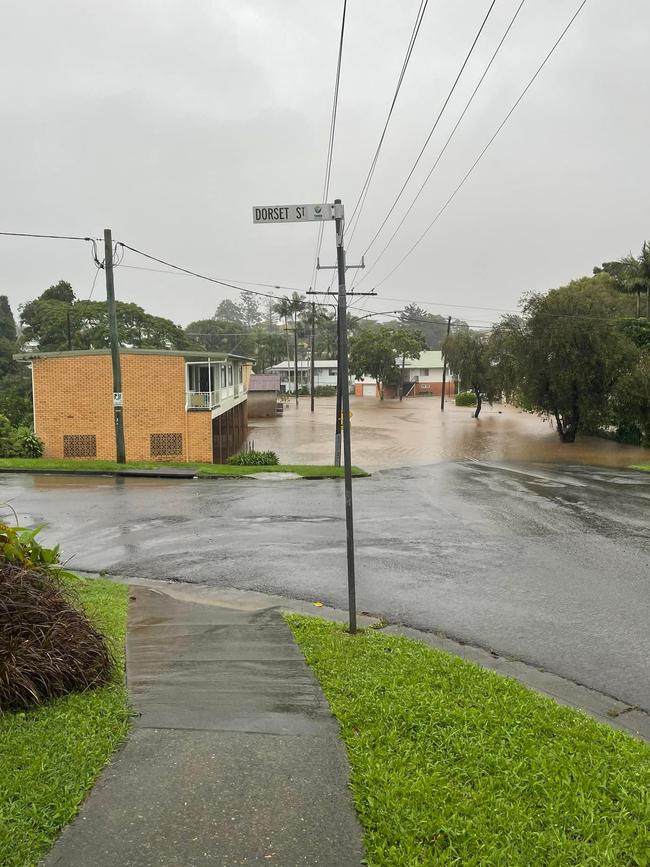
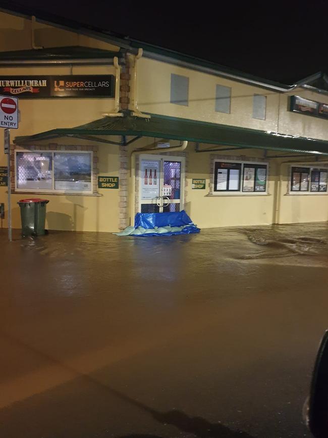
Mr Browne said the weather system causing the torrential rain would move out to sea from the Northern Rivers this afternoon.
“The system is going offshore from the area this afternoon, the Mid North Coast will still experience periods of heavy rainfall,” Mr Browne said
“There is also rainfall in store for Sydney, but not until midweek Wednesday and Thursday.”
It comes as heavy rainfall has caused flooding in southeast Queensland and Brisbane, with seven people dead and the Brisbane River set to burst its banks.


