
NSW weather: More flooding forecast with days of rain to come
Clean-up efforts are on pause as NSW braces for more flooding while commuters are warned to expect train chaos.
NSW
Don't miss out on the headlines from NSW. Followed categories will be added to My News.
As clean-up efforts continue across NSW in the wake of the deadly flood disaster, the state is bracing for more flooding with a three-day rain event forecast.
The Bureau of Meteorology (BOM) says heavy rainfall and storms forecast from Sunday through to Tuesday could trigger a renewed flood risk in the already inundated Hawkesbury-Nepean.
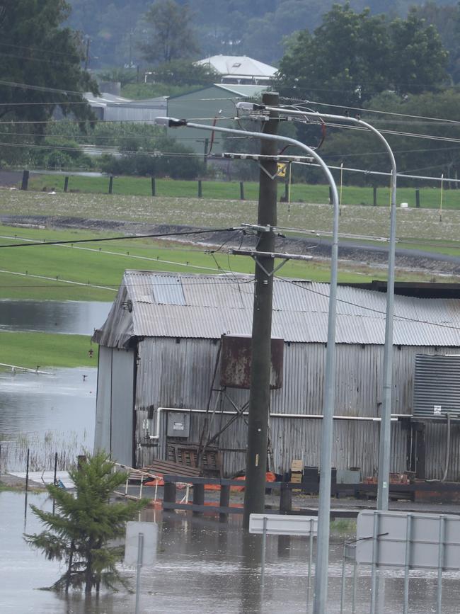
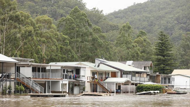
Rivers are already responding to heavy rainfall, with renewed major flooding already seen at North Richmond in the Hawkesbury and Lower Nepean River.
Residents in flood-ravaged Lismore are now bracing for more flash flooding after severe thunderstorms on Sunday afternoon. Locations which may be affected include Lismore, Grafton, Coffs Harbour, Armidale, Tenterfield and Dorrigo.
It comes as Transport for NSW issued a warning for commuters to expect delays on Monday amid the renewed wet weather.
“Due to severe weather conditions, significant delays and cancellations are expected on most Sydney Trains, NSW TrainLink Intercity and Regional trains services,” a statement from TfNSW read.
“Trains will run to a changed timetable and will take longer than normal to reach your destination. Avoid any non-essential travel and if you do need to use the network please plan ahead and leave plenty of extra travel time.”

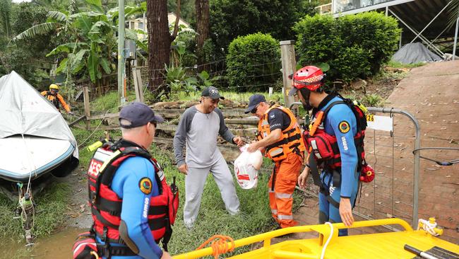
The weather alert and travel warnings come as clean-up efforts continue across the coast, with works suspended in Wisemans Ferry ahead of the expected downpour.
BOM duty forecaster Grace Legge said the renewed flood risk could see 100-200mm fall in parts over two to three days.
“There is a risk over the next few days at least of heavy rainfall through the Hawkesbury-Nepean but that could move further north,” she said.
As of 5:30am on Monday, the BOM said the Hawkesbury-Nepean had already peaked again with major flooding at North Richmond and Wisemans Ferry as well as moderate flooding in Windsor, Sackville, Lower Portland, and Wisemans Ferry.
Minor flooding is occurring at Penrith and at Menangle, but so far flood levels have stayed lower than last week’s waters in all areas.
The NSW Coastal Rivers from the Bellinger River on the Mid-North Coast to the Bega River on the South Coast have also been put on high alert, with a flood watch issued.
âš ï¸ Moderate to Major #Flood Warning issued for the #NepeanRiver, #HawkesburyRiver and #ColoRiver. Renewed major flooding occurring at #NorthRichmond. See https://t.co/AdztI2rqg1 for details and updates; follow advice from @NSWSES. #NSWFloodspic.twitter.com/oKY5tTUQZV
— Bureau of Meteorology, New South Wales (@BOM_NSW) March 5, 2022
A severe thunderstorm warning has been issued for heavy rainfall with falls of up to 140mm in parts which may lead to flash flooding in the Illawarra and parts of Hunter, parts of Metropolitan Sydney, South Coast, Central Tablelands and the Southern Tablelands districts.
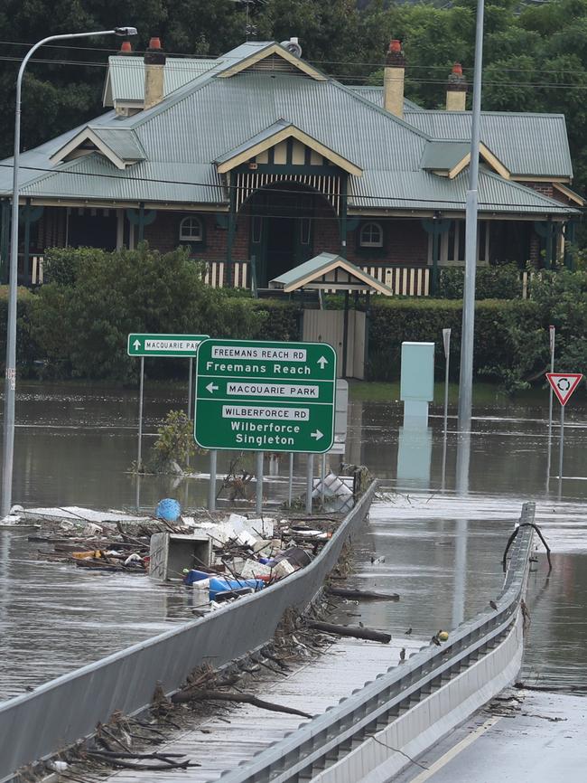
Hawkesbury-Nepean residents are bracing for flooding to reach levels similar to those experienced over the past week as further heavy rainfall into early next week causes renewed rises.
Minor to major flooding is also possible for coastal catchments from the Northern Rivers to the South Coast including Greater Sydney from late Sunday.
The focus of the heaviest rainfall, and rivers at greatest risk are those extending from Greater Sydney to the Hunter, where moderate to major flooding is possible.
Renewed moderate to major flooding is possible along the Upper Nepean River on Sunday and Monday.
Moderate flooding is already occurring along the Colo River, however, major flooding is possible.
Major flooding is occurring along the Hawkesbury River at North Richmond, however, renewed major flooding is possible at Windsor and renewed moderate flooding is possible at Penrith, Sackville, Lower Portland and Wisemans Ferry.
Renewed moderate to major flooding is also possible in the Hunter, Paterson, Williams, Gloucester and the Manning Rivers from Sunday.
The State Emergency Services (SES) is reminding people to never drive, ride or walk through flood waters.
Ms Legge said the severe weather conditions should ease from Wednesday, with showers likely to continue for the next week.
“Once we get through to about Wednesday we could see a little bit of an ease as the system pulls away,” she said.
In life threatening emergencies, call 000 (triple zero) immediately. If you require rescue, assistance to evacuate or other emergency help, ring NSW SES on 132 500.
More Coverage


Read related topics:NSW floods
Join the conversation

Probe after Sydney dancer dies suddenly
A coroner will investigate the shocking death of a talented 18-year-old Sydney dancer who died suddenly in her home.
Read more

Controversial Islamic centre hosts sermon attacking the West
An Australian cleric has claimed Muslims are being “belittled” without sharia law, while calling down the “wrath of Allah” on Western powers at a fiery sermon in western Sydney.
Read more