
NSW floods: Hawkesbury-Nepean Valley ‘bathtub effect’
The Hawkesbury-Nepean Valley has one of the highest flood risks in the country, with a ‘bathtub effect’ making such natural disasters especially dangerous. Find out why.
The Bowral News
Don't miss out on the headlines from The Bowral News. Followed categories will be added to My News.
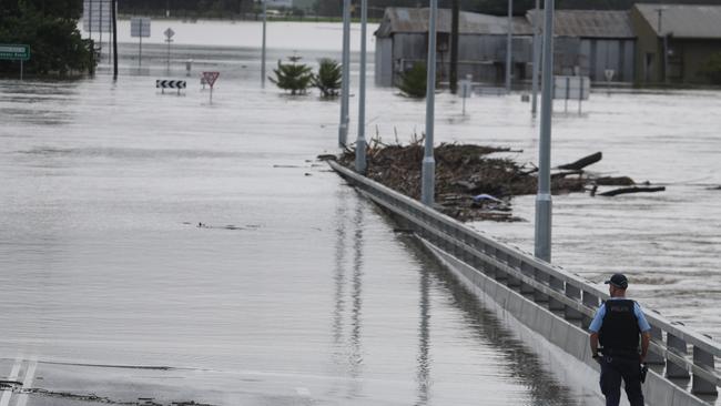
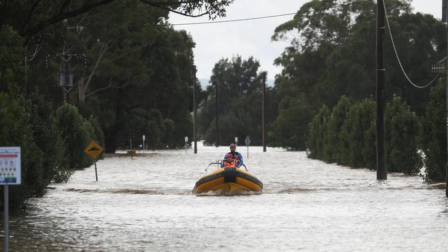
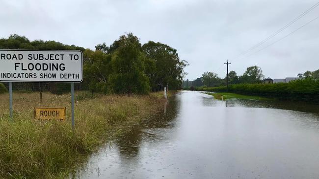
A ‘bathtub effect’ in the Hawkesbury-Nepean Valley makes flooding in the region especially dangerous, says the State Emergency Service (SES).
According to the SES, the valley has one of the highest flood risks in the country due to five major tributaries pouring water into the area, including several narrow areas which choke the water flow.
The water backs up and floods the lower-lying areas because there is only a narrow plughole releasing the flow. Choke points along the valley are areas like Wallacia, Castlereagh, and Sackville – all of which are forecast to experience major flooding in the next few days.
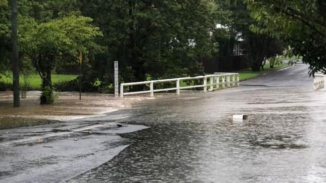
The worst flood at Wallacia saw the river reach depths of 20m above the normal levels, while the worst floods at the Castlereagh choke point saw the river rise to 12m above normal levels and seep into Woodriff St in Penrith.
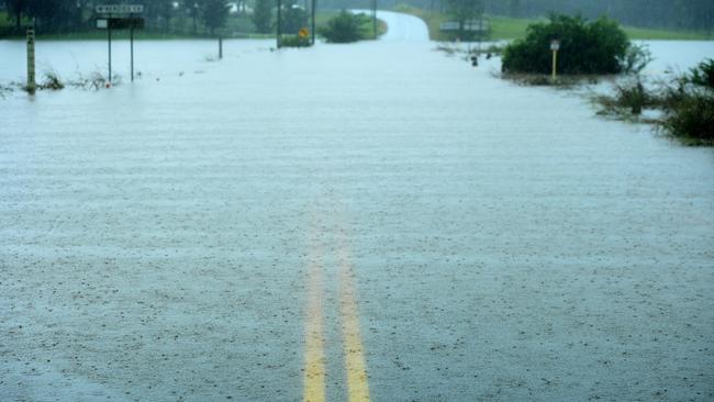
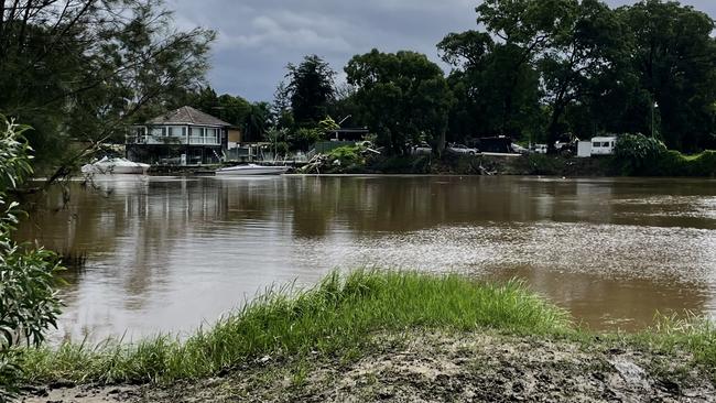
As the choke points restrict the output of the water, the rivers back up into creeks and spill out onto the flood plains at a rapid rate.
Because areas like the Richmond-Windsor flood plain are so wide and flat, the water is able to quickly blanket a large area and endanger a large number of people and properties.
As the SES remind us, “the risk is real”.
‘The risk is real’: severe storms to lash south eastern NSW
The Bureau of Meteorology (BOM) has warned severe weather is expected to lash parts of Sydney and the Illawarra from Sunday, with heavy triple-figure rainfall and possible flash flooding forecast.
After flirting with sunshine on Saturday, the weather will return to the severe storms and downpours experienced last week.
The BOM issued a severe weather warning for heavy rainfall in the western Sydney area, the eastern slopes of the Central and Southern Tablelands, and through the Illawarra and south coast districts.
Meteorologists are predicting six-hourly rainfall totals between 70 to 140mm, which could lead to flash flooding in the affected areas. The deluge is expected to continue through to Monday in the areas.
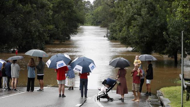
Meteorologist Helen Reid said the BOM was concerned about rivers and riverine areas which had already experienced flooding, including the Hawkesbury-Nepean Valley which was still experiencing major flooding downstream of where the peak flows occurred.
Heavy rainfall has caused flooding in the valley over the last week, and the rainfall on Saturday evening and Sunday morning had created renewed rises in the Upper Nepean, Nepean, Hawkesbury and Colo Rivers.
The BOM warned the flooding could reach levels experienced last week.
“We’re expecting that rainfall to also be affecting those western parts of Sydney so we’ll need to keep an eye on that Hawkesbury Nepean valley and those rivers that are south of St Georges Basin, and the Shoalhaven as well,” Ms Reid said.
“Anywhere that has been in flood needs to be aware they could be in flood again or have renewed rises.”
The Nepean River at Menangle Bridge is forecast to reach major flooding level on Monday, while the Hawkesbury River is already experiencing major flooding at North Richmond.
Meteorologists advise renewed major flooding is possible at Windsor on Monday night, Sackville on Sunday night and Lower Portland on Monday.
The Nepean River at Penrith is expected to reach the moderate flood level on Monday morning, with further rises possible.
Meanwhile, the Colo River at Putty Road may reach the major flood level on Sunday evening with major flooding predicted.
Severe thunderstorm warnings were issued by the NSW State Emergency Service on Saturday night for the Blue Mountains and Wollondilly areas.
Meteorologist Helen Reid said, despite the reprieve on Saturday, residents need to stay vigilant and prepared for the oncoming deluge.
“We’ve got another bit of weather coming through in the next couple of days that will make life still wet, still flooded, and may put other people on notice as well,” she said.
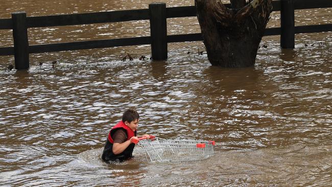
Residents are reminded never to drive through floodwater and to follow advice from the SES on best practice in floods.
Sydney’s southwest on Georges River watch
Despite warnings of more flooding along the Georges River, particularly in the Milperra area, residents appear unconcerned as they went about their Sunday afternoon.
Milperra’s ‘Flower Power’, a garden centre with a cafe on Henry Lawson Dr, was buzzing as families went about their shopping and gathered to eat lunch.
No one mentioned the possibility of flooding – even though this garden centre is a few hundred metres from the Georges River.
A minor flooding alert was issued for Milperra on Sunday morning, warning rain could make the situation worse as the day went on.
This warning predicted low lying areas – particularly Cambridge Av, Glenfield (between Moorebank Ave and Canterbury Rd) – could be hit with overland flooding, running off from the Georges River.
An evacuation warning was also issued by SES Liverpool for residents and business owners on the southern side of Newbridge Rd, between Davey Robinson Drive and Milperra Bridge, as well as on Rickard Rd and Arthur St.
The SES has warned minor flooding was possible along the Georges River at Liverpool on Monday morning.
Saturday, March 6
Despite the sun breaking through in some parts of the state today, the Bureau of Meteorology has warned thunderstorms are again expected to batter south eastern NSW, with triple digit rainfall forecasts and possible flash flooding in the Illawarra and Southern Highlands.
After a week of torrential rain, endless flood warnings and massive storm, it’s been nice to have a reprieve from the deluge — but sadly it isn’t going to last.
Meteorologist Helen Reid said Saturday’s sunshine will soon give way to storms and heavy rainfall in south eastern NSW. The wet weather is set to ramp up again on Saturday evening and hit its stride in the early hours of Sunday.
“By the time we get to tomorrow (Sunday), the action will have shifted more towards the Illawarra, Greater Sydney and Blue Mountains region,” she said.
“We can expect to see a return of severe thunderstorms through there and some fairly big rainfall totals – particularly through the Illawarra. We’re looking at triple figures (in rainfall totals) through there.”
Ms Reid said the BOM was predicting rainfall in the range of 100mm tomorrow for the region, but a thunderstorm could easily push the total over 200mm in some parts. Particularly in areas such as the town of Robertson in the Southern Highlands, which received a massive 201mm last Wednesday.
Unfortunately the nature of a thunderstorm makes it difficult to predict or localise the impact, Ms Reid said.
“There’s a widespread area of thunderstorms expected through tomorrow, and it’s just a matter of who gets the brunt of the thunderstorm or just the collateral damage,” she said.
“It’s so volatile where the focal point of this system is going to align that there could be areas affected in a fairly major way.”
Flash flooding is a major concern for the Illawarra, Shoalhaven, Southern Highlands and Camden on Sunday, Ms Reid said.
She said the riverine areas to watch will be the Hawkesbury Nepean Valley, which has experienced major flooding in the last few days, and the rivers south of St Georges Basin.
“Anywhere that has been in flood needs to be aware they could be in flood again or have renewed rises,” she said.
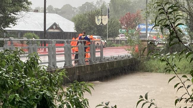
The predicted storms will place further pressure on the state’s emergency services teams, who have been working around the clock to save lives and property. Since the beginning of the floods on February 22, the State Emergency Services has answered a staggering 14,685 requests for assistance and performed 1,714 flood rescues across NSW.
While many of those have been actioned in storm-battered northern NSW, Deputy Zone Commander for the South Eastern Zone, Matt Price, said the Illawarra SES have responded to 1,281 calls for assistance in the last week alone.
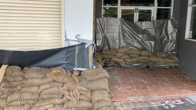
“The really good thing is that communities have been really well prepared over the last three or four days and we’ve sent out well in excess of 10,000 sandbags … which is unheard of,” he said.
Mr Price said the SES is “as prepared as much as we can reasonably be” for the predicted deluge, with two incident zones set up in the Illawarra/Shoalhaven and the Southern Highlands. He said flood rescue assets will be readily available if flash floods occur.
Despite the preparedness, Mr Price said the affected areas are “purely flash flood risks” rather than threatened by rising rivers, which makes it hard to predict which areas will be worst affected by the heavy rainfall.
“We have to see what the real life impact is and be prepared for that,” he said.
That issue is compounded by the lack of accurate data available for thunderstorm forecasts, which he said are “notoriously difficult to predict”.
“The Bureau (of Meteorology) can’t predict thunderstorms. They can predict totals but not the thunderstorm risk, so we just have to be prepared for it and see how much falls,” he said.
The Deputy Zone Commander said the rainfall in the Illawarra, Shoalhaven and Southern Highlands is unique in that it’s very localised.
“It doesn’t depend on the total there. What does concern me is the fall rate – how quick does that fall in a one hour period,” he said.
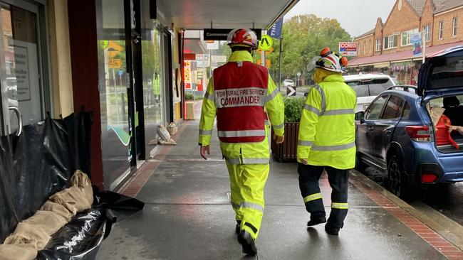
After a day of reprieve, Mr Price said the SES, along with teams from Fire and Rescue and Police Rescue, is equal to the challenge.
The good news is that there’s sunshine coming in just a few days time, on either Wednesday or Thursday.
“There will still be a couple of showers around along the coast, but we’re expecting that things might be able to start thinking about drying out a little bit more,” Ms Reid said.
Until then, she reminded people to continually check weather warnings and forecasts and to stick to the old adage of “if it’s flooded, forget it”.
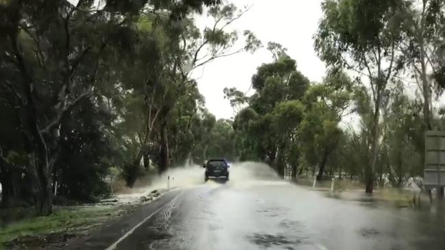
Mr Price agreed and said he sounded like a “stuck record” when he repeated warnings not to drive through floodwater.
“The key to all emergencies and all disasters is good people making good decisions – good people doing good things – and helping to help themselves,” he said.
He urged residents to stay vigilant and be prepared for the oncoming storms.
For those affected by the floods, a large swath of NSW local government areas have now been declared natural disaster zones which means residents can apply for financial assistance.
See if your area is included with our guide below.


Join the conversation

Major hauls: 38 points, and a prop goes rogue in four-try bender
Club statisticians were left scrambling for the record books after a couple of massive individual returns in round 11 of the Macarthur RL. That and more from all five venues.
Read more

Bowral sale and auction results, week ending June 29
Bowral recorded 10 property sales over a million dollars last week, the latest auction and sales results reveal.
Read more