
NSW weather: Man dies in floodwaters as deluge continues
NSW is set to be inundated with more heavy rain and dangerous weather conditions after days of torrential downpour caused chaos across the state.
NSW
Don't miss out on the headlines from NSW. Followed categories will be added to My News.
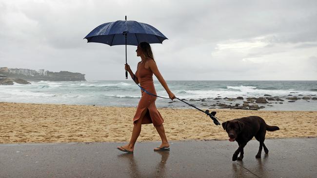
NSW is bracing for more heavy rain and dangerous weather conditions after days of torrential downpour triggered flooding, damaged homes and caused chaos on the roads.
The wet weather is expected to persist for the next week, with the Bureau of Meteorology expecting hundreds of millimetres to fall in coming days, mostly on the far north coast near Byron Bay and Grafton.
“This is a very dangerous set-up as very heavy rainfall falls over already saturated soils. That means flash and riverine flooding is likely,” meteorologist Dean Narramore said.
“This kind of rainfall over highly populated areas is likely to lead to inundation of homes, properties and businesses.”
The SES responded to 350 Sydney metro calls and 1050 calls across NSW in the past 24 hours as the emergency service pleads for motorists to stay out of life threatening flood waters.
Severe thunderstorm warning issued for heavy rainfall. Thunderstorms in the warning area are bringing heavy rainfall that may lead to dangerous flash flooding. #IfItsFloodedForgetIthttps://t.co/VEEgNIyM7Rpic.twitter.com/4TTKaxEtUr
— Bureau of Meteorology, New South Wales (@BOM_NSW) February 25, 2022
Of the 34 flood rescues in the past day, most were from cars driving into flood waters.
SES flood rescue operator Adam Jones begged the public to stay off the roads.
“Can the community please think about making smart decisions when travelling, we have incredibly wet soil and full dams and river systems,” he said.
“Next week we have sporadic storms up and down the whole coast, it will only take a little rain to cause flooding. If its raining think about if you have to make that trip.
“If you do come across a flooded road even if you are running late or there are cars behind you, do the right thing to save your life and the lives of your passengers – turn around.”
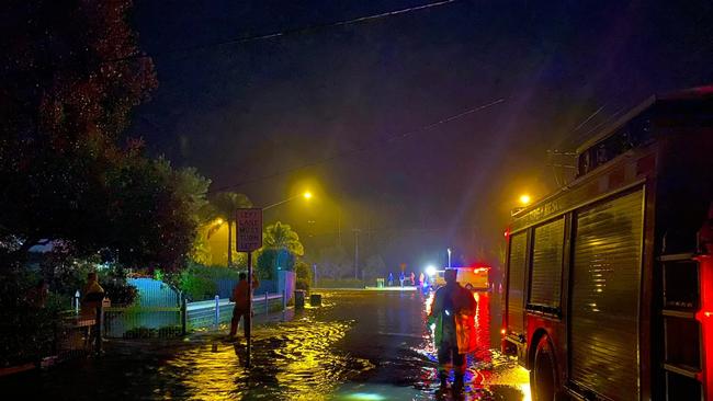
It comes after a 54-year-old man died when his car was swept away by flood waters on the Central Coast.
Just after midnight on Friday emergency services started looking for the Toyota Land Cruiser on Oak Rd in Matcham, and eventually the man was found dead in his car at 1.30am.
The car was stuck next to a foot bridge over Maddens Creek and it is likely the man was unable to open the doors to free himself and tragically drowned in the flood waters.
In the 24 hours to Friday morning, Gosford received 138mm of rain and Wamberal saw 142mm.
âš ï¸ #Flood Warning issued for #NambuccaRiver. Minor flooding occurring at #Bowraville. See https://t.co/AdztI2rqg1 for details and updates; follow advice from @NSWSES. #NSWFloodspic.twitter.com/AmyGFIKJFr
— Bureau of Meteorology, New South Wales (@BOM_NSW) February 25, 2022
Moderate flood warnings were issued for the Wilsons, Orara, Nambucca and Richmond rivers, with minor flood warnings issued in other parts of the state.
The SES said the worst of the flash flooding was hitting the Hawkesbury up to the Northern Rivers with significant flooding on the Central Coast.
The rain is showing no sign of stopping with the Bureau of Meteorology predicting 200mm in the Northern Rivers and 100mm in the south coast over the next four days.
In Wolli Creek streets were under water this week and damaged furniture abandoned in the roads.
In the Royal National Park’s Audley Weir kayaks broke free from a nearby boat shed and floated away into the high speed flood waters.
It’s not just NSW bearing the brunt of the colossal downpour with Brisbane seeing a biblical deluge.
Two lives were lost in Queensland including a motorcyclist who rode his bike into flood waters.
Queensland Fire and Emergency Services Deputy Commissioner Mark Roche warned Queenslanders to stay home.
“What’s disappointing to me is that we are actually seeing the footage of people driving into floodwaters,” he said.
“This is a serious event. It is a life-threatening event. We found a number of rescues this morning where people were clinging on to trees. ”
#Showers and #thunderstorms continuing on Friday and over the weekend across #NSW, with heaviest rainfall about the #NorthCoast. Moderate to heavy #rainfall rates expected, particularly with #storms. For latest weather conditions and forecasts visit https://t.co/19oIzXTKtfpic.twitter.com/wMwQWIj3B4
— Bureau of Meteorology, New South Wales (@BOM_NSW) February 24, 2022
TORRENTIAL RAIN
It comes as a major storm clean-up efforts continue across much of Sydney and the Central Coast after a month’s worth of rain fell in a mere hours in parts of the state on Thursday. Parts of the far north coast received 250mm of rain in 24 hours, well above the monthly average rainfall for eastern NSW in February.

Adam Jones from the State Emergency Service (SES) said the risk of flash flooding remains high with much of the state already waterlogged.
“Although the situation is easing, with the thunderstorms that could develop, with any rain that comes down there’s the risk of flash flooding so we’re asking the community to make smart decisions and plan ahead,” he said.
“If you come up to a flood road, turn around. We’re also asking people not to play in floodwaters.”
Got a news tip? Email weekendtele@news.com.au
.
More Coverage

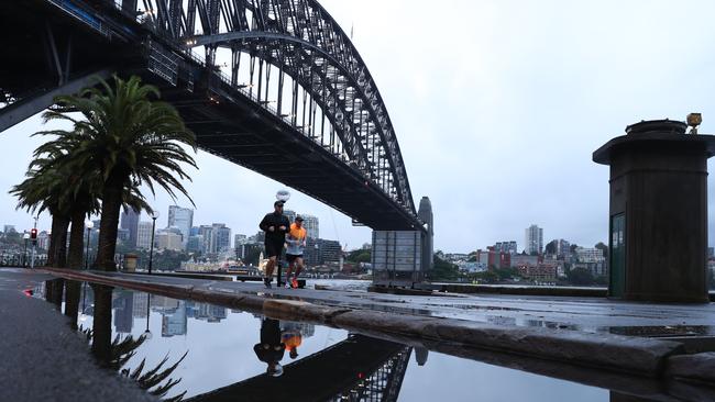
Sydney braces for days of rain, cold temps
Sydney is in for a stretch of wet and windy weather, with rain forecast through to Sunday.

‘Disaster’ for commuters: Backflip on bus services
The Minns government has quietly abandoned its pledge to end bus privatisation, entering direct talks with a private operator to extend a controversial Sydney contract without a competitive tender process.