
NSW weather: up to 300mm rain to smash Sydney, SES upgrade warning
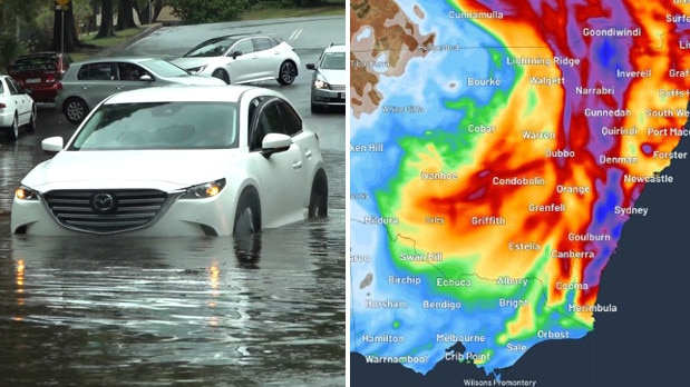
NSW’s severe weather warning was upgraded on Friday morning with residents urged to prepare for heavy rain and flash flooding with downpours up to 300mm forecast in some areas.

NSW
Don't miss out on the headlines from NSW. Followed categories will be added to My News.
Follow Friday’s rolling coverage for live updates here.
NSW’s severe weather warning was upgraded on Friday morning with the State Emergency Service urging residents to prepare for heavy rain and flash flooding with downpours of 300mm forecast for some areas.
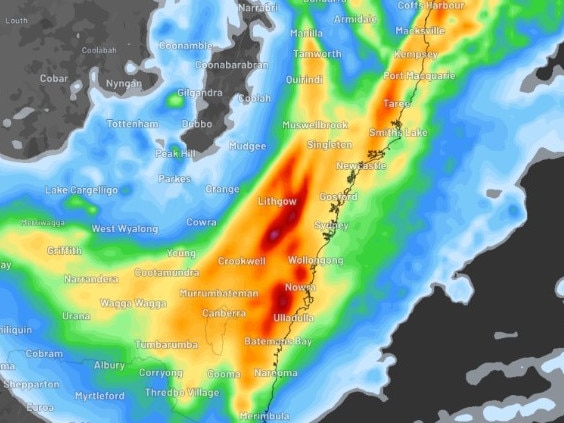
A ‘watch-and-act’ weather warning has been issued for the areas along the east coast from Newcastle all the way down to Bega, including Sydney, the Illawarra, the Central Coast and the Blue Mountains.
The upgraded warning has SES crews poised for flash and life-threatening flooding.
Areas under most risk include Richmond, Camden, Liverpool, Tempe the Blue Mountains and the Illawarra. The worst of the rain is expected on Friday with rainfall possibly exceeding 300mm.
“Six-hourly rainfall totals between 50 to 90mm are likely, reaching up to 130mm over the Illawarra escarpment,” the Bureau of Meteorology said in a statement on Friday.
“24 hour totals of 70-120 mm are also likely, reaching up to 150mm over the Blue Mountains and Illawarra escarpment.”
Why is it raining so much in #NSW?
— Bureau of Meteorology, Australia (@BOM_au) April 4, 2024
It's all to do with the interaction between different weather events occurring in different levels of the atmosphere at the same time. Severe Weather Warnings are currently in place for central & southern NSW. Latest: https://t.co/4W35o8iFmh pic.twitter.com/wjvq17113A
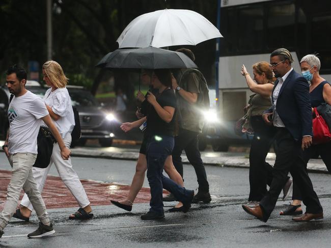
Sydney CBD has been hit with more than 100mm of rain since 9am on Thursday.
The average rainfall in greater Sydney for the month of April is 106mm, meaning the harbour city is expected to get two months of rain in just two days.
The Bureau of Meteorology issued severe weather warnings for heavy and intense rainfall as well as damaging winds for several areas across the state.
“Intense rainfall which may lead to dangerous and life-threatening flash flooding is possible between the Blue Mountains and Narooma from this evening into Saturday morning, with localised six-hourly rainfall totals between 90 to 150mm possible, reaching up to 220mm over the Illawarra escarpment,” BOM said on Friday.
“Localised 24-hourly rainfall totals between 120 and 200mm are possible, and may reach up to 300mm over the Illawarra escarpment.
“A separate Severe Thunderstorm Warning will be issued if very dangerous thunderstorms with intense rainfall are detected.”

This type of weather event is known as a ‘Black Nor’easter’, with its name deriving from the darkness of the moisture-rich clouds coming from the northeast, that can turn the middle of the day as dark as twilight.
Flooding has closed some roads across Sydney on Friday morning, southbound lanes on Harris St between Allen and Fig St in Ultimo are shut.
Water is also blocking roads in St Peters and Rushcutters Bay.
SES and Fire and Rescue crews were also called to Caringbah after a tree fell onto a car and powerlines.
On Thursday, SES crews were on hold preparing for flood rescues.
“On Thursday, widespread showers of 30 to 50mm, locally reaching 70 to 100mm are expected in the northern districts in New England, Northern Rivers, and the northern half of the Mid North Coast regions are possible,” a statement from SES said.
“On Friday, heavy and intense falls, flash flooding, strong gale force coastal winds and hazardous surf conditions are likely to impact parts of the Mid North Coast, Hunter, Sydney Metro, Blue Mountains, and Illawarra.
The Bureau have issued initial flood warnings for parts the Mid North Coast, Wollombi Brook, Sydney and Surrounding Regions, South Coast and parts of the North West.
Strong wind warnings are also set for Coffs Coast and Macquarie Coast Wind Warnings on Thursday and gale force wind warnings are in place for the Hunter Coast, Sydney Coast and Illawarra Coast on Friday.
People have also been warned to stay away from the ocean on Friday with dangerous surf conditions stretching from the Macquarie coast all the way down to the Illawarra.
“To stay up to date with current warnings and advice, people should download the Hazards Near Me app and set up a watch zone for their home neighbourhood, or the place they could be visiting,” Assistant Commissioner Kearns said.
“We’re urging the community to prepare ahead of the weather impact, by tying down loose items, moving their cars from underneath trees, clean your gutters, trim branches away from properties and understand what your flash flooding risk may be.
“If you do come across a flooded road, please do not drive, walk or ride through it. Stop, turn around and find an alternate route.”
Do you have a story for The Daily Telegraph? Message 0481 056 618 or email tips@dailytelegraph.com.au


Join the conversation

‘Hijack’ fear: Jewish leader’s Sydney Biennale warning
A prominent Jewish leader has called on governments “not to be naive” as speculation mounts that Australia’s largest arts festival in Sydney next year will be hijacked as a platform for pro-Palestinian activism.
Read more

Shock twist: Drug pilot’s case of history repeating
A pilot jailed for flying a small plane into Australia full of drugs did the same thing a decade earlier under a different name but escaped prison because the court heard he had cancer. See the latest twist to this story.
Read more