
NSW weather: Flood warnings in place across the state
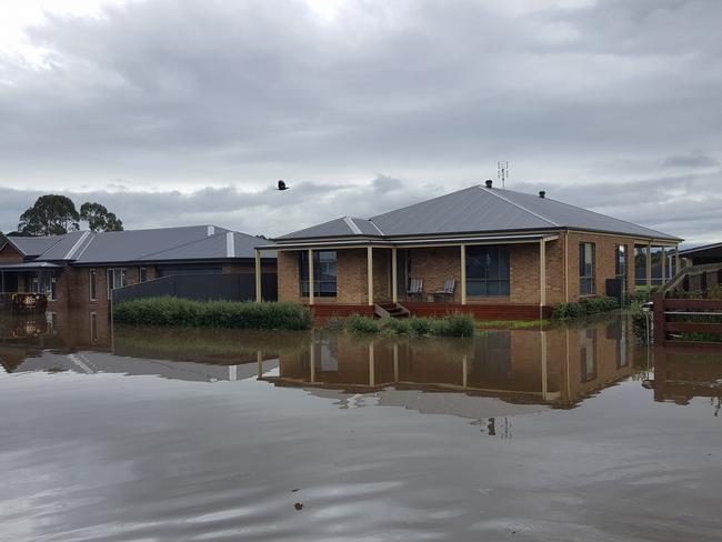
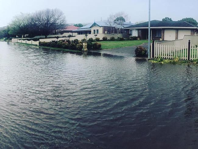
THE SES have rescued 22 people in floodwaters in NSW since Friday, and severe weather moving in from the west has seen the Bureau of Meteorology issue 13 fresh flood warnings across the state.

NSW
Don't miss out on the headlines from NSW. Followed categories will be added to My News.
- Heatwaves, storms and bushfires expected this summer in NSW
- Sydney District Weather
- Nationwide Weather Warnings & Alerts
- Heavy rains expected for Sydney this September
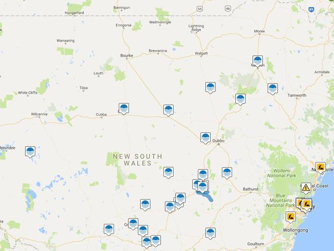
NSW’S north-east will continue to be pounded by rain tomorrow, and 13 major flood warnings still in place across the state.
The Bureau of Meteorology is forecasting rain for Thursday in the state’s north east, with showers likely in most other parts particularly the western slopes of the southern Alps.
Since 9am this morning, Collarenebri has recorded 52mm, Barraba 40mm, Quirindi 39mm, Coonabarabran 33m and Mungindi 32mm.
Snow showers are expected on the southern Alps down to 1200m with fresh west to north westerly winds over the coast and ranges.
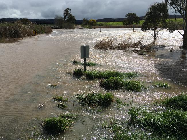
Rain has caused local flooding. Please drive to conditions and not enter flooded areas https://t.co/y2pnctWD9F pic.twitter.com/GDIawRZ2SL
— Coonabarabran (@Coonabarabran) September 14, 2016
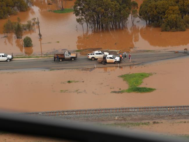
With much of NSW already drenched, and more rain on its way, the State Emergency Services are warning people not to drive through floodwater.
Since Friday, SES volunteers have conducted 22 flood rescues with the latest involving a man who was trapped in his vehicle after driving through a flooded causeway at Forbes in the states central west.
With so many roads closed around the Forbes area, the region almost became an island on the weekend, with travelling local residents forced to circumnavigate the shire to find their way home.
SES spokeswoman Becky Gollings said this year there had been more than 500 flood rescues.
“This is concerning for us as people continues to put themselves in harms way,” Ms Gollings said.
At the moment, Ms Gollings said it was ‘relatively calm’ with 30 calls for assistance statewide.
But she said with most of the catchments saturated they were on standby with additional rain forecasted by the BOM.
#SydneyWeather Rain at times today, gusty storms possible this arvo. Forecasts & warnings at https://t.co/UqlGxUsuBw pic.twitter.com/r4QWSi99Uq
— BOM New South Wales (@BOM_NSW) September 13, 2016
OTHER NEWS: TERROR FEARS AS AUSSIE JIHADIS RETURN HOME
The BOM also released a Marine Wind Warning, with strong winds expected in Byron Coast, Coffs Coast, Macquarie Coast, Hunter Coast, Sydney Coast, Illawarra Coast, Batemans Coast and Eden Coast across Wednesday and Thursday.
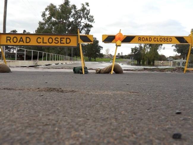
And, on Wednesday morning, the Live Traffic NSW website had issued 25 flood traffic warnings, with roads closed across the state.
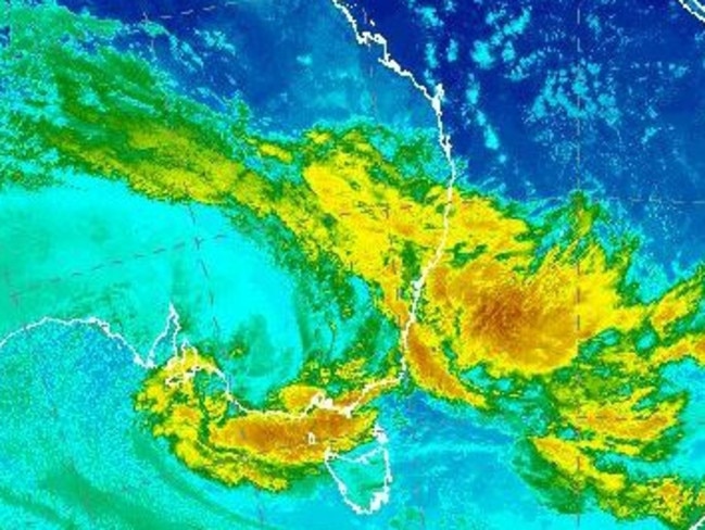
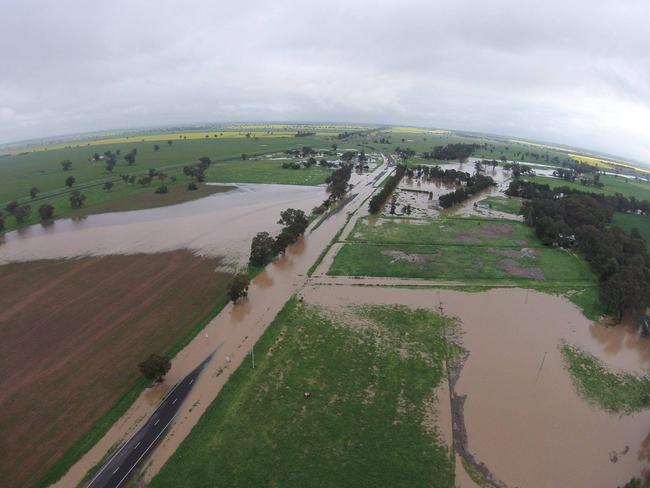
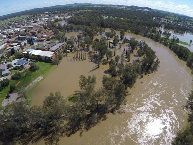
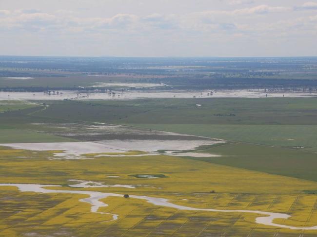
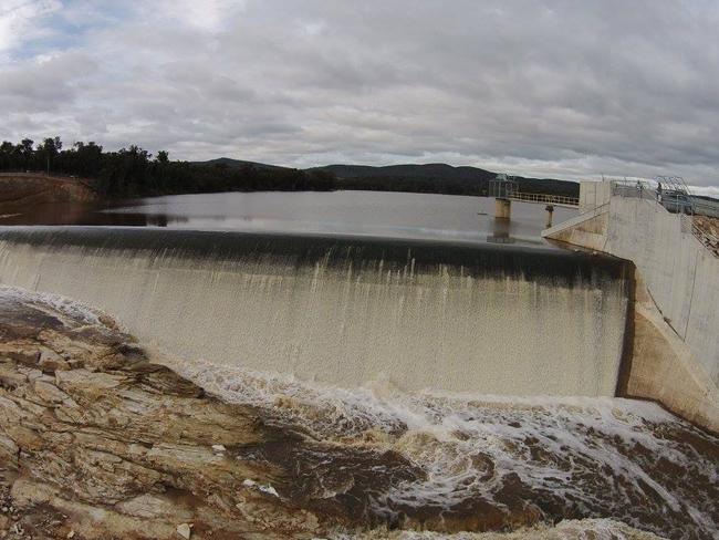
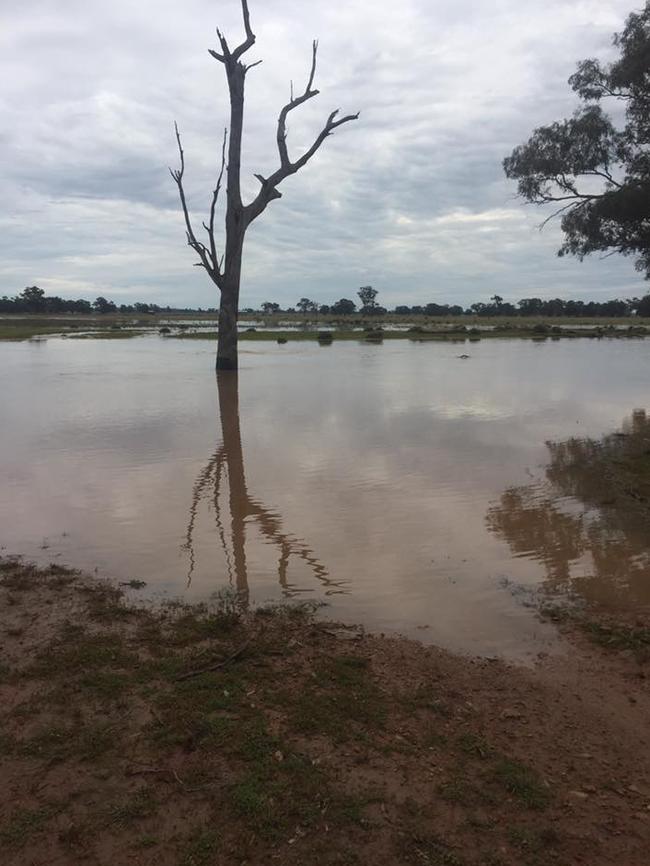
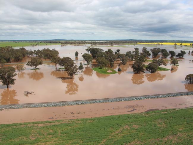
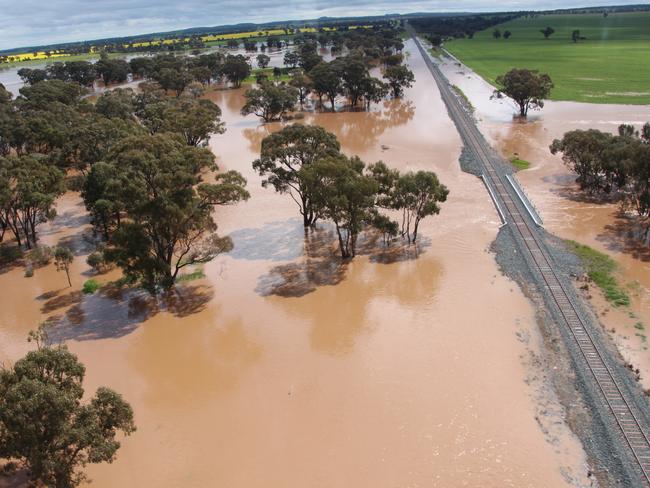
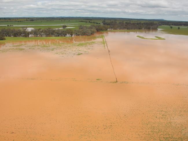
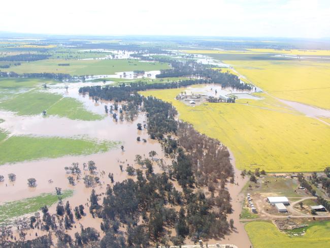
These latest conditions, along with significant rainfall and flooding in the NSW inland catchments over the past month, has seen the BOM issue flood warnings for the Warrego, Paroo, Namoi, Bogan, Macquarie, Lachlan, Murrumbidgee and Murray rivers.
Towns in the North West Slopes and Plains, Central West Slopes and Plains, Riverina, Northern Tablelands and northern parts of the Hunter can expect the worst of the weather.
“This Flood Watch means that people living or working along rivers and streams must monitor the latest weather forecasts and warnings and be ready to move to higher ground should flooding develop,” a warning on the BOM website states.
The NSW SES is warning locals in affected areas to stay inside where possible, after a busy week rescuing people and animals from already flooding rivers and dams.
“You may think it is safe, but it is never safe to drive into floodwaters,” the NSW SES spokeswoman said.
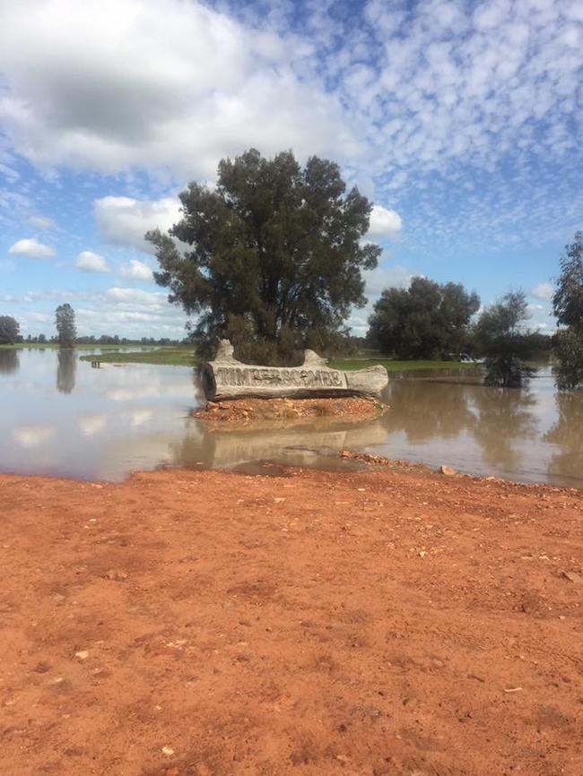

In Bland Shire, north of Wagga Wagge in the state’s west, floodwater has postponed the local elections as residents in the region were unable to vote and polling booths were closed.
“On Saturday morning, the water was starting to rise in the Humbug Creek in town,” local resident Glenn Neyland said.
“The Ungarie Show which was to be held that day had to be cancelled, and the local council election also being held that day had to have the voting site moved from the school to the community hall.
“In nearby Tallimba, the voting site was inaccessible with voting postponed until the following week.”
Residents who were evacuated from their homes in the Bland Shire have been able to return today.
Meanwhile, in Sydney is expected to miss the worst of the weather, but rain is expected to hang around all day with the chance of a thunderstorm.
A maximum of 23 degrees in Sydney, and winds up to 30km/h are expected.
MORE FLOOD UPDATES FROM ACROSS AUSTRALIA
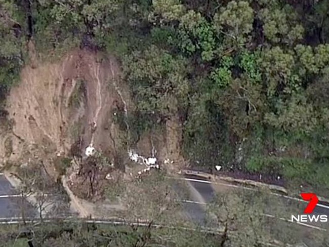
Victoria has been hit possibly the hardest by this week’s wild weather, and earlier today the Great Ocean Rd was closed to non-essential traffic after landslides blocked part of the world-famous tourist route.
Evacuation warnings remain in replace in Hamilton, 300km west of Melbourne, and severe weather warnings are in place for damaging winds and heavy rain for people in the northern country, north central, northeast and parts of the central, East Gippsland and south west forecast districts.
In South Australia, electricity has been restored to thousands of homes but hundreds more are still without power.
The Bureau of Meteorology has issued a severe weather warning for potential wind gusts of between 90km/h to 100km/h in areas such as Adelaide, Kingscote, Murray Bridge, Gawler, Victor Harbor and Meningie.

PM hosts Teals for charm offensive drinks at The Lodge
The Prime Minister may well need them in the coming federal election, so it’s no surprise Anthony Albanese is hosting Teal and independent MPs tonight at The Lodge as he seeks to win their support in the event of a minority government.

Man miraculously survives 25-metre cliff fall
A man has fallen 25 metres off a cliff on the Central Coast, with paramedics attributing his miraculous survival to the fact he hit several ledges on the way down.