
NSW weather: Heatwaves, storms and bushfires expected this summer
BUSHFIRES, heatwaves, supersized thunderstorms and flash floods from torrential downpours are set to hit our state this summer.
NSW
Don't miss out on the headlines from NSW. Followed categories will be added to My News.
BUSHFIRES, heatwaves, supersized thunderstorms and flash floods from torrential downpours are set to hit our state this summer.
Forecasters have released their outlook for the next seven months and, while it does not suggest an El Niño drought or La Nina soaking, it does not look pretty.
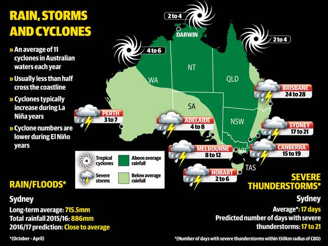
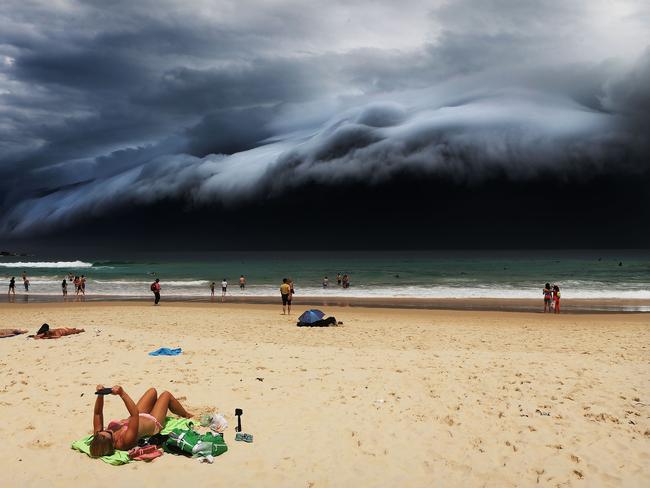
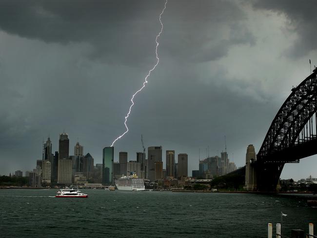
The “highlights” include almost a month’s worth of severe storms for northern NSW, heatwaves in southern NSW and the ACT, an explosion of bushfires in western NSW — and Sydney set to have its sunny summer washed out by frequent rain and between 17 and 21 destructive storms.
The Sky News Weather Severe Weather Outlook for 2016-17 also revealed high rainfall will continue for Sydney between now and April 2017.
Sky News Weather chief meteorologist Tom Saunders said Australia had its wettest May to August period on record.
“For NSW, much of the state will remain wetter than normal,” he said.
“And we are also expecting severe thunderstorm numbers to be above average.”
Sydney is predicted to cop 17-21 days of severe thunderstorms between now and April, which could be above average.
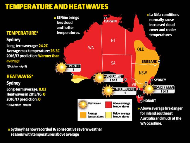
Sydney temperatures are also expected to exceed the long-term average of 24.2C, the 17th straight year that this has happened.

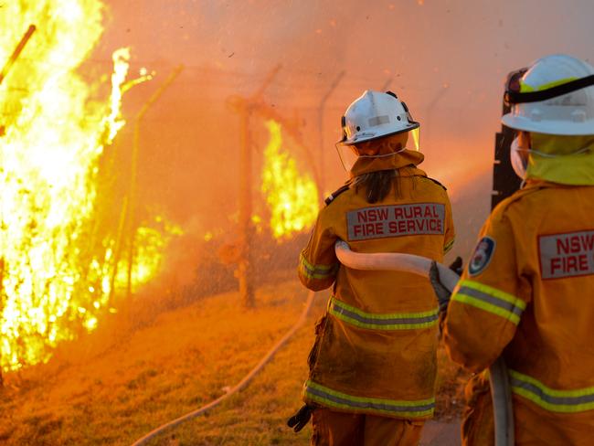
The high level of rain, especially in the state’s west, is predicted to create an increased risk of bushfires.
The Murray-Darling Basin’s total catchment storage level has gone up more than 30 per cent in the past four months, Mr Saunders said.
“There is a higher bushfire threat on the western side of the ranges,” he said.
“Heavy rainfall has resulted in greater grassland growth.
“Even if rainfall is above average through the summer, typically in the west of NSW, it is dry enough that you can still get grassland fires.
“You would expect above average bushfire behaviour roughly from Dubbo down to Orange and then Wagga Wagga west of that line.”
In the Brisbane and northern NSW region the report is predicting 24-28 days of severe storms, well above the long-term average of 20 days. This, and the increased rainfall, is being driven by changes in ocean temperatures.
“Severe thunderstorm conditions will be above average in northern NSW,” Mr Saunders said.
“The ocean is not in a La Nina or El Niño phase, it is in a neutral phase, and that is when you get the most number of severe thunderstorms in that area.”
The south coast is also expected to see above average temperatures, while the ACT is expected to cop at least one or two severe heatwaves.
Other factors driving this season’s forecast are warmer than normal ocean temperatures off the northern and eastern coastlines and a negative Indian Ocean Dipole (IOD).
The ongoing negative IOD (which pushes warmer waters to Australia from India) and the risk of a weak La Nina (cold phase) forming, should ensure rainfall remains above average over much of northern and eastern Australia.
This is particularly true during the first half of the severe weather season.
Mr Saunders also pointed to the influence of global warming on current conditions.
According to the CSIRO, air and ocean temperatures across Australia are now, on average, almost 1C warmer than they were in 1910, with most of the warming occurring since 1950.
“This warming has seen Australia experiencing more warm weather and extreme heat, and fewer cool extremes,” the CSIRO’s State of the Climate 2014 report found.
“There has been an increase in extreme fire weather, and a longer fire season, across large parts of Australia,” he said.

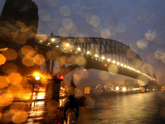
Sydney braces for days of rain, cold temps
Sydney is in for a stretch of wet and windy weather, with rain forecast through to Sunday.

‘Disaster’ for commuters: Backflip on bus services
The Minns government has quietly abandoned its pledge to end bus privatisation, entering direct talks with a private operator to extend a controversial Sydney contract without a competitive tender process.