
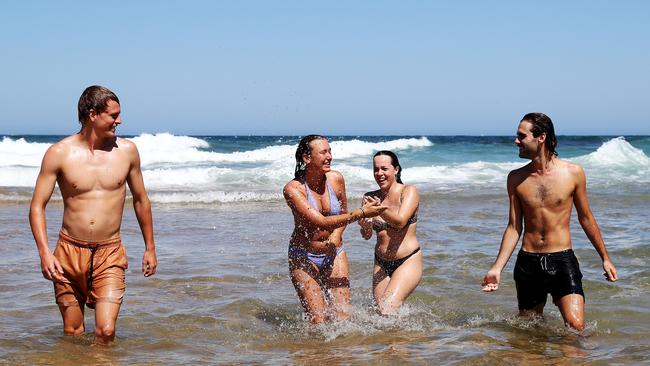
NSW weather: Crowds flock to beaches as heatwave hits Sydney
Police and council rangers will be patrolling Sydney’s beaches to make sure people are social distancing, as the mercury is set to rise over the next few days.

NSW
Don't miss out on the headlines from NSW. Followed categories will be added to My News.
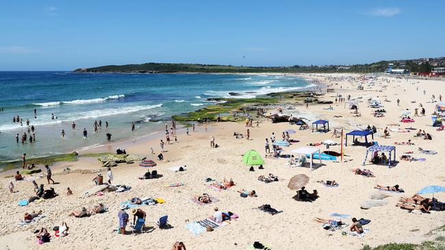
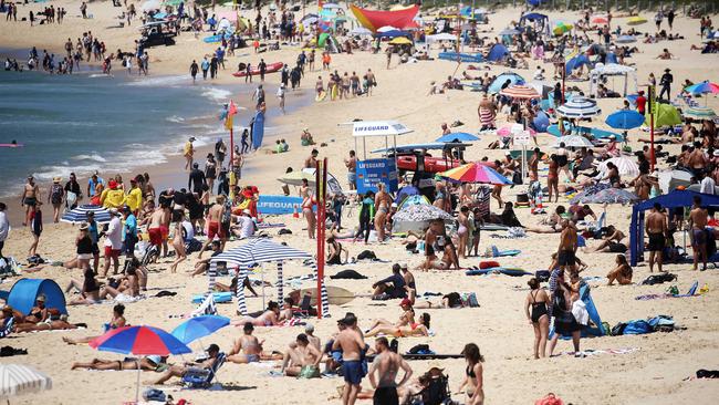
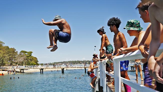
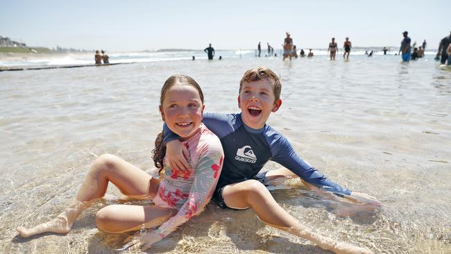
Hoards of Sydneysiders made a beeline for the coast on Saturday as the mercury soared in the western suburbs. But if you think it’s hot now, it’s only going to get worse as we head into Australia Day.
Temperatures in the west topped 38C on Saturday, with Sunday expected to hit 39C. There will be no relief tomorrow with a forecast top of 38C before a scorching 40C on the Australia Day public holiday.
Conditions will be much milder in the city and on the coast where temperatures over the next four days aren’t expected to reach much higher than 33C which is forecast for both Sunday and Tuesday.
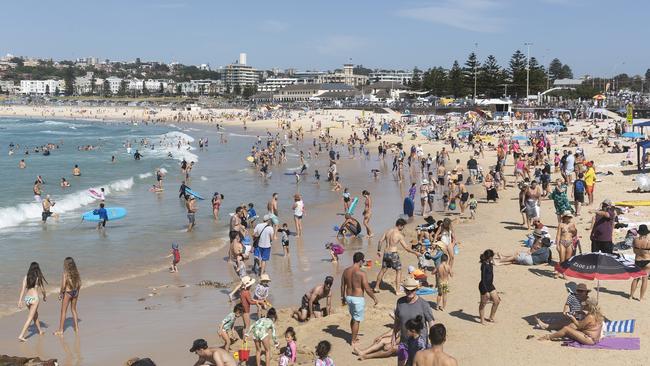
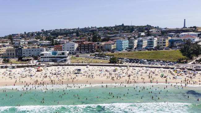
Bondi, typically one of the busiest of Sydney’s beaches, was a sea of bronzed bodies and bikinis yesterday but a spokesman for Waverley Council said they remained under capacity and the crowds were acting responsibly and social distancing.
Council staff will be monitoring crowd numbers over the next couple of days and will restrict access if they near their limit, which is believed to be around 6000 at Bondi.
The council has introduced temporary measures to try to limit crowds, including switching off all park barbecues at 3pm and installing fencing around picnic huts at Bronte and Tamarama.
After a wet and mild start to summer, there were fears the number of frustrated beachgoers might be overwhelming and be a COVID risk, but that didn’t eventuate.
Police, who have increased patrols along the coast had no reports of significant breaches of health protocols.
NSW has celebrated its sixth straight day of zero community transmission but the state government is still urging people to remain vigilant after COVID-19 fragments were detected in sewage treatment plants at both Liverpool and Glenfield, facilities that cover a combined population of more than 300,000.
HEATWAVE HITS SYDNEY
A warm high-thirties day on Friday kicked off a five-day heatwave for NSW, with residents expected to swelter through “mid forties” temperatures until Australia Day.
According to the Bureau of Meteorology the hottest places in the state on Friday were Borrona Downs and Smithville at 40.5C in NSW’s northwest.
The thermometer tipped 37C in Penrith and Badgerys Creek in western Sydney, with only a top of 24C in the CBD.
Bathurst and Goulburn saw a top of 33C and Dubbo hit 34.9C, while Albury peaked at 36.8C and Wagga Wagga at 36.1C.
On the Mid North Coast, Taree reached 30 and Coffs Harbour saw 28C.
ðŸŒ¡ï¸ Severe to extreme heatwave conditions for much of the state over the next several days. It's important to stay cool, hydrated and plan ahead. Check in on family, friends and vulnerable neighbours. #BeatTheHeat @NSWHealth
— Bureau of Meteorology, New South Wales (@BOM_NSW) January 21, 2021
🌊 Heading to the water? https://t.co/etM9H4IsN7 pic.twitter.com/Bcj0J5Jy6s
On the Mid North Coast, Taree reached 30C and Coffs Harbour saw 28C.
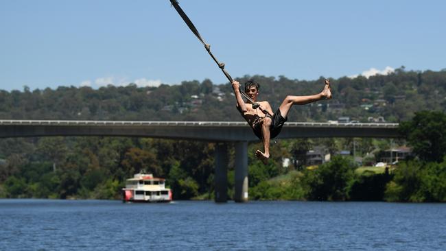
Friday’s warm temperatures saw waterway revellers cop a warning from State Transport Minister Andrew Constance surrounding water safety over the weekend and on Australia Day.
Following a spike in maritime incidents across NSW and nine deaths, Mr Constance urged punters to be cautious around rivers, lakes and beaches and to know the rules around boating and swimming at certain spots.
“In the past six months, we’ve lost nine lives on our waterways, including two this year. I can’t stress enough how crucial it is for boaters to know and follow the rules which exist to keep us all safe,” Mr Constance said.
“We’re about to head into some really warm summer weather combined with hazardous swells, the end of school holidays and the Australia Day public holiday. I am urgently reminding everyone to take the necessary safety measures to ensure a fun day out doesn’t end in tragedy.”
It comes as the heat will reach fever pitch into the forties early next week, with the BOM warning much of the state to brace for “increasing temperatures” until next Wednesday.
BOM Meteorologist Stephen Stefanac said the temperature gauge would hit 40C for parts of Sydney’s west by Monday, while NSW’s northwest would see “consecutive days” of up to 44C.
He said a slow moving high pressure system combining with a low pressure trough would create “hot and dry” conditions across NSW, with each day bringing higher temperatures.
“The pattern of hot, dry weather isn’t going to change much over the next few days, it’s a slow moving system … the heat will build and continue to drag in hot air, it’s just going to get hotter (over the weekend),” Mr Stefanac said.
“Generally the next few days will see temperatures get to their highest, by Monday and Tuesday we’ll have low to mid forties broadly across large parts of the state.”
A significant #heatwave will impact #SA, #Vic, #NSW and #ACT as temps soar over the weekend and into the #AustraliaDay public holiday.
— Bureau of Meteorology, Australia (@BOM_au) January 21, 2021
Make sure you keep cool and stay hydrated – and don't forget your pets! ðŸ¶ðŸ±
Latest forecasts: https://t.co/qDSm8yAGi4 or the #BOMWeather app pic.twitter.com/rzRiUtQSZX
Mr Stefanac said Australia Day would see the last of the heat, with temperatures in the high thirties and forties before a southerly change sweeps in from late in the evening.
But NSW shouldn’t rule out another heatwave by the end of the summer.
“On average, NSW has had a milder summer but we can’t rule out the possibility of another heatwave before the summer ends,” he said.
Hot and dry conditions have also prompted a stark warning from the Rural Fire Service, with fire danger expected to spike to High, Severe and even Extreme ratings in some areas as the temperature continues to climb.
RFS spokesman Ben Shepherd said total fire bans were “likely” on Monday and potentially Australia Day, and warned revellers to stay alert across the weekend.
He said areas of the Riverina and the state’s west were “the most vulnerable” to bush and grass fires in the coming days due to heavy crop and grass growth.
“Over the weekend as temperatures climb we’ll see fire danger peak, especially in the Riverina and west of the Great Dividing Range where crop and grass growth will continue to be problematic over the fire season,” Mr Shepherd said.
“Dry grass fires move three times faster than bushfires, so even though it’s been a quiet fire season so far, it is by no means over … but anywhere where it’s hot will still have a fire risk, even on the coast, so we’re asking people to remain alert.”
The impending heatwave has also prompted warnings from NSW Health officials about heat-related illnesses, with Acting Director of Environmental Health Dr Adi Vyas asking residents to plan ahead and keep an eye out for symptoms.
“Hot weather puts a lot of strain on the body, including dehydration, and can make underlying health conditions worse … it also causes heat stress and heat stroke,” Dr Vyas said.
“Plan for the upcoming heatwave by checking your fridges, freezers, fans and airconditioners work properly …. reduce the impact of heat by avoiding being outside during the hottest part of the day; keeping well hydrated with water; and looking after vulnerable neighbours and relatives.”

It comes as Twitter and Red Cross Australia announced a partnership on Friday, so when users search for words like “bushfire”, “flooding” or “cyclone”, a prompt at the top of search results will direct users to resources from the community services organisation.
Using the button, users will be able to find out the impact of different natural disasters, contact lists for help organisations, directions to get up to date emergency information and a survival kit checklist.
Temperatures will drop back into the high twenties and low thirties for the rest of next week from Wednesday.
More Coverage

The Aussie in Trump’s inner circle: Donald’s favourite alpha male
Who is Nick Adams, a former Ashfield councillor now on the cusp of becoming the US Ambassador to Malaysia? The Sunday Telegraph tracked his unique journey to the Trump inner circle.

Controversial Islamic centre hosts sermon attacking the West
An Australian cleric has claimed Muslims are being “belittled” without sharia law, while calling down the “wrath of Allah” on Western powers at a fiery sermon in western Sydney.