
NSW weather: 100km/h winds, dangerous surf as state emergency service issue severe weather warning
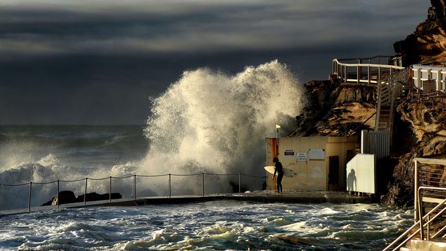
Severe weather warnings are in place for Sydney and other parts of NSW as 100km/h wind gusts lash the suburbs.

NSW
Don't miss out on the headlines from NSW. Followed categories will be added to My News.
Severe weather warnings are in place for Sydney and other parts of NSW as 100km/h wind gusts lash the suburbs.
Sydneysiders woke on Wednesday to cool Autumn conditions, as a strong southerly change and low-pressure system swepts up the NSW coast.
The mercury dropped to 13C in Sydney’s CBD overnight while residents in Sydney’s west and southwest woke to lows of 10C.
“This strong surge of southerly winds is being accompanied by potentially damaging surf over the next 24 hours,” reported website Weatherzone.
The wild weather is expected to ease on Thursday, but senior meteorologist Angus Hines from the Bureau of Meteorology said winds will be hitting the coastline hard on Wednesday morning.
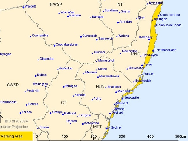
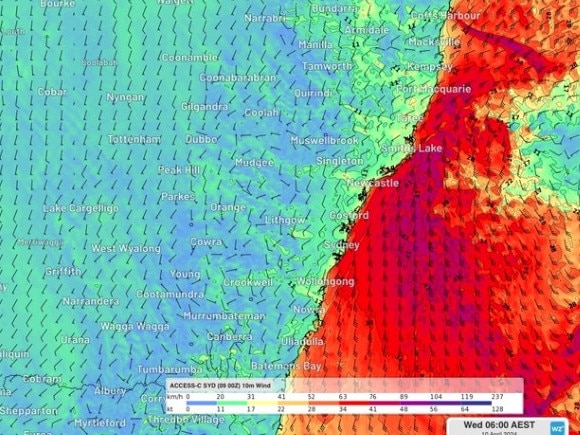
“The winds are forecast to reach 80, 90, maybe 100km/h right along the coast,” Mr Hines said.
“That is where we have severe weather warnings located along the coast of three forecast districts, the Sydney Metro area, the Hunter District and the Mid North Coast.”
Since midnight, the bureau has recorded 100km/h winds at Wattamolla in Sydney’s south, 80km/h winds at Molineux Point in Port Botany and 78km/h winds in Sydney Harbour.
State emergency services have responded to 50 calls for help overnight, with most relating to wind and rain damage.
Severe Weather Update for the #NSW coast, where damaging winds of up to 90-100km/h are possible in some areas. Video current: Midday AEST 9 April 2024.
— Bureau of Meteorology, Australia (@BOM_au) April 9, 2024
Latest forecasts and warnings: https://t.co/4W35o8iFmh or the BOM Weather app. pic.twitter.com/cXQdH2egTh
They’ve also urged residents to “prepare now” for intense winds and warned motorists to take care on the roads today.
“We are asking residents to prepare your homes and businesses now for the expected strong winds. You can do this by following a few safety tips including clearing any overhanging branches and securing and putting away any loose items around your backyard or balcony,” Assistant Commissioner Burnes said.
“Given the recent extreme weather experienced across much of the coast over the last few days, the soil is already saturated so there is an increased chance of trees falling.
“During high winds we also see trees and powerlines falling on vehicles. Make sure you park your car undercover and do not park under any large trees or powerlines.”
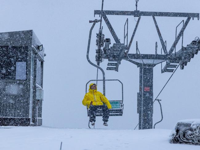
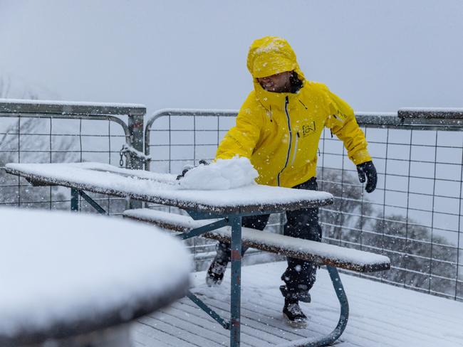
It comes as Australia’s biggest ski resorts celebrated their first snowfall for the year.
Thredbo in NSW’s Snowy Mountains recorded 10cm on Monday night and another 5cm overnight.
Pictures showed a snow covered chairlift, tables, trees, ski trail signs, and even the new Alpine Coaster, which launches this winter season.
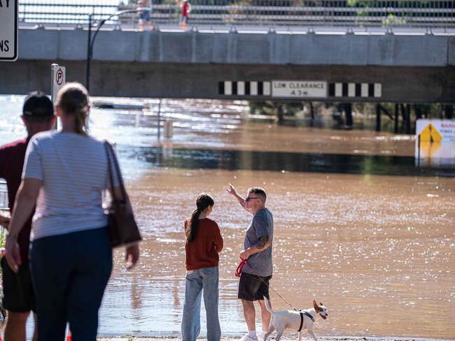
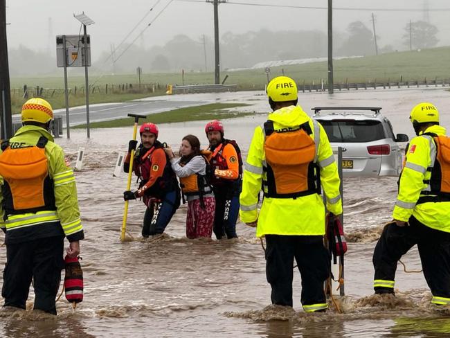
The cold snap follows a horror weekend of weather for NSW which saw floodwaters inundate thousands of homes when more than 180mm of rain fell on Friday night.
Emergency services had their hands full conducting flood rescues, while many now face the daunting task of cleaning up their destroyed properties.
Sydneysiders will soon breathe a sigh of relief with conditions expected to ease drastically over the next few days, setting up the city for some clear Autumn days.
Do you have a story for the Daily Telegraph? Message 0481 056 618 or email tips@dailytelegraph.com.au


‘If I was PM’: Aussies have their say on key priorities
A temperature check of what people would do themselves if they were PM for a day has revealed the things most important to Australians. Watch the video. What would you do? Tell us here.

Teen boy dead, another loses arm in horror jet ski crash
A teenage boy has died in a jet ski crash in Sydney’s south, with another taken to hospital in a critical condition with a severed arm.