
NSW bushfires: Aerial photos show how close fires came to homes
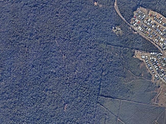
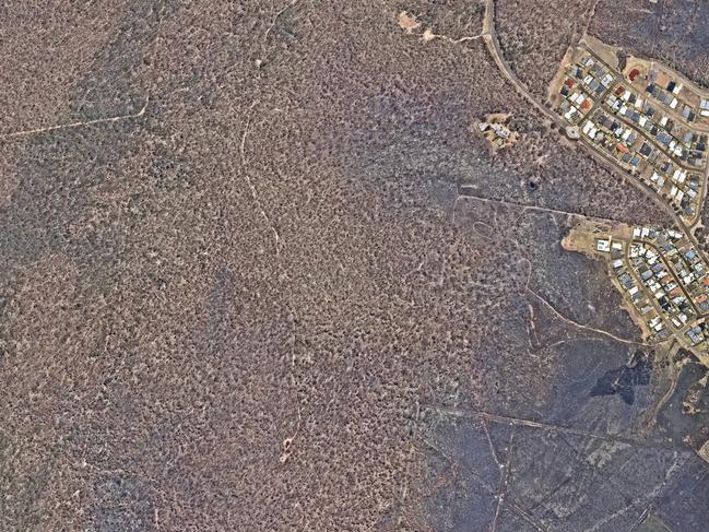
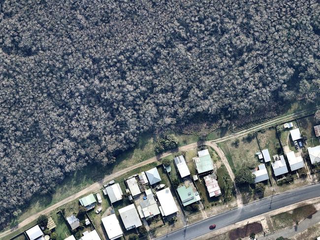
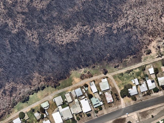
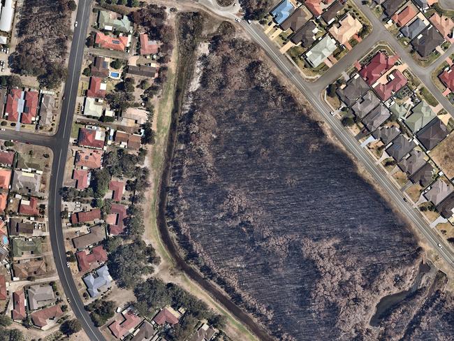
Chilling aerial photographs show how NSW fireys saved homes from almost certain destruction. Residential developments once hidden in hinterland now look like islands among an ocean of flattened and charred trees 335km north east of Sydney.

NSW
Don't miss out on the headlines from NSW. Followed categories will be added to My News.
They are the photos that show how close whole NSW neighbourhoods came to complete destruction.
Aerial imagery taken over the mid north coast shows how fires last month raged through thick bushland right up to residents’ boundary fences.
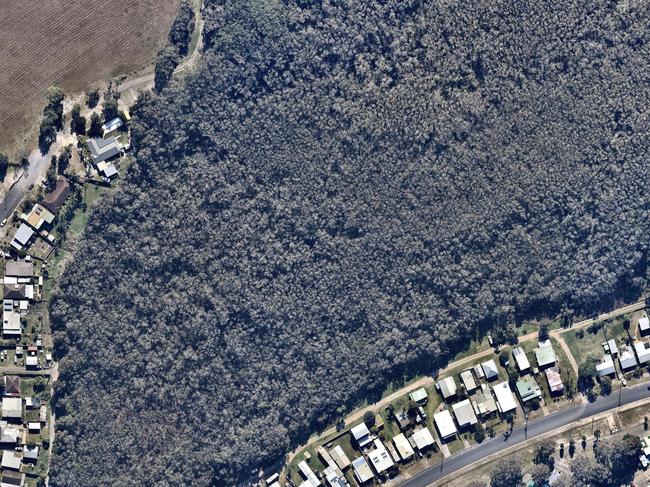
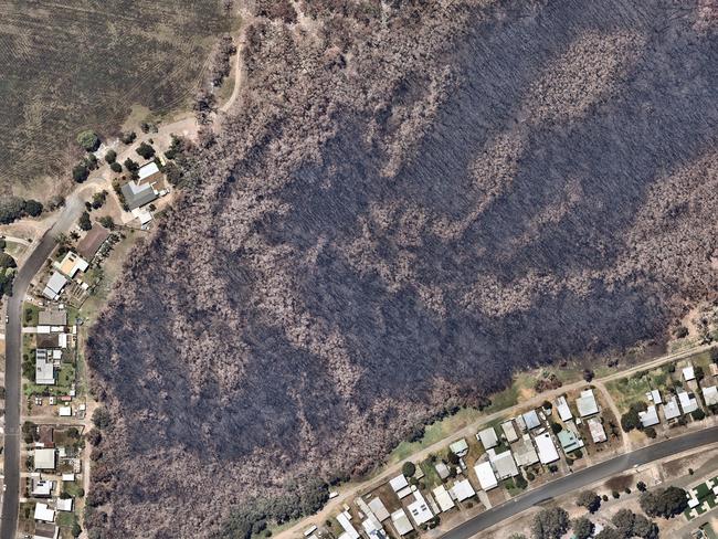
Residential developments that were once hidden in hinterland now look like islands among an ocean of flattened and charred trees 335km north east of Sydney.
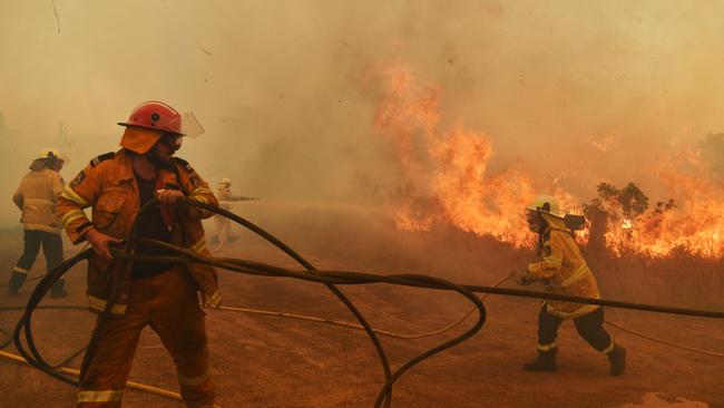
Firefighters with their backs to homes beat back the flames, while homeowners fled to the beach where they huddled together and hoped for the best.
Just two weeks into summer, 741 homes destroyed and six people have lost their lives.
The timelapse pictures of Wallabi Point, Harrington and Forster – between Forster and Port Macquarie – instead tell the story of the 6000 homes NSW Rural Fire Service (RFS) fireys have saved this season.
At their peak on November 8 and 9, the fires blacked out the sky in Harrington and Wallabi Point and turned the sky orange in the nearby coastal capital of Port Macquarie.
Residents on rooftops reported four-storey flames towering over Wallabi Point, which were fanned by swirling winds.
The pink residue has washed away, but the Large Air Tanker Marie Bashir dropped 15,000 litres of fire retardant at a time on the outskirts of Harrington.
A fleet of sky cranes and firebombing helicopters dived in and doused flames while the Marie Bashir filled up.
The fire that threatened Harrington was the Hillville fire, which destroyed homes when it tore through Rainbow Flat before carrying on to Old Bar.
As well as a dozen homes, the Rainbow Flat RFS double brick fire station was completely destroyed while its occupants were out manning hoses.
Remarkably, firefighters saved every house in Harrington, Wallabi Point and Forster.
In nearby Bobin, 85km south-west of Port Macquarie, homes were destroyed and the school built in 1883 was flattened.