
Third La Nina could bring a cool spring and summer but not all are convinced
The BOM have declared a third La Nina and a Tweed farmer says more ‘massive rain events’ will keep happening unless we urgently cut our emissions.
Lismore
Don't miss out on the headlines from Lismore. Followed categories will be added to My News.
Forecasters are predicting a third consecutive La Nina could bring more rain to a region already devastated by recent flooding events.
It is only the fourth time in recorded history that Australia has been hit by a triple La Nina, the other times from 1954 to 1957, 1973 to 1976 and from 1998 to 2001.
Already underway in the Pacific, the event will increase the likelihood of above-average rainfall during Spring and Summer in eastern Australia, as predicted in June.
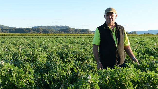
Tweed Valley Sugarcane farmer Robert Quirk said it wasn’t the news he wanted to hear since big falls were predicted in April.
“I’m worried about how people in Lismore will cope with a wet spring,” he said.
“These massive rain events will keep happening unless we do something urgently to cut our emissions to protect our farms in the future.”
Yet the big wet may not deliver as harshly as the previous year although forecasts appear to say the rain will never stop, Sky News Australia meteorologist Rob Sharpe said the forecast isn’t that bleak.
“We will have plenty of dry days to mix with wet ones – yes, it is going to be wetter than normal for the next three months, but that doesn’t mean it’s going to be as wet as it’s been over the past 12 months,” Mr Sharpe said.
“It’s still likely to be wetter than normal for springtime but it’s unlikely that we’re going to have much in the way of extreme rainfall.”
Not convinced
Mullumbimby resident and founder of Resilient Byron, Dr Jean Renouf isn’t convinced.
“Now that the BOM has announced that we are in La Nina watch, we have to expect more possible floods, and just this prospect is enough to make the recovery from these latest floods even harder.”
Bureau of Meteorology said the outlook follows recent cooling in the central tropical Pacific and model outlooks indicating that cooler than average ocean temperatures will be sustained until at least the end of 2022.
“The majority of models predict an easing of the La Niña in early 2023, suggesting a relatively short-lived event,” a spokesman said.
ENSO events typically peak during the southern hemisphere summer and decay during the autumn.
Haven’t recovered from last year’s flood
Ulmarra cattle grazier Peter Lake is worried.
‘’We haven’t recovered from the impacts of last year’s flood,” Mr Lake said.
“New warnings of a La Nina for the third consecutive year is a great concern. We’ve made the hard call to not do crops this year, it’s too big a risk.
“The change in climate makes seasons too hard to predict and management decisions increasingly difficult.”
The cautious sentiment is also held by the State Emergency Service, who have advised those in flood prone areas to take precautions.
NSW SES Commissioner Carlene York said while the agency is well-prepared for another busy period, it is critically important for people to take responsibility and be prepared.
“Today’s declaration means eastern Australia is heading into a third consecutive La Nina season, which presents unique risks and challenges,” Commissioner York said.
She said there is already wet soil, high rivers and full dams right across our state, and with more rain on the horizon comes the very real possibility of flooding.
“If you live in a flood-prone area, I urge you to take steps to prepare now. Make sure you know your risk, have an up-to-date emergency plan and emergency kit.”


Lismore sale and auction results, week ending July 12
Lismore recorded 26 property sales over a million dollars last week, the latest auction and sales results reveal.

Missing surfer paddled out to remote island, authorities reveal
A surfer who made headlines across the world after becoming stranded on a remote uninhabited island 13km off the northern NSW coast actually paddled there and was not sucked out to sea by a rip, authorities believe.