
Seabed mapping first for Byron
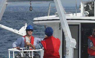
THE Cape Byron Marine Park has become the first in NSW to have its seabed fully mapped using a program that has been described as one of the best in Australia.
Lismore
Don't miss out on the headlines from Lismore. Followed categories will be added to My News.
THE Cape Byron Marine Park has become the first in NSW to have its seabed completely mapped using a program that has been described as one of the best in Australia.
Using side scan sonar technology, Cape Byron’s diverse habitats have now been fully documented.
Key findings include:
- Julian Rocks’ huge fish diversity, grey nurse sharks and abundance of temperate corals.
- One of the narrowest points on the continental shelf is at Cape Byron.
- The Lennox Head moat with its boulder reef habitats.
- The spanner crab spawning area south of Cape Byron.
Scientific teams will soon return to the Northern Rivers to map areas outside the marine reserve and identify areas of similar habitat.
They will also study the region’s river plumes to examine the effects of large flood events on the ecosystems in the Cape Byron Marine Park and nearby areas.
This comes as a new report, Marine Park Science in NSW, An Independent Review, was released by a group of renowned professors and researchers.
It sets the direction for the next five years of research at the Department of Environment, Climate Change and Water.
Director of environment and conservation science, Klaus Koop, said the report also praised the scientific work being done in NSW marine parks as ‘innovative’ and ‘excellent’.
He said he was thrilled their hard work had been recognised.
“Of course this is all very encouraging news,” Dr Koop said.
“Not only are we on the right track with our scientific program within marine parks, but a number of specific programs, including the seabed mapping and the Baited Remote Underwater Video System, which measures fish abundances, sizes and biomasses, have been recognised.
“The seabed mapping is high technology mapping of the estuaries and seabed along the open coast, and has been undertaken now in all the marine parks.
“Sonar instruments send down signals and these signals bounce back off thebottom of the ocean to create images for us.
“On land it’s very easy to see what’s there, but the bottom of the sea is hidden from us.
“We’ve now found new habitat in a number of the marine parks.
“And with our new high tech boat, the Bombora, now out and working, we’re looking forward to discovering even more about the world at the bottom of the ocean.”
Originally published as Seabed mapping first for Byron

Legal costs awarded to crash death accused after trial delayed
A man claiming he suffered a covid blackout behind the wheel before the road death of a northern NSW farmer has been awarded legal costs due to ongoing delays ahead of his trial.
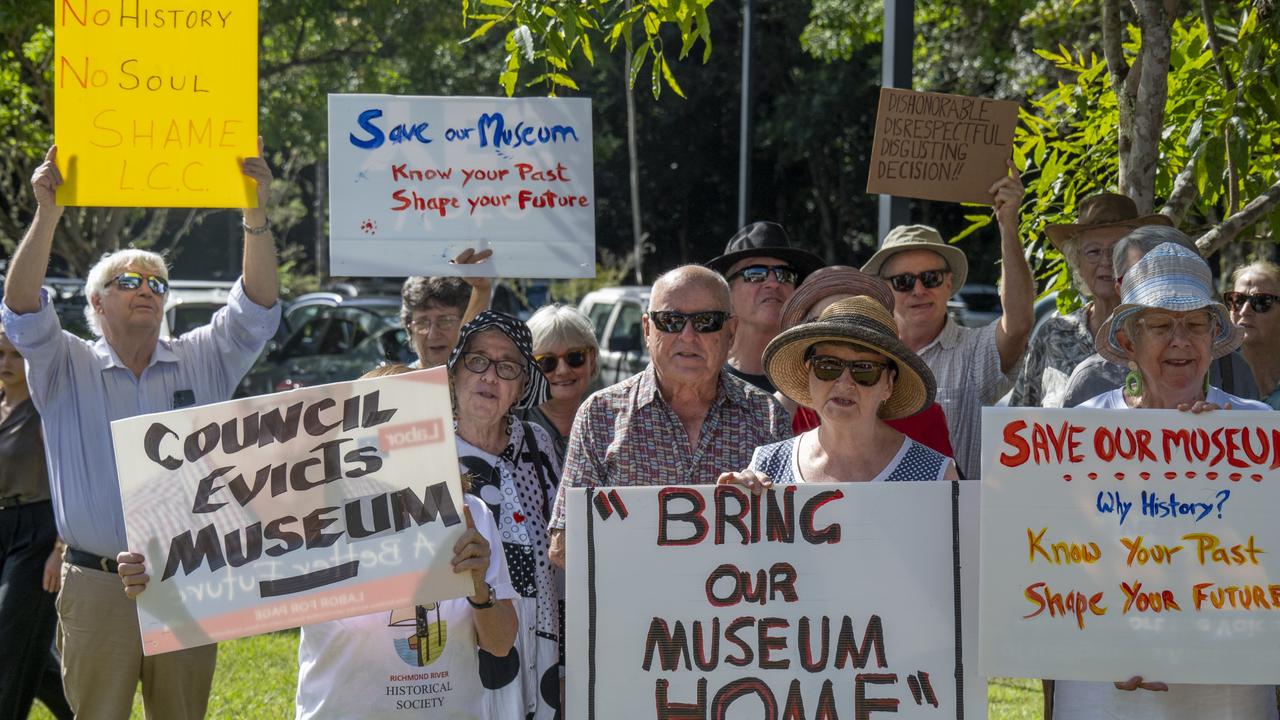
‘Enormous reputational damage’: Council evicts its own museum
A Northern Rivers council wanting to better manage their assets has reneged on an agreed lease to allow its museum to return – leaving the organisation homeless and precious artefacts sitting idly in shipping containers.