
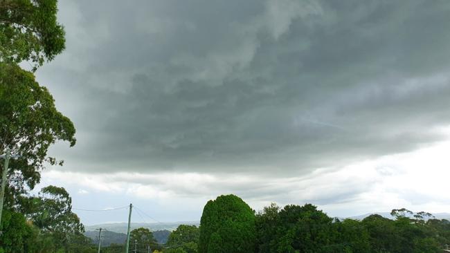
SES warns, ‘be prepared’ for severe storms and heavy rain
The Bureau of Meteorology said an inland trough continues to bring unsettled weather to the region.
Lismore
Don't miss out on the headlines from Lismore. Followed categories will be added to My News.
UPDATE 5.00pm: A severe Thunderstorm Warning has been issued for areas in the far west of the region for damaging winds, large hailstones and heavy rainfall.
The storms will impact parts of North West Slopes and Plains and Northern Tablelands Forecast Districts.
Severe thunderstorms may lead to flash flooding in the warning area over the next several hours.
Locations which may be affected include Armidale, Tenterfield, Tamworth, Gunnedah, Moree and Narrabri.
UPDATE 4.20pm: The NSW SES is encouraging all Northern Rivers and Mid North Coast residents to get ready for the possibility of heavy rainfall and severe storms continuing today and extending through the weekend.
The Bureau of Meteorology are predicting storms with the likelihood of heavy bursts of rain and hail possible.
This pattern is likely to continue tomorrow and into the weekend with the biggest risk being flash flooding.
With the possibility of stormy wet weather on the way, NSW SES Operations Commander Christina Hovey urges residents to prepare their homes.
"While the sun is out, bring in or secure any outdoor items in the yard or on the balcony, check your gutters are clear and your roof is in good condition, trim any overhanging branches and put together a home emergency kit in case of power outages." Ms Hovey said,
"These stormy conditions are typical in a La Nina event and will be the norm over the next several days. Please check your Insurance is up to date and information handy in case you need to make a claim."
NSW SES urges residents and visitors to take care when driving in wet weather on the local roads and especially if you are driving in areas where low lying causeways overflow and are dangerous to cross when flooded.
It's important that drivers slow down as roads may have floodwater, trees, branches or debris covering them.
Stay alert this week, listen to any updates and advice and monitor the Bureau of Meteorology website on www.bom.gov.au.
For further information related to preparing for floods and storms, please go to www.ses.nsw.gov.au .
Original story: More thunderstorms could hit the Northern Rivers this afternoon as an inland trough continues to cause unsettled weather across the region.
The Bureau of Meteorology said this was likely to continue over coming days.
The forecast for the rest of today, Wednesday, is for showers and the chance of thunderstorms in the northeast, and about the northwestern slopes and plains.
Thursday can expect a few showers and possible thunderstorms across all but the far west.
Some areas potentially subjected to heavy rainfall may be at risk of flash flooding, and the public is advised to stay up with the latest weather warnings.
Storms on the Northern Rivers caused flash flooding and downed powerlines around Casino yesterday and a spectacular light show across the region, which recorded more than 4500 lightning strikes.
In the 24 hours to 9am the following rainfall was recorded:
• Eungella 62mm
• Evans Head 59mm
• Casino 56mm
• Yorklea 56mm
• Rock Valley 52mm
• Murwillumbah 33mm
• Kyogle 31mm
• Tweed Heads 29mm
• Lismore 25mm
• Ballina 24mm
• Cape Byron 7.4mm

Johns/Daley Cup: Top-10 performers from round one
There were matchwinning halves and destructive backrowers. See who were the top-10 stars during round one of the Andrew Johns and Laurie Daley Cup.

Woman, boy charged over Aldi TV smash and grab
A woman and a teen boy have been charged in relation to a smash and grab break in at a Northern Rivers Aldi. Here’s what we know.