
BOM has warned the Northern Rivers will receive more heavy rain, which could lead to flash flooding
BOM has warned more rain could bring flooding on the Northern Rivers.
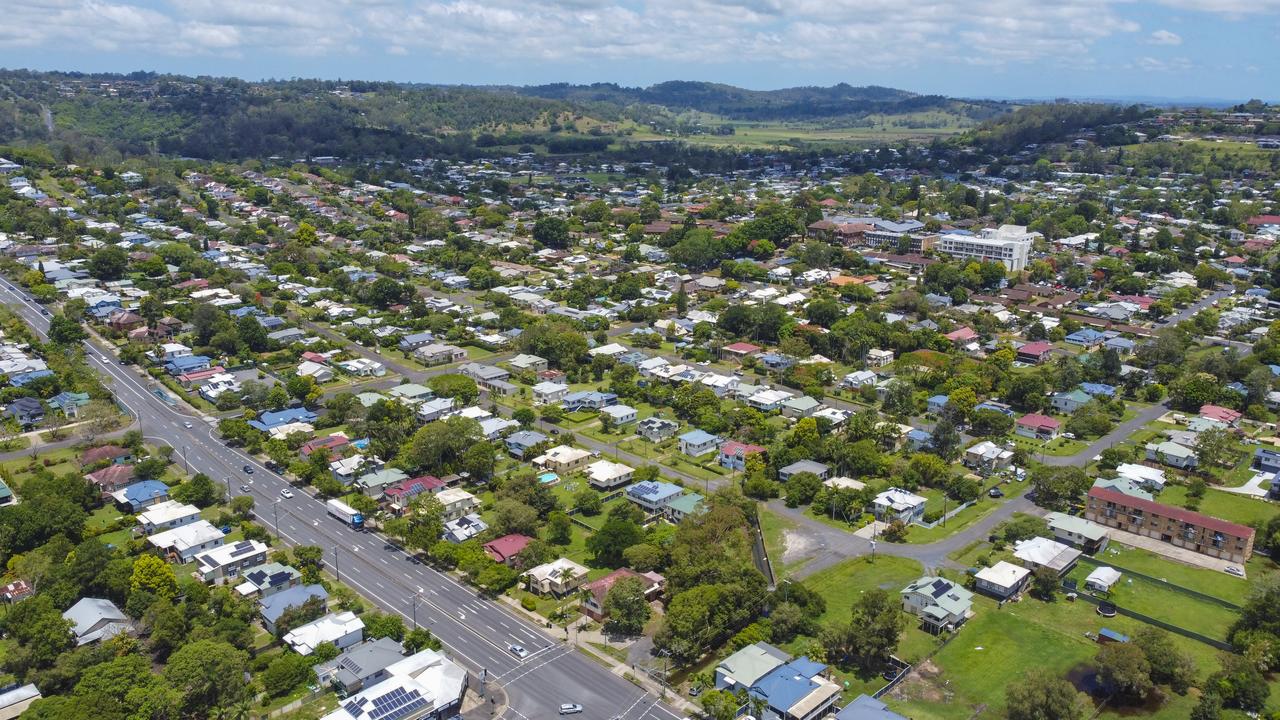
Lismore
Don't miss out on the headlines from Lismore. Followed categories will be added to My News.
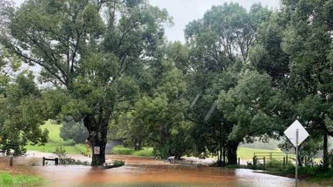
UPDATE 4.40pm: There has been a lot of water fall on an already saturated catchment on the Northern Rivers this week.
The Bureau of Meteorlogy said moderate to heavy rain in the past 24 hours has caused significant river level rises along the Marshalls Creek at Billinudgel where minor flooding is possible Sunday afternoon.
Marshalls Creek:
Minor flooding may occur along the Marshalls Creek, it may peak around the minor flood level (2.50 m) Sunday afternoon.
What we are expecting:
- Low lying farmland will be affected
- Low lying causeways in the upper valley may close causing isolations
- Rainfall run off (flash flooding) may rapidly impact low lying residential areas and access roads
- Flood height levels may be affected by tides
At Billinudgel: (Federation Bridge Gauge)::
- The Pocket Road between Red Hill and Billinudgel may be impassable for vehicles
- Wilfred Street and Stock Route Road will close
What you need to do:
People in areas likely to be impacted by flooding should consider:
- Refraining from driving or walking through flood water
- Road closures and flood isolation may impact on work, family and educational commitments
- Monitoring emergency warnings and severe weather updates on local ABC radio, NSW SES
Northern Rivers Facebook Page and Bureau of Meteorology website
- If your property is at risk of inundation, please raise moveable items, such as furniture, as high as possible onto benches or tables, placing electrical items on top
- If you are advised by an emergency services officer to evacuate, please do so
- Securing outside belongings and before leaving; turn off the power, water and take essential medicines and clothes with you
- Farmers should move machinery, livestock, pumps and fodder to flood free ground.
Evans Head received 104mm of rain in the 24 hours to 9am today, but in the six hours since, some towns have received in excess of 100mm of rain.
In the six hours since 9am, Bilambil Heights has received 125mm.
Nashua copped 113mm, Myocum 103mm, Cudgera Ck 102mm, Alstonville 78mm, an Lismore 50mm.
From 2pm-3pm, Cawongla received 16mm and Numinbah in the Tweed Shire got 17mm.
Flood Safety Advice:
In life threatening emergencies, call 000 (triple zero) immediately. If you require rescue, assistance to evacuate or other emergency help, ring NSW SES on 132 500.
* Avoid drowning. Stay out of rising water, seek refuge in the highest available place.
* Prevent damage to your vehicle. Move it under cover, away from areas likely to flood.
* Avoid being swept away. Stay out of fast-flowing creeks and storm drains.
* Never drive, ride or walk through flood water. Flood water can be deceptive and dangerous.
For more emergency information, advice, and access to the latest river heights and rainfall observations and forecasts:
UPDATE 2.00pm: A warning that flooding is possible on the Northern Rivers has been issued.
The Flood Watch is for the Northern Rivers, Mid North Coast, Hunter, parts of Sydney, South Coast, Central West and North West and was issued at 1.03pm.
Flood Warnings are current and rainfall associated with a second trough has the potential to cause minor to moderate flooding from Sunday through to the middle of the week along parts NSW coast from the Northern Rivers to the South Coast as well as parts of the Central West and North West.
The Bureau of Meteorology said a severe weather warning is current.
Catchments likely to be affected by flooding are currently wet following rainfall earlier in the week.
The weather system is expected to cause flooding for the catchments listed from Sunday and into the week. Flood Classes (minor, moderate, major) are only defined for catchments where the Bureau provides a flood warning service. The catchments with no flood class provided may experience local flooding.
Much of the east coast of NSW is on alert for flooding.
Flood Warnings have already been issued for the following catchments: Orara River, Bellinger and Kalang Rivers, Nambucca River, Macleay River, Hastings River, Camden Haven River, Manning and Gloucester Rivers, Myall River, Wallis Lake, Paterson and Williams Rivers, Wollombi Brook, Tuggerah Lake, Hawkesbury Nepean, and Paroo River.
For the latest flood and weather warnings see www.bom.gov.au/nsw/warnings/.
Flood Safety Advice:
This Flood Watch means that people living or working along rivers and streams must monitor the latest weather forecasts and warnings and be ready to move to higher ground should flooding develop.
Flood Warnings will be issued if Minor Flood Level is expected to be exceeded at key sites along the main rivers for which the Bureau of Meteorology provides a flood warning service.
Severe Weather Warnings will be issued or updated if very heavy rain is forecast or observed.
FloodSafe advice is available at www.ses.nsw.gov.au
For emergency assistance call the SES on telephone number 132 500
For life threatening emergencies, call 000 immediately
UPDATE 12.40pm: The SES has warned further heavy rain is forecast for parts of the Northern Rivers.
The Bureau of Meteorology is predicting heavy rainfall, damaging winds and thunderstorms across many areas of the East Coast today including the Northern Rivers. This has the potential to cause flash flooding and possible riverine flooding.
Widespread rainfall is forecast across these areas with some isolated heavy downfalls possible. With recent rainfall, many of the river catchments in the Northern Rivers are already saturated.
With the possibility of further severe storms and heavy rain, NSW SES Northern Zone Chief Superintendent Steve Patterson urges residents to prepare their homes now especially if there is a break in the weather.
"While communities down south are experiencing the brunt of the severe weather, the Northern Rivers needs to remain prepared."
"Bring in or secure any outdoor items in the yard or on the balcony, check your gutters are clear and your roof is in good condition, trim any overhanging branches".
Chief Superintendent Patterson added, "Rainfall over the last few weeks in the Northern Rivers has contributed to a number of soaked catchments. This means water runoff and flash flooding is more likely in these areas."
NSW SES urges residents and visitors to avoid unnecessary travel and if you need to; take the time to plan your trip, check road closures and traffic conditions before you travel. NSW SES advise to never drive, ride or walk through floodwater as this is the main cause of death during floods.
"It's important that drivers slow down on the roads and drive to the conditions," Chief Superintendent Patterson said.
"If you come across a flooded road please make the safe decision. Turn around, it's just not worth the risk!"
UPDATE 11.30am: A warning has been issued for hazardous along the NSW coast.
Surf and swell conditions are expected to be hazardous for coastal activities such as rock fishing, boating, and swimming in the following areas.
The warning is in place for:
Byron Coast, Coffs Coast, Macquarie Coast, Hunter Coast, Sydney Coast, Illawarra Coast, Batemans Coast and Eden Coast
>>> Latest road closures and cancellations
Safety Advice
NSW Police Force, Marine Area Command advise that:
- People should consider staying out of the water and avoid walking near surf-exposed areas.
- Rock fishers should avoid coastal rock platforms exposed to the ocean and seek a safe location that is sheltered from the surf.
- Boaters planning to cross shallow water and ocean bars should consider changing or delaying their voyage.
- Boaters already on the water should carry the appropriate safety equipment and wear a lifejacket.
Boaters should remember to log on with their local Marine Rescue radio base, via VHF Radio or the Marine Rescue APP, and consider their safety management plan.
Check the Coastal Waters Forecast for information on wind, wave and weather conditions for these areas at http://www.bom.gov.au/nsw/ or on marine radio.
UPDATE 10.20am: The Public Information Inquiry Centre (PIIC), is now open to take calls from the public about the flood-affected areas in NSW.
The PIIC is open 24 hours a day until at least 5pm on Monday, March 22.
The number is 1800 227 228.
For emergency flood and storm assistance, the public can continue to contact the SES on 132 500 or visit their website.
In case of an emergency, dial Triple Zero (000).
MORE NEWS: Trains impacted by flooding
Original story: Unsettled conditions continue to bring wet weather to the Northern Rivers, and it's not going away fast.
The Bureau of Meteorology said a low pressure trough lying along the New South Wales coast is generating widespread and persistent rain in many eastern districts, along with windy conditions. This trough, in conjunction with a strong high to the south, is also bringing windy weather to higher parts of the southern ranges.
Most parts of the warning area will see the heaviest rain during the next 12 to 18 hours, however some places may continue to experience periods of heavy rain through to Monday or Tuesday.
BOM warns "very heavy rainfall, likely leading to flashflooding, presents a serious risk to the Northern Rivers, Mid North Coast, Hunter, Sydney Metropolitan, Illawarra, and Central Tablelands districts.
The focus of heavy rain in the next 6-12 hours will be the Mid North Coast, Blue Mountains and surrounds including western Sydney, parts of the Northern Rivers and Illawarra districts.
Roads are likely to be cut off by water, and there will be an increased risk of landslips during this period.
River catchments are relatively wet, bringing an enhanced risk of riverine flooding.
Numerous flood watches and warnings are current. Latest updates on the BOM website.
Rainfall observations according to BOM for 24 hours up to 8am today (Sunday) include:
Banora Point 97mm
Kingscliff 71mm
Chinderah 68mm
Cudgera Ck 66mm
Yelgun 67mm
Middle Pocket 76mm
Mullumbimby 66mm
Goonengerry 54mm
Kunghur 55mm
Byron Bay 18mm
Myocum 13mm
Corndale 35mm
Nashua 49mm
Houghlahans Ck 60mm
Tuckombil 33mm
Alstonville 24mm
Ballina 8.2mm
Lismore 6mm
Evans Head 38mm
Kyogle 5mm

Named: Man accused of parking meter mayhem
Paying for a car space is never fun but one man took things too far after allegedly smashing a number of parking meters in a northern NSW tourist town, causing more than $15,000 damage.
Lismore sale and auction results, week ending October 20
Lismore recorded 30 property sales over a million dollars last week, the latest auction and sales results reveal.