
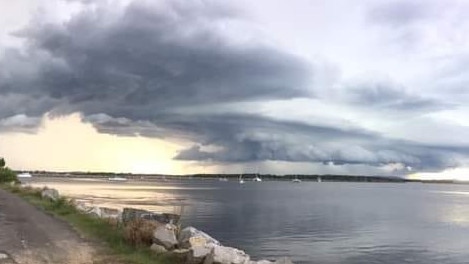
The Bureau of Meteorology predicts storms on the horizon for the next three days
Upper level trough means more widespread rain and severe thunderstorm activity in northern NSW.
Grafton
Don't miss out on the headlines from Grafton. Followed categories will be added to My News.
The Bureau of Meteorology predicts more thunderstorm activity for the next three days in northern NSW after damaging storms hit the region on Tuesday.
Fallen trees from strong wind gusts caused chaos north of Grafton including a woman airlifted to hospital after she was trapped in a car and the XPT train service disrupted.
Related Articles:
Train fuel leak during storm chaos
SES on standby as more storms forecast for region
BOM meteorologist Helen Kirkup said wind gusts of up to 78km/h were recorded at Grafton as the storm front swept through at 5.11pm.
"20 millimetres of rain fell the space of about 15 minutes at a number of places in the Northern Rivers," Ms Kirkup told The Daily Examiner.
"There was fairly large hail reported in the northeast corner, including at Ballina."

Ms Kirkup said a low pressure inland trough hovering over the state meant we could expect similar 'tropical' conditions for the next three days.
"An inland trough has been sitting across the northeast for a number of days, in a situation where most cold fronts aren't pushing all the way through, so it's more of a tropical system going on," she explained.
"There's a high pressure system in the northern tropics feeding humid air from the northeast. There's a whole lot of moisture coming in, and an unstable atmosphere.
"We are experiencing tropical days of mostly afternoon thunderstorms. In the northeast corner there is a risk of thunderstorms occurring again with storm cells that may develop into something bigger.
"An upper level trough moving through from Thursday into Friday, which means air rises even more because the air above it is diverging, so we are expecting showers to be more widespread and thunderstorms again.
"So we've got another few days when we certainly could expect to see thunderstorms, mainly in the afternoon period."
"The vertical structure of the atmosphere has a big influence on whether we'll get thunderstorms that are severe. It depends on the temperature profile going up whether we get hail and damaging wind gusts.
Originally published as The Bureau of Meteorology predicts storms on the horizon for the next three days

From ‘living in hell’ to hope: School shift a miracle for autistic boy
It’s the words no parent ever wants to hear. Here is one father’s story of going from “living in hell” to hope as an autism specific class saved his son’s life.

Faces of the NSW DV hotspot almost double state average
The Coffs Coast's domestic violence rate has soared to 1.7 times the state average, with court records revealing the faces behind a 72 per cent surge in assaults.