
ROAD CLOSURES: Full list of impacted roads and routes
Find out which roads in the Clarence, and further afield are closed or impacted by wet weather conditions.
Grafton
Don't miss out on the headlines from Grafton. Followed categories will be added to My News.
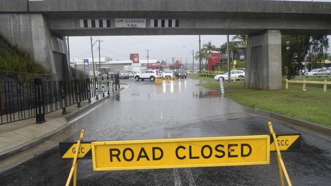
Roads across the Clarence Valley have been impacted by the wet weather conditions. Here is the latest update on our local roads:
CLOSED ROADS
Tucabia-Tyndale Road, Ulmarra - Water over road
Six Mile Lane, Glenugie - Water over road
Big River Way between South Grafton and Clarenza. Motorists are advised to avoid all non-essential travel.
Winegrove Road, Lilydale Bridge - Water over road
Cangai Bridge Road - Water over road
Hanging Rock Road - Water over road
Rushforth Road, Poley Bridge - Water over road
McPhersons Crossing - Water over McPhersons Bridge
Orara Way at School Lane - Water over road
Orara Way at Lanitza, south of Lanitza Shop - road damage
Orara Way, Bluff Bridge - Water over bridge
McPhillips Road, Halfway Creek - Washaways at the bridge
Shipmans Road - Pavement damage
Tallawudjah Creek Road
Armidale Road at Wards Gully and Hortons Creek - local traffic only under escort
DAMAGED OR IMPACTED ROADS
Big River Way, Glenugie, near Six Mile Lane. Alternating stop/slow traffic conditions may be in place at times.
Clarence Way, Fine Flower. Motorists advised to use caution.
Eight Mile Lane, Sandy Crossing - Water over road
Wooli Road, Pillar Valley - Water over road at various locations
Iluka Road, Iluka - Water over road at various locations
Mantons Road, Lawrence - Water over road
FERRY SERVICE
Ulmarra Ferry is currently out of service
Lawrence Ferry remains open for now
Across the state, here are the road closures according to the Transport Management Centre
ACROSS THE STATE
In the state's north:
- The Waterfall Way closure has been extended - Waterfall Way is now closed between Dorrigo Mountain and Bellingen
- The Pacific Highway is now open to local traffic only between Cundletown and Glenthorne, but remains closed to all traffic between George Gibson Drive and Princes Street between Cundletown and Coopernook
- Manning River Drive is closed over the Manning River Bridge Between Glenthorne and Taree
- Oxley Highway is closed between Henry Street at Long Flat and Billabong Drive in Sancrox
- Oxley Highway is closed between Walcha to Mount Seaview due to a landslide
- Giinagay Way is closed between the Pacific Highway and Edgewater Drive between Macksville and Nambucca Heads
- Failford Road is closed between the Pacific Highway and The Lakes Way in Failford
- The Bucketts Way is closed due to a landslide between Saxbys Road and Roys Road at Krambah
- Lismore Road/Bangalow Road is closed at Binna Burra between Bungalow and Lismore
- Golden Highway is closed between Range Road and New England Highway through the Singleton Military Area
- Big River Way is closed between South Grafton and Clarenza
- The Ulmarra Ferry is not running
- Main Road/Cessnock Road is closed between Avery Lane and Russell Street between Cliftleigh and Gillieston Heights
In the state's west:
- The Cobb Highway is closed between Ivanhow and Wilcannia
- Jenolan Caves Road is closed in both directions between Hartley to Jenolan.
In the state's south:
- Illawarra Highway is closed between Mount Murray Rd and Yellow Rock Rd at Macquarie Pass
- Illawarra Highway is closed between Tongarra Road and Croome Lane at Albion Park
Originally published as ROAD CLOSURES: Full list of impacted roads and routes

‘Little hottie’: Artist walks after court hears of ‘hideous’ online chat
A Northern Rivers artist who told a pedophile after watching child abuse material it was “another example of why boys are made for this” has walked free on a suspended jail sentence. Warning: Graphic.

‘Got into our groove’: Group 2 big guns get off to a flyer
One frontrunner put on a tryscoring clinic while the defending premiers were given a baptism of fire during round two of Group 2 Rugby League.