
Hey Google! What’s wrong with this image of Yamba?
Technology might be all the rage for finding your way, but these images might leave you a little confused
Grafton
Don't miss out on the headlines from Grafton. Followed categories will be added to My News.
Thousands of tourists flooded our coastal areas such as Yamba over the Christmas holidays, and like many of us they used technology to help find their way around.
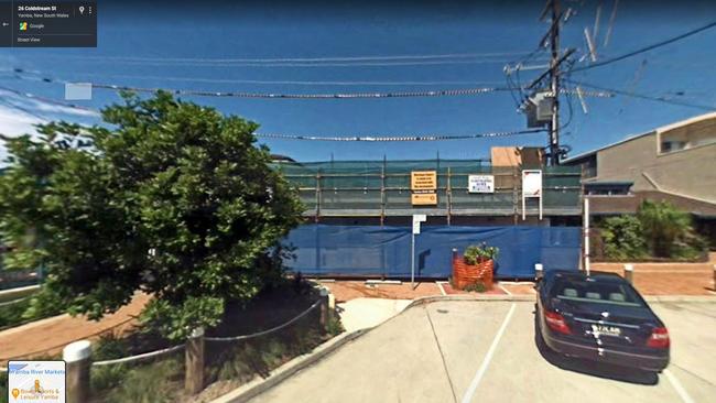
Now you can use Google Maps to drive virtually up Coldstream St, looking left at the NRMA building, and looking right to see the first signs of construction on the Yamba Backpackers.
Wait, what?
That’s right. A quick drive around Google Maps for Yamba reveals a step back in time for the town, 2008 to be precise.
The coastal town of Iluka shows similar age for its main street.
Maclean fares better, but still shows some signs of age with its main street last recorded in 2016.
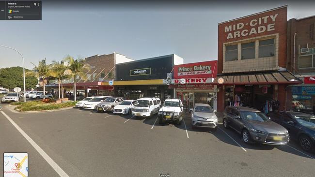
Grafton and South Grafton have images from 2018, marking the last time the special Google cameras were in the Clarence Valley.
A Google spokeswoman said Google Street View imagery was something they did constantly.
“Updating our Street View imagery is something we do from time to time as part of our effort to provide users with the richest, most up-to-date maps possible,” the spokeswoman said.
The process for updating Street View imagery is lengthy, from the capture to the processing. Cars need to drive along both sides of the road to ensure accuracy, and ideally only when the weather is clear.
Then the imagery is aligned and faces etc are blurred – and finally delivered to users.
>>> RELATED: How Google Maps helped solve a murder
According to Google cars are driving across Australia throughout the year to map as much of the country as possible. They focus on updating high traffic areas (both for travellers and for those searching locations) as well as locations where there have been road upgrades or changes.
Councils were encouraged to reach out to Google to encourage them to update the area, and Google has a specific partnership team for this purpose.
The Google spokeswoman said they also encouraged Google users to help with the mega-mapping effort.
There is new technology available in certain countries that even lets Google users map their own street data, and while it is not available yet, they said they were working hard to let everyone use it. More information on this program is available here: https://blog.google/products/maps/anyone-can-share-their-world-with-street-view/
To find out where the Google cars are mapping at any particular time, visit this website: https://www.google.com/streetview/explore/

NRRRL: Seagulls fly with razzle dazzle footy
On the back of some free-flowing footy, the Tweed Seagulls have taken another huge step forward in their return season in the NRRRL.

‘Shining light’: Former Lismore Mayor farewelled
A former Lismore mayor is being remembered as a “trailblazer” and “shining light” for women in local government. Read the tributes here.