
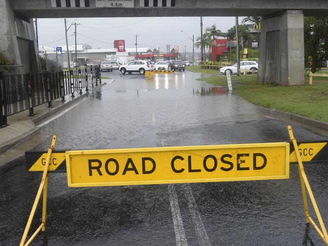
Clarence Valley flooding impact: Full list of roads and routes
UPDATED 3PM: Find out which Clarence Valley roads are closed or impacted by wet weather conditions.
Community News
Don't miss out on the headlines from Community News. Followed categories will be added to My News.
Looking for Tuesday's (March 23) latest road closure information? CLICK HERE
Roads across the Clarence Valley have been impacted by the wet weather conditions. Here is the latest update on our local roads:
>>> RELATED: TAKE CARE as warning comes for potholes on highway/roads
Closed
1. Braunstone Road (Closed)
Water over the road between McPhersons Road and Armidale Road Braunstone
2. Cangai Bridge Road (Closed)
Road closed water over the road
3. Carrs Drive Yamba (Closed)
Carrs Drive is currently closed due to local flooding.
4. Coaldale Road (Closed)
Road closed at Barrets Creek
5. Coaldale Road at Chevalleys Bridge (Closed)
Coaldale Road at Chevalley's Bridge closed
6. Eight Mile Lane at Sandy Crossing (Closed)
Water over road
7. Experiment Farm Road (Closed)
Water over the road
8. Four Mile Lane (Closed)
Water over bridge south of Washpool Road
9. Hanging Rock Road (Closed)
Water over the road
10. James Lane (Closed)
Drive with caution damaged road pavement
11. Kungala Road (Closed)
Kungala Road at Dundoo Bridge (Closed)
Road Closed at Dundoo bridge
Kungala Road near Pacific Highway (Closed)
Road closed at Sherwood Creek Bridge
12. Lower Kangaroo Creek Road (Closed)
Lower Kangaroo Creek Road closed water over the road at 15 Mile Creek
13. McPhersons Crossing (Closed)
Road closed due to water over McPhersons bridge
14. McPhillips Road (Closed)
Due to wash aways at the bridge McPhillips Road is closed until further assessment can be undertaken.
15. Mulquinneys Road (Closed)
Water over road
16. Orara Way - Bluff Bridge (Closed)
Water over bridge - road closed
17. Orara Way at Lanitza (Closed)
Road closed south of Lanitza Shop due to damaged road pavement.
18. Orara Way at School Lane (Closed)
Orara Way at School Lane closed - water over road
19. Plain Station Road - Yates Flat (Closed)
Road closed - water over bridge
20. Possum Hole Lane Ulmarra (Closed)
Possum Hole Lane is closed due to flood waters
21. Rogan Bridge Road (Closed)
Rogan Bridge Road - Rogan Bridge (Closed)
Road closed - Water over Rogan Bridge
22. Rushforth Road Poley Bridge (Closed)
Water over the road
23. School Lane, Braunstone (Closed)
Water over road
24. Sherwood Creek Road (Closed)
Road closed at Palm Creek tributary 2 bridge
25. Shipmans Road (Closed)
Road closed due to road pavement damage
26. Shores Drive Yamba (Closed)
Shores Drive at the intersection of Yamba Road during roundabout construction works will be closed from 18/1/21. Please follow detour signs.
27. Six Mile Lane, Grafton (Closed)
Water over road
28. Tallawudjah Creek Road (Closed)
Tallawudjah Creek Road closed
29. Tucabia-Tyndale Road (Closed)
Water over road
30. Winegrove Road - Lilydale Bridge (Closed)
Bridge closed, water over the road
Caution
1. Armidale Road - Clouds Creek (Caution)
Armidale Road at Clouds Creek caution side track in use with no load limits
2. Avenue Road (Caution)
Water on road - drive with caution
3. Clarence Way Fine Flower (Caution)
Road open motorists to use caution
4. Deep Creek Road Ulmarra (Caution)
Deep Creek Road - drive with caution
5. Wooli Road (Caution)
Wooli Road (Caution)
Water over road in multiple locations - drive with caution
6. Wooli Road at White bridge (Caution)
Use caution
FERRY SERVICE
Ulmarra Ferry is currently out of service
Lawrence Ferry is currently out of service
STATEWIDE:
In the State's North:
- Between Coopernook and Glenthorne:
- The Pacific Highway is open to southbound motorists under escort in very limited numbers. Expect lengthy delays.
- The Pacific Highway is only open northbound to 4WDs and heavy vehicles only
- Between Taree and Glenthorne - Manning River Drive is closed over the Manning River Bridge
- Between Walcha and Gloucester - Thunderbolts Way is closed
- At Krambach - The Bucketts Way is closed between Saxbys Road and Roys Road
- At Failford - Failford Road is closed between the Pacific Highway and The Lakes Way
- The Oxley Highway is closed between Sancrox and Long Flat, as well as between Walcha and Mount Seaview
- Between Macksville and Nambucca Heads - Giinagay Way is closed between the Pacific Highway and Edgewater Drive
- Between Bellingen and Dorrigo Mountain - Waterfall Way is closed
- At Corindi Beach - Solitary Islands Way is closed between Blackadder Road and Coral Street
- Between South Grafton and Clarenza - Big River Way is closed
- Between Bangalow and Lismore - Lismore Road/Bangalow Road is closed at Binna Burra
In the Hunter/Central Coast:
Roads:
- At Singleton - the Golden Highway is closed between Range Road and New England Highway
- Between Cliftleigh and Gillieston Heights - Main Road/Cessnock Road is closed between Avery Lane and Russell Street
- At Charmhaven - the Pacific Highway is closed between Lowana Avenue and Costa Avenue
Public Transport
- On the Central Coast & Newcastle Line - buses are replacing trains between Newcastle Interchange and Fassifern due to flooding at Cockle Creek.
- On the Hunter Line - buses are replacing trains between Newcastle Interchange, Maitland and Dungog/Scone due to flooding
Originally published as Clarence Valley flooding impact: Full list of roads and routes

Former News Corp cartoonist, marine animal advocate dies
Tributes are flowing for former Coffs Coast Advocate cartoonist and animal advocate Hec Goodall, who was known for living a “unique life”.

‘Lucky to be alive’: Mountain biker’s tough road ahead after crash
A Mid-North Coast dad and mechanic whose passion for mountain biking took a tragic turn faces a “long, slow road” to recovery after a horror crash doing what he loved most.