
Clarence River hits major flood level of 5.4m at Grafton and rising
Latest weather and flood updates as swollen Clarence hits 6m at Prince St gauge in Grafton.

Grafton
Don't miss out on the headlines from Grafton. Followed categories will be added to My News.
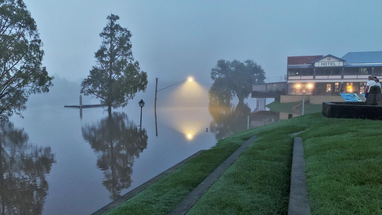
The swollen Clarence River shrouded in fog produced eerie scenes at dawn in Grafton on Wednesday morning.
The river reached the major flood level of 5.4m at the Prince St gauge overnight and by 6.30am was approaching the 6m mark - the magic number used by many graziers downriver to move cattle to higher ground.

The various gauging stations upriver continued to rise or remain steady overnight, and at 7.08am this morning the Bureau of Meteorology upgraded its predicted peak for the Clarence from 6.00m to 6.20m on Wednesday evening.
“Major flooding is occurring along the Clarence River at Grafton, moderate flooding is occurring at Ulmarra and minor flooding at Maclean,” the BOM reported.
“The Clarence River at Ulmarra may reach around 4.75 metres Wednesday evening with moderate flooding.
“The Clarence River at Maclean is likely to exceed the moderate flood level (2.20 m) Wednesday morning. The river level may reach around 2.35 metres Wednesday night.”
River levels at Grafton and locations downstream are affected by tides, and the high tides at Grafton on Wednesday will occur around 10am and 10.30pm.
Latest river heights (6am unless stated):
Clarence River at Tabulam - 9.93m (falling)
Clarence River at Baryulgil - 11.03m (steady)
Clarence River at Lilydale - 13.90m (rising)
Nymboida River at Nymboida - 6.19m (falling)
Mann River at Mitchell - 2.56m (steady)
Boyd River at Broadmeadows - 6.16m (steady)
Mann River at Jackadgery - 7.28m (falling) (12am)
Orara River at Glenreagh - 7.08m (rising)
Clarence River at Grafton (Prince St) - 5.98 (rising)
Clarence River at Ulmarra - 4.54 (rising)
Clarence River at Maclean - 2.18m (steady)

‘Monkey off our back’: 2025 drought sensationally snapped
There were comebacks, big swings and a deciding play after the siren. Two sides slugged it out in a thriller that had just about everything in Group 2.

Inquest hears dad did shoot son before killing himself
An inquest into the deaths of Wayne and Noah Smith has determined the dad did fatally shoot his son before killing himself, and highlighted the need for improved firearm safety measures for those with poor mental health.