
Amazing aerials show extent of flooding south of Grafton
Take a look at the extent of water captured from the air by local drone photographer
Grafton
Don't miss out on the headlines from Grafton. Followed categories will be added to My News.
Coutts Crossing has copped more than their fair share of water, with the river rising to a flood peak multiple times over the past few months.
However, with the latest flood, the Orara reached another medium flooding level, spilling water over the surrounding land, and isolating the village.
Photographer Sharn Domatas managed to get her drone high above the land to capture the extent of the water flowing through, and she said that in all the floods she’d photographed, she’d never seen patterns in the landscape like in this one.
“There are unbelievable oil patterns in this flood... I’ve never seen it so dirty,” she said.
Take a look at the amazing photos here:
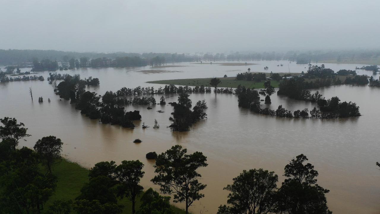
As of 5pm yesterday, upriver the Orara River at Glenreagh had fallen to minor levels at 5.70, down from its peak at 10.65m on Tuesday afternoon.

‘Achieve balance’: New Kyogle mayor reveals plans
Familiar face Danielle Mulholland said she plans to “get cracking” to find a new general manager and agitate for funding as the re-elected Kyogle mayor. Here’s her plan.
Read more
‘Did you f–k my boyfriend?’: Teen kidnapped, attacked with axe
A North Coast kidnapper tricked a girl, 17, into a car by promising a fun trip and instead took her to a caravan park, before a balaclava-clad co-offender hit her with an axe, a court heard.
Read more